Old Maps of Hemphill County, Texas for Metal Detecting
Plan your next treasure hunt with 157 historic maps of Hemphill County. Find old homesites, ghost towns, trails, and gathering spots that may be lost to time — perfect for identifying promising metal detecting locations.
- Locate forgotten sites: Uncover places like long-lost settlements, abandoned rail lines, or gathering spots.
- Plan better hunts: Use map overlays combined with LiDAR or satellite views to narrow in on historically rich areas.
- Made for detectorists: Thousands of hobbyists use these maps to discover relics, coins, and hidden history.
Use these historic maps to boost your research and find new opportunities beneath the surface of Hemphill County.
Hemphill County, TX maps
(157)- 1954 Map of Perryton, 1966 Print
 1954 Perryton1966 Print · USGSThe High Plains of the Texas and Oklahoma panhandles are shown during a period of steady growth in the mid-1950s. Genealogists and researchers can trace rail history and local landmarks like Panhandle A & M College, Spurlock Chapel, and the isolated Lord Station.3 unique versions available
 - 1954 Map of Amarillo, 1966 Print
 1954 Amarillo1966 Print · USGSThe Texas Panhandle in the mid-1960s shows a landscape of rising industrial power and deep-rooted ranching tradition. Local historians can trace the paths of the Panhandle and Santa Fe railroad or locate sites like the Pantex Ordnance Plant and Mobeetie.2 unique versions available
 - 1958 Map of Perryton
 1958 Perryton1958 Print · USGSThe Oklahoma Panhandle and Texas borderlands come alive in this mid-century survey, showing the vital rail-and-ranch economy of the High Plains. Researchers can trace historic stops along the Chicago Rock Island and Pacific and locate rural landmarks like Bethel Church and Spurlock Chapel.
 - 1958 Map of Amarillo
 1958 Amarillo1958 Print · USGSThe Texas Panhandle in the mid-1950s reveals a landscape of expanding military installations and oil-rich rail towns. Local historians can trace the development of Amarillo Air Force Base or locate smaller settlements like Magic City and New Mobeetie.
 - 1963 Map of Allison, 1965 Print
 1963 Allison1965 Print · USGSThe Texas Panhandle meets the Oklahoma border in this mid-century survey of the Wheeler County plains. Researchers can trace the path of the Panhandle and Santa Fe railroad through Allison or locate the historic water levels at Frye Lakes.
 - 1963 Map of Briscoe, 1965 Print
 1963 Briscoe1965 Print · USGSThe eastern Texas Panhandle comes into focus during the early sixties, centered on the ranching community of Briscoe. Genealogists and historians can trace the Panhandle and Santa Fe rail line and water sources like Lake Fensterwald and Sweetwater Creek.
 - 1963 Map of Allison SW, 1966 Print
 1963 Allison SW1966 Print · USGSThe Texas Panhandle in the early sixties is shown here as a landscape of cattle ranching and rail transport. Genealogists and local historians can locate the Zypach Cem and trace the paths of Goodin Creek and the Santa Fe and Panhandle railroad.3 unique versions available
 - 1963 Map of Mobeetie, 1966 Print
 1963 Mobeetie1966 Print · USGSThe Panhandle frontier near the Wheeler and Hemphill county line is captured here in the 1960s. Genealogists and historians can trace the transition from Port Elliott to New Mobeetie and locate the Mobeetie Cem.
 - 1967 Map of Mendota, 1969 Print
 1967 Mendota1969 Print · USGSThe Texas Panhandle breaks into a network of creek valleys during the late sixties as the railroad reaches across the Canadian River basin. Researchers can trace the rail sidings and cattle-country landmarks like Mendota, Mendota Siding, and Major Creek.
 - 1967 Map of Dads Creek, 1969 Print
 1967 Dads Creek1969 Print · USGSIn the Texas Panhandle during the late sixties, the Hemphill County ranchlands were defined by an intricate network of river tributaries and water management projects. Genealogists and local historians can locate the Washita Cem, Gageby Ch, and early industrial sites like the Gas Well.
 - 1967 Map of Gem, 1969 Print
 1967 Gem1969 Print · USGSThe Texas-Oklahoma borderlands in the late 1960s are defined by the wide, sandy course of the Canadian River. Researchers can trace the rural settlement of Gem, locate the Prairie Dell Cem, and find local landmarks like Rattlesnake Hill.
 - 1967 Map of Hackberry Creek, 1969 Print
 1967 Hackberry Creek1969 Print · USGSThe Texas Panhandle meets the Oklahoma border during the late 1960s in this survey of Hemphill County ranchland. Trace the path of the Atchison Topeka and Santa Fe railroad or locate local landmarks like Hext and Huston - Stickley Lake.
 - 1967 Map of Lake June, 1969 Print
 1967 Lake June1969 Print · USGSHemphill County in the late sixties reveals a landscape of water management and energy extraction along the panhandle breaks. You can trace the rural landscape through the location of the Cataline Cem and small reservoirs like Lake June and Lake Cindy.
 - 1967 Map of Young Ranch, 1969 Print
 1967 Young Ranch1969 Print · USGSIn the late 1960s, this portion of Hemphill County was defined by its cattle ranching roots and the expansion of the energy sector. Researchers can locate family landmarks like the Arrington Ranch and Young Ranch or trace the path of the Washita River.
 - 1967 Map of Blue Ridge School, 1969 Print
 1967 Blue Ridge School1969 Print · USGSThe Hemphill County panhandle in the late sixties is defined by its transition between the Canadian River and the Washita headwaters. Local historians can trace family land via the Blue Ridge Sch and named water sources like Jo Spring.
 - 1967 Map of Tody School, 1970 Print
 1967 Tody School1970 Print · USGSThe Texas Panhandle's rugged drainages and rail corridors are revealed here in the late sixties, where Gray and Wheeler counties meet. Genealogists and historians can locate the Tody Sch and trace the path of the Atchison Topeka and Santa Fe near Cowboy Creek.2 unique versions available
 - 1967 Map of Canadian SE, 1970 Print
 1967 Canadian SE1970 Print · USGSHemphill County cattle country and canyonlands come to life in the late sixties. Trace the locations of rural Panhandle outposts like Needmore, Needa, and Substa among the drainage basins of Big Timber Creek and Major Creek.
 - 1967 Map of Lora, 1970 Print
 1967 Lora1970 Print · USGSThe Texas Panhandle comes into focus in the late sixties as the rail-and-river economy defines Roberts and Hemphill counties. Genealogists and local historians can trace the Atchison Topeka and Santa Fe line past Lora and find the Miami Cem near the creek breaks.2 unique versions available
 - 1972 Map of Washburn Arroyo, 1974 Print
 1972 Washburn Arroyo1974 Print · USGSThe Texas Panhandle in the early seventies reveals a landscape defined by energy and rail. Trace the Pipeline networks and Gas Wells that dotted the plains, or follow the Atchison Topeka and Santa Fe railroad along Red Deer Creek.
 - 1972 Map of Canadian West, 1974 Print
 1972 Canadian West1974 Print · USGSThe Hemphill County seat of Canadian is shown in the early 1970s at the height of its energy and rail influence. Trace the town's development through the Courthouse and High Sch, or follow the Atchison Topeka and Santa Fe line across the Canadian River.
 - 1972 Map of East Dry Creek, 1974 Print
 1972 East Dry Creek1974 Print · USGSThe Texas Panhandle rangeland meets the wide Canadian River valley in the early 1970s. Researchers can trace the development of the local energy economy via numerous Oil Wells and a Pipeline, alongside landmarks like Home Ranch and a solitary Grave.
 - 1972 Map of Canadian East, 1974 Print
 1972 Canadian East1974 Print · USGSThe Texas Panhandle comes alive in the early 1970s as the Canadian River flows past the rail lines and ranches of Hemphill County. Genealogists and historians can trace the Atchison Topeka and Santa Fe Railroad route, locate the local Cemetery, and find the Urschell Ranch and Anvil Park.
 - 1972 Map of Glazier, 1974 Print
 1972 Glazier1974 Print · USGSThe Texas Panhandle's industrial and rail landscape is on display in the early 1970s as the energy sector expands across Hemphill County. Genealogists and researchers can trace the Atchison Topeka and Santa Fe tracks to Glazier or locate rural sites like Locust Grove.
 - 1972 Map of Lake Marvin, 1974 Print
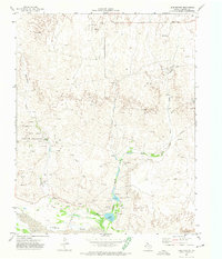 1972 Lake Marvin1974 Print · USGSThe Texas Panhandle plains meet the Canadian River during the early 1970s, revealing a landscape shaped by water and energy. Researchers can trace rural landmarks from the Gene Howe Wildlife Management Area to isolated Graves and Oil Wells.
 - 1972 Map of Dreyfoos, 1974 Print
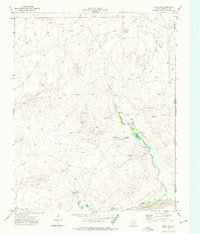 1972 Dreyfoos1974 Print · USGSHemphill County and the Oklahoma border are captured here in the early 1970s during a period of active oil exploration and ranching. Researchers can trace the network of oil wells around Dreyfoos or locate landmarks like Goettsche Lake and the McQuiddy Curves.
Showing maps 1-25 of 157
Top cities of Hemphill County
Frequently asked questions
- What are the different types of historical maps available for Hemphill County?
- What is the oldest map of Hemphill County?
- Where can I purchase historical maps of Hemphill County for my home or office?
- Where can I download high-res historical maps of Hemphill County?
- Are there historical topographic maps available for Hemphill County?
- Is there historical aerial imagery available for Hemphill County?
- Where are historical maps of Hemphill County sourced from?