1930s Maps of Hidalgo County, Texas
Explore 6 historic maps of Hidalgo County from the 1930s. These maps offer a rare glimpse into what life looked like during the 1930s — showing old roads, neighborhoods, homes, and landmarks that have changed or disappeared over time.
Whether you're researching your family's past, planning a metal detecting trip, or studying how Hidalgo County's landscape evolved across the 1930s, these high-resolution maps are a powerful tool for exploring the history of this region.
- Focus on a specific era: All maps on this page are from the 1930s, giving you a focused view of this time period.
- See what’s changed: Compare century-old streets, trails, and buildings to today's modern landscape using overlays and satellite layers.
- Research with precision: Use these maps for genealogy, historical research, land use analysis, or educational projects.
- View, download, or print: Maps are fully viewable online in high resolution, and can be downloaded or printed for your own records.
Start exploring Hidalgo County's history through authentic maps from the 1930s. This is your window into the past.
Hidalgo County, TX maps
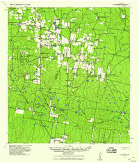
(6)- 1933 Map of Santa Rosa
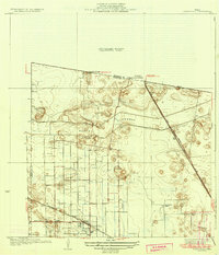 1933 Santa Rosa1933 Print · USGSThe Rio Grande Valley landscape comes into focus in the early thirties as irrigation and flood control reshape the coastal plain. Researchers can trace the footprints of family estates like Santa Rita Ranch and the vital paths of the Missouri Pacific railroad.3 unique versions available
 - 1936 Map of La Feria
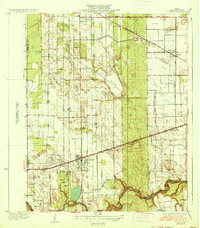 1936 La Feria1936 Print · USGSThe lower Rio Grande Valley comes to life in this mid-1930s survey of the irrigated farmlands and rail towns of Cameron County. Genealogists and local historians can trace the early streets and family farms near La Feria, Bixby, and the Wilson Sch country school site.3 unique versions available
 - 1936 Map of Santa Maria
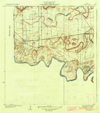 1936 Santa Maria1936 Print · USGSLower Rio Grande Valley ranching and early irrigation systems are preserved in this pre-war survey of Cameron County. Genealogists and historians can trace family-named outposts and infrastructure like Gloria Ranch, Bluetown, and the Santa Maria Pumping Sta.3 unique versions available
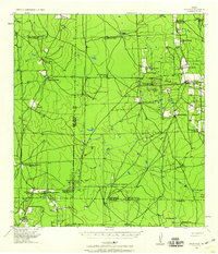
 - 1939 Map of Linn, 1958 Print
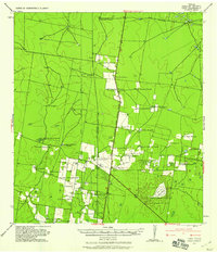 1939 Linn1958 Print · USGSSouth Texas ranching culture and early transport networks define this pre-war survey of the Hidalgo County backcountry. Researchers can trace historic family-named properties like Delmita Ranch, the site of the Laguna Seca School, and the salt lake at La Sal Del Rey.
 - 1939 Map of La Reforma, 1959 Print
 1939 La Reforma1959 Print · USGSThe ranching country of South Texas comes alive in the late 1930s, showing the intersection of cattle territory and the budding oil industry. Genealogists can trace family holdings and local landmarks like the Sam Lane School, Arkansas City, and La Reforma.
 - 1939 Map of Encantada, 1959 Print
 1939 Encantada1959 Print · USGSBrooks and Starr counties are shown in the late 1930s as a landscape of established cattle ranches and emerging oil fields. Genealogists and researchers can locate family landmarks such as Guerra, Encantada Ranch, and La Particion Ranch.
End of results
Showing maps 1-6 of 6
Top cities of Hidalgo County
- McAllen historical maps
- Edinburg historical maps
- Mission historical maps
- Pharr historical maps
- Weslaco historical maps
- San Juan historical maps
See more
Frequently asked questions
- What are the different types of historical maps available for Hidalgo County?
- What is the oldest map of Hidalgo County?
- Where can I purchase historical maps of Hidalgo County for my home or office?
- Where can I download high-res historical maps of Hidalgo County?
- Are there historical topographic maps available for Hidalgo County?
- Is there historical aerial imagery available for Hidalgo County?
- Where are historical maps of Hidalgo County sourced from?