1960s Maps of Hidalgo County, Texas
Explore 26 historic maps of Hidalgo County from the 1960s. These maps offer a rare glimpse into what life looked like during the 1960s — showing old roads, neighborhoods, homes, and landmarks that have changed or disappeared over time.
Whether you're researching your family's past, planning a metal detecting trip, or studying how Hidalgo County's landscape evolved across the 1960s, these high-resolution maps are a powerful tool for exploring the history of this region.
- Focus on a specific era: All maps on this page are from the 1960s, giving you a focused view of this time period.
- See what’s changed: Compare century-old streets, trails, and buildings to today's modern landscape using overlays and satellite layers.
- Research with precision: Use these maps for genealogy, historical research, land use analysis, or educational projects.
- View, download, or print: Maps are fully viewable online in high resolution, and can be downloaded or printed for your own records.
Start exploring Hidalgo County's history through authentic maps from the 1960s. This is your window into the past.
Hidalgo County, TX maps
(26)- 1962 Map of Brownsville
 1962 Brownsville1962 Print · USGSThe Lower Rio Grande Valley in the early sixties was a landscape of coastal wildlands, booming oil fields, and international border commerce. Trace the development of this frontier region through landmarks like Harlingen Air Force Base, Boca Chica Island, and the Willamar Oil Field.
 - 1962 Map of McAllen
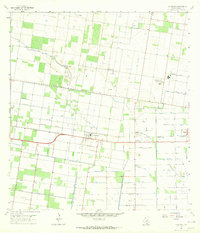
 1962 McAllen1962 Print · USGSThe Lower Rio Grande Valley in the mid-twentieth century shows a complex landscape of irrigation, oil production, and border commerce. Genealogists and historians can trace family roots through riverside towns like Zapata, Roma-Los Saenz, and Hidalgo, or locate landmarks like Santa Elena Ch and Moore Air Force Base.
 - 1962 Map of San Juan SE, 1965 Print
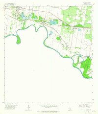
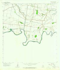 1962 San Juan SE1965 Print · USGSThe Texas-Mexico borderlands come into focus in the early sixties, showing the complex river meanders of the Rio Grande. Researchers can trace land tracts like Monterrey Banco No 89 or locate local landmarks such as Webber Cem and the Donna Pumping Station.
 - 1962 Map of Las Milpas, 1965 Print
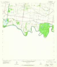 1962 Las Milpas1965 Print · USGSThe Rio Grande borderlands in the early sixties reveal a landscape of irrigation canals, gas fields, and conservation. Researchers can trace family history through sites like Pharr Memorial Cem, Capota Cem, and the rural Valley View Sch.2 unique versions available
 - 1963 Map of Monte Christo, 1965 Print
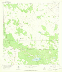
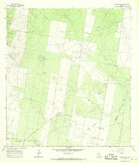
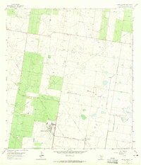 1963 Monte Christo1965 Print · USGSThe Hidalgo County brushlands in the early 1960s reveal a landscape of energy extraction and military aviation. Researchers can trace the infrastructure of Mission Air Base, the Missouri Pacific railroad, and local landmarks like La Gloria Ranch.2 unique versions available
 - 1963 Map of La Joya, 1965 Print
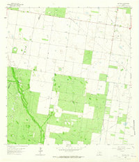
 1963 La Joya1965 Print · USGSThe Lower Rio Grande Valley in the early 1960s reveals a landscape shaped by river border shifts and a booming petroleum industry. Researchers can trace family sites at San Antonio Cem and follow the old Missouri Pacific line through Penitas and Abram.2 unique versions available
 - 1963 Map of Callo Padrones, 1965 Print
 1963 Callo Padrones1965 Print · USGSBrooks and Hidalgo counties were a landscape of vast ranching tracts and early oil exploration during the early sixties. Researchers can trace family ranching boundaries and water infrastructure through sites like Huisaches Alton Ranch and Viboras Well.2 unique versions available
 - 1963 Map of Hargill, 1965 Print
 1963 Hargill1965 Print · USGSHargill and the surrounding Rio Grande Valley were defined by gas production and industrial irrigation in the early 1960s. Genealogists can locate family landmarks like Cibilo Cem and La Coma Ranch or trace the Missouri Pacific rail line.2 unique versions available
 - 1963 Map of Linn NW, 1965 Print
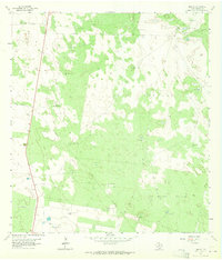
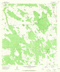
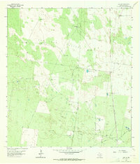 1963 Linn NW1965 Print · USGSIn the early sixties, the cattle country of Hidalgo County was adapting to the rise of the energy sector. Researchers can trace historic ranch boundaries and water networks through features like Santa Fe Ranch, the Beaurline Gas Field, and Agua Dulce Windmill.3 unique versions available
 - 1963 Map of Edinburg, 1965 Print
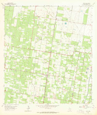
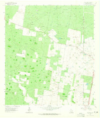
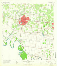
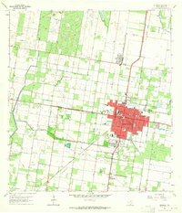 1963 Edinburg1965 Print · USGSEdinburg in the early sixties was a thriving valley hub where irrigation canals and rail lines met amongst the citrus groves. Researchers can trace the layout of Pan American College, the Old Edinburg Cem, and the tracks of the Southern Pacific Railroad.3 unique versions available
 - 1963 Map of Faysvillle, 1965 Print
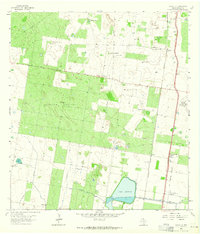 1963 Faysvillle1965 Print · USGSHidalgo County ranchlands come into focus in the early sixties, showing a landscape defined by water management and family outposts. Trace the cattle-country history of Faysville through landmarks like Vela Cem, Guadalupe Ranch, and Lake Edinburg.
 - 1963 Map of Citrus City, 1965 Print
 1963 Citrus City1965 Print · USGSIn the early sixties, the Hidalgo County landscape was a blend of intensive citrus farming and energy production. Genealogists and local historians can trace irrigation canals through Citrus City, locate the Tabasco Oil and Gas Field, and find family sites like Santa Rita Ranch.3 unique versions available
 - 1963 Map of McCook, 1965 Print
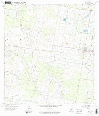
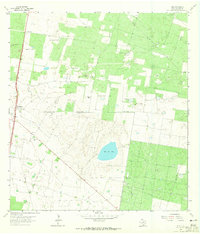
 1963 McCook1965 Print · USGSHidalgo County's ranchlands and early energy fields come into focus during the early sixties as the regional landscape transitioned. Local researchers can trace family landmarks like the Immaculate Conception Cem and follow the industry footprint of the Javelina Gas Field.
 - 1963 Map of Alton, 1965 Print
 1963 Alton1965 Print · USGSThe Rio Grande Valley's citrus groves and energy fields are laid bare in the early sixties near Alton. Genealogists and historians can trace the development of Palmhurst and Cantu alongside the industrial infrastructure of the Mission Gas Field and the Missouri Pacific railroad.
 - 1963 Map of Hidalgo, 1965 Print
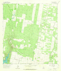
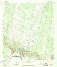
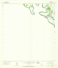 1963 Hidalgo1965 Print · USGSHidalgo and the international border come to life in the early sixties as a hub of river commerce and irrigation. Researchers can trace the path of the Missouri Pacific railroad or locate the McAllen-Hidalgo-Reynosa Toll Bridge and U S Customs office.2 unique versions available
 - 1963 Map of Linn Siding, 1965 Print
 1963 Linn Siding1965 Print · USGSHidalgo County ranching and energy production intersect in the early sixties along the Southern Pacific railroad. Researchers can trace family-owned tracts like Tijerina Ranch and locate community landmarks including Santa Anita Cem and the Niño Jesus de Praga Ch.2 unique versions available
 - 1963 Map of Linn NE, 1965 Print
 1963 Linn NE1965 Print · USGSSouth Texas ranching territory in the early sixties is captured here through its expansive pasture systems and critical water wells. Genealogists and historians can trace family-named sites like Maria Chavez Windmill, Santa Fe Pasture, and San Carlos Windmill.2 unique versions available
 - 1963 Map of Donna, 1965 Print
 1963 Donna1965 Print · USGSThe Rio Grande Valley during the early sixties comes into focus here, showing the citrus and irrigation networks of Hidalgo County. Genealogists can locate family names at St Joseph Cem or trace early school sites like Franklin Sch and South Donna Sch.4 unique versions available
 - 1963 Map of Hartland, 1965 Print
 1963 Hartland1965 Print · USGSThe ranching country along the Brooks and Hidalgo County border comes alive in the early sixties as a network of pastures and rail. Trace the Southern Pacific tracks past Hartland or locate family landmarks like Coyote Ranch and Buena Suerte Windmill.2 unique versions available
 - 1963 Map of Mission, 1965 Print
 1963 Mission1965 Print · USGSThe citrus-rich corridor of the Rio Grande Valley comes to life in this early 1960s survey of Hidalgo County. Genealogists and historians can trace family-named sites and landmarks like La Lomita Mission, Marcell Sch, and the Laurel Hill Cem.3 unique versions available
 - 1963 Map of Linn, 1965 Print
 1963 Linn1965 Print · USGSCoastal brush country in Hidalgo County during the early sixties is shown here as a landscape of historic cattle ranches and emerging gas fields. Genealogists can trace family holdings like San Felipe Ranch and El Rucio Ranch or locate the El Rucio Cem near the salt lake at Sal del Rey.2 unique versions available
 - 1963 Map of Pharr, 1965 Print
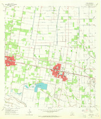
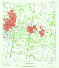 1963 Pharr1965 Print · USGSHidalgo County's urban and industrial corridor is captured in the early sixties as it centers on the growth of McAllen and Pharr. Researchers can trace the mid-century development of landmarks like Miller International Airport, Guadalupe Cem, and the massive Main Floodway.2 unique versions available
 - 1963 Map of La Blanca, 1965 Print
 1963 La Blanca1965 Print · USGSThe Rio Grande Valley in the early sixties is shown here as a landscape of energy and irrigation. Genealogists and historians can trace the early layout of San Carlos, Engleman Gardens, and Evergreen alongside the Southern Pacific rail lines.2 unique versions available
 - 1965 Map of Sullivan City, 1968 Print
 1965 Sullivan City1968 Print · USGSSullivan City and the Rio Grande borderlands come alive in the mid-sixties, showing a landscape defined by the river and the oil industry. Genealogists and historians can trace the foundations of Sullivan City and Cuevitas, or locate landmarks like San Guillermo Ch and El Faro Sch.2 unique versions available
 - 1965 Map of Camp Garcia, 1968 Print
 1965 Camp Garcia1968 Print · USGSStarr County in the mid-1960s was a landscape shaped by the intensive growth of the Texas petroleum industry. Genealogists and historians can trace family-named sites like Samano Ranch and Camp Garcia alongside industrial landmarks like the Davenport Oil Field.3 unique versions available
Showing maps 1-25 of 26
Top cities of Hidalgo County
- McAllen historical maps
- Edinburg historical maps
- Mission historical maps
- Pharr historical maps
- Weslaco historical maps
- San Juan historical maps
See more
Frequently asked questions
- What are the different types of historical maps available for Hidalgo County?
- What is the oldest map of Hidalgo County?
- Where can I purchase historical maps of Hidalgo County for my home or office?
- Where can I download high-res historical maps of Hidalgo County?
- Are there historical topographic maps available for Hidalgo County?
- Is there historical aerial imagery available for Hidalgo County?
- Where are historical maps of Hidalgo County sourced from?