2000s (21st Century) Maps of Hidalgo County, Texas
Explore 215 historic maps of Hidalgo County from the 2000s (21st Century). These maps offer a rare glimpse into what life looked like during the 2000s — showing old roads, neighborhoods, homes, and landmarks that have changed or disappeared over time.
Whether you're researching your family's past, planning a metal detecting trip, or studying how Hidalgo County's landscape evolved across the 2000s, these high-resolution maps are a powerful tool for exploring the history of this region.
- Focus on a specific era: All maps on this page are from the 2000s, giving you a focused view of this time period.
- See what’s changed: Compare century-old streets, trails, and buildings to today's modern landscape using overlays and satellite layers.
- Research with precision: Use these maps for genealogy, historical research, land use analysis, or educational projects.
- View, download, or print: Maps are fully viewable online in high resolution, and can be downloaded or printed for your own records.
Start exploring Hidalgo County's history through authentic maps from the 2000s. This is your window into the past.
Hidalgo County, TX maps
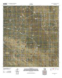
(215)- 2002 Map of La Feria, 2003 Print
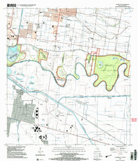
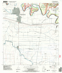
 2002 La Feria2003 Print · USGSThe Lower Rio Grande Valley's agricultural and conservation lands are captured here at the turn of the millennium. Researchers can locate specific family landmarks like Tiocano Lake Cem or trace the early development of La Feria and Primera.
 - 2002 Map of Progreso, 2003 Print
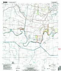
 2002 Progreso2003 Print · USGSThe Texas-Mexico border comes into focus at the start of the new millennium as commerce and conservation meet along the river. Trace the vital crossings at Progreso Toll Bridge and find rural landmarks like San Pedro Ranch, Toluca, and the Cem near Relampago.
 - 2002 Map of Mercedes, 2003 Print
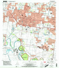
 2002 Mercedes2003 Print · USGSThe Rio Grande Valley cities of WESLACO and MERCEDES are shown in detail at the start of the 21st century, revealing a landscape shaped by irrigation and agriculture. Researchers can trace local family history through numerous landmarks like Highland Memorial Cemetery, Leon R Graham Sch, and the Arroyo Colorado shoreline.
 - 2002 Map of Edinburg, 2003 Print
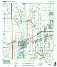
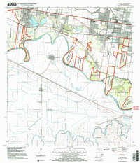
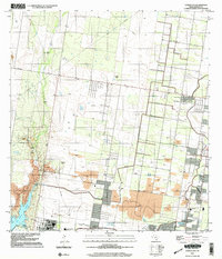
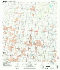
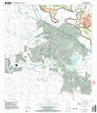
 2002 Edinburg2003 Print · USGSEdinburg and northern McAllen are shown during a period of rapid expansion in the early 2000s, reflecting the region's educational and civic growth. Researchers can trace local heritage through sites like Old Edinburg Cemetery, the University of Texas Pan American, and the Sacred Heart Sch.
 - 2002 Map of Las Milpas, 2003 Print
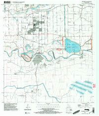
 2002 Las Milpas2003 Print · USGSThe international border along the Rio Grande was a landscape of wildlife refuges and growing irrigation hubs at the turn of the millennium. Researchers can trace old family burial grounds like Old Cem and Jackson Cem alongside the complex river bancos of the Rio Grande Bravo.
 - 2002 Map of San Juan SE, 2003 Print
 2002 San Juan SE2003 Print · USGSThe Texas-Mexico borderlands along the Rio Grande come into focus in the early 2000s, showing a landscape defined by irrigation and river bancos. Researchers can trace land tracts like Longoria Banco No 39 or locate family sites at Webber Cem and Asadores Cem.
 - 2002 Map of Mission, 2003 Print
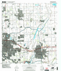
 2002 Mission2003 Print · USGSThe Rio Grande borderlands come alive in this early 2000s survey of the Hidalgo County corridor. Genealogists and historians can trace family sites from La Lomita Mission to the Valley Memorial Gardens and the community of Granjeno.
 - 2002 Map of Santa Maria, 2003 Print
 2002 Santa Maria2003 Print · USGSThe Lower Rio Grande valley at the turn of the millennium shows a landscape defined by the river's winding path and the Military Highway. Genealogists and historians can trace local settlements like Santa Maria and Bluetown, or locate rural sites like Gloria Ranch.
 - 2002 Map of La Joya, 2003 Print
 2002 La Joya2003 Print · USGSThe Rio Grande Valley at the start of the twenty-first century reveals a complex borderland of irrigation canals and growing riverside communities. Genealogists and local historians can trace family-named landmarks like Perezville, old burial grounds such as Sacramento Cem, and numerous school sites.
 - 2002 Map of Los Ebanos, 2003 Print
 2002 Los Ebanos2003 Print · USGSAlong the border at the turn of the millennium, this area features the unique International Ferry at Los Ebanos. Genealogists and historians can trace numerous named settlements like Venecia and San Juan del Rio alongside the complex Canal Principal Guillermo Rode.
 - 2002 Map of Citrus City, 2003 Print
 2002 Citrus City2003 Print · USGSNear the turn of the millennium, this portion of Hidalgo County reveals a landscape where historic ranching and modern industry meet. Genealogists and historians can trace legacy sites like La Morita Ranch and Santa Rita Ranch alongside the vast Tabasco Oil and Gas Field.
 - 2002 Map of Sullivan City, 2003 Print
 2002 Sullivan City2003 Print · USGSSullivan City and the Rio Grande riverfront are captured here at the turn of the millennium, documenting the border landscape of Hidalgo County. Researchers can locate San Guillermo Ch, the Cemetery at Cuevitas, and the sprawling Garcia Oil Field.
 - 2002 Map of La Blanca, 2003 Print
 2002 La Blanca2003 Print · USGSHidalgo County's industrial and natural borders met at the start of the millennium in this survey of the Rio Grande Valley. Researchers can trace the layout of San Carlos, Evergreen, and the National Wildlife Refuge alongside numerous local schools.
 - 2002 Map of Alton, 2003 Print
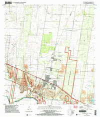
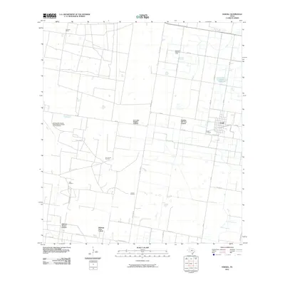
 2002 Alton2003 Print · USGSHidalgo County's residential and industrial growth is captured here at the start of the new millennium. Researchers can trace local school districts and energy sites like the Oblate Gas Field, Salinas Sch, and the community of Alton.
 - 2002 Map of Hidalgo, 2003 Print
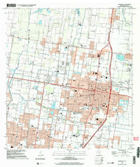
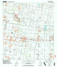
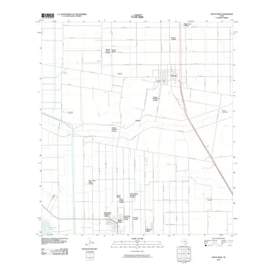
 2002 Hidalgo2003 Print · USGSHidalgo and the border region are captured in the early 2000s, showing the international connection between Texas and Mexico. Researchers can trace the infrastructure of the Rio Grande, from the International Bridge to local schools like Salinas Elem Sch.
 - 2010 Map of Santa Rosa, 2010 Print
 2010 Santa Rosa2010 Print · USGSCovers Hidalgo County, including Santa Rosa, Sebastian, and other nearby areas
 - 2010 Map of Hargill, 2010 Print
 2010 Hargill2010 Print · USGSCovers Hidalgo County, including Edinburg, Hargill, and other nearby areas
 - 2010 Map of Bentsen Ranch, 2010 Print
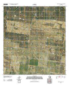 2010 Bentsen Ranch2010 Print · USGSCovers Hidalgo County, including Starr County, United States, and other nearby areas
 - 2010 Map of Hartland, 2010 Print
 2010 Hartland2010 Print · USGSCovers Hidalgo County, including Brooks County, United States, and other nearby areas
 - 2010 Map of McCook, 2010 Print
 2010 McCook2010 Print · USGSCovers Hidalgo County, including McCook, Starr County, and other nearby areas
 - 2010 Map of Linn NE, 2010 Print
 2010 Linn NE2010 Print · USGSCovers Hidalgo County, including United States, Texas, and other nearby areas
 - 2010 Map of Santa Elena SE, 2010 Print
 2010 Santa Elena SE2010 Print · USGSCovers Hidalgo County, including Starr County, Brooks County, and other nearby areas
 - 2010 Map of Los Ebanos, 2010 Print
 2010 Los Ebanos2010 Print · USGSCovers Hidalgo County, including Gustavo Díaz Ordaz, Venecia, and other nearby areas
 - 2010 Map of Monte Christo, 2010 Print
 2010 Monte Christo2010 Print · USGSCovers Hidalgo County, including McAllen, Monte Christo, and other nearby areas
 - 2010 Map of La Reforma, 2010 Print
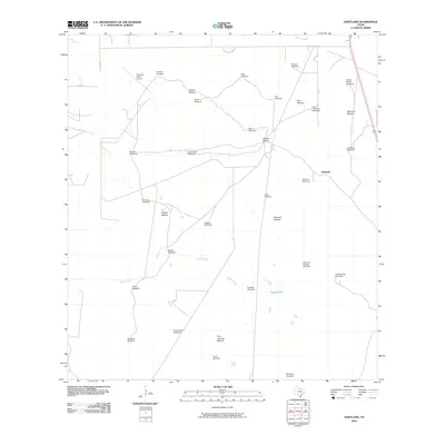
 2010 La Reforma2010 Print · USGSCovers Hidalgo County, including Puerto Rico, Cipres, and other nearby areas
Showing maps 1-25 of 215
Top cities of Hidalgo County
- McAllen historical maps
- Edinburg historical maps
- Mission historical maps
- Pharr historical maps
- Weslaco historical maps
- San Juan historical maps
See more
Frequently asked questions
- What are the different types of historical maps available for Hidalgo County?
- What is the oldest map of Hidalgo County?
- Where can I purchase historical maps of Hidalgo County for my home or office?
- Where can I download high-res historical maps of Hidalgo County?
- Are there historical topographic maps available for Hidalgo County?
- Is there historical aerial imagery available for Hidalgo County?
- Where are historical maps of Hidalgo County sourced from?