Old Maps of Karnes County, Texas for Hiking & Exploration
Hike through history with 155 historic maps of Karnes County. Explore old trails, ghost towns, and forgotten backroads — perfect for outdoor adventurers and local explorers.
- Rediscover forgotten places: Map out old mining camps, roads, and footpaths that no longer exist on modern maps.
- Layer with modern tools: Combine with LiDAR or satellite views to plan hikes through historical terrain.
- Made for exploration: Popular among hikers, overlanders, and local history lovers.
Use these maps to find adventure and explore the hidden past of Karnes County.
Karnes County, TX maps
(155)- 1920 Map of Smiley
 1920 Smiley1920 Print · USGSSouth Texas ranching and rail life are preserved here in the era following the first World War. Genealogists can trace family roots through labeled landmarks like Willow Springs Ranch, the Southern Pacific Railroad, and the settlement at Nixon.
 - 1925 Map of Tordia No. 1
 1925 Tordia No. 11925 Print · USGSKarnes and Wilson Counties are documented here in the mid-1920s as rural agriculture and rail lines shaped the river valley. Genealogists can trace family landmarks and local education hubs like Deweeville, Froshinn Hall, and the Three Oaks School.
 - 1931 Map of Falls City
 1931 Falls City1931 Print · USGSSouth Texas river life and rail transport meet in this early thirties survey of Karnes and Wilson Counties. Trace the Southern Pacific through Falls City or locate rural landmarks like Froshinn Hall and Laake Sch.4 unique versions available
 - 1936 Map of Pettus
 1936 Pettus1936 Print · USGSCoastal plains ranching meets the 1930s oil boom in this detailed survey of Bee and Karnes counties. Genealogists can locate family-named landmarks and rural hubs such as Zunkerville, Salt Branch Church, and the Pettus Oil Field.
 - 1936 Map of Floresville, 1958 Print
 1936 Floresville1958 Print · USGSWilson County was a landscape of independent ranches and river-bend missions in the mid-1930s. Genealogists can locate family landmarks like Dewees Ranch, rural schoolhouses such as Green School, and the historic site of Mission de las Cabras.
 - 1953 Map of Crystal City
 1953 Crystal City1953 Print · USGSSouth Texas in the early fifties was a landscape of expanding oil fields and vital rail connections. Genealogists and researchers can trace family lands along the Nueces River or locate heritage sites in Asherton, Big Wells, and Batesville.
 - 1953 Map of Beeville
 1953 Beeville1953 Print · USGSThe Texas Coastal Bend in the early fifties shows a landscape of growing regional hubs and vital maritime corridors. Trace the rail-and-river economy through Goliad, locate the Matagorda Lighthouse, and explore the sprawling Aransas National Wildlife Refuge.
 - 1953 Map of Seguin, 1965 Print
 1953 Seguin1965 Print · USGSSouth Texas in the early fifties shows a thriving river-and-rail economy across the Guadalupe and Colorado basins. Genealogists and historians can trace rail routes like the Southern Pacific through Seguin, locate oil wells, or find the Gary AAF near San Marcos.4 unique versions available
 - 1954 Map of San Antonio, 1964 Print
 1954 San Antonio1964 Print · USGSSan Antonio and the Texas Hill Country are captured here in the mid-fifties, showing a landscape defined by massive military air bases and the rising Canyon Reservoir. Trace family ties through historic rail towns like D'Hanis and Castroville or explore the Cold War footprint of Lackland AFB and Randolph AFB.3 unique versions available
 - 1955 Map of Crystal City, 1976 Print
 1955 Crystal City1976 Print · USGSSouth Texas ranching and oil country come into focus in the mid-fifties as the rail lines and rivers connect growing hubs. Researchers can trace the development of energy fields like Washburn Oil Field or locate historic settlements from Asherton to Three Rivers.
 - 1956 Map of Suniland
 1956 Suniland1956 Print · USGSLive Oak County ranching culture and rural infrastructure are captured here in the mid-fifties, just as the region’s landscape was maturing. Genealogists can trace family legacies through properties like the Poe Ranch and find defunct community hubs like North School and the Whitsett Pump Station.
 - 1956 Map of Beeville
 1956 Beeville1956 Print · USGSCoastal Texas and the brush country interior are shown in the mid-fifties, from the coastal bays to the inland oil fields. Trace the old rail lines of the Southern Pacific RR or locate the historic Matagorda Lighthouse and the Aransas National Wildlife Refuge.2 unique versions available
 - 1956 Map of Pettus
 1956 Pettus1956 Print · USGSBee and Karnes counties are shown during the mid-century oil boom, when petroleum production and rail transport defined the landscape. Researchers can trace family homesteads and vanished schools such as Richland School, the North Pettus Oil Field, and the Salt Branch Church.
 - 1956 Map of Karnes City
 1956 Karnes City1956 Print · USGSKarnes County in the mid-twentieth century was a landscape of river-bottom farms and segregated rural schools. Genealogists can trace family holdings like the Salge Ranch and Pollock Farm or locate vanished sites like Bridger School (Colored) and Germania Hall.
 - 1957 Map of San Antonio
 1957 San Antonio1957 Print · USGSSan Antonio and the Texas Hill Country are shown here during the mid-fifties, capturing the region's expanding post-war military and transportation footprint. Genealogists and local historians can trace the early residential boundaries of Alamo Heights or locate rural landmarks like St Hedwig and Medina Lake.
 - 1958 Map of Seguin
 1958 Seguin1958 Print · USGSSouth Texas in the late fifties was a network of river-valley settlements and active oilfields tied together by major rail lines. Genealogists and historians can trace family-named sites across Rabb Prairie, locate the Behring Store, or follow the Southern Pacific through Schulenburg.
 - 1960 Map of Beeville
 1960 Beeville1960 Print · USGSCoastal Texas in the mid-fifties reveals a landscape of growing towns and vital military outposts like Foster AFB. Researchers can trace old rail lines including the Missouri Pacific and explore the vast Aransas National Wildlife Refuge.
 - 1960 Map of Karnes City
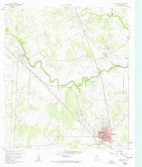 1960 Karnes City1960 Print · USGSMid-century South Texas life centers on the river valleys and rail lines between Panna Maria and Karnes City. Researchers can trace old family sites at St Mary Cem, locate the Karnes City Hot Springs, or follow the Texas and New Orleans railroad corridor.3 unique versions available
 - 1960 Map of Kosciusko, 1961 Print
 1960 Kosciusko1961 Print · USGSPolish-Texan heritage in the early sixties is preserved on this survey of the Wilson and Karnes county line. Genealogists and researchers can trace the rural landscape surrounding Kosciusko, including local landmarks like St Anns Ch, Pulaski Sch, and the winding Cibolo Creek.2 unique versions available
 - 1960 Map of Helena, 1961 Print
 1960 Helena1961 Print · USGSThe rural landscape of Karnes County in the early sixties is dominated by the meandering San Antonio River and the settlement at Helena. Genealogists and historians can trace the community layout near the Helena Cem and Lookout Hill.3 unique versions available
 - 1961 Map of Crystal City
 1961 Crystal City1961 Print · USGSSouth Texas in the early sixties reveals a landscape of massive cattle ranches and emerging oil fields. Genealogists and historians can trace the Missouri Pacific rail lines through Crystal City, or locate water features like Espantosa Lake and Boynton Reservoir.
 - 1961 Map of Falls City, 1963 Print
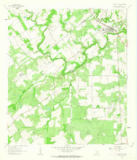 1961 Falls City1963 Print · USGSFalls City and the surrounding South Texas river country are shown here in the early sixties as the oil and quarrying industries expanded. Researchers can trace river crossings like Conquista Crossing, locate the Mueller Cem, and follow the Southern Pacific rail line.
 - 1961 Map of Kenedy, 1963 Print
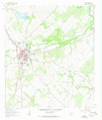 1961 Kenedy1963 Print · USGSThe South Texas plains around Kenedy are captured here in the early sixties as a center of rail transport and oil production. Genealogists and researchers can locate Butler Cem, the Southern Pacific line, and the old Evanston Airport.3 unique versions available
 - 1961 Map of Coy City, 1963 Print
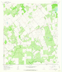 1961 Coy City1963 Print · USGSThe Karnes County brush country is captured here in the early sixties, showing the rural crossroads of Coy City and Fashing. Researchers can trace the development of the local oil industry through a network of Pipelines and an isolated Landing Strip.
 - 1961 Map of Lenz, 1963 Print
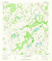 1961 Lenz1963 Print · USGSKarnes County ranching and water management are on display in the early sixties, showing the landscape around the settlement of Lenz. Researchers can trace old property lines and rural landmarks like the Drive-in Theater and the winding Doe Branch.2 unique versions available
Showing maps 1-25 of 155
Top cities of Karnes County
Frequently asked questions
- What are the different types of historical maps available for Karnes County?
- What is the oldest map of Karnes County?
- Where can I purchase historical maps of Karnes County for my home or office?
- Where can I download high-res historical maps of Karnes County?
- Are there historical topographic maps available for Karnes County?
- Is there historical aerial imagery available for Karnes County?
- Where are historical maps of Karnes County sourced from?