1900s (20th Century) Maps of Lee County, Texas
Explore 37 historic maps of Lee County from the 1900s (20th Century). These maps offer a rare glimpse into what life looked like during the 1900s — showing old roads, neighborhoods, homes, and landmarks that have changed or disappeared over time.
Whether you're researching your family's past, planning a metal detecting trip, or studying how Lee County's landscape evolved across the 1900s, these high-resolution maps are a powerful tool for exploring the history of this region.
- Focus on a specific era: All maps on this page are from the 1900s, giving you a focused view of this time period.
- See what’s changed: Compare century-old streets, trails, and buildings to today's modern landscape using overlays and satellite layers.
- Research with precision: Use these maps for genealogy, historical research, land use analysis, or educational projects.
- View, download, or print: Maps are fully viewable online in high resolution, and can be downloaded or printed for your own records.
Start exploring Lee County's history through authentic maps from the 1900s. This is your window into the past.
Lee County, TX maps
(37)- 1904 Map of Bastrop
 1904 Bastrop1904 Print · USGSBastrop and Smithville thrive along the Colorado River at the turn of the century, serving as vital hubs for the Texas interior. Trace ancestral roots and old transport routes through Nashs Ferry, the Coal Mine near Sayersville, and Colorado Chapel.3 unique versions available
 - 1919 Map of Giddings
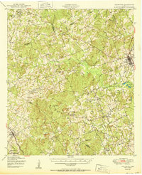
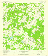
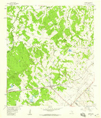
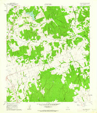
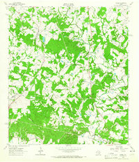
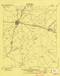 1919 Giddings1919 Print · USGSGiddings and the surrounding Lee County countryside are documented here at the end of the Great War era, when rail travel dominated the Texas interior. Local historians can trace the foundations of rural life through family-named landmarks like the Willy Branch School and numerous post offices including Northrup P.O. and Ledbetter P.O.
 - 1919 Map of Dime Box, 1956 Print
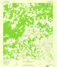
 1919 Dime Box1956 Print · USGSLee County and the surrounding Texas Brazos Valley are shown here just after the Great War, during a period of shifting settlements. Genealogists can trace early homesteads and community hubs near Old Dime Box, Loebau, and Shady Grove School.
 - 1948 Map of Smithville, 1956 Print
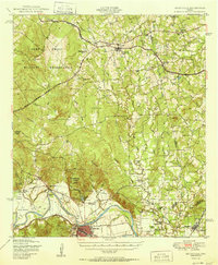
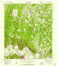 1948 Smithville1956 Print · USGSBastrop and Fayette counties are captured here shortly after the war, showing the footprint of military expansion alongside traditional river life. Genealogists can locate family landmarks like Milton Chapel Cem, Crafts Prairie Sch, and the rural community of Paige.2 unique versions available
 - 1948 Map of Elgin, 1969 Print
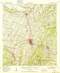
 1948 Elgin1969 Print · USGSCentral Texas in the late 1940s was a landscape of rail-junction towns and emerging military training grounds. Genealogists can trace rural family legacies through sites like Youngs Prairie Cem, the Camp Swift Military Reservation, and Red Town Sch.2 unique versions available
 - 1948 Map of Lexington, 1974 Print
 1948 Lexington1974 Print · USGSCentral Texas rural life in the late 1940s is captured here, showing the intersection of Lee, Milam, and Williamson counties. Genealogists can locate family burial sites at New Knobs Springs Cem and trace the influence of the Southern Pacific line through Lexington.
 - 1950 Map of Lexington
 1950 Lexington1950 Print · USGSLee and Bastrop Counties are captured in the late 1940s as rural crossroads like Beaukiss and Fedor thrived alongside the Southern Pacific railroad. Genealogists can trace family roots at New Knobs Springs Cem, Biehle Sch, and the Peat Mine.
 - 1950 Map of Smithville
 1950 Smithville1950 Print · USGSBastrop and Fayette Counties come into focus at the dawn of the fifties, centered on the Colorado River and the busy rail hub of Smithville. Genealogists can trace family roots through numerous rural landmarks like Crafts Prairie Sch, Goebel Store, and St Michaels Cem and Ch.
 - 1950 Map of Elgin
 1950 Elgin1950 Print · USGSMid-century Elgin and the surrounding blackland prairies are shown here just as the local rail and brick industries were peaking. Researchers can trace family roots through numerous local sites like Youngs Prairie Cem, Coupland, and the Brickyards at Butler.
 - 1954 Map of Austin, 1964 Print
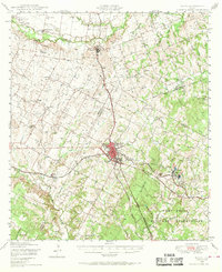
 1954 Austin1964 Print · USGSCentral Texas is captured during a period of steady growth as the capital city and its neighboring farm towns began to modernize. Researchers can trace historic rail corridors like the Southern Pacific RR or locate landmarks such as Bergstrom Air Force Base and Pilot Knob.4 unique versions available
 - 1956 Map of Milano
 1956 Milano1956 Print · USGSRailroad junctions and rural post offices define this Milam County landscape during the early twentieth century. Genealogists and historians can locate family-named landmarks like Septimus) Olson or trace the early paths of the San Antonio and Aransas Pass Railway.
 - 1956 Map of Somerville
 1956 Somerville1956 Print · USGSThe rail junctions of Burleson County come into focus in this post-World War I era survey of the Brazos River valley hinterlands. Genealogists can locate family-named landmarks and rural hubs like Frenstat, Charlesville School, and Lyons P.O.
 - 1958 Map of Ledbetter, 1959 Print
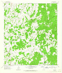
 1958 Ledbetter1959 Print · USGSLedbetter and the surrounding cattle-and-rail country of Lee County are shown here in the late fifties. Genealogists and local historians can trace the foundations of Jones Colony, locate the Atkinson Cem, and follow the Texas and New Orleans railroad line.2 unique versions available
 - 1958 Map of Nechanitz, 1959 Print
 1958 Nechanitz1959 Print · USGSThe rural landscape of Fayette County is captured in the late fifties, showcasing a network of small farming communities and family-named landmarks. Researchers can trace local history through Waldeck Ch, Walhalla, and cemeteries like Schumann Cem.2 unique versions available
 - 1958 Map of Carmine, 1959 Print
 1958 Carmine1959 Print · USGSThe rail-and-road junction at Carmine anchor this late 1950s survey of the Fayette and Washington County border. Genealogists and local historians can trace family-named sites like Hartstack Cem, La Bahia, and St Matthew Missionary Ch.2 unique versions available
 - 1958 Map of Giddings, 1979 Print
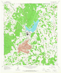
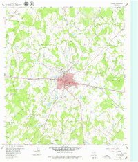 1958 Giddings1979 Print · USGSGiddings was a bustling rail hub in the late fifties where the Southern Pacific and Texas and New Orleans lines crossed. Researchers can trace early Texas history along El Camino Real or find family sites like Goacher Cem and Serbin.2 unique versions available
 - 1959 Map of Flag Pond, 1960 Print
 1959 Flag Pond1960 Print · USGSThe tri-county borderlands of Burleson, Lee, and Washington counties are captured here in the late fifties. Genealogists can trace rural communities through landmarks like Flat Prairie Cem, Post Oak Sch, and St Mary Ch.
 - 1959 Map of Dime Box, 1960 Print
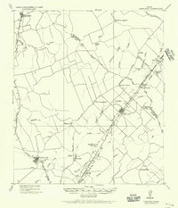
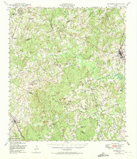
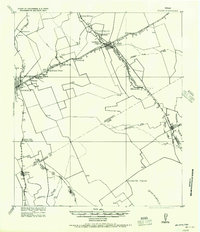
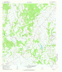
 1959 Dime Box1960 Print · USGSTexas ranching and rail history intersect in Lee County during the late fifties, where the original town sites are clearly delineated. Researchers can trace the path of El Camino Real and locate family landmarks like Sweet Home High Sch and Sandy Point Cem.4 unique versions available
 - 1960 Map of Tanglewood, 1962 Print
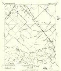
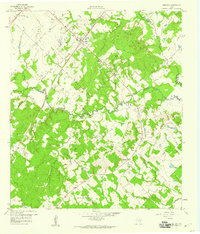
 1960 Tanglewood1962 Print · USGSLee County as it appeared in the early 1960s was a landscape defined by the Southern Pacific rail line and rural church communities. Genealogists can locate family burial sites at Mt Zion Cem or German Cem and trace the paths of East Yegua Creek and its many branches.3 unique versions available
 - 1960 Map of Deanville, 1963 Print
 1960 Deanville1963 Print · USGSBurleson and Lee counties in the early sixties reveal a landscape of rural schoolhouses and family cemeteries along the railroad. Genealogists can locate Sulphur Spring School, San Antonio Prairie Cemetery, and the original site of Old Dime Box.3 unique versions available
 - 1961 Map of Lincoln, 1962 Print
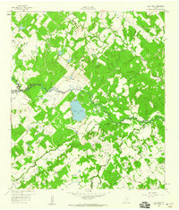
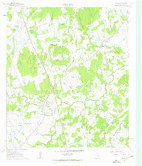 1961 Lincoln1962 Print · USGSLee County's rural landscape is captured here in the early sixties, showing the transition from old rail routes to modern ranching. Researchers can trace family-named sites like Molly Smith Lake and Gloyds Cem, or locate historic hubs like Lincoln and Loebau.3 unique versions available
 - 1962 Map of Hicks, 1964 Print
 1962 Hicks1964 Print · USGSThe tri-county junction of Milam, Lee, and Burleson counties is captured in the early sixties as a landscape of rural industry and community. Researchers can trace family history at Harmony Cem or locate the old Railroad Grade and Hicks Mine.2 unique versions available
 - 1962 Map of Warda, 1965 Print
 1962 Warda1965 Print · USGSLee and Fayette Counties are shown in the early sixties as rural Texas life followed the rail lines and creek beds. Genealogists and local historians can trace family locations near Northrup, St Paul Ch, and the school at Warda.2 unique versions available
 - 1963 Map of Alcoa Lake, 1966 Print
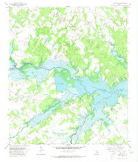
 1963 Alcoa Lake1966 Print · USGSThe Milam and Lee County border undergoes an industrial shift in the early sixties. Researchers can trace the massive Strip Mine operations at Sandow or locate rural family sites like Richards Cem and Holliman Cem.2 unique versions available
 - 1971 Map of Flag Pond, 1973 Print
 1971 Flag Pond1973 Print · USGSTexas lake country comes into focus in the early 1970s as the waters of Somerville Lake define the border between Burleson and Washington Counties. Local historians can trace the rural landscape surrounding the reservoir, locating landmarks like Post Oak School, St Mary Ch, and the namesake Flag Pond.2 unique versions available
Showing maps 1-25 of 37
Top cities of Lee County
Frequently asked questions
- What are the different types of historical maps available for Lee County?
- What is the oldest map of Lee County?
- Where can I purchase historical maps of Lee County for my home or office?
- Where can I download high-res historical maps of Lee County?
- Are there historical topographic maps available for Lee County?
- Is there historical aerial imagery available for Lee County?
- Where are historical maps of Lee County sourced from?