Old Maps of Loving County, Texas for Metal Detecting
Plan your next treasure hunt with 146 historic maps of Loving County. Find old homesites, ghost towns, trails, and gathering spots that may be lost to time — perfect for identifying promising metal detecting locations.
- Locate forgotten sites: Uncover places like long-lost settlements, abandoned rail lines, or gathering spots.
- Plan better hunts: Use map overlays combined with LiDAR or satellite views to narrow in on historically rich areas.
- Made for detectorists: Thousands of hobbyists use these maps to discover relics, coins, and hidden history.
Use these historic maps to boost your research and find new opportunities beneath the surface of Loving County.
Loving County, TX maps
(146)- 1925 Map of Orla 2-b
 1925 Orla 2-b1925 Print · USGSThe Pecos River valley at the Texas and New Mexico border comes to life in this mid-1920s survey. Researchers can trace the early rail corridor of the Panhandle and Santa Fe or locate landmarks like the Orla School and Olds Ranch.
 - 1931 Map of Orla
 1931 Orla1931 Print · USGSThe Pecos River valley at the Texas-New Mexico border appears here in the early thirties. Trace the route of the Panhandle and Santa Fe railroad past Angeles and the ranching homestead at Olds Ranch.2 unique versions available
 - 1954 Map of Hobbs, 1963 Print
 1954 Hobbs1963 Print · USGSThe High Plains and Permian Basin transition is captured here at the height of the mid-century energy boom. Genealogists and industrial historians can trace the foundations of Humble City, locate the Potash Mine and Plant, and follow the Texas-New Mexico RR.2 unique versions available
 - 1954 Map of Pecos, 1964 Print
 1954 Pecos1964 Print · USGSMid-century West Texas reveals a landscape of expanding oil fields and cattle ranching along the winding Pecos River. Local historians can trace family ranch lands like Goodrich Ranch, follow the Texas and Pacific rails, or locate the historic Horsehead Crossing.3 unique versions available
 - 1957 Map of Pecos
 1957 Pecos1957 Print · USGSWest Texas in the mid-fifties is a landscape of desert oil fields and vital rail corridors. Researchers can trace the sprawling Pyote Air Force Base, the historic Horsehead Crossing, and the rail stops at Mentone and Saragosa.
 - 1958 Map of Hobbs
 1958 Hobbs1958 Print · USGSThe High Plains of the Texas-New Mexico border are shown here during the height of the mid-century oil boom. Genealogists and historians can trace the development of Hobbs, Lovington, and Jal, alongside ranching landmarks like James Ranch and the early Texas-New Mexico Railway.
 - 1961 Map of Mentone, 1963 Print
 1961 Mentone1963 Print · USGSMentone and the surrounding West Texas plains are captured here in the early sixties as the local economy balanced ranching with an intensive oil boom. Researchers can trace the industrial layout of the Wheat Oil Field alongside family landmarks like Moorehead Ranch and the Panhandle and Santa Fe railroad.2 unique versions available
 - 1961 Map of Anderson Ranch, 1963 Print
 1961 Anderson Ranch1963 Print · USGSThe Pecos River frontier in the early sixties reveals a landscape shaped by petroleum and ranching at the border of Reeves and Loving counties. Researchers can trace the mid-century industrial footprint of the Dixieland Oil Field and the rail sidings at Arno.2 unique versions available
 - 1961 Map of Orla SE, 1963 Print
 1961 Orla SE1963 Print · USGSThe Pecos Valley in the early 1960s reveals a West Texas landscape dominated by the petroleum industry and the winding river boundary. Researchers can trace the rail-and-oil economy through the Tunstill Oil Field, the river stop at Riverton, and the refinery near Mason Station.2 unique versions available
 - 1961 Map of Lindley Ranch, 1963 Print
 1961 Lindley Ranch1963 Print · USGSLoving County ranching and petroleum exploration are captured here in the early sixties. Researchers can trace the layout of Lindley Ranch and locate early infrastructure like North Windmill and numerous Oil Wells across the landscape.2 unique versions available
 - 1961 Map of Narrow Bow Draw, 1963 Print
 1961 Narrow Bow Draw1963 Print · USGSReeves and Loving counties are shown here during the early 1960s oil boom, where the desert landscape is densely marked by petroleum extraction. Researchers can trace the industrial footprint of the South Orla Oil Field and the path of the Panhandle and Santa Fe (AT & SF) railroad near the Pecos River.2 unique versions available
 - 1967 Map of Soda Lake NW, 1971 Print
 1967 Soda Lake NW1971 Print · USGSThe West Texas oil frontier comes into focus in the late 1960s along the boundary of Loving and Ward counties. Researchers can trace the infrastructure of the Two Fredis Oil Field and locate family-named water sources like Ward Well and Humble Well.3 unique versions available
 - 1968 Map of Orla, 1971 Print
 1968 Orla1971 Print · USGSReeves County at the end of the sixties shows a landscape of rail-centered industry and remote ranching outposts. Researchers can trace the development of the Oil Field and find scattered landmarks like Arroyo Bonito Windmill and the Roadside Park near Orla.
 - 1968 Map of Orla NE, 1971 Print
 1968 Orla NE1971 Print · USGSLoving County ranching and energy production intersect in the late sixties as industry expanded across the state line. Trace the remote infrastructure of the era through Boyd Ranch, the Pecos River, and the Gyp Windmill.
 - 1968 Map of Red Bluff, 1971 Print
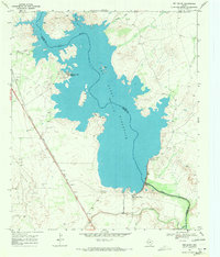 1968 Red Bluff1971 Print · USGSThe Texas-New Mexico borderlands in the late sixties were defined by the massive Red Bluff Reservoir and the Pecos River. Trace the industrial footprint of the Sullivan Oil Field and the Atchison Topeka and Santa Fe rail line.
 - 1968 Map of Soda Lake NE, 1971 Print
 1968 Soda Lake NE1971 Print · USGSWinkler County ranching and oil operations are captured in the late sixties at the intersection of three West Texas counties. Researchers can trace historic water infrastructure and early petroleum sites like Little Joe Oil Field, China Windmill, and Bachelor Windmill.2 unique versions available
 - 1968 Map of Phantom Banks, 1971 Print
 1968 Phantom Banks1971 Print · USGSSoutheastern New Mexico's ranching and resource frontier is captured here in the late sixties, just as modern energy exploration began to mark the desert. Genealogists and historians can locate Steeple Ranch and trace the many water catchments like Big Seep Tank and Lone Tree Tank.2 unique versions available
 - 1968 Map of Ross Ranch, 1971 Print
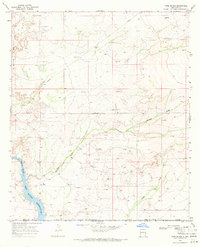 1968 Ross Ranch1971 Print · USGSEddy County ranching and energy extraction are captured here in the late sixties, just as the regional pipeline network was expanding. Researchers can trace the layout of the Ross Ranch and the industrial activity near Rustler and the Pecos River Red Bluff Reservoir.
 - 1969 Map of Kyle Ranch, 1972 Print
 1969 Kyle Ranch1972 Print · USGSLoving County, Texas, and the New Mexico border are shown during the late sixties oil boom. Researchers can trace petroleum infrastructure through the El Mar Oil Field or locate water sources like Lake Well and Kyle Ranch.
 - 1969 Map of Cheyenne Draw SW, 1972 Print
 1969 Cheyenne Draw SW1972 Print · USGSLoving County ranching and oil exploration are recorded here as they appeared in the late sixties. Researchers can trace family-named landmarks like the West Lehman Windmill and Brookfield Windmill or locate industrial sites such as the Pumping Station.
 - 1969 Map of Rudd Draw NE, 1972 Print
 1969 Rudd Draw NE1972 Print · USGSThe Texas-New Mexico borderlands come into focus in the late sixties as the regional oil industry expands across Loving and Lea Counties. Genealogists and historians can trace industrial footprints through El Mar Oil Field or locate named landmarks like White Elephant Tank and Bryant Wells.
 - 1969 Map of Rudd Draw, 1972 Print
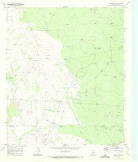 1969 Rudd Draw1972 Print · USGSLoving County at the height of the West Texas energy boom reveals a landscape defined by ranching and petroleum. Trace family-named landmarks and industrial infrastructure from Slash Ranch to the extensive Wheat Oil Field and Rondo Well.2 unique versions available
 - 1970 Map of Brunson Ranch, 1972 Print
 1970 Brunson Ranch1972 Print · USGSThe Texas-New Mexico borderlands in the early seventies reveal a sparse landscape of remote ranching outposts and emerging energy infrastructure. Researchers can locate family-named landmarks like Brunson Ranch and vital water sources such as Lehman Windmill or the South Windmill.
 - 1970 Map of Cheyenne Draw, 1973 Print
 1970 Cheyenne Draw1973 Print · USGSThe Texas-New Mexico borderlands in the early seventies reveal an industrial landscape defined by the Permian Basin energy boom. Genealogists and historians can trace family-named landmarks and infrastructure like Magnolia Windmill, Dooley Windmill, and the Crittendon Gas Field.
 - 1970 Map of Cheyenne Draw SE, 1973 Print
 1970 Cheyenne Draw SE1973 Print · USGSWinkler County ranching and energy operations are documented here in the early 1970s. Trace the location of family-named sites like Haley Ranch or Yantis Ranch and industrial landmarks including the Pumping Sta and various Drill Holes.2 unique versions available
Showing maps 1-25 of 146
Top cities of Loving County
Frequently asked questions
- What are the different types of historical maps available for Loving County?
- What is the oldest map of Loving County?
- Where can I purchase historical maps of Loving County for my home or office?
- Where can I download high-res historical maps of Loving County?
- Are there historical topographic maps available for Loving County?
- Is there historical aerial imagery available for Loving County?
- Where are historical maps of Loving County sourced from?