1970s Maps of Maverick County, Texas
Explore 18 historic maps of Maverick County from the 1970s. These maps offer a rare glimpse into what life looked like during the 1970s — showing old roads, neighborhoods, homes, and landmarks that have changed or disappeared over time.
Whether you're researching your family's past, planning a metal detecting trip, or studying how Maverick County's landscape evolved across the 1970s, these high-resolution maps are a powerful tool for exploring the history of this region.
- Focus on a specific era: All maps on this page are from the 1970s, giving you a focused view of this time period.
- See what’s changed: Compare century-old streets, trails, and buildings to today's modern landscape using overlays and satellite layers.
- Research with precision: Use these maps for genealogy, historical research, land use analysis, or educational projects.
- View, download, or print: Maps are fully viewable online in high resolution, and can be downloaded or printed for your own records.
Start exploring Maverick County's history through authentic maps from the 1970s. This is your window into the past.
Maverick County, TX maps
(18)- 1974 Map of Cometa, 1977 Print
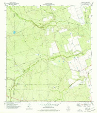 1974 Cometa1977 Print · USGSThe South Texas Brush Country in the 1970s is captured here as the ranching and oil economies of Zavala and Dimmit counties intersect. Family historians can locate specific sites like Vivian Cem or the settlement of Cometa near the winding Comanche Creek.
 - 1974 Map of Goofy Lake, 1977 Print
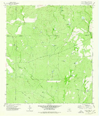
 1974 Goofy Lake1977 Print · USGSMaverick and Kinney County ranchlands are documented here in the 1970s, showcasing a landscape defined by livestock tanks and seasonal creeks. Trace the isolated Holingreen Ranch or follow the paths of Muela Creek and Palo Blanco Creek.
 - 1974 Map of Olmos Creek, 1977 Print
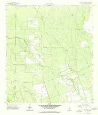
 1974 Olmos Creek1977 Print · USGSThe brush country of South Texas in the mid-1970s is shown at the meeting point of four counties. Researchers can trace the essential water-security network of the era, from ranching landmarks like Government Tank and Muela Well to Kennedy Flats.
 - 1974 Map of Indian Tank, 1977 Print
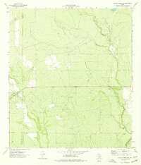
 1974 Indian Tank1977 Print · USGSMaverick County ranching and energy production intersect in the 1970s across this Texas landscape. Researchers can trace the infrastructure of the Chittim Gas Field and locate historic water catchments like Rincon de Flores Tank and Indian Tank.
 - 1974 Map of Deadmans Hill, 1977 Print
 1974 Deadmans Hill1977 Print · USGSMaverick County in the mid-1970s was a landscape defined by ranching, rail, and the industrial infrastructure of Seco Mines. Researchers can trace the path of the Southern Pacific and an Old Railroad Grade past landmarks like Deadmans Hill.
 - 1974 Map of Trosado Tank, 1977 Print
 1974 Trosado Tank1977 Print · USGSMaverick County ranch lands in the mid-1970s reveal a landscape optimized for water management and livestock. Researchers can trace historic water sources and property markers like Gallina Windmill, Trosado Tank, and the course of Salado Creek.
 - 1974 Map of Sacatosa Tank, 1977 Print
 1974 Sacatosa Tank1977 Print · USGSMaverick County in the mid-1970s shows a landscape deeply shaped by the petroleum industry and cattle ranching. Researchers can trace the dense network of Oil Wells and PIPELINE routes or locate remote landmarks like the Gasoline Plant and Sacatosa Tank.
 - 1974 Map of Quemado SE, 1977 Print
 1974 Quemado SE1977 Print · USGSMaverick County sits along the international border in the mid-1970s, where the river bend dictates the reach of Texas ranch and utility lands. Researchers can trace the extensive water infrastructure of the Maverick County Canal or locate early industrial sites like the Mine and local Gravel Pits.
 - 1974 Map of Chacon Creek NW, 1977 Print
 1974 Chacon Creek NW1977 Print · USGSMaverick County in the mid-seventies reveals a rural landscape defined by its vital waterways and ranching infrastructure. Researchers can locate remote features like a Landing Strip, several wells, and the Roadside Park along the southern route.
 - 1974 Map of Paloma, 1977 Print
 1974 Paloma1977 Print · USGSMaverick County ranching and rail infrastructure are on full display in the mid-1970s. Trace the Southern Pacific rail line between Paloma and Darling, or locate specific landmarks like the Ruins and Consuelo Hill.
 - 1974 Map of Chacon Creek SE, 1977 Print
 1974 Chacon Creek SE1977 Print · USGSThe South Texas brush country along the Maverick and Zavala county line is captured here in the mid-1970s. Researchers can trace the path of a major Pipeline across ranchlands and locate water sources like Twin Lakes and the Mato Oso Tank.
 - 1974 Map of Chacon Creek SW, 1977 Print
 1974 Chacon Creek SW1977 Print · USGSSouth Texas ranching and water management are frozen in time on this 1970s survey of Maverick County. Researchers can trace the network of earthen reservoirs like Bean Salinas Tank, the family-named Burke Ranch, and the isolated Landing Strip used for regional transport.
 - 1974 Map of Chacon Creek NE, 1977 Print
 1974 Chacon Creek NE1977 Print · USGSZavala County and Maverick County are captured here in the mid-seventies, showing the ranching and energy footprint of the south Texas plains. Local historians can trace the winding paths of Chaparrosa Creek and locate remote landmarks like the Landing Strip and various Gas Wells.
 - 1974 Map of Peloncillo Peak, 1977 Print
 1974 Peloncillo Peak1977 Print · USGSSouth Texas ranching country at the Kinney and Maverick county line is mapped here in the mid-1970s. Researchers can trace land use through named water features like Hard Luck Tank and Birdnest Tank near Peloncillo Peak.
 - 1974 Map of Imperialist Tank, 1977 Print
 1974 Imperialist Tank1977 Print · USGSThe ranchlands of Maverick and Kinney Counties are captured here in the mid-seventies, showing a landscape shaped by water management and transit. Researchers can trace the Southern Pacific rail line and numerous named catchments like Imperialist Tank and Xmas Tank.
 - 1978 Map of Tequesquite Spring
 1978 Tequesquite Spring1978 Print · USGSThe Texas-Mexico borderlands in the late seventies reveal a rugged landscape of spring-fed creeks and ranching infrastructure. Researchers can trace the Kinney and Maverick County line across Cañon Grande or locate the historic Tequesquite Spring.
 - 1979 Map of Quemado West
 1979 Quemado West1979 Print · USGSThe Texas-Mexico border comes alive in the late 1970s along the winding riverbank of the Rio Grande. Genealogists and researchers can trace the agricultural layout of Quemado or locate the Maverick County Canal and scattered Oil Wells.
 - 1979 Map of Tequesquite Creek SW
 1979 Tequesquite Creek SW1979 Print · USGSAlong the border in the late seventies, this survey traces the international boundary and local water infrastructure. Genealogists and historians can locate the Maverick County Canal and landmarks like the Gravel Pit or Roadside Park.
End of results
Showing maps 1-18 of 18
Top cities of Maverick County
- Eagle Pass historical maps
- Chula Vista historical maps
- Rosita historical maps
- Las Quintas Fronterizas historical maps
- El Indio historical maps
Frequently asked questions
- What are the different types of historical maps available for Maverick County?
- What is the oldest map of Maverick County?
- Where can I purchase historical maps of Maverick County for my home or office?
- Where can I download high-res historical maps of Maverick County?
- Are there historical topographic maps available for Maverick County?
- Is there historical aerial imagery available for Maverick County?
- Where are historical maps of Maverick County sourced from?