1900s (20th Century) Maps of Mills County, Texas
Explore 46 historic maps of Mills County from the 1900s (20th Century). These maps offer a rare glimpse into what life looked like during the 1900s — showing old roads, neighborhoods, homes, and landmarks that have changed or disappeared over time.
Whether you're researching your family's past, planning a metal detecting trip, or studying how Mills County's landscape evolved across the 1900s, these high-resolution maps are a powerful tool for exploring the history of this region.
- Focus on a specific era: All maps on this page are from the 1900s, giving you a focused view of this time period.
- See what’s changed: Compare century-old streets, trails, and buildings to today's modern landscape using overlays and satellite layers.
- Research with precision: Use these maps for genealogy, historical research, land use analysis, or educational projects.
- View, download, or print: Maps are fully viewable online in high resolution, and can be downloaded or printed for your own records.
Start exploring Mills County's history through authentic maps from the 1900s. This is your window into the past.
Mills County, TX maps
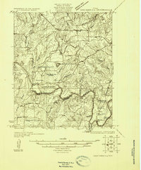
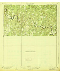
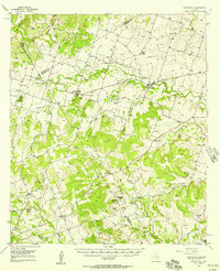
(46)- 1925 Map of San Saba 4-a
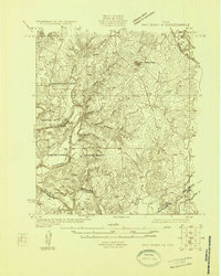
 1925 San Saba 4-a1925 Print · USGSTexas river life in the mid-twenties is defined by the winding paths of the Colorado and San Saba rivers as they meet near San Saba County. Genealogists can trace early rural communities through Bend Cem and a network of country schools including Colony School and Harmony Ridge School.
 - 1925 Map of San Saba 2-a
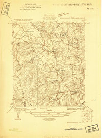
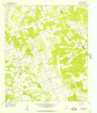
 1925 San Saba 2-a1925 Print · USGSMills and San Saba counties are shown in the mid-1920s as rural ranching communities centered on the Colorado River. Genealogists and historians can trace family roots through the Hanna Valley Cem, Ratler, and the Mesquite Church.
 - 1925 Map of Brownwood 3-d
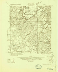
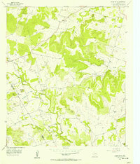
 1925 Brownwood 3-d1925 Print · USGSCentral Texas ranching country along the border of Mills and Brown counties is shown here in the mid-1920s. Researchers can trace historic river fords and family landmarks like Adams Crossing, Slightdale School, and Shaws Ranch.
 - 1925 Map of San Saba 1-c
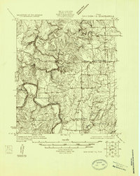
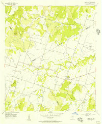
 1925 San Saba 1-c1925 Print · USGSThe Colorado River valley at the border of Mills and San Saba Counties comes alive in this 1920s survey. Genealogists and local historians can trace the rural school districts of Big Valley School and Liveoak School or locate old river fords like Ogilby Crossing.
 - 1925 Map of San Saba 1-b
 1925 San Saba 1-b1925 Print · USGSMills and San Saba counties are shown during the mid-1920s as the Colorado River winds through a landscape of rural schools and crossings. Researchers can trace early community hubs like Big Valley Church, Ebony School, and the remote Goughenor Crossing.
 - 1925 Map of San Saba 2-b
 1925 San Saba 2-b1925 Print · USGSCentral Texas river life in the mid-twenties is centered here on the winding COLORADO RIVER. You can trace rural family roots at Bowser Cemetery and locate vanished schools like Indian Cr School and Oakland School.
 - 1925 Map of San Saba 1-d
 1925 San Saba 1-d1925 Print · USGSThe Colorado River corridor between Mills and San Saba counties is captured here in the mid-1920s. Genealogists can locate rural community hubs like Nabors Creek School and Shaw Bend School or trace the early Santa Fe rail line.
 - 1925 Map of Brownwood 4-c
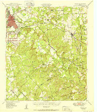
 1925 Brownwood 4-c1925 Print · USGSMills County in the mid-1920s shows a landscape transitioning between pioneer ranching roots and modern rail transit. Genealogists can trace family footprints near Williams Ranch, local schoolhouses like Center Point School, or the busy tracks of the Gulf Colorado and Santa Fe in Mullin.
 - 1928 Map of Zephyr
 1928 Zephyr1928 Print · USGSCentral Texas ranching and rail activity are on full display in the mid-1920s as Brownwood expands toward the southeast. Trace ancestral connections at Steppes Creek Church or locate vanished local landmarks like Slighdale School and Adams Crossing.
 - 1928 Map of Goldthwaite
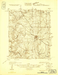
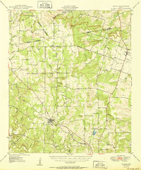
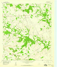
 1928 Goldthwaite1928 Print · USGSThe Colorado River snakes through the Mills and San Saba county line during the mid-twenties, a time of small schoolhouses and river fords. Genealogists can trace family landmarks like San Saba Peak, Big Valley Church, and the Rock Spring School.
 - 1930 Map of Richland Springs
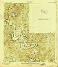
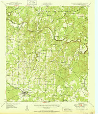
 1930 Richland Springs1930 Print · USGSThe Colorado River divides Mills and San Saba counties in the late 1920s, a period defined by small-town farming and ranching. You can trace early family sites through several river crossings and community hubs like Hanna Valley Cem and the Jones Valley Sch.
 - 1931 Map of Mullin
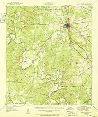
 1931 Mullin1931 Print · USGSMills County, Texas, was a landscape of rail-driven trade and rural ranching in the mid-1920s. Genealogists and historians can trace family locations near the Gulf Colorado and Santa Fe railroad, Duren Sch, and the old Williams Ranch.
 - 1931 Map of Bend
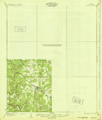
 1931 Bend1931 Print · USGSThe confluence of the Colorado and San Saba rivers in the mid-1920s reveals a rural Texas landscape of river crossings and country schools. Genealogists can trace early homesteads near Bend, the Bend Cem, and several local schoolhouses like Colony Sch.2 unique versions available
 - 1948 Map of Richland Springs, 1966 Print
 1948 Richland Springs1966 Print · USGSThe northern San Saba County landscape in the late 1940s is defined by its deep river valleys and the presence of the Camp Bowie Military Reservation. Genealogists and historians can trace rural school districts and small settlements like Locker, Skeeterville, and Varga Chapel Church.
 - 1948 Map of Goldthwaite, 1970 Print
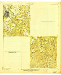
 1948 Goldthwaite1970 Print · USGSMills and San Saba Counties come to life in the late 1940s as the railroad and the Colorado River define the local economy. Researchers can trace ancestral footprints at McMillan Cem, Rock Spring School, or the remote Big Valley Church.
 - 1950 Map of Zephyr
 1950 Zephyr1950 Print · USGSBrownwood and the surrounding central Texas countryside are shown at a pivotal mid-century moment as the military and rail industries shaped the local economy. Researchers can locate the sprawling Camp Bowie Military Reservation, find local burial sites like Indian Creek Cemetery, and trace the path of the Santa Fe railroad.2 unique versions available
 - 1950 Map of Mullin
 1950 Mullin1950 Print · USGSThe crossroads of Mills and Brown counties come into focus at the mid-century, centered on the rail hub of Mullin. Researchers can trace old family sites and rural institutions like Williams Ranch, Rock Springs Cem, and the Villa Siding railroad stop.2 unique versions available
 - 1950 Map of Richland Springs
 1950 Richland Springs1950 Print · USGSRichland Springs and the surrounding San Saba ranch lands are captured here at mid-century, just as the regional rail and river network reached its mature form. Genealogists can locate family landmarks like Varga Chapel, Old Algerita Cemetery, and China Creek School.
 - 1950 Map of Goldthwaite
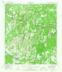
 1950 Goldthwaite1950 Print · USGSGoldthwaite and the surrounding ranchlands of Mills County are shown here at mid-century, following the winding meanders of the Colorado River. Researchers can locate several rural schools and churches like Flat Rock School and Lower Valley Church, or trace the path of the Gulf Colorado and Santa Fe Railway.
 - 1954 Map of Brownwood, 1955 Print
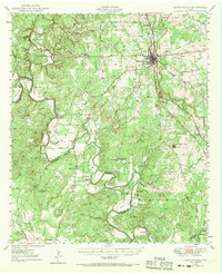
 1954 Brownwood1955 Print · USGSCentral Texas in the early fifties shows a landscape of rail-linked cattle towns and winding river valleys before modern highway expansion. Genealogists and historians can trace family-named peaks and vanished rail stops like Trickham, Santa Anna, and the Brady Mountains.3 unique versions available
 - 1956 Map of Pottsville, 1957 Print
 1956 Pottsville1957 Print · USGSHamilton County ranching and rural life are preserved here in the mid-1950s, showing the landscape before modern consolidation. Researchers can trace family sites like the Cottage Hill Cem, locate the Indian Cave, or find the now-abandoned McGirk Sch.
 - 1956 Map of Caradan, 1957 Print
 1956 Caradan1957 Print · USGSThe rural borderlands between Mills and Hamilton counties come to life in this mid-fifties survey of the Lampasas River valley. Genealogists can locate family landmarks such as the Pecan Wells Cem, Bethel Ch, and the site of the Midway Sch (Aband).
 - 1956 Map of Pecan Wells, 1957 Print
 1956 Pecan Wells1957 Print · USGSHamilton and Mills Counties were characterized by quiet ranching life and scattered settlements in the mid-1950s. Researchers can trace family history through several burial grounds like Cottage Hill Cem and identify the location of the McGirk Sch (Aband).
 - 1956 Map of Indian Gap, 1957 Print
 1956 Indian Gap1957 Print · USGSHamilton County ranching and early energy development meet in the mid-fifties near the settlement of Indian Gap. Genealogists and local historians can trace family ties at the Spivey-Baxter Cemetery, the Land School, and the St Johns Cem.
 - 1959 Map of Star, 1960 Print
 1959 Star1960 Print · USGSThe crossroads of Mills, Hamilton, and Lampasas counties come into focus in the late fifties as a landscape of rural ranching and rugged gaps. Genealogists and local historians can trace family ties at the Hurst Ranch Cem or locate the settlements of Star and Moline.2 unique versions available
Showing maps 1-25 of 46
Top cities of Mills County
Frequently asked questions
- What are the different types of historical maps available for Mills County?
- What is the oldest map of Mills County?
- Where can I purchase historical maps of Mills County for my home or office?
- Where can I download high-res historical maps of Mills County?
- Are there historical topographic maps available for Mills County?
- Is there historical aerial imagery available for Mills County?
- Where are historical maps of Mills County sourced from?