1900s (20th Century) Maps of Real County, Texas
Explore 36 historic maps of Real County from the 1900s (20th Century). These maps offer a rare glimpse into what life looked like during the 1900s — showing old roads, neighborhoods, homes, and landmarks that have changed or disappeared over time.
Whether you're researching your family's past, planning a metal detecting trip, or studying how Real County's landscape evolved across the 1900s, these high-resolution maps are a powerful tool for exploring the history of this region.
- Focus on a specific era: All maps on this page are from the 1900s, giving you a focused view of this time period.
- See what’s changed: Compare century-old streets, trails, and buildings to today's modern landscape using overlays and satellite layers.
- Research with precision: Use these maps for genealogy, historical research, land use analysis, or educational projects.
- View, download, or print: Maps are fully viewable online in high resolution, and can be downloaded or printed for your own records.
Start exploring Real County's history through authentic maps from the 1900s. This is your window into the past.
Real County, TX maps
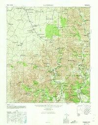
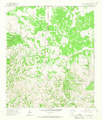
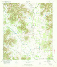
(36)- 1944 Map of Barksdale
 1944 Barksdale1944 Print · USGSThe Edwards County ranching country of the mid-1940s is detailed here during the expansion of rural utility lines and cattle operations. Genealogists can locate family-named landmarks like Double Wells Ranch, Old Chapman Place, and the riverfront grounds of Camp Wood.
 - 1947 Map of Hackberry, 1973 Print
 1947 Hackberry1973 Print · USGSRanching life in the Edwards Plateau is captured here just after the war. Family historians can trace ancestral holdings like Wittenburg Ranch and Hampton Ranch, or locate the rural Cedar Creek School.
 - 1954 Map of Llano, 1964 Print
 1954 Llano1964 Print · USGSThe Texas Hill Country and Highland Lakes appear in the mid-fifties, just as new reservoirs began reshaping the landscape. Trace ranching history and river routes from Mason to Llano, or follow the Gulf Colorado and Santa Fe RR past Buchanan Lake.2 unique versions available
 - 1954 Map of San Antonio, 1964 Print
 1954 San Antonio1964 Print · USGSSan Antonio and the Texas Hill Country are captured here in the mid-fifties, showing a landscape defined by massive military air bases and the rising Canyon Reservoir. Trace family ties through historic rail towns like D'Hanis and Castroville or explore the Cold War footprint of Lackland AFB and Randolph AFB.3 unique versions available
 - 1955 Map of Llano
 1955 Llano1955 Print · USGSCentral Texas and the Hill Country are seen here during the mid-1950s growth of the Highland Lakes. Trace old settlements and geologic landmarks from Enchanted Rock and Longhorn Cavern to the small community of Luckenbach.
 - 1956 Map of Utopia
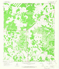
 1956 Utopia1956 Print · USGSThe Sabinal and Frio River valleys are mapped here during the mid-twentieth century, showcasing a transition from pioneer homesteads to established ranching. Genealogists and historians can trace family locations like Paterson Ranch or find vanished landmarks like Thompsons Mill and Taylor School.
 - 1956 Map of Llano, 1976 Print
 1956 Llano1976 Print · USGSThe Texas Hill Country comes alive in this mid-seventies survey of the Llano Uplift and Colorado River lakes. Genealogists and historians can trace family roots through settlements like Luckenbach and Castell or locate the famed L B J Ranch and Enchanted Rock.
 - 1957 Map of San Antonio
 1957 San Antonio1957 Print · USGSSan Antonio and the Texas Hill Country are shown here during the mid-fifties, capturing the region's expanding post-war military and transportation footprint. Genealogists and local historians can trace the early residential boundaries of Alamo Heights or locate rural landmarks like St Hedwig and Medina Lake.
 - 1957 Map of York Hollow
 1957 York Hollow1957 Print · USGSThe ranchlands of the Frio River canyons are shown during a period of transition in the mid-1950s. Genealogists and local historians can trace family landmarks and rural education sites like Reagan Wells, Exile School, and the Wheeler Ranch.
 - 1958 Map of Del Rio, 1970 Print
 1958 Del Rio1970 Print · USGSThe Texas-Mexico borderlands come alive in the late fifties, showing the confluence of the Rio Grande and the emerging Amistad Reservoir. Trace the lineage of the Southern Pacific rail line through stops at Pumpville, Shumla, and the mining vicinity of Blewett.2 unique versions available
 - 1963 Map of Garven Store, 1966 Print
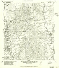
 1963 Garven Store1966 Print · USGSThe Texas Hill Country at the edge of the Divide is captured in the early sixties as a ranching landscape defined by the Real and Kerr county line. Researchers can locate remote landmarks like the Divide Community House, Garven Store, and Buffalo Windmill.2 unique versions available
 - 1964 Map of Del Rio
 1964 Del Rio1964 Print · USGSAlong the Mexican border during the mid-sixties, this area centered on the confluence of the Rio Grande and Devils River. Researchers can trace the Southern Pacific line through isolated stops like Pumpville or locate military and industrial sites such as Laughlin Air Force Base and the mines at Blewett.
 - 1964 Map of Hillcrest Ranch, 1966 Print
 1964 Hillcrest Ranch1966 Print · USGSRanching life in the Texas Hill Country during the mid-sixties centered on sprawling family estates and vital water sources. Researchers can trace land boundaries and legacy sites from Hillcrest Ranch to Frio Ranch, as well as local landmarks like Yellow Bluff.
 - 1964 Map of Circle Bluff, 1966 Print
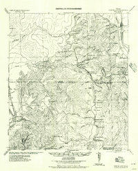
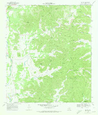
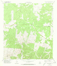
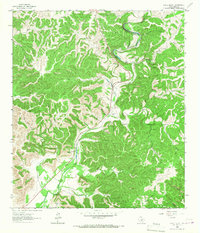 1964 Circle Bluff1966 Print · USGSReal County ranchlands and the winding canyons of the Frio River are captured here in the mid-1960s. Researchers can locate the Cypress Creek Cem and trace early property lines at Hillcrest Ranch or the Butt Foundation Camp.
 - 1964 Map of Sabinal Canyon, 1967 Print
 1964 Sabinal Canyon1967 Print · USGSTexas Hill Country ranching and river drainage are documented in the 1960s along the Real and Bandera county line. Historians can locate family-named landmarks like Wedgeworth, the Post Oak Waterhole, and Flatrock Spring.2 unique versions available
 - 1964 Map of Well Hollow, 1967 Print
 1964 Well Hollow1967 Print · USGSThe headwaters of the Guadalupe and Medina rivers meet at the Kerr and Bandera county line during the mid-sixties. Researchers can trace the rugged drainage of Well Hollow, find a remote Landing Strip, and locate early water infrastructure like the Water Tank.
 - 1969 Map of Vanderpool, 1972 Print
 1969 Vanderpool1972 Print · USGSThe Sabinal River valley in the late sixties reveals a landscape of isolated ranching and deep limestone canyons. Trace local family history and rural industry at the Jones Cem, the Vanderpool settlement, and several named peaks like Taylor Mountain.2 unique versions available
 - 1969 Map of Rio Frio, 1973 Print
 1969 Rio Frio1973 Print · USGSThe Rio Frio area of the Hill Country is documented here in the late sixties, showing the complex river networks of the Edwards Plateau. Genealogists and hikers can locate family-named landmarks like Bailey Hollow and Panther Springs or the local Cem near the river.2 unique versions available
 - 1971 Map of Leakey, 1974 Print
 1971 Leakey1974 Print · USGSThe town of Leakey and its surroundings in the early 1970s reveal a community defined by the Frio River and its rugged draws. Genealogists and researchers can locate family landmarks like Exile Cem, Clark Cem, and the springs at Leakey Springs.
 - 1971 Map of Earwood Creek, 1974 Print
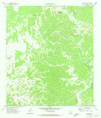
 1971 Earwood Creek1974 Print · USGSThe Texas Hill Country at the meeting of Edwards, Real, and Kerr counties was a land of remote ranching and deep draws in the early seventies. Genealogists and historians can locate family-named landmarks like Dardy Windmill and trace the paths of Earwood Creek and Wildcat Draw.
 - 1971 Map of Owl Hollow, 1974 Print
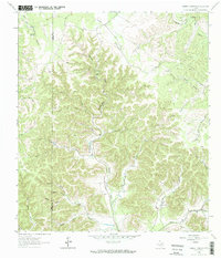
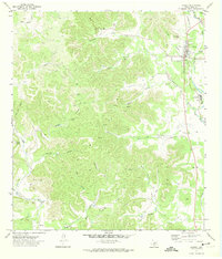
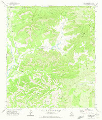
 1971 Owl Hollow1974 Print · USGSReal County ranch land is captured in the early seventies as a network of deep hollows and river bends. Trace local topography along the West Frio River, locating remote landmarks like the Landing Strip and named canyons such as Plum Hollow.
 - 1971 Map of Lake Creek, 1974 Print
 1971 Lake Creek1974 Print · USGSThe Uvalde County backcountry in the early 1970s is a landscape of high ridges and spring-fed canyons. Researchers can trace the Old Railroad Grade along the Nueces River or locate rural sites like Blucher and Walnut Springs.
 - 1971 Map of Hackberry, 1974 Print
 1971 Hackberry1974 Print · USGSThe Edwards County ranch lands and the Nueces River valley are captured in the early 1970s, showing a landscape of deep draws and isolated homesteads. Researchers can trace family sites at Hackberry Cem, locate the old Laughlin settlement, and identify landmarks like Schoolhouse Mountain.
 - 1971 Map of Joy Hollow, 1974 Print
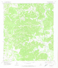
 1971 Joy Hollow1974 Print · USGSDeep in the Texas Hill Country in the early seventies, the Edwards and Real County line runs through a landscape of remote ranch lands and limestone canyons. Researchers can trace family holdings at Eagle Ranch and find unique landmarks like Pape Cave, the Kaolin Mine, and the Blue Hole.
 - 1971 Map of Earwood Creek SW, 1974 Print
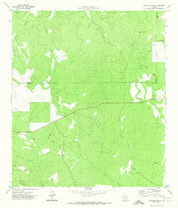
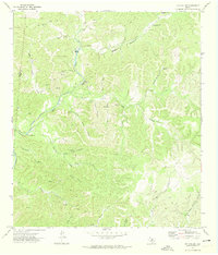
 1971 Earwood Creek SW1974 Print · USGSThe Edwards and Real county line in the early seventies shows a landscape shaped by the search for water and mineral resources. Researchers can trace the path of the East Prong Nueces River and locate ranching landmarks like Blair Windmill and Ranger Hollow.2 unique versions available
Showing maps 1-25 of 36
Top cities of Real County
Frequently asked questions
- What are the different types of historical maps available for Real County?
- What is the oldest map of Real County?
- Where can I purchase historical maps of Real County for my home or office?
- Where can I download high-res historical maps of Real County?
- Are there historical topographic maps available for Real County?
- Is there historical aerial imagery available for Real County?
- Where are historical maps of Real County sourced from?