1960s Maps of Travis County, Texas
Explore 25 historic maps of Travis County from the 1960s. These maps offer a rare glimpse into what life looked like during the 1960s — showing old roads, neighborhoods, homes, and landmarks that have changed or disappeared over time.
Whether you're researching your family's past, planning a metal detecting trip, or studying how Travis County's landscape evolved across the 1960s, these high-resolution maps are a powerful tool for exploring the history of this region.
- Focus on a specific era: All maps on this page are from the 1960s, giving you a focused view of this time period.
- See what’s changed: Compare century-old streets, trails, and buildings to today's modern landscape using overlays and satellite layers.
- Research with precision: Use these maps for genealogy, historical research, land use analysis, or educational projects.
- View, download, or print: Maps are fully viewable online in high resolution, and can be downloaded or printed for your own records.
Start exploring Travis County's history through authentic maps from the 1960s. This is your window into the past.
Travis County, TX maps
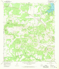
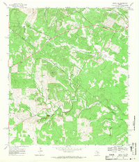
(25)- 1962 Map of Liberty Hill, 1966 Print
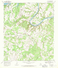
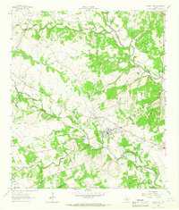 1962 Liberty Hill1966 Print · USGSThe rural landscape of Liberty Hill and Seward Junction is captured in the early sixties as the railroad era still shaped the hill country. Researchers can find family-named landmarks and old burial grounds like Buck Cem and Liberty Hill Cem.2 unique versions available
 - 1962 Map of Leander, 1966 Print
 1962 Leander1966 Print · USGSCentral Texas settlements and Hill Country ranch land thrive along the rail line during the early sixties. Genealogists can trace family names at Bagdad Cem and White Stone, or locate the Independent Sch near the Southern Pacific tracks.4 unique versions available
 - 1962 Map of Nameless, 1966 Print
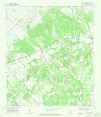
 1962 Nameless1966 Print · USGSThe rural Texas Hill Country comes to life in the 1960s, showing the intersection of Travis and Williamson counties. Genealogists can locate family landmarks like Miller Cem, the small settlement of Nameless, and the sprawling Post Oak Ridge.2 unique versions available
 - 1963 Map of Dripping Springs, 1965 Print
 1963 Dripping Springs1965 Print · USGSDripping Springs and the Hays County backcountry are captured in the early sixties as a region of winding creeks and limestone hills. Researchers can trace family history at Fitzhugh Cem and Phillips Cem, or locate landmarks like Camp Ben McCulloch and Walnut Spring.2 unique versions available
 - 1966 Map of Oak Hill, 1969 Print
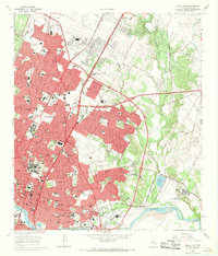
 1966 Oak Hill1969 Print · USGSSouthwest Austin was undergoing a transformation in the late sixties as suburban development reached into Travis County. Researchers can trace early family sites and rural landmarks like Kineheonville, Manchaca, and Williamson Creek Cem.2 unique versions available
 - 1966 Map of Travis Peak, 1969 Print
 1966 Travis Peak1969 Print · USGSThe Texas Hill Country at the meeting of Travis, Burnet, and Williamson counties is shown here in the mid-1960s. Family historians and researchers can locate Hensel Cem, trace the drainage of Cow Creek, and identify high points like Boultinghouse Mountain.2 unique versions available
 - 1966 Map of Austin East, 1969 Print
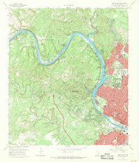
 1966 Austin East1969 Print · USGSMid-century Austin is captured here during a season of significant urban growth and institutional expansion. Local researchers can trace the historic grounds of the University of Texas, the former Robert Mueller Municipal Airport, and the French Embassy.3 unique versions available
 - 1966 Map of Austin West, 1969 Print
 1966 Austin West1969 Print · USGSThe hills west of the capital come alive in the mid-sixties as West Lake Hills and Rollingwood develop along the Colorado River. Trace the path of the Missouri Pacific railroad or locate historic sites like Treaty Oak and Breece Cem.4 unique versions available
 - 1966 Map of Montopolis, 1970 Print
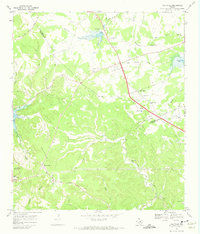
 1966 Montopolis1970 Print · USGSSoutheast Austin and the Colorado River corridor are captured here during the mid-sixties as the city began to edge toward the surrounding farmland. Genealogists and local historians can locate early landmarks such as Burdett Prairie Cem, Moores Crossing, and the sprawling Bergstrom Air Force Base.
 - 1967 Map of Pace Bend, 1969 Print
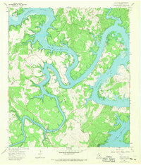 1967 Pace Bend1969 Print · USGSLake Travis and the Colorado River meander through Travis and Burnet Counties in the late sixties as the shoreline began its modern transformation. Genealogists can locate family landmarks like Fall Creek Cem and the traces of Old Ferry Road.2 unique versions available
 - 1967 Map of Spicewood, 1969 Print
 1967 Spicewood1969 Print · USGSThe Blanco and Burnet county line is shown here in the late sixties as the rising waters of the Colorado River reshaped the land. Trace family history at Holloway Cem or follow the old paths near Spicewood and Cypress Mill.4 unique versions available
 - 1967 Map of Bertram, 1970 Print
 1967 Bertram1970 Print · USGSBertram thrived as a railroad and quarrying hub in the Texas Hill Country during the late sixties. Genealogists and local researchers can trace old family burial grounds like South Gabriel Cem or locate rural landmarks such as Mt Zion Ch and Buzzard Roost.2 unique versions available
 - 1967 Map of Shingle Hills, 1970 Print
 1967 Shingle Hills1970 Print · USGSThe Travis and Hays County line crosses this central Texas landscape in the late sixties, where the hills meet the waters of Lake Travis. Family researchers and local historians can locate the Peryear Cem, the Shield Ranch Landing Strip, and springs like Bell Spring.
 - 1967 Map of Hammetts Crossing, 1970 Print
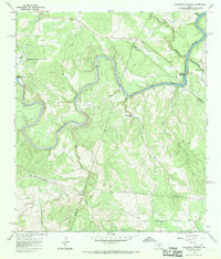 1967 Hammetts Crossing1970 Print · USGSTexas Hill Country life centers on the river in the late sixties, where Blanco, Hays, and Travis counties meet. Researchers can trace historic river access at Hammetts Crossing, Dead Mans Ford, and the natural landmark at Hamilton Pool.2 unique versions available
 - 1968 Map of Signal Hill, 1971 Print
 1968 Signal Hill1971 Print · USGSTexas ranching life and early suburban development converge on the Travis and Hays county line during the late sixties. Researchers can trace family landmarks like Cedar Valley, Oliver Cem, and legacy properties such as Signal Hill Ranch.3 unique versions available
 - 1968 Map of Mansfield Dam, 1971 Print
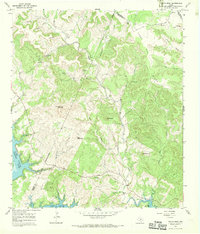
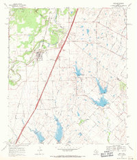
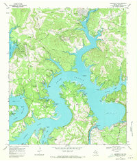 1968 Mansfield Dam1971 Print · USGSThe Travis County hill country is captured here in the late sixties as recreational growth transforms the landscape around Lake Travis. Researchers can trace local heritage at Simpson Cem or explore the development of Jonestown, Volente, and Hudson Bend.3 unique versions available
 - 1968 Map of Webberville, 1971 Print
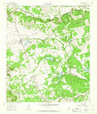
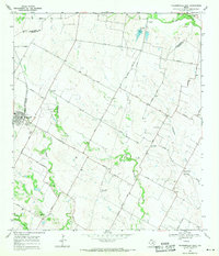
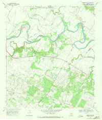 1968 Webberville1971 Print · USGSThe Colorado River bends through Travis County in the late 1960s, shaping a landscape of family farms and historic river crossings. Genealogists can trace deep local roots at Comanche Cemeteries, Webberville, and Garfield Cem.3 unique versions available
 - 1968 Map of Manor, 1971 Print
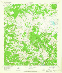
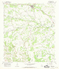
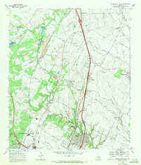
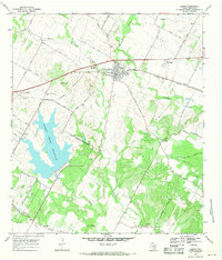 1968 Manor1971 Print · USGSNortheast of Austin in the late sixties, this area shows the growth of Manor along the Southern Pacific rail line. Researchers can trace numerous family burial grounds like Easley Cem and Glasscock Cem near the new Decker Creek Reservoir.3 unique versions available
 - 1968 Map of Lytton Springs, 1971 Print
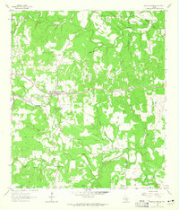
 1968 Lytton Springs1971 Print · USGSBastrop and Caldwell counties are shown in the late sixties as a landscape of rural oil exploration and established family homesteads. Genealogists can locate Upper Cedar Creek Cem and historical church sites like Saint Marys Ch and Mt Pleasant Ch.3 unique versions available
 - 1968 Map of Buda, 1971 Print
 1968 Buda1971 Print · USGSThe Hays and Travis County borderlands come to life in this late sixties survey of the Buda area. Genealogists and historians can trace family names and early rural centers through sites like Allen Cem, Science Hall, and the Martin Ch.4 unique versions available
 - 1968 Map of Jollyville, 1971 Print
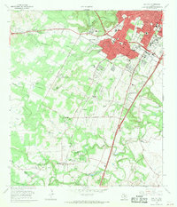
 1968 Jollyville1971 Print · USGSNorth of Austin in the late sixties, the landscape was beginning to shift from rural crossroads to suburban centers. Trace the foundations of Jollyville and Pecan Park alongside historic sites like Pond Springs Cem and the Oak Grove Ch.3 unique versions available
 - 1968 Map of Creedmoor, 1971 Print
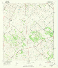 1968 Creedmoor1971 Print · USGSCentral Texas farm country comes into focus in the late sixties as Creedmoor and Niederwald anchor the rural landscape. Trace family roots through local landmarks like Vasquez Cem, Creedmoor Cem, and the Center Union Ch.4 unique versions available
 - 1968 Map of Bee Cave, 1971 Print
 1968 Bee Cave1971 Print · USGSIn the Texas Hill Country during the late sixties, the landscape around Bee Cave was shifting from quiet ranchland to a lakeside retreat. Genealogists and researchers can trace family lines through the White Rock Cem or locate the historic Trading Post and Shield Ranch.3 unique versions available
 - 1968 Map of Pflugerville East, 1971 Print
 1968 Pflugerville East1971 Print · USGSThe rural countryside east of Pflugerville in the late sixties reveals a landscape of family farms and Swedish-German heritage. Trace early roads and burial sites like New Sweden, Germania Hall, and Pfluger Cem.3 unique versions available
 - 1968 Map of Pflugerville West, 1971 Print
 1968 Pflugerville West1971 Print · USGSThe rail-and-road corridor north of Austin is captured here in the late sixties, showing the early industrial and suburban growth of Travis and Williamson counties. Genealogists and local historians can trace family sites like Bratton Cem and vanished waypoints such as Merrelltown and Coxville.2 unique versions available
End of results
Showing maps 1-25 of 25
Top cities of Travis County
- Austin historical maps
- Pflugerville historical maps
- Lakeway historical maps
- Manor historical maps
- Lago Vista historical maps
- Bee Cave historical maps
See more
Frequently asked questions
- What are the different types of historical maps available for Travis County?
- What is the oldest map of Travis County?
- Where can I purchase historical maps of Travis County for my home or office?
- Where can I download high-res historical maps of Travis County?
- Are there historical topographic maps available for Travis County?
- Is there historical aerial imagery available for Travis County?
- Where are historical maps of Travis County sourced from?