Old Maps of Travis County, Texas for Academic Research
Study the evolution of Travis County with 242 high-resolution historic maps. Whether you're teaching, researching, or modeling changes in land use, these maps provide essential visual documentation of urban, environmental, and geographic change.
- Analyze long-term change: Track patterns in development, transportation, and natural features.
- Ideal for environmental or urban studies: Support academic projects with primary historical map data.
- Use in the classroom or lab: Educators and researchers rely on these maps to bring historical context to life.
These maps are a powerful tool for teaching, research, and visualizing how Travis County has changed over the decades.
Travis County, TX maps
(242)- 1885 Map of Bastrop
 1885 Bastrop1885 Print · USGSCentral Texas was undergoing a rail-driven transformation in the late nineteenth century as steam power connected the frontier to the Gulf. Genealogists can trace family names and old homesites near Rice's Crossing, Hills Prairie, and along the vital Houston and Texas Central Railroad.
 - 1887 Map of Blanco
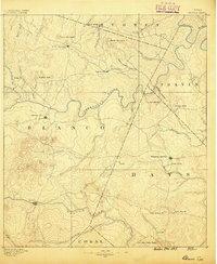 1887 Blanco1887 Print · USGSCentral Texas at the dawn of the Hill Country's development, when early ranching life centered on river fords and spring-fed creeks. Trace the paths between Johnson City, Blanco, and Dripping Springs, or locate landmarks like Jacob's Well and Dead Mans Hole.
 - 1887 Map of Burnet
 1887 Burnet1887 Print · USGSCentral Texas in the late nineteenth century is defined here by the arrival of the rail line and the wild course of the Colorado River. Genealogists and historians can trace early settlements and transit points like Tiger Mill, Bluffton, and Wolf Crossing.
 - 1893 Map of Georgetown
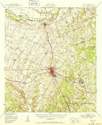
 1893 Georgetown1893 Print · USGSCentral Texas in the late 1800s was a landscape in flux as rail lines reshaped old frontier settlements. Genealogists can trace the shift from riverside villages like Bagdad and Old Round Rock to new rail hubs such as Leander and Hutto.5 unique versions available
 - 1893 Map of Burnet
 1893 Burnet1893 Print · USGSThe Texas Hill Country comes alive in this late nineteenth-century survey, showcasing a landscape of river crossings and early rail expansion. Researchers can locate vanished communities and rural landmarks like Tiger Mill, Wolf Crossing, and the old depot at Bertram.
 - 1893 Map of Bastrop
 1893 Bastrop1893 Print · USGSBastrop and the Colorado River valley are captured here in the late nineteenth century as the railroad transformed the Texas interior. Researchers can trace early property lines and community centers like Lexington, McDade, and the high vistas of the Yegua Knobs.
 - 1894 Map of Blanco
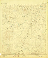 1894 Blanco1894 Print · USGSThe Texas Hill Country comes into focus during the late frontier era, centered on the newly established Johnson City and Blanco. Genealogists can trace early homesteads and communities near Jacobs Well, Dripping Springs, and the isolated Cypress Mill.5 unique versions available
 - 1896 Map of Austin
 1896 Austin1896 Print · USGSAustin and its surrounding counties are shown in the mid-1890s, capturing the transition from frontier river crossings to a rail-centered regional hub. Researchers can trace historic river access points like Cameron Ferry alongside vanished landmarks such as Johnson's Institute and Moore & Berry's Store.
 - 1897 Map of Austin
 1897 Austin1897 Print · USGSTexas in the late 1890s reveals a capital city defined by its river and an expanding railroad network. Genealogists and historians can trace family-named landmarks and early centers of learning like Saint Edward's College, Johnson's Institute, and Anderson Mill.
 - 1903 Map of Burnet
 1903 Burnet1903 Print · USGSThe Texas Hill Country at the turn of the century shows a landscape of river-side industry and early rail expansion. Trace the historic Houston and Texas Central Railroad line through Burnet and Bertram or locate long-standing landmarks like Morman Mill and Tanyard Crossing.
 - 1904 Map of Bastrop
 1904 Bastrop1904 Print · USGSBastrop and Smithville thrive along the Colorado River at the turn of the century, serving as vital hubs for the Texas interior. Trace ancestral roots and old transport routes through Nashs Ferry, the Coal Mine near Sayersville, and Colorado Chapel.3 unique versions available
 - 1909 Map of Burnet
 1909 Burnet1909 Print · USGSThe Texas Hill Country at the turn of the century shows a landscape of river crossings and rail towns before the creation of the Highland Lakes. Genealogists can locate family-named landmarks like Morman Mill, Tumlinson, and rural schoolhouses such as Berry School or Sunny Lane.3 unique versions available
 - 1910 Map of Austin
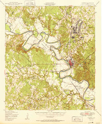
 1910 Austin1910 Print · USGSAustin and the surrounding Travis County hill country are captured here at the start of the twentieth century. Genealogists and researchers can locate pioneer landmarks like Anderson Mill, Mc.Kinney Falls, and numerous river crossings including Lohmann Ford.3 unique versions available
 - 1925 Map of Georgetown 4-d
 1925 Georgetown 4-d1925 Print · USGSWilliamson County in the mid-1920s shows a landscape of developing prairie towns and rural cotton gins. Genealogists can trace early homesteads and landmarks like Stony Point School, Bell Gin, and the historic Hutto townsite.
 - 1928 Map of Round Rock
 1928 Round Rock1928 Print · USGSWilliamson County in the mid-twenties shows a landscape of developing rail hubs and scattered rural school districts. Genealogists can locate family landmarks like Bell Gin, Old Round Rock, and the Strickland Grove Church.2 unique versions available
 - 1930 Map of Austin-2
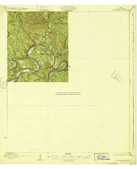
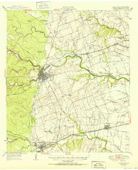
 1930 Austin-21930 Print · USGSThe winding loops of the Colorado River dominate this 1930 survey of Travis County before the era of major dams. Researchers can trace early crossings like Stewart Ford and locate local landmarks such as the Jack Sch and Ch.
 - 1930 Map of Blanco-1
 1930 Blanco-11930 Print · USGSCentral Texas river valleys appear in high detail during the early 1930s, showing the landscape before later reservoir projects. Trace the original paths of the Colorado River and Pedernales River past Pleasant Grove Sch and Buggy Ford.
 - 1932 Map of Mt. Bonnell
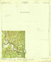
 1932 Mt. Bonnell1932 Print · USGSThe meanders of the Texas Hill Country are captured here in the early 1930s, just before the landscape was transformed by dam construction. You can trace early river life through multiple historical crossings like Lohmann Ford and rural sites like Cox Spring Sch.2 unique versions available
 - 1932 Map of Bertram
 1932 Bertram1932 Print · USGSBurnet County’s river-bound landscape is documented here in the early 1930s, featuring the rural life of Smithwick and the winding COLORADO RIVER. Genealogists can trace family footprints at Pleasant Valley Sch, Hale Ch, and historic river fords like SINGLETON CROSSING.2 unique versions available
 - 1948 Map of Elgin, 1969 Print
 1948 Elgin1969 Print · USGSCentral Texas in the late 1940s was a landscape of rail-junction towns and emerging military training grounds. Genealogists can trace rural family legacies through sites like Youngs Prairie Cem, the Camp Swift Military Reservation, and Red Town Sch.2 unique versions available
 - 1948 Map of Bastrop, 1972 Print
 1948 Bastrop1972 Print · USGSBastrop and its winding river bends are captured here in the late 1940s as the military and oil industries integrated with rural farming life. Trace the footprints of the Camp Swift Military Reservation or locate family sites at Bartons Farm, Woods Cem, and Shiloh Sch.
 - 1949 Map of Round Rock, 1967 Print
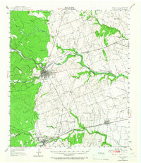 1949 Round Rock1967 Print · USGSCentral Texas in the late 1940s reveals a landscape defined by cotton ginning and the heavy influence of competing rail lines. Genealogists can locate family landmarks like Palm Valley Ch, the Bell Gin, and rural schools such as Palacky Sch or Bell Sch.2 unique versions available
 - 1950 Map of Bastrop
 1950 Bastrop1950 Print · USGSThe Colorado River valley around the turn of the decade is defined by sprawling military infrastructure and tight-knit farming communities. Researchers can trace the heritage of Bastrop and Sayersville or locate family landmarks like Burleson Cem and Union Hill Sch.
 - 1950 Map of Elgin
 1950 Elgin1950 Print · USGSMid-century Elgin and the surrounding blackland prairies are shown here just as the local rail and brick industries were peaking. Researchers can trace family roots through numerous local sites like Youngs Prairie Cem, Coupland, and the Brickyards at Butler.
 - 1951 Map of Round Rock
 1951 Round Rock1951 Print · USGSWilliamson County at mid-century reveals a landscape of thriving rural communities and intersecting rail lines before the era of modern suburban expansion. Local researchers can pinpoint family landmarks like Palm Valley Ch, trace the old settlement at Old Round Rock, or locate the Bell Gin.
Showing maps 1-25 of 242
Top cities of Travis County
- Austin historical maps
- Pflugerville historical maps
- Lakeway historical maps
- Manor historical maps
- Lago Vista historical maps
- Bee Cave historical maps
See more
Frequently asked questions
- What are the different types of historical maps available for Travis County?
- What is the oldest map of Travis County?
- Where can I purchase historical maps of Travis County for my home or office?
- Where can I download high-res historical maps of Travis County?
- Are there historical topographic maps available for Travis County?
- Is there historical aerial imagery available for Travis County?
- Where are historical maps of Travis County sourced from?