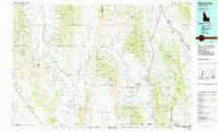
1980s Maps of Box Elder County, Utah
Explore 37 historic maps of Box Elder County from the 1980s. These maps offer a rare glimpse into what life looked like during the 1980s — showing old roads, neighborhoods, homes, and landmarks that have changed or disappeared over time.
Whether you're researching your family's past, planning a metal detecting trip, or studying how Box Elder County's landscape evolved across the 1980s, these high-resolution maps are a powerful tool for exploring the history of this region.
- Focus on a specific era: All maps on this page are from the 1980s, giving you a focused view of this time period.
- See what’s changed: Compare century-old streets, trails, and buildings to today's modern landscape using overlays and satellite layers.
- Research with precision: Use these maps for genealogy, historical research, land use analysis, or educational projects.
- View, download, or print: Maps are fully viewable online in high resolution, and can be downloaded or printed for your own records.
Start exploring Box Elder County's history through authentic maps from the 1980s. This is your window into the past.
Box Elder County, UT maps
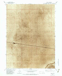
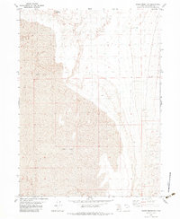
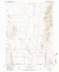
(37)- 1981 Map of Wells
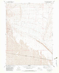
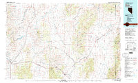 1981 Wells1981 Print · USGSNortheast Nevada during the early 1980s reveals a landscape shaped by transcontinental rail lines and remote desert outposts. Trace the historic paths of the Southern Pacific and Western Pacific near the settlements of Wells, Cobre, and Montello.2 unique versions available
 - 1982 Map of Jackpot
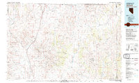 1982 Jackpot1982 Print · USGSThe high desert borderlands of Nevada, Idaho, and Utah are captured here in the early eighties as a hub of mining and transport. Researchers can locate remote operations like Gold Note Mine and trace the Union Pacific line past Delaplain.
 - 1983 Map of Jackson
 1983 Jackson1983 Print · USGSBox Elder County's desert landscape was defined by the iron rail and sun-baked basins in the early 1980s. Researchers can trace the Southern Pacific line past the settlement of Jackson and identify the rocky outcrops of Pigeon Mountain.
 - 1983 Map of Desert Peak
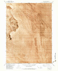
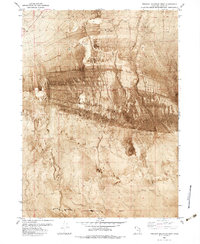
 1983 Desert Peak1983 Print · USGSThe Newfoundland Mountains rise from the Great Basin salt crusts in the early 1980s, revealing a landscape defined by isolation and military use. Researchers can trace old prospecting sites near Desert Peak and locate remote infrastructure like the Landing Strips and Jeep Trail.
 - 1983 Map of Lemay
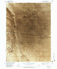
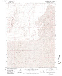
 1983 Lemay1983 Print · USGSThe Great Salt Lake Desert in the early 1980s reveals a landscape defined by industrial infrastructure and extreme terrain. Researchers can trace the path of the Southern Pacific railroad past Lemay and across the expansive Mud Flat.
 - 1983 Map of Lucin 4 SW
 1983 Lucin 4 SW1983 Print · USGSThe western edges of the Great Salt Lake Desert are captured in the early eighties, showcasing a landscape of stark geological formations. Trace the remote Jeep Trail through the Silver Island Mountains and locate a solitary mine overlooking the vast Mud Flat.
 - 1983 Map of Round Mountain NW
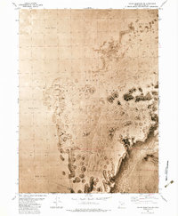
 1983 Round Mountain NW1983 Print · USGSThe West Desert of Box Elder County is documented in the early eighties as a specialized military training environment. Researchers can trace the boundaries of the Hill Air Force Range and the expansive Mud Flat terrain that characterizes this isolated landscape.
 - 1983 Map of Bovine SE
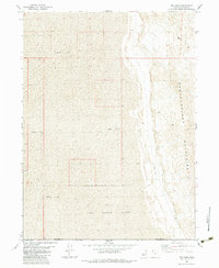
 1983 Bovine SE1983 Print · USGSThe high desert of Box Elder County during the early 1980s reveals a landscape defined by industrial transit and water engineering. Trace the straight path of the Southern Pacific railroad as it crosses the Mud Flat near several Flowing Wells.
 - 1983 Map of Terrace Mountain West
 1983 Terrace Mountain West1983 Print · USGSBox Elder County at the start of the eighties reveals a desert landscape shaped by water management and unique topography. Trace the path of an Aqueduct across the Mud Flat or locate the historic Watercress (Site) and Flowing Wells.
 - 1983 Map of Terrace Mountain East
 1983 Terrace Mountain East1983 Print · USGSBox Elder County at the start of the eighties reveals a stark landscape of desert peaks and prehistoric lakebeds. Geologists and outdoorsmen can trace the elevation changes of Terrace Mountain as it meets the vast expanse of the Mud Flat.
 - 1983 Map of Big Pass
 1983 Big Pass1983 Print · USGSThe high desert of western Utah was a landscape of military range and rugged ridges in the early 1980s. Researchers can trace the boundaries of the Hill Air Force Range and locate remote infrastructure like the Landing Strip near Big Pass.
 - 1983 Map of Round Mountain SW
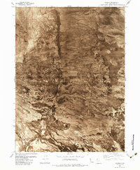
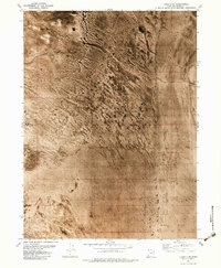
 1983 Round Mountain SW1983 Print · USGSThe Great Salt Lake Desert was a critical military landscape in the early eighties, as shown on this unique orthophoto survey. Military history researchers can locate an Observation Tower and trace the vast expanse of the Hill Air Force Range across the Mud Flat.
 - 1983 Map of Sheep Mountain
 1983 Sheep Mountain1983 Print · USGSBox Elder County at the start of the 1980s reveals a landscape defined by the stark transition from high peaks to desert basins. Researchers can trace the minimal paths through this terrain, including a remote Jeep Trail and the reaches of the Mud Flat below Sheep Mountain.
 - 1983 Map of Groome
 1983 Groome1983 Print · USGSThe northern Utah desert is defined by rail and mineral extraction in the early 1980s. Local researchers can trace the path of the Southern Pacific through Groome or locate industrial sites like the Mines and Gravel Pits near the Newfoundland Mountains.
 - 1983 Map of Lucin 4 NE
 1983 Lucin 4 NE1983 Print · USGSBox Elder County at the start of the eighties reveals a stark desert landscape shaped by ancient lake beds. Researchers can examine the intricate drainage patterns of the Mud Flat and locate the isolated Flowing Well in this remote corner of Utah.
 - 1983 Map of Round Mountain
 1983 Round Mountain1983 Print · USGSThe border of Box Elder and Tooele counties in the early eighties shows a landscape of military range and high desert ridges. Researchers can locate the Observation Tower, trace the contours of Round Mountain, and identify industrial Gravel Pits.
 - 1983 Map of Meadow Spring
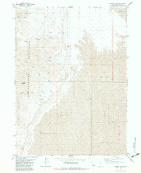
 1983 Meadow Spring1983 Print · USGSThe high desert of Box Elder County in the early eighties shows a landscape defined by the stark transition from peaks to salt flats. Researchers can trace the path of the Southern Pacific railroad and locate remote features like Meadow Spring and the Landing Strip.
 - 1983 Map of Keller Well
 1983 Keller Well1983 Print · USGSThe Great Salt Lake Desert's western reaches are captured here in the early eighties, where the Newfoundland Mountains meet the vast Mud Flat. Researchers can trace remote desert infrastructure like Keller Well and the boundaries of the Hill Air Force Range.
 - 1983 Map of Bovine
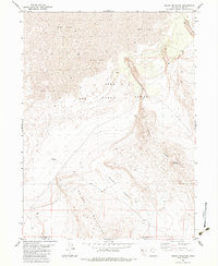
 1983 Bovine1983 Print · USGSThe high deserts of Box Elder County in the early 1980s reveal a landscape of extreme contrasts between mountain peaks and level plains. Researchers can locate the remote settlement of Bovine, trace the reach of the Mud Flat, and find landmarks like Bull Springs and a Radio Tower.
 - 1983 Map of Tangent Peak
 1983 Tangent Peak1983 Print · USGSNorthern Utah's high desert reveals its mining and transit history in the early eighties. Trace mineral exploration at various prospects or navigate the passes at Shelter Mountain Pass and Big Pass.
 - 1983 Map of Sally Mountain
 1983 Sally Mountain1983 Print · USGSThe Great Salt Lake Desert was a center for military and industrial activity in the early 1980s. Local researchers can trace the infrastructure of the Hill Air Force Range, locating Heliports, an Aqueduct, and mining sites near Wrathall Pass.
 - 1983 Map of Miners Basin
 1983 Miners Basin1983 Print · USGSThe western desert of Box Elder County is captured in the early eighties as a landscape of stark contrasts. Researchers can trace the legacy of remote mining operations through Miners Basin, locating various Mines and the USLM No 1 survey marker.
 - 1983 Map of Lucin 4 SE
 1983 Lucin 4 SE1983 Print · USGSBox Elder and Tooele counties meet in this stark desert corridor during the early 1980s. Researchers of military and western land use can trace the perimeter of the Air Force Range as it crosses the vast Mud Flat and lone Hill.
 - 1983 Map of Lucin 4 NW
 1983 Lucin 4 NW1983 Print · USGSThe Great Salt Lake Desert's edge comes into focus during the early 1980s, revealing a landscape shaped by salt and stone. Researchers can trace hydrology and terrain from the Silver Island Mountains to Miry Wash and several isolated Springs.
 - 1984 Map of Malad City
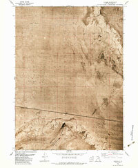
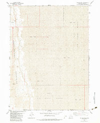
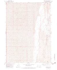
 1984 Malad City1984 Print · USGSSoutheastern Idaho in the mid-eighties shows a landscape of high valleys and prominent ranges between the Malad and Curlew basins. Genealogists and historians can trace the foundations of local ranching communities like Samaria, Holbrook, and Arbon, or locate the Black Pine Bird Sanctuary.2 unique versions available
Showing maps 1-25 of 37
Top cities of Box Elder County
- Brigham City historical maps
- Tremonton historical maps
- Perry historical maps
- Garland historical maps
- Willard historical maps
- Honeyville historical maps
See more
Frequently asked questions
- What are the different types of historical maps available for Box Elder County?
- What is the oldest map of Box Elder County?
- Where can I purchase historical maps of Box Elder County for my home or office?
- Where can I download high-res historical maps of Box Elder County?
- Are there historical topographic maps available for Box Elder County?
- Is there historical aerial imagery available for Box Elder County?
- Where are historical maps of Box Elder County sourced from?