1960s Maps of Millard County, Utah
Explore 34 historic maps of Millard County from the 1960s. These maps offer a rare glimpse into what life looked like during the 1960s — showing old roads, neighborhoods, homes, and landmarks that have changed or disappeared over time.
Whether you're researching your family's past, planning a metal detecting trip, or studying how Millard County's landscape evolved across the 1960s, these high-resolution maps are a powerful tool for exploring the history of this region.
- Focus on a specific era: All maps on this page are from the 1960s, giving you a focused view of this time period.
- See what’s changed: Compare century-old streets, trails, and buildings to today's modern landscape using overlays and satellite layers.
- Research with precision: Use these maps for genealogy, historical research, land use analysis, or educational projects.
- View, download, or print: Maps are fully viewable online in high resolution, and can be downloaded or printed for your own records.
Start exploring Millard County's history through authentic maps from the 1960s. This is your window into the past.
Millard County, UT maps
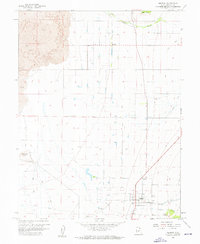
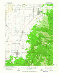
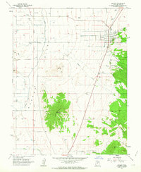
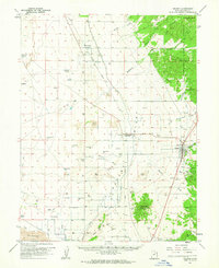
(34)- 1960 Map of Lund
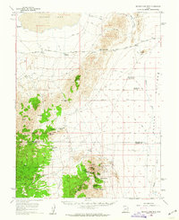
 1960 Lund1960 Print · USGSEastern Nevada and the Utah borderlands are mapped here during the mid-twentieth century, showing a landscape of high peaks and isolated ranching outposts. Researchers can locate remote mining sites like the Tungsten Queen Mine and early settlements including Lund and Shoshone.
 - 1960 Map of Notch Peak, 1961 Print
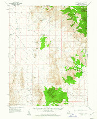
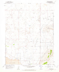
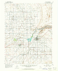
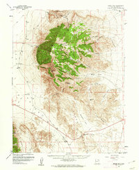 1960 Notch Peak1961 Print · USGSMillard County's high desert peaks and mining claims are detailed in this early 1960s survey of the House Range. Researchers can trace historic access routes to the Brown Queen Mine, identify remote water sources like Painter Spring, and locate landmarks like Notch Peak.2 unique versions available
 - 1960 Map of Granite Mountain, 1962 Print
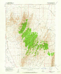
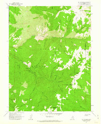
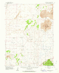
 1960 Granite Mountain1962 Print · USGSJuab and Millard Counties are shown here during the early sixties, a period of remote ranching and rugged desert navigation. Genealogists and historians can trace the foundations of Granite Ranch and locate water sources like Hole-in-the-Wall Reservoir.
 - 1960 Map of Conger Range, 1962 Print
 1960 Conger Range1962 Print · USGSWest of the Sevier Desert in the early 1960s, this area of Millard County reveals a world of remote ranching outposts and high-altitude mountain passes. Researchers can trace the early footprints of Eskdale or find family-named landmarks like Robison Ranch and Okelberry Pass.
 - 1960 Map of Burbank Hills, 1962 Print
 1960 Burbank Hills1962 Print · USGSBurbank Hills and the Ferguson Desert come into focus during the early sixties, showing a landscape shaped by high-desert ranching and travel. Trace the routes of the Ferguson Trail and Cowboy Jeep Trail or locate remote water sources like Davies Well and Clay Spring.2 unique versions available
 - 1960 Map of Meadow, 1962 Print
 1960 Meadow1962 Print · USGSMeadow and Flowell are captured here in the early 1960s as vital agricultural communities sustained by a complex irrigation network. Researchers can locate family sites near the Meadow Cem or trace the volcanic geology of the western Lava fields and White Mtn.
 - 1960 Map of Frisco Peak, 1962 Print
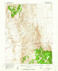
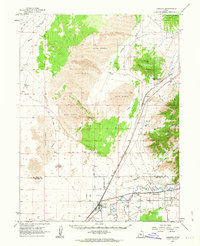
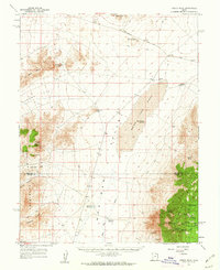 1960 Frisco Peak1962 Print · USGSThe high desert of western Utah is captured here in the early sixties, showing the rugged intersection of the Beaver and Millard county lines. Researchers can trace historic industrial sites like the Two Rock Charcoal Kilns, Indian Queen Mine, and remote outposts such as Bagnell Corral.2 unique versions available
 - 1960 Map of Gandy, 1962 Print
 1960 Gandy1962 Print · USGSIn the arid borderlands of West-Central Utah during the early sixties, water and remote transit routes defined the local landscape. Genealogists and historians can trace the foundations of Gandy, the Smithville site, and scattered Graves along the Gandy Road.2 unique versions available
 - 1960 Map of Wah Wah Summit, 1962 Print
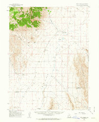
 1960 Wah Wah Summit1962 Print · USGSThe western Utah desert at the start of the 1960s shows a landscape defined by ranching and ecological research. Genealogists and historians can trace old landmarks like Kelleys Place and Range Headquarters or follow the Sand Pass Jeep Trail.2 unique versions available
 - 1960 Map of Beaver Lake Mts., 1962 Print
 1960 Beaver Lake Mts.1962 Print · USGSThe Millard and Beaver county line ran through a busy mining district in the early sixties. You can trace early industrial sites like the Galena Mine, locate the Charcoal Kilns, and find the School Bus Corral near the Frisco Mts.2 unique versions available
 - 1960 Map of Crystal Peak, 1962 Print
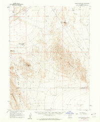
 1960 Crystal Peak1962 Print · USGSMillard County, Utah, was a land of isolation and high-desert terrain in the early sixties, crisscrossed by remote jeep trails. Researchers can trace historic routes over Snake Pass and locate desert landmarks like Crystal Peak and the Pine Pass Reservoir.2 unique versions available
 - 1960 Map of Conger Mountain, 1962 Print
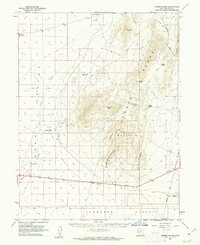
 1960 Conger Mountain1962 Print · USGSThe high desert of western Millard County is captured here in the early 1960s, showing the intersection of the Confusion Range and the Ferguson Desert. Researchers can trace remote water sources and cattle-country landmarks like Conger Spring, Horse Heaven, and Kings Canyon.2 unique versions available
 - 1960 Map of The Barn, 1962 Print
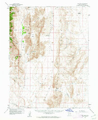 1960 The Barn1962 Print · USGSMillard County's high desert peaks and lonely ranching outposts are preserved here in the early sixties. Researchers can trace remote routes like the Snake Pass Road and locate the settlement at Ibex or the water at Ibex Well.3 unique versions available
 - 1961 Map of Fillmore, 1963 Print
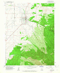 1961 Fillmore1963 Print · USGSFillmore and the Pavant Valley are captured here in the early sixties, showing the town's grid alongside Utah's first seat of government. Researchers can locate the Old State Capitol, the historic Old Indian Reservation Boundary, and local family landmarks like Ruths Pond.2 unique versions available
 - 1961 Map of Mt. Catherine, 1963 Print
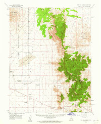
 1961 Mt. Catherine1963 Print · USGSThe Pavant Range in Millard County comes into focus in the early sixties, showing the recreational development of the forest. Researchers can locate remote forest outposts like Indian Springs Guard Station and unique landmarks such as Pistol Rock Picnic Area.2 unique versions available
 - 1961 Map of Richfield, 1963 Print
 1961 Richfield1963 Print · USGSRichfield and the Sevier River valley thrive in the early sixties as a center for agriculture and local industry. Genealogists and historians can trace the irrigation network of the Vermillion Canal, identify early schools like High Sch, and locate the old path of the Denver and Rio Grande Western Railroad.
 - 1961 Map of Trout Creek, 1963 Print
 1961 Trout Creek1963 Print · USGSJuab County’s remote desert basins and mountain ranges are documented here in the early 1960s, showing a landscape shaped by scarce water and isolation. Researchers can trace the layout of Partoun and Trout Creek or locate vital desert water sources like Coyote Spring and Salt Marsh Lake.
 - 1962 Map of Delta
 1962 Delta1962 Print · USGSWest Central Utah in the early sixties reveals a landscape of desert agriculture and military testing grounds. Researchers can trace the Union Pacific line through Delta or locate historic sites like the Pony Express Monument and Silver City.
 - 1962 Map of Fillmore, 1963 Print
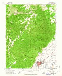
 1962 Fillmore1963 Print · USGSMillard County is captured here in the early 1960s, showing the transition from the Pavant Range to the valley floor. Genealogists can locate family sites near Kanosh Indian Village, Meadow Cem, and the Old Indian Treaty Boundary.2 unique versions available
 - 1962 Map of The Sink, 1963 Print
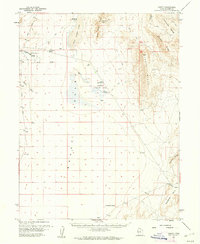
 1962 The Sink1963 Print · USGSMillard County's arid basin is captured in the early sixties, a landscape defined by its vital water sources and volcanic geology. Researchers can trace the Central Utah Trail or locate numerous Flowing Wells near The Sink and Bald Mountain.2 unique versions available
 - 1962 Map of Tabernacle Hill, 1963 Print
 1962 Tabernacle Hill1963 Print · USGSThe volcanic fields of Millard County are captured here in the early sixties, showing a landscape of lava flows and desert ridges. Explore the rugged geography of Tabernacle Hill, the volcanic expanse of The Cinders, and isolated water sites like Hot Springs.2 unique versions available
 - 1962 Map of Lynndyl, 1963 Print
 1962 Lynndyl1963 Print · USGSThe high desert of Juab and Millard Counties comes into focus during the early sixties, centered on the railroad hub of Lynndyl. Local historians can trace the Union Pacific line, the remote Arrowhead Mine, and the irrigation network of the Utah Central Canal.2 unique versions available
 - 1962 Map of Holden, 1963 Print
 1962 Holden1963 Print · USGSMillard County's agricultural heartland is captured here in the early sixties, showing the vital systems of the Pavant Valley. Genealogists and local historians can trace the foundations of Holden and Greenwood alongside the Union Pacific rail line and the Cem.2 unique versions available
 - 1962 Map of Holden, 1963 Print
 1962 Holden1963 Print · USGSThe Pavant Valley's mid-century agricultural and rail landscape is captured here just as the highway network was evolving. Researchers can locate the Cem at Holden, trace the Union Pacific line through Greenwood, and find the Central Utah Canal.2 unique versions available
 - 1962 Map of Delta, 1964 Print
 1962 Delta1964 Print · USGSThe Sevier Desert in the early sixties was a landscape defined by its intricate irrigation network and the Union Pacific rail line. Researchers can trace the heritage of local water systems and settlements from Sugarville down to the historic Ft Deseret (Ruins).3 unique versions available
Showing maps 1-25 of 34
Top cities of Millard County
- Delta historical maps
- Fillmore historical maps
- Hinckley historical maps
- Oak City historical maps
- Kanosh historical maps
- Holden historical maps
See more
Frequently asked questions
- What are the different types of historical maps available for Millard County?
- What is the oldest map of Millard County?
- Where can I purchase historical maps of Millard County for my home or office?
- Where can I download high-res historical maps of Millard County?
- Are there historical topographic maps available for Millard County?
- Is there historical aerial imagery available for Millard County?
- Where are historical maps of Millard County sourced from?