2000s (21st Century) Maps of Millard County, Utah
Explore 748 historic maps of Millard County from the 2000s (21st Century). These maps offer a rare glimpse into what life looked like during the 2000s — showing old roads, neighborhoods, homes, and landmarks that have changed or disappeared over time.
Whether you're researching your family's past, planning a metal detecting trip, or studying how Millard County's landscape evolved across the 2000s, these high-resolution maps are a powerful tool for exploring the history of this region.
- Focus on a specific era: All maps on this page are from the 2000s, giving you a focused view of this time period.
- See what’s changed: Compare century-old streets, trails, and buildings to today's modern landscape using overlays and satellite layers.
- Research with precision: Use these maps for genealogy, historical research, land use analysis, or educational projects.
- View, download, or print: Maps are fully viewable online in high resolution, and can be downloaded or printed for your own records.
Start exploring Millard County's history through authentic maps from the 2000s. This is your window into the past.
Millard County, UT maps
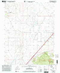
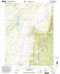
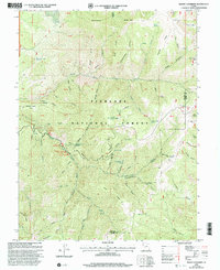
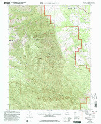
(748)- 2001 Map of Dog Valley Peak, 2003 Print
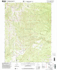
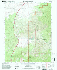 2001 Dog Valley Peak2003 Print · USGSMillard County at the start of the millennium remains a landscape of high passes and hidden canyons where forest and desert meet. Researchers can trace land use through scattered Mine Shaft locations, old Corral sites, and the notable Cove Fort-Dog Valley Pass.
 - 2001 Map of Elsinore, 2003 Print
 2001 Elsinore2003 Print · USGSThe Sevier Valley at the turn of the millennium was a hub of irrigation-based agriculture and small-town life. Researchers can trace the path of historic waterworks like the Elsinore Canal and locate family landmarks in Elsinore, Joseph, and Monroe.
 - 2001 Map of Joseph Peak, 2003 Print
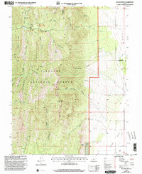
 2001 Joseph Peak2003 Print · USGSThe high peaks and deep hollows of the Millard-Sevier county line are mapped here at the start of the millennium. Researchers can trace remote trails and 4WD tracks to high-country landmarks like Joseph Peak, Indian Flat, and the Gardener Hollow Reservoirs.
 - 2001 Map of Fillmore, 2003 Print
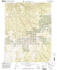
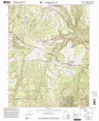
 2001 Fillmore2003 Print · USGSFillmore remains a vital Utah county seat at the start of the twenty-first century, anchored by its civic heritage and high mountain backdrop. Researchers can locate the Old State Capitol, the Fillmore Cem, and regional landmarks like the Fillmore Airport.
 - 2001 Map of White Pine Peak, 2003 Print
 2001 White Pine Peak2003 Print · USGSThe high wilderness of Sevier County is documented here at the turn of the millennium, showing a landscape of deep canyons and forest ridges. Trace high-clearance 4WD routes to remote landmarks like The Elbow, White Pine Peak, and Burnt Hollow.
 - 2001 Map of Kanosh, 2003 Print
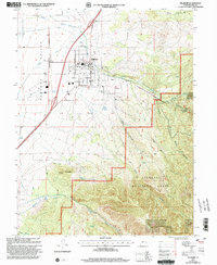
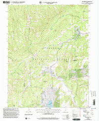
 2001 Kanosh2003 Print · USGSThe Pahvant Valley landscape around Kanosh appears at the turn of the millennium as a crossroads of mountain runoff and high-desert agriculture. Researchers can trace the local water network from the Black Rock Volcano past the Kanosh Indian Village to the cemetery and athletic field in town.
 - 2001 Map of Scipio Lake, 2003 Print
 2001 Scipio Lake2003 Print · USGSMillard County at the start of the twenty-first century reveals a landscape of high-altitude canyons and vital water sources. Researchers can trace the drainage of Round Valley Creek into Scipio Lake or locate remote landmarks like Maple Grove and Dairy Knoll.
 - 2001 Map of Oak City South, 2003 Print
 2001 Oak City South2003 Print · USGSMillard County, Utah, is shown here as it transitioned into the new millennium, where the Pahant Valley rises into the high peaks of the Fish Lake National Forest. Researchers can locate the Cem near Oak City, trace old mining activity at a Mine Shaft, or find secluded spots like Oak Creek Campground.
 - 2001 Map of Sixmile Point, 2003 Print
 2001 Sixmile Point2003 Print · USGSMillard County at the turn of the millennium shows an intricate desert landscape shaped by water and high-altitude forest boundaries. Researchers can trace the extensive network of Wells and irrigation ditches across the Pahvant Valley or locate landmarks like Sixmile Point and Telegraph Point.
 - 2001 Map of Williams Peak, 2003 Print
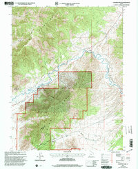
 2001 Williams Peak2003 Print · USGSThe Fishlake National Forest area and the mountains bordering Millard and Juab Counties are shown here as they appeared at the turn of the century. Trace the drainages of Eightmile Creek and Little Oak Creek or locate remote spots like Little Creek Campground and Williams Peak.
 - 2001 Map of Champlin Peak, 2003 Print
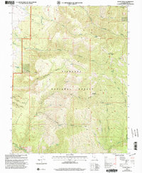
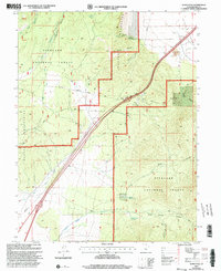
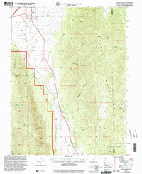
 2001 Champlin Peak2003 Print · USGSThe Sevier River corridor in Juab County is shown here at the turn of the millennium, detailing a landscape shaped by water management and industry. Researchers can trace the routes of the Leamington Canal and Central Utah Canal or locate the Cement Plant near Uisco.
 - 2001 Map of Fool Creek Peak, 2003 Print
 2001 Fool Creek Peak2003 Print · USGSThe high ridges of the Fish Lake Mountains are documented at the turn of the millennium, following the Juab and Millard county line. Researchers can trace early mining traces at Mine Shafts and remote water sources like Mourning Dove Spring and Wild Horse Spring.
 - 2001 Map of Oak City North, 2003 Print
 2001 Oak City North2003 Print · USGSOak City and the surrounding Millard County desert are captured here as they appeared at the turn of the millennium. Researchers can trace the Central Utah Canal and historic landmarks like Fool Creek Reservoir, Corral, and the Sand Dunes.
 - 2001 Map of Sunset Peak, 2003 Print
 2001 Sunset Peak2003 Print · USGSMillard County's high Pavant Range is shown here at the start of the millennium within the Fish Lake National Forest. Outdoor historians and researchers can trace the drainages of Big Cottonwood Creek, locate high-altitude prospects, or find the Adelaide Campground.
 - 2001 Map of Red Ridge, 2003 Print
 2001 Red Ridge2003 Print · USGSHigh-desert peaks and national forest boundaries define the Millard and Sevier County line during the early 2000s. Researchers can trace remote water sources like Bull Valley Spring and navigate by landmarks like Granddad Peak and Three Creeks Reservoir.
 - 2001 Map of Trail Mountain, 2003 Print
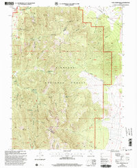
 2001 Trail Mountain2003 Print · USGSHigh-altitude forest and mountain terrain in central Utah are documented here at the turn of the millennium. Researchers can trace historic access routes and water sources like Three Creeks Reservoir, Sawmill Bench, and the winding 4WD Trail.
 - 2001 Map of Mount Catherine, 2003 Print
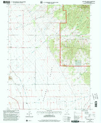
 2001 Mount Catherine2003 Print · USGSThe high Pahvant Range at the turn of the millennium reveals a landscape of remote ridges and vital forest springs. Outdoor historians can trace recreation and water sources across Fishlake National Forest, from Copley's Cove Campground to Shingle Mill Spring.
 - 2001 Map of Cove Fort, 2003 Print
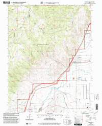
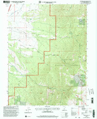
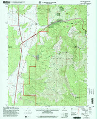 2001 Cove Fort2003 Print · USGSCentral Utah at the start of the twenty-first century reveals a rugged landscape where pioneer history meets modern energy and forestry. Researchers can trace the layout of Old Cove Fort, the mining sites near Sulphurdale, and the reaches of the Tushar Mountains.
 - 2001 Map of Scipio Pass, 2003 Print
 2001 Scipio Pass2003 Print · USGSMillard County at the turn of the millennium remains a high-desert crossroads defined by rugged transit corridors and isolated water sources. Researchers can trace the alignment of the modern Pipeline and locate essential springs like Wild Goose Spring or the historic Prospect near Ebbs Canyon.
 - 2001 Map of Duggins Creek, 2003 Print
 2001 Duggins Creek2003 Print · USGSMillard County at the start of the twenty-first century reveals a landscape defined by the intersection of forest highlands and valley irrigation. Trace the vital water networks of the Central Utah Canal and East Fork Church Ditch as they serve the Pahvant Valley.
 - 2001 Map of Beehive Peak, 2003 Print
 2001 Beehive Peak2003 Print · USGSThe high ridgelines of the Sevier and Millard county line are captured here at the turn of the millennium. Researchers can trace historic water sources and terrain features like Willow Creek Spring, the heights of Beehive Peak, and the livestock flats at Ezras Flat.
 - 2001 Map of Coffee Peak, 2003 Print
 2001 Coffee Peak2003 Print · USGSThe high canyons of Millard County are captured here at the start of the millennium, showing a landscape of forest management and remote ranching. Trace the path of the Pioneer Aqueduct Ditch or locate landmarks like the Indian Ranch and Coffee Peak.
 - 2001 Map of Scipio South, 2003 Print
 2001 Scipio South2003 Print · USGSThe outskirts of Scipio at the turn of the 21st century reveal a landscape of high-desert valleys and steep National Forest canyons. Researchers can locate family-named landmarks like Billys Canyon, find the town Cem, or trace the path of Round Valley Creek.
 - 2010 Map of Deadman Point, 2010 Print
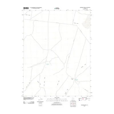 2010 Deadman Point2010 Print · USGSCovers Millard County, including United States, Utah, and other nearby areas
 - 2010 Map of Burbank Pass, 2010 Print
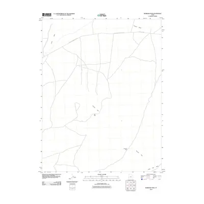 2010 Burbank Pass2010 Print · USGSCovers Millard County, including United States, Utah, and other nearby areas
Showing maps 1-25 of 748
Top cities of Millard County
- Delta historical maps
- Fillmore historical maps
- Hinckley historical maps
- Oak City historical maps
- Kanosh historical maps
- Holden historical maps
See more
Frequently asked questions
- What are the different types of historical maps available for Millard County?
- What is the oldest map of Millard County?
- Where can I purchase historical maps of Millard County for my home or office?
- Where can I download high-res historical maps of Millard County?
- Are there historical topographic maps available for Millard County?
- Is there historical aerial imagery available for Millard County?
- Where are historical maps of Millard County sourced from?