1980s Maps of Millard County, Utah
Explore 58 historic maps of Millard County from the 1980s. These maps offer a rare glimpse into what life looked like during the 1980s — showing old roads, neighborhoods, homes, and landmarks that have changed or disappeared over time.
Whether you're researching your family's past, planning a metal detecting trip, or studying how Millard County's landscape evolved across the 1980s, these high-resolution maps are a powerful tool for exploring the history of this region.
- Focus on a specific era: All maps on this page are from the 1980s, giving you a focused view of this time period.
- See what’s changed: Compare century-old streets, trails, and buildings to today's modern landscape using overlays and satellite layers.
- Research with precision: Use these maps for genealogy, historical research, land use analysis, or educational projects.
- View, download, or print: Maps are fully viewable online in high resolution, and can be downloaded or printed for your own records.
Start exploring Millard County's history through authentic maps from the 1980s. This is your window into the past.
Millard County, UT maps
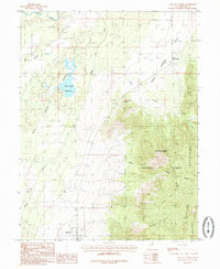
(58)- 1980 Map of Elsinore, 1981 Print
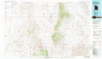
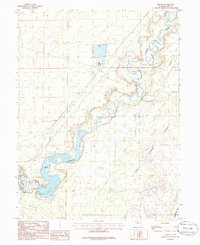
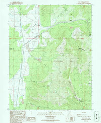
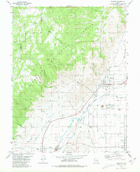 1980 Elsinore1981 Print · USGSThe Sevier River valley thrives as an irrigated agricultural corridor in the early 1980s, where rail and water define the landscape. Local historians can trace the paths of the Denver and Rio Grande Western through Elsinore and Joseph, or locate rural landmarks like the Rodeo Ground and regional Cemeteriers.
 - 1980 Map of Joseph Peak, 1981 Print
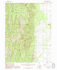
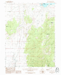
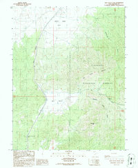
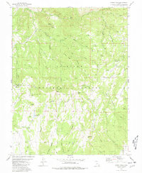 1980 Joseph Peak1981 Print · USGSCentral Utah's high-country terrain is captured here during the 1980s, revealing a landscape of remote peaks and essential water resources. Genealogists and historians can trace routes through Coalbed Pass and locate landmarks like the Rockwood Guard Station or Gardner Hollow Reservoirs.
 - 1980 Map of Wah Wah Mts. North, 1984 Print
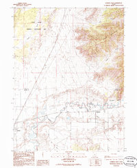
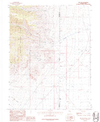
 1980 Wah Wah Mts. North1984 Print · USGSSouthwestern Utah's high desert was a landscape of remote mining claims and railroad outposts during the late twentieth century. Researchers can trace historic operations like the Carbonate Mine and Magnolia Mine, or locate early valley settlements such as Lund and Milford.2 unique versions available
 - 1980 Map of Richfield, 1987 Print
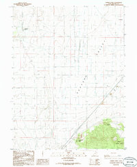
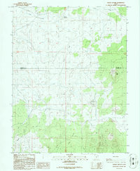
 1980 Richfield1987 Print · USGSCentral Utah in the early eighties shows a landscape of volcanic fields and high mountain forests. Genealogists can trace family roots through the Sevier River valley in Richfield, Fillmore, and Monroe, or follow the Union Pacific rail lines.2 unique versions available
 - 1981 Map of Tule Valley
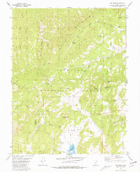
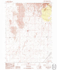
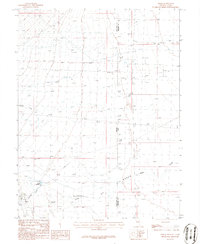
 1981 Tule Valley1981 Print · USGSMillard County in the early eighties shows a remote Great Basin landscape of isolated springs and high limestone ridges. Trace early ranching and mineral sites from the Wheeler Amphitheater Mines to the settlements of Gandy and Eskdale.3 unique versions available
 - 1981 Map of Red Ridge
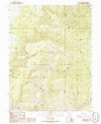
 1981 Red Ridge1981 Print · USGSThe high country along the border of Millard and Sevier counties is documented here in the early 1980s. Outdoor researchers and hunters can trace the network of jeep trails and pack trails connecting Three Creeks Reservoir to landmarks like Marys Nipple and the Guard Station.
 - 1981 Map of Trail Mountain
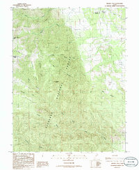
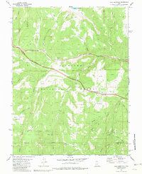 1981 Trail Mountain1981 Print · USGSSevier County's high country is captured in the early eighties as modern infrastructure began to bisect the wilderness. Researchers can trace historical resource sites like the Mine and Sawmill Bench alongside the construction of the interstate and The Airstrip.2 unique versions available
 - 1985 Map of Harding
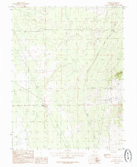 1985 Harding1985 Print · USGSMillard County's arid landscape is captured here in the mid-1980s, revealing the intricate water management systems of the Sevier Desert. Researchers can trace the path of the Central Utah Canal and locate specific sites like Harding, the Gravel Pit, and Sixmile Point.
 - 1985 Map of Oak City North
 1985 Oak City North1985 Print · USGSMillard County's agricultural edge is captured here in the mid-1980s, where the high desert meets the forest. Genealogists and researchers can trace the water systems of Oak City or locate family landmarks like Taylors Flat and Fool Creek Reservoir.
 - 1985 Map of Williams Peak
 1985 Williams Peak1985 Print · USGSThe high ridges of Millard County are captured in this mid-eighties survey during a period of steady land management. Researchers can trace remote water sources like John Williams Spring or follow the descent of Eightmile Creek into the Scipio Valley.
 - 1985 Map of Fool Creek Peak
 1985 Fool Creek Peak1985 Print · USGSThe high Canyon Mountains in the mid-eighties mark a landscape of sharp ridges and vital water sources on the Juab-Millard county line. Researchers can trace remote 4WD routes leading to Mourning Dove Spring and family-named landmarks like Charley Johnson Canyon.
 - 1985 Map of Oak City South
 1985 Oak City South1985 Print · USGSOak City and the surrounding Millard County foothills are captured in the mid-1980s as a quiet intersection of agriculture and wilderness. Researchers can trace local landmarks like the Cem and Jack Hill or explore the rugged canyons of the Fishlake National Forest to find a hidden Mine Shaft and remote springs.
 - 1985 Map of Strong
 1985 Strong1985 Print · USGSMillard County water management and desert geography are on display in the mid-1980s. Trace the path of the Sevier River and Central Utah Canal, and locate local landmarks like Strong and the DMAD Reservoir.
 - 1985 Map of Scipio North
 1985 Scipio North1985 Print · USGSThe high desert of central Utah comes into focus in the mid-1980s, centered on the settlement of Scipio. Researchers can trace local landmarks like the Cem and the vast Sevier Bridge Reservoir or explore family-named terrain like Dick and Dalton Flat.
 - 1986 Map of Lynndyl East
 1986 Lynndyl East1986 Print · USGSJuab and Millard counties are captured in the mid-eighties as a landscape of desert dunes and irrigated river valleys. Researchers can trace the Union Pacific rail corridor through Lynndyl and Leamington or follow the path of the Central Utah Canal.
 - 1986 Map of Sixmile Point
 1986 Sixmile Point1986 Print · USGSMillard County, Utah, was still a landscape of vast desert ranching and irrigation in the mid-1980s. Genealogists and researchers can trace the locations of isolated wells, the thermal waters of Hot Springs, and the borders of the Fishlake National Forest.
 - 1986 Map of Dog Valley Peak
 1986 Dog Valley Peak1986 Print · USGSHigh mountain passes and desert drainage basins define this Millard County landscape in the mid-1980s. Local researchers can trace historic transit routes through Cove Fort-Dog Valley Pass and locate remote features like The Narrows and Dog Valley Peak.
 - 1986 Map of Lynndyl West
 1986 Lynndyl West1986 Print · USGSThe high desert of western Utah is captured here in the mid-1980s, highlighting the transition from rugged dunes to the rail-side settlement of Lynndyl. Trace the Union Pacific tracks and the vast borders of the Little Sahara National Recreation Area.
 - 1986 Map of Sunset Peak
 1986 Sunset Peak1986 Print · USGSMillard County high country is shown in detail during the mid-1980s, revealing the complex water and trail systems of the Fishlake National Forest. Researchers can trace old family-named landmarks and water sources like Leavitts Spring, Mortensen Canyon, and the distinctively named The Devils Armchair.
 - 1986 Map of Cove Fort
 1986 Cove Fort1986 Print · USGSBeaver County is captured in the mid-eighties at the historic junction of pioneer defenses and mining industry. Researchers can locate the iconic Old Cove Fort, trace mineral Prospect sites near Sulphurdale, and find remote water sources like Dead Cow Spring.
 - 1986 Map of Baker
 1986 Baker1986 Print · USGSThe Nevada-Utah borderlands near the settlement of Baker are documented here in the mid-1980s. Local historians and researchers can trace water usage through the Baker Reservoir and Ditch networks or locate the Landing strip and Trailer Park.2 unique versions available
 - 1986 Map of Cinder Crater
 1986 Cinder Crater1986 Print · USGSThe volcanic landscape of the Beaver and Millard county line is captured here in the mid-1980s, showcasing a remote high-desert region. Geologists and local historians can trace small-scale mining and ranching markers like the Cinder Pits, Danish Reservoir, and Cinder Crater.
 - 1986 Map of The Cove
 1986 The Cove1986 Print · USGSThe Nevada-Utah borderlands are captured here in the 1980s, showing a rugged landscape of high-elevation forests and mining prospects. Trace the footprints of early exploration through the quarries near The Cove and water sources like Caine Spring.2 unique versions available
 - 1986 Map of Little Horse Canyon
 1986 Little Horse Canyon1986 Print · USGSThe Nevada and Utah borderlands come into focus in the mid-1980s, showcasing the transition from national forest wilderness to open basin. Researchers can trace remote infrastructure like the Aqueduct, local landmarks such as Natural Arch, and mining activity at the Prospect.2 unique versions available
 - 1986 Map of Beehive Peak
 1986 Beehive Peak1986 Print · USGSCentral Utah’s backcountry unfolds in the mid-eighties along the high ridges of the Fishlake National Forest. Researchers can trace the drainages of Pharo Creek and Kennedy Fork or locate remote landmarks like Beehive Peak and Ezras Flat.
Showing maps 1-25 of 58
Top cities of Millard County
- Delta historical maps
- Fillmore historical maps
- Hinckley historical maps
- Oak City historical maps
- Kanosh historical maps
- Holden historical maps
See more
Frequently asked questions
- What are the different types of historical maps available for Millard County?
- What is the oldest map of Millard County?
- Where can I purchase historical maps of Millard County for my home or office?
- Where can I download high-res historical maps of Millard County?
- Are there historical topographic maps available for Millard County?
- Is there historical aerial imagery available for Millard County?
- Where are historical maps of Millard County sourced from?