Old Maps of Millard County, Utah for Hiking & Exploration
Hike through history with 386 historic maps of Millard County. Explore old trails, ghost towns, and forgotten backroads — perfect for outdoor adventurers and local explorers.
- Rediscover forgotten places: Map out old mining camps, roads, and footpaths that no longer exist on modern maps.
- Layer with modern tools: Combine with LiDAR or satellite views to plan hikes through historical terrain.
- Made for exploration: Popular among hikers, overlanders, and local history lovers.
Use these maps to find adventure and explore the hidden past of Millard County.
Millard County, UT maps
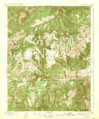
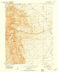
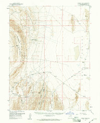
(386)- 1885 Map of Beaver
 1885 Beaver1885 Print · USGSSouth-central Utah in the 1880s was a landscape of high plateaus and valley settlements tied to the lifelines of the Sevier River and Beaver Creek. Family researchers can trace early town layouts in Beaver and Fillmore or locate rural outposts like Minersville and Kanosh.5 unique versions available
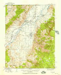
 - 1885 Map of Sevier Desert
 1885 Sevier Desert1885 Print · USGSMining districts and desert outposts across central Utah come to life in the mid-1880s as the railroad pushes through the canyon. Researchers can trace early industrial footprints at Silver City, locate the riverside settlement of Deseret, and follow the original Central Pacific Railroad line.5 unique versions available
 - 1908 Map of Fish Springs
 1908 Fish Springs1908 Print · USGSWestern Utah at the turn of the century is a land of remote mining camps and desert outposts. Trace family history and early industry at Utah Mine, Joy P.O., and the isolated Butson's Ranch near the Confusion Range.
 - 1910 Map of Fish Springs
 1910 Fish Springs1910 Print · USGSWestern Utah's high desert and isolated mining districts are mapped here in the early twentieth century, showing a landscape of remote ranching and rugged mineral claims. Local historians can trace family-named outposts like Meecham's Ranch and Thomas' Ranch or locate the Queen of Sheba Mine and Fish Springs.6 unique versions available
 - 1932 Map of Sevier, 1975 Print
 1932 Sevier1975 Print · USGSThe high plateau country of central Utah comes into focus in the early 1930s, showing a landscape defined by the Denver & Rio Grande Western railroad and remote mountain peaks. Genealogists and local historians can trace family-named landmarks like Parker Ranch or locate early forest service outposts at Rockwood Ranger Sta.
 - 1935 Map of Sevier
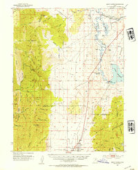
 1935 Sevier1935 Print · USGSThe high country of Sevier and Millard Counties is captured here in the mid-1930s, documenting the early forest management and transit routes of the era. Genealogists and historians can trace old homesteads like Parker Ranch and find remote outposts such as Rockwood Ranger Sta and Pavant Ranger Sta.3 unique versions available
 - 1940 Map of Monroe, 1957 Print
 1940 Monroe1957 Print · USGSThe Sevier River valley was a thriving corridor of rail and irrigation just before the mid-century. Researchers can trace the path of the Denver and Rio Grande Western Railroad through Monroe or locate the Antelope Mine and Poverty Flat Ranch.2 unique versions available
 - 1944 Map of Monroe
 1944 Monroe1944 Print · USGSThe Sevier River Valley thrived as a hub of irrigation and rail transport in the mid-twentieth century. Genealogists and historians can trace the foundations of Monroe, Elsinore, and Annabella alongside the ANTELOPE MINE and Poverty Flat Ranch.
 - 1949 Map of Garrison, 1957 Print
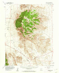
 1949 Garrison1957 Print · USGSThe high desert border of White Pine County and Utah’s Millard County comes into focus in the late 1940s as a land of isolated ranches and mountain peaks. Genealogists and historians can locate family landmarks like Davies Ranch and Burbank Cem or trace the early paths to Lehman Caves National Monument.4 unique versions available
 - 1951 Map of Garrison
 1951 Garrison1951 Print · USGSThe Nevada-Utah borderlands are captured here in the early fifties, where the high peaks of the Snake Range descend into the ranching country of Snake Valley. Researchers can trace early family landholdings at Davies Ranch and Dearden Ranch, or locate the Burbank Cem near the state line.2 unique versions available
 - 1951 Map of Oak City, 1953 Print
 1951 Oak City1953 Print · USGSMillard County's high desert and mountain frontier are captured here in the early fifties, showing the precarious balance of irrigation and transport. Researchers can find the old Utah Central Railroad grade, the Oak City cemetery, and the Oak Creek Ranger Sta at the forest edge.3 unique versions available
 - 1952 Map of Scipio North, 1954 Print
 1952 Scipio North1954 Print · USGSIn the early 1950s, the desert borderlands of Millard and Juab Counties were defined by the Sevier River's path and the rise of the high mountains. Trace the old Union Pacific corridor through Mills or locate family sites near Scipio and Dick & Dalton Flat.3 unique versions available
 - 1953 Map of Topaz Mtn, 1955 Print
 1953 Topaz Mtn1955 Print · USGSThe West Desert of Utah in the early fifties reveals a landscape shaped by mining and the search for water. Researchers can trace the routes between the Willden Mine, Freighters Well, and the high peaks of Lady Laird Peak.4 unique versions available
 - 1953 Map of Richfield, 1963 Print
 1953 Richfield1963 Print · USGSCentral Utah in the early fifties reveals a complex geography of high plateaus and desert basins tied together by the Union Pacific rail lines. Genealogists and historians can trace family roots in Richfield or Kanosh and locate remote operations like the Blue Star Mine or Newhouse.3 unique versions available
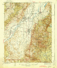
 - 1953 Map of Delta, 1969 Print
 1953 Delta1969 Print · USGSWest-central Utah in the early fifties shows a landscape of vast desert playas and rising mountain ranges. Genealogists and historians can trace rail sidings like Champlin Siding, local industry at the Tungsten Mill, and historic outposts such as Fort Deseret.3 unique versions available
 - 1956 Map of Lund, 1963 Print
 1956 Lund1963 Print · USGSEastern Nevada and the Utah borderlands are mapped here during the mid-fifties, showing a landscape of high-desert ranches and mountain mining camps. Genealogists and historians can trace family locations through sites like Bristol Silver Mines, Lund, and the Sunnyside Whipple Ranch.2 unique versions available
 - 1956 Map of Ely, 1968 Print
 1956 Ely1968 Print · USGSEastern Nevada in the mid-fifties is a land of massive mountain ranges and silver-boom history. Trace the legacy of mining ruins at Hamilton and Treasure City or follow the path of the Nevada Northern RR through Ely.5 unique versions available
 - 1958 Map of Richfield
 1958 Richfield1958 Print · USGSCentral Utah in the late fifties shows a landscape of mountain forests and desert basins connected by the Union Pacific Railroad. Genealogists and historians can trace rail stops at Nada Station, mines like the Blue Star Mine, and tribal lands of the Paiute Indian Reservation.2 unique versions available
 - 1958 Map of Delta
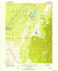
 1958 Delta1958 Print · USGSThe West Desert of Utah comes into sharp focus during the late 1950s, showing the intersection of military ranges, irrigation projects, and historical transit. You can trace the proximity of the Topaz Camp to Delta, or locate the Pony Express Monument and the ruins of Fort Deseret.
 - 1959 Map of Ely
 1959 Ely1959 Print · USGSEastern Nevada's high desert reveals its mining heart and pioneer ranching outposts during the late fifties. Genealogists and historians can trace family-named outposts like Goicoechea Ranch or explore the ruins of former silver-mining hubs like Hamilton and Treasure City.2 unique versions available
 - 1959 Map of Cowboy Pass, 1961 Print
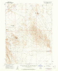
 1959 Cowboy Pass1961 Print · USGSMillard County's high-desert basins and limestone ridges are captured here during the late fifties, showing a landscape defined by ranching and transit. Researchers can trace remote water sources like Skunk Spr and paths through Cowboy Pass or across Rattlesnake Bench.2 unique versions available
 - 1960 Map of Lund
 1960 Lund1960 Print · USGSEastern Nevada and the Utah borderlands are mapped here during the mid-twentieth century, showing a landscape of high peaks and isolated ranching outposts. Researchers can locate remote mining sites like the Tungsten Queen Mine and early settlements including Lund and Shoshone.
 - 1960 Map of Notch Peak, 1961 Print
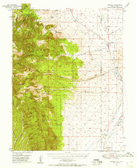
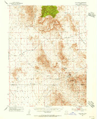
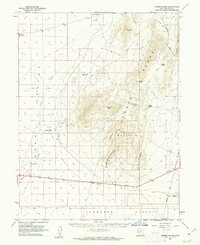
 1960 Notch Peak1961 Print · USGSMillard County's high desert peaks and mining claims are detailed in this early 1960s survey of the House Range. Researchers can trace historic access routes to the Brown Queen Mine, identify remote water sources like Painter Spring, and locate landmarks like Notch Peak.2 unique versions available
 - 1960 Map of Granite Mountain, 1962 Print
 1960 Granite Mountain1962 Print · USGSJuab and Millard Counties are shown here during the early sixties, a period of remote ranching and rugged desert navigation. Genealogists and historians can trace the foundations of Granite Ranch and locate water sources like Hole-in-the-Wall Reservoir.
 - 1960 Map of Conger Range, 1962 Print
 1960 Conger Range1962 Print · USGSWest of the Sevier Desert in the early 1960s, this area of Millard County reveals a world of remote ranching outposts and high-altitude mountain passes. Researchers can trace the early footprints of Eskdale or find family-named landmarks like Robison Ranch and Okelberry Pass.
Showing maps 1-25 of 386
Top cities of Millard County
- Delta historical maps
- Fillmore historical maps
- Hinckley historical maps
- Oak City historical maps
- Kanosh historical maps
- Holden historical maps
See more
Frequently asked questions
- What are the different types of historical maps available for Millard County?
- What is the oldest map of Millard County?
- Where can I purchase historical maps of Millard County for my home or office?
- Where can I download high-res historical maps of Millard County?
- Are there historical topographic maps available for Millard County?
- Is there historical aerial imagery available for Millard County?
- Where are historical maps of Millard County sourced from?