Old Maps of Koosharem, Utah for Hiking & Exploration
Hike through history with 12 historic maps of Koosharem. Explore old trails, ghost towns, and forgotten backroads — perfect for outdoor adventurers and local explorers.
- Rediscover forgotten places: Map out old mining camps, roads, and footpaths that no longer exist on modern maps.
- Layer with modern tools: Combine with LiDAR or satellite views to plan hikes through historical terrain.
- Made for exploration: Popular among hikers, overlanders, and local history lovers.
Use these maps to find adventure and explore the hidden past of Koosharem.
Koosharem, UT maps
(12)- 1885 Map of Fish Lake
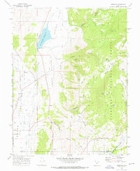
 1885 Fish Lake1885 Print · USGSThe high plateaus and early canyon settlements of central Utah are documented here in the mid-1880s, shortly after the Powell Survey. Genealogists and historians can trace early families in Salina, Antimony, and Cousharem, or locate remote sites like Bean Spring.
 - 1896 Map of Fish Lake, 1899 Print
 1896 Fish Lake1899 Print · USGSSouthern Utah in the late nineteenth century is a land of high plateaus and isolated river settlements. Trace early pioneer outposts like Thurber, Teardale, and Antimony alongside geological marvels such as Fish Lake and the Water Pocket Flexure.4 unique versions available
 - 1956 Map of Salina
 1956 Salina1956 Print · USGSCentral Utah in the mid-fifties reveals a landscape of high plateaus and desert basins before the modern highway era. Researchers can trace the ranching and mining roots of Hanksville and Loa or locate the Lucky Strike Mine near the San Rafael Swell.5 unique versions available
 - 1960 Map of Salina
 1960 Salina1960 Print · USGSThe high plateaus and canyonlands of south-central Utah appear in the early sixties as a region of remote ranching towns and developing parklands. Researchers can trace historic settlements like Fruita and Loa or locate the uranium mines and the tracks of the Denver and Rio Grande Western RR.2 unique versions available
 - 1962 Map of Salina
 1962 Salina1962 Print · USGSSevier County and the surrounding desert wilderness appear here in the early sixties as a network of isolated river valley towns and high-altitude forests. Researchers can locate remote landmarks like Fruita, trace the Denver & Rio Grande Western RR, and find backcountry sites like the Aquarius Ranger Station.
 - 1968 Map of Koosharem, 1972 Print
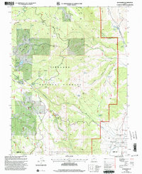
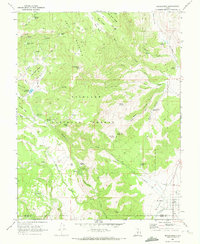 1968 Koosharem1972 Print · USGSGrass Valley and the high plateaus of Sevier County come into focus in the late sixties, showing the rural community of Koosharem and its surrounding water infrastructure. Researchers can locate the Koosharem Cemetery and trace remote mountain trails leading to landmarks like Magleby Reservoir and Milos Kitchen.2 unique versions available
 - 1968 Map of Burrville, 1972 Print
 1968 Burrville1972 Print · USGSGrass Valley and the high plateaus of central Utah are captured in the late sixties as agricultural and forest lands intersected. Researchers can locate the Burrville Cem and trace historic routes like the Old Bamberger Road and the Aqueduct.
 - 1980 Map of Salina, 1981 Print
 1980 Salina1981 Print · USGSCentral Utah in the late twentieth century reveals a landscape of high plateaus and transit corridors. Trace the Denver and Rio Grande Western RR past Salina or locate remote sites like Browning Mine and Fish Lake.2 unique versions available
 - 2001 Map of Burrville, 2003 Print
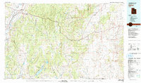
 2001 Burrville2003 Print · USGSThe rural community of Burrville and the high country of the Fishlake National Forest are shown here at the start of the millennium. Researchers can trace the legacy of early settlers at Burrville Cem and locate historic water sources like Torgerson Spring or the Old Bamberger Road.
 - 2001 Map of Koosharem, 2003 Print
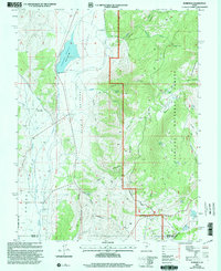
 2001 Koosharem2003 Print · USGSKoosharem and the eastern edge of the Fishlake National Forest are captured here at the turn of the millennium. Researchers can locate the Koosharem Cem, trace the Aqueduct in Grass Valley, and find landmarks like Milos Kitchen.
 - 2023 Map of Koosharem, 2023 Print
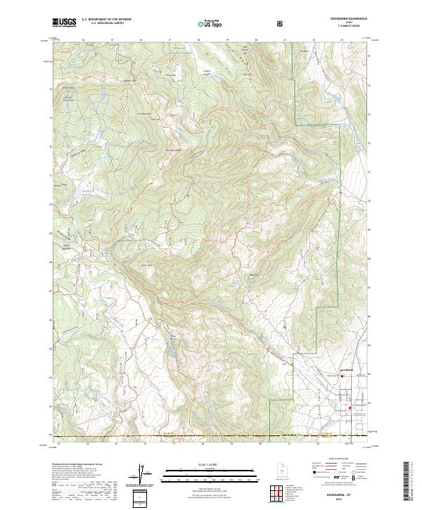 2023 Koosharem2023 Print · USGSKoosharem and the eastern Sevier County uplands are documented in this modern survey of the Grass Valley area. Researchers can trace the local irrigation network via the Koosharem Canal and locate family history sites such as the Koosharem Cem and Milos Kitchen.
 - 2023 Map of Burrville, 2023 Print
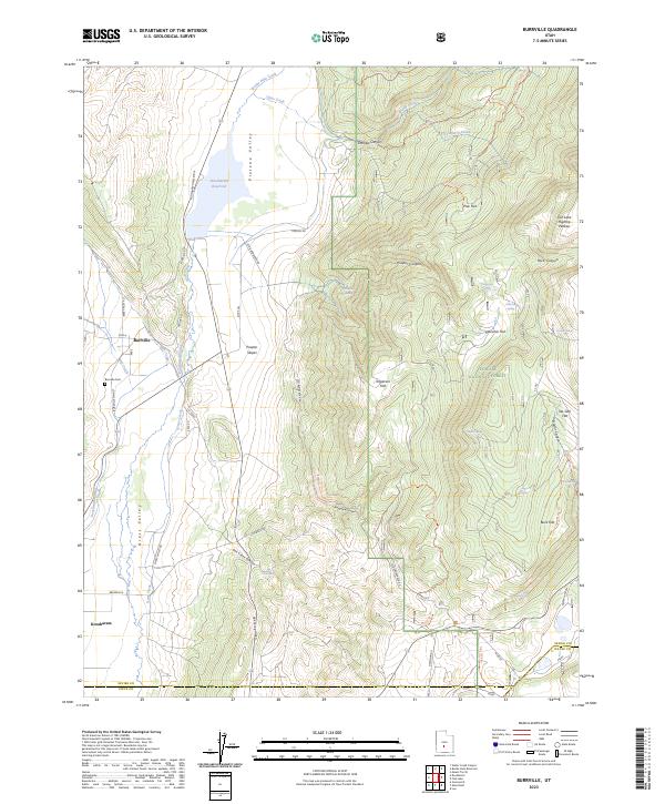 2023 Burrville2023 Print · USGSThe high valleys of Sevier County come alive on this map, showing the lifeblood of Burrville and Koosharem through their complex irrigation and mountain trails. Genealogists and historians can locate the Burrville Cem or trace old routes like Old Bamberger Rd and the Piute Trl.
End of results
Showing maps 1-12 of 12
Top cities near Koosharem
- Richfield historical maps
- Monroe historical maps
- Annabella historical maps
- Central Valley historical maps
Frequently asked questions
- What are the different types of historical maps available for Koosharem?
- What is the oldest map of Koosharem?
- Where can I purchase historical maps of Koosharem for my home or office?
- Where can I download high-res historical maps of Koosharem?
- Are there historical topographic maps available for Koosharem?
- Is there historical aerial imagery available for Koosharem?
- Where are historical maps of Koosharem sourced from?