Old Maps of Lake Point, Utah for Genealogy
Trace your family roots with 18 historic maps of Lake Point. These high-res maps reveal old neighborhoods, homesites, landmarks, and streets — helping you uncover where your ancestors lived and how the area evolved over time.
- Explore historic neighborhoods: Identify where your relatives may have lived in the 1800s or 1900s.
- Compare maps over time: Trace the changes in streets, buildings, and landmarks for multi-generational research.
- Perfect for genealogy & ancestry research: Used by family historians and researchers to map out lineage and migration.
These maps are an incredible resource for exploring your personal connection to Lake Point's past.
Lake Point, UT maps
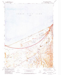
(18)- 1885 Map of Tooele Valley
 1885 Tooele Valley1885 Print · USGSThe valleys and ranges west of the Wasatch are captured here in the mid-1880s, showcasing the early mining and rail infrastructure of the region. Genealogists can trace early settlements like Grantsville, Ophir, and Stockton, or the route of the Utah and Nevada R. R.6 unique versions available
 - 1952 Map of Garfield, 1954 Print
 1952 Garfield1954 Print · USGSThe industrial corridor of the southern Great Salt Lake comes alive in the early fifties, showing the massive milling and smelting operations at Garfield and Arthur. Trace historical sites like the Site of First Utah Smelter alongside the rail networks of the Western Pacific Railroad.
 - 1953 Map of Tooele, 1968 Print
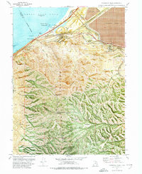
 1953 Tooele1968 Print · USGSTooele County is shown here in the 1950s, a vast landscape transitioning between the industrial growth of the Salt Lake Valley and isolated military testing grounds. Researchers can trace the routes of the Western Pacific railroad and locate historic outposts like Iosepa Ranch and St John Station.3 unique versions available
 - 1955 Map of Mills Junction, 1957 Print
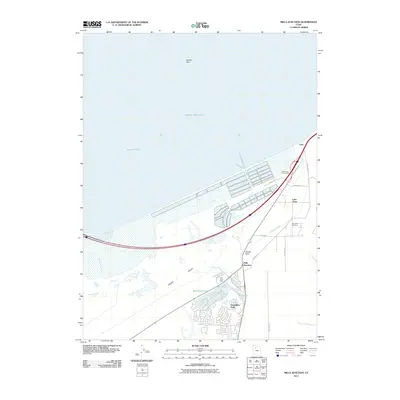
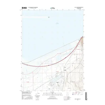
 1955 Mills Junction1957 Print · USGSThe Tooele Valley meets the receding Great Salt Lake in the mid-1950s, showing a landscape defined by industrial salt works and rail junctions. Trace family roots and local landmarks at the Lake Point Cemetery, the Adobe Rock (Historic Marker), and the School (Abn'd).
 - 1955 Map of Tooele, 1958 Print
 1955 Tooele1958 Print · USGSTooele County and the Great Salt Lake are captured here during the mid-fifties, an era of burgeoning military testing and industrial mining. Researchers can trace the rail sidings at Salduro Station, the grounds of the Deseret Chemical Corps Depot, and the International Smelting Co facilities.3 unique versions available
 - 1972 Map of Mills Junction, 1974 Print
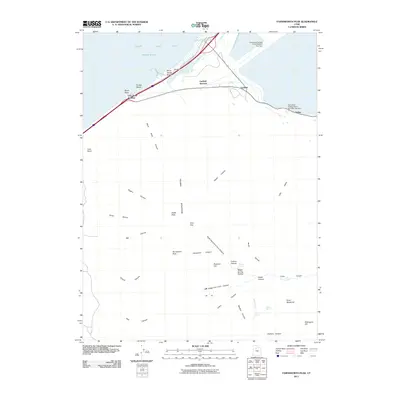
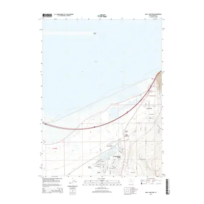
 1972 Mills Junction1974 Print · USGSTooele Valley sits at a crossroads of salt extraction and suburban emergence in the early seventies. Genealogists and historians can trace family roots at Lake Point Cem or explore early landmarks like Adobe Rock Historical Marker and Mills Junction.2 unique versions available
 - 1972 Map of Farnsworth Peak, 1974 Print
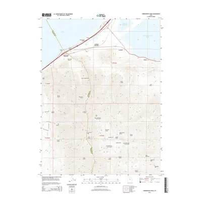
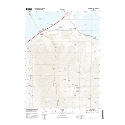
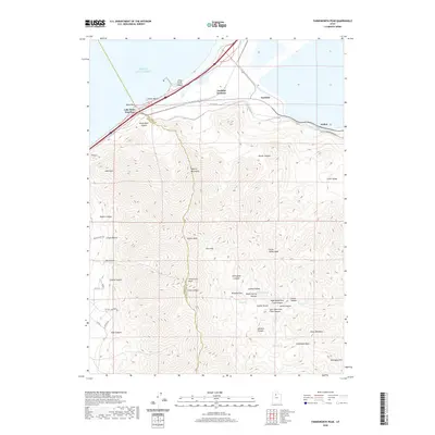
 1972 Farnsworth Peak1974 Print · USGSThe industrial shoreline of the Salt Lake Valley meets the high Oquirrh peaks in the early seventies, capturing a landscape of massive mines and vital rail corridors. Researchers can trace the legacy of the Garfield townsite, the sprawling tailings ponds, and the operations at Arthur and Lake Point.4 unique versions available
 - 1979 Map of Tooele, 1980 Print
 1979 Tooele1980 Print · USGSTooele and the eastern Oquirrh foothills appear here in the late seventies, showing a landscape defined by massive industrial works and military sites. Researchers can trace the rail corridors of the Western Pacific or locate the historic Monarch Mine and the vast Open Pit Mine near Bingham.
 - 2011 Map of Mills Junction, 2011 Print
 2011 Mills Junction2011 Print · USGSCovers Lake Point, including Stansbury Park, Tooele County, and other nearby areas
 - 2011 Map of Farnsworth Peak, 2011 Print
 2011 Farnsworth Peak2011 Print · USGSCovers Lake Point, including Magna, Salt Lake County, and other nearby areas
 - 2014 Map of Farnsworth Peak, 2014 Print
 2014 Farnsworth Peak2014 Print · USGSCovers Lake Point, including Magna, Salt Lake County, and other nearby areas
 - 2014 Map of Mills Junction, 2014 Print
 2014 Mills Junction2014 Print · USGSCovers Lake Point, including Stansbury Park, Tooele County, and other nearby areas
 - 2017 Map of Mills Junction, 2017 Print
 2017 Mills Junction2017 Print · USGSCovers Lake Point, including Stansbury Park, Tooele County, and other nearby areas
 - 2017 Map of Farnsworth Peak, 2017 Print
 2017 Farnsworth Peak2017 Print · USGSCovers Lake Point, including Magna, Salt Lake County, and other nearby areas
 - 2020 Map of Farnsworth Peak, 2020 Print
 2020 Farnsworth Peak2020 Print · USGSCovers Lake Point, including Magna, Salt Lake County, and other nearby areas
 - 2020 Map of Mills Junction, 2020 Print
 2020 Mills Junction2020 Print · USGSCovers Lake Point, including Stansbury Park, Tooele County, and other nearby areas
 - 2023 Map of Mills Junction, 2023 Print
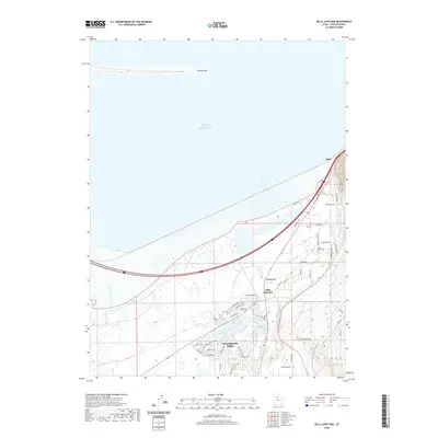
 2023 Mills Junction2023 Print · USGSThe southern shores of the Great Salt Lake meet the Tooele Valley in this contemporary study of growth and geography. Local historians can trace the development of Stansbury Park and locate historic burial sites at Lake Point Cem and Stansbury Park Cem.
 - 2023 Map of Farnsworth Peak, 2023 Print
 2023 Farnsworth Peak2023 Print · USGSThe southern shore of the Great Salt Lake meets the industrial heart of the Salt Lake Valley in this recent survey. Researchers can trace the rail and road hubs of Garfield Junction and Arthur or locate landmarks like Black Rock and Kesler Peak.
End of results
Showing maps 1-18 of 18
Top cities near Lake Point
- Salt Lake City historical maps
- West Valley City historical maps
- West Jordan historical maps
- South Jordan historical maps
- Herriman historical maps
- Tooele historical maps
See more
Frequently asked questions
- What are the different types of historical maps available for Lake Point?
- What is the oldest map of Lake Point?
- Where can I purchase historical maps of Lake Point for my home or office?
- Where can I download high-res historical maps of Lake Point?
- Are there historical topographic maps available for Lake Point?
- Is there historical aerial imagery available for Lake Point?
- Where are historical maps of Lake Point sourced from?