1960s Maps of Vermont
Explore 57 historic maps of Vermont from the 1960s. These maps offer a rare glimpse into what life looked like during the 1960s — showing old roads, neighborhoods, homes, and landmarks that have changed or disappeared over time.
Whether you're researching your family's past, planning a metal detecting trip, or studying how Vermont's landscape evolved across the 1960s, these high-resolution maps are a powerful tool for exploring the history of this region.
- Focus on a specific era: All maps on this page are from the 1960s, giving you a focused view of this time period.
- See what’s changed: Compare century-old streets, trails, and buildings to today's modern landscape using overlays and satellite layers.
- Research with precision: Use these maps for genealogy, historical research, land use analysis, or educational projects.
- View, download, or print: Maps are fully viewable online in high resolution, and can be downloaded or printed for your own records.
Start exploring Vermont's history through authentic maps from the 1960s. This is your window into the past.
Vermont maps
(57)- 1960 Map of Williamstown, 1961 Print
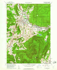 1960 Williamstown1961 Print · USGSThe Berkshires of western Massachusetts are shown in detail during the early sixties, centered on the college town and the state's highest peak. Researchers can trace the Appalachian Trail over Mt Greylock or locate ancestral sites at Westlawn Cem and Southlawn Cem.2 unique versions available
 - 1960 Map of North Adams, 1961 Print
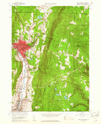 1960 North Adams1961 Print · USGSThe Northern Berkshires in the early 1960s reveal a landscape where industrial river towns like NORTH ADAMS and Adams meet high mountain forests. Genealogists and historians can trace local roots through Southview Cem, visit the Natural Bridge, or follow the BOSTON AND MAINE RAILROAD through Zylonite.2 unique versions available
 - 1960 Map of Berlin, 1961 Print
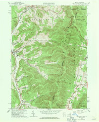 1960 Berlin1961 Print · USGSRensselaer County at the start of the sixties reveals a valley life shaped by the Taconic Range and the winding Little Hoosic River. Genealogists can trace family heritage through numerous hillside burial grounds like Brimmer Cem and Weaver Cem, or locate landmarks like the Carmelite Novitiate.2 unique versions available
 - 1960 Map of Rowe, 1961 Print
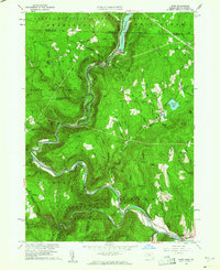 1960 Rowe1961 Print · USGSThe Berkshires at the start of the 1960s show a landscape shaped by the Deerfield River and the industrial infrastructure of the Boston and Maine RR. Genealogists and historians can trace family plots at Sherman Cem or locate the famed Hoosac Tunnel and the mills at Monroe Bridge.2 unique versions available
 - 1961 Map of Lewiston
 1961 Lewiston1961 Print · USGSWestern Maine and the White Mountains appear here during the early sixties, showing the industrial river towns and vast timberlands before the modern interstate era. Genealogists and historians can trace the Grand Trunk RR through Berlin or locate landmarks like Old Speck Mountain and Elephant Mountain.
 - 1961 Map of Heath, 1962 Print
 1961 Heath1962 Print · USGSThe Berkshire foothills of the early 1960s are revealed here, showing the rural landscape of Heath and Colrain along the Vermont border. Genealogists and researchers can locate several remote burial grounds like Center Cem and Panel Hill Cem, or trace the historical Mohawk Trail along the Deerfield River.2 unique versions available
 - 1961 Map of Bernardston, 1963 Print
 1961 Bernardston1963 Print · USGSThe Massachusetts and Vermont borderlands come into focus in the early sixties as the modern interstate era begins to reshape the river valleys. Researchers can locate family burial sites at Beaver Meadow Cem or trace the old Boston and Maine Railroad through Bernardston and Hales Crossing.2 unique versions available
 - 1961 Map of Colrain, 1963 Print
 1961 Colrain1963 Print · USGSNorthwestern Massachusetts in the early sixties remains a landscape of river-valley industry and colonial frontier sites. Researchers can trace the heritage of Colrain and Leyden through numerous family-named landmarks like Franklin Hill and historic locations such as Fort Morrison (Site).2 unique versions available
 - 1961 Map of Northfield, 1963 Print
 1961 Northfield1963 Print · USGSThe Connecticut River valley at the tri-state border was a hub of academic and rail life in the early sixties. Genealogists can trace family plots at West Northfield Cem and Coller Cem or locate the sprawling grounds of the Northfield School for Boys.2 unique versions available
 - 1961 Map of Chittenden, 1964 Print
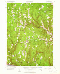
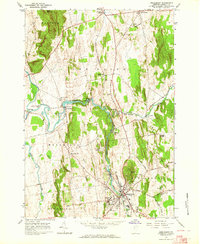
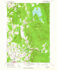 1961 Chittenden1964 Print · USGSThe Green Mountains of central Vermont appear here in the early sixties, showing the vital water systems and forests surrounding the Chittenden valley. Genealogists can locate family landmarks like Horton Cem, Baird Cem, and the Barstow Sch among the timbered ridges.5 unique versions available
 - 1961 Map of Killington Peak, 1964 Print
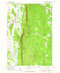
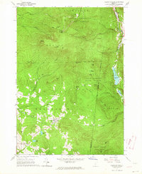 1961 Killington Peak1964 Print · USGSThe Green Mountains of central Vermont are captured here during the early 1960s as the regional ski industry was beginning to reshape the landscape. Genealogists and hikers can trace the Appalachian Long Trail or locate family sites like Northam Cemetery and the Mission Chapel.3 unique versions available
 - 1961 Map of Rutland, 1964 Print
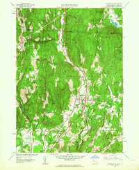
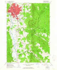 1961 Rutland1964 Print · USGSRutland at the start of the 1960s was a bustling rail and civic hub defined by its transition from urban streets to the Green Mountains. Researchers can trace the mid-century city layout, numerous neighborhood schools, and rural landmarks like the Appalachian Long Trail, Union Chapel, and Old Marsh Cem.5 unique versions available
 - 1961 Map of Pico Peak, 1964 Print
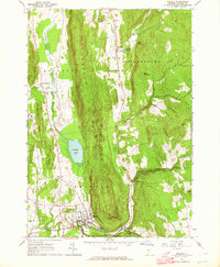
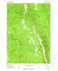 1961 Pico Peak1964 Print · USGSSherburne and the high peaks of the Green Mountains are captured here in the early 1960s as recreational skiing began to shape the peaks. Researchers can trace the junction of the Appalachian Trail, locate the Riverside Cem, and find local landmarks like the Sherburne Valley Sch.5 unique versions available
 - 1962 Map of Lewiston
 1962 Lewiston1962 Print · USGSThe industrial river valleys and high peaks of Maine and New Hampshire define the region in the early sixties. Trace the rail-and-river network from Lewiston to the White Mountains, passing through mill towns like Berlin and Rumford.
 - 1962 Map of Albany
 1962 Albany1962 Print · USGSThe Hudson and Connecticut River valleys meet the Green Mountains and Berkshires in this mid-century overview of the Northeast. Genealogists and historians can trace the industrial hearts of Albany and Springfield or locate features like Quabbin Reservoir and Westover Air Force Base.
 - 1962 Map of Lake Champlain, 1975 Print
 1962 Lake Champlain1975 Print · USGSLake Champlain and the high peaks of the Adirondacks and Green Mountains are captured here during the mid-twentieth century. Researchers can trace the industrial legacy of the Lyon Mountain Mine and the rail corridors of the Central Vermont RR and Delaware & Hudson RR.3 unique versions available
 - 1963 Map of Jackman
 1963 Jackman1963 Print · USGSThe international borderlands of Maine and Quebec come alive in the mid-twentieth century, showing a landscape of timber towns and rail connections. Genealogists and historians can trace the paths of the Canadian Pacific Railway through Jackman or locate families in Sherbrooke and Megantic.
 - 1963 Map of Middlebury, 1964 Print
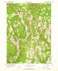
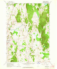
 1963 Middlebury1964 Print · USGSMiddlebury and the Otter Creek valley are shown in the early sixties as industrial power and agricultural tradition shaped this part of Addison County. Genealogists and researchers can locate several burial grounds like Old Middlebury Cem and trace the historic Univ of Vermont Morgan Horse Farm.3 unique versions available
 - 1963 Map of South Mountain, 1964 Print
 1963 South Mountain1964 Print · USGSAddison County's rural character is on display in the early sixties as the Green Mountains meet the valley floor. Researchers can trace family homesteads near New Haven Mills or locate ancestral sites at Munger Street Cem and Maple Cem.3 unique versions available
 - 1963 Map of Bristol, 1964 Print
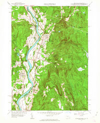
 1963 Bristol1964 Print · USGSThe mid-century Green Mountains come alive in this survey of the high ridges and river valleys surrounding Bristol and Starksboro. Genealogists can trace early homesteads through landmarks like Greenwood Cem, Monkton Ch, and Robinson Sch.3 unique versions available
 - 1963 Map of Monkton, 1964 Print
 1963 Monkton1964 Print · USGSIn the early 1960s, this pocket of Addison County was a landscape of upland ridges and creek-fed valleys. Genealogists and historians can trace family ties through numerous small burying grounds like Quaker Cem and Carter Cem, or locate landmarks such as Beeman Academy and the Armory in Vergennes.3 unique versions available
 - 1964 Map of Glens Falls
 1964 Glens Falls1964 Print · USGSThe tri-state borderlands of New York, Vermont, and New Hampshire appear here in the mid-1960s. Researchers can trace the rail routes of the Rutland RR and find historic sites like Ticonderoga and Saratoga National Historical Park.
 - 1964 Map of East Alburg, 1965 Print
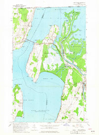 1964 East Alburg1965 Print · USGSLake Champlain's northern reaches and the Vermont-Quebec border come into focus in the mid-1960s. Trace the lakeside history of Alburg Springs or locate rural family landmarks like Tabor Cem and the Riverside Cem near the Missisquoi River.3 unique versions available
 - 1964 Map of Highgate Center, 1965 Print
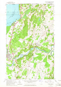 1964 Highgate Center1965 Print · USGSFranklin County in the mid-sixties reveals a landscape of international borders and river-powered industry along the Missisquoi River. Genealogists can trace deep local roots through numerous burial sites like Stimet Cem and Webster Cem or explore the rail hubs at Swanton Junction.3 unique versions available
 - 1964 Map of West Rutland, 1965 Print
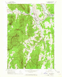 1964 West Rutland1965 Print · USGSRutland County's industrial and rural character is preserved here in the mid-1960s. Genealogists and historians can trace the rail lines of the Delaware and Hudson Railroad and find long-established sites like Clarendon Springs and Edmunds Cem.4 unique versions available
Showing maps 1-25 of 57
Top cities of Vermont
- Burlington historical maps
- South Burlington historical maps
- Colchester historical maps
- Rutland City historical maps
- Essex historical maps
- Essex Junction historical maps
See more
Top counties of Vermont
- Chittenden County historical maps
- Rutland County historical maps
- Washington County historical maps
- Windsor County historical maps
- Windham County historical maps
- Bennington County historical maps
See more
Frequently asked questions
- What are the different types of historical maps available for Vermont?
- What is the oldest map of Vermont?
- Where can I purchase historical maps of Vermont for my home or office?
- Where can I download high-res historical maps of Vermont?
- Are there historical topographic maps available for Vermont?
- Is there historical aerial imagery available for Vermont?
- Where are historical maps of Vermont sourced from?