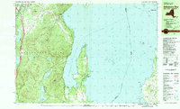
1980s Maps of Vermont
Explore 118 historic maps of Vermont from the 1980s. These maps offer a rare glimpse into what life looked like during the 1980s — showing old roads, neighborhoods, homes, and landmarks that have changed or disappeared over time.
Whether you're researching your family's past, planning a metal detecting trip, or studying how Vermont's landscape evolved across the 1980s, these high-resolution maps are a powerful tool for exploring the history of this region.
- Focus on a specific era: All maps on this page are from the 1980s, giving you a focused view of this time period.
- See what’s changed: Compare century-old streets, trails, and buildings to today's modern landscape using overlays and satellite layers.
- Research with precision: Use these maps for genealogy, historical research, land use analysis, or educational projects.
- View, download, or print: Maps are fully viewable online in high resolution, and can be downloaded or printed for your own records.
Start exploring Vermont's history through authentic maps from the 1980s. This is your window into the past.
Vermont maps
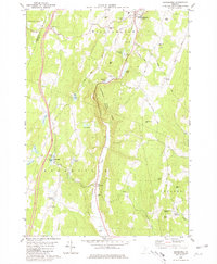
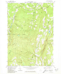
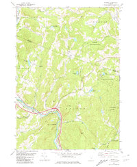
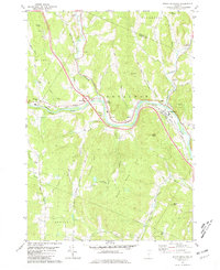
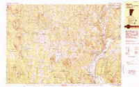
(118)- 1980 Map of Northfield
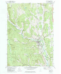
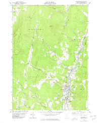 1980 Northfield1980 Print · USGSThe Green Mountain valleys near Northfield and the Dog River are shown in detail during the late 1970s. Genealogists and local historians can trace family locations through Mount Hope Cem, the Norwich University campus, and local crossings like the Covered Bridge.2 unique versions available
 - 1980 Map of Willsboro
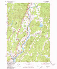
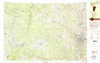
 1980 Willsboro1980 Print · USGSThe Lake Champlain shoreline at the edge of the Adirondacks was a bustling corridor of rail and water transport in the late twentieth century. Researchers can trace the Delaware and Hudson line between Willsboro and Essex, or locate family sites like Brookfield Cem and St Josephs Ch.
 - 1980 Map of Westport, 1981 Print
 1980 Westport1981 Print · USGSLake Champlain divides the New York Adirondacks from the Vermont plains in the early eighties, showing a landscape defined by water and rail. Researchers can trace family sites at Riverside Cem and Prospect Cem, or locate landmarks like Camp Dudley and the Delaware and Hudson railroad.3 unique versions available
 - 1980 Map of Brookfield, 1981 Print
 1980 Brookfield1981 Print · USGSThe upland villages and mountain gaps of Orange County are documented here during the early 1980s. Researchers can trace local heritage through the Floating Bridge at Sunset Lake, several old burial grounds like Wiggins Cem, and landmarks such as St Edwards Ch.
 - 1980 Map of Roxbury, 1981 Print
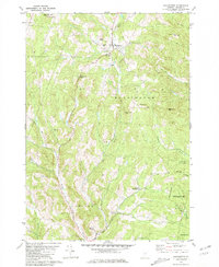
 1980 Roxbury1981 Print · USGSRoxbury and South Northfield are captured here in the early 1980s, showcasing the high-elevation settlements and rail corridors of central Vermont. Genealogists can locate the First Settler Cem, the Rabbit Hollow Sch, and family-named terrain like Belcher Hill.2 unique versions available
 - 1980 Map of Bethel, 1981 Print
 1980 Bethel1981 Print · USGSWindsor County's high ridges and river valleys are captured here in the early eighties, showing the traditional mountain settlements of the Green Mountains. Researchers can trace family sites at the Sylvester Plot Cem, the village of Gaysville, and the White River National Fish Hatchery.3 unique versions available
 - 1980 Map of Port Henry, 1981 Print
 1980 Port Henry1981 Print · USGSLake Champlain's narrows were a hub of activity in the late twentieth century, balancing heavy industry with significant colonial heritage. Genealogists and historians can trace Fort St Frederic Ruins, family cemeteries like Spear Cem, and the path of the Delaware and Hudson railroad.
 - 1980 Map of Willsboro Bay, 1981 Print
 1980 Willsboro Bay1981 Print · USGSLake Champlain and the eastern edge of the Adirondacks meet in the early eighties, revealing a landscape of shoreline camps and mountain peaks. Trace the Delaware and Hudson rail line through Port Douglass or locate historic family spots near Highlands Forge Lake and Schuyler Island.2 unique versions available
 - 1981 Map of Sharon
 1981 Sharon1981 Print · USGSThe White River valley in the early eighties shows a landscape of mountain forests and river-bottom transport. You can locate family landmarks like the Joseph Smith Monument, the Button Cem, and the old Covered Bridge.2 unique versions available
 - 1981 Map of Barre East
 1981 Barre East1981 Print · USGSThe granite industry of central Vermont is captured here in the early 1980s, centered on the massive extraction sites of Millstone Hill. Researchers can trace the layout of quarrying villages like Websterville and Graniteville or locate family sites near Hope Cem and Wilson Cem.2 unique versions available
 - 1981 Map of Knox Mountain
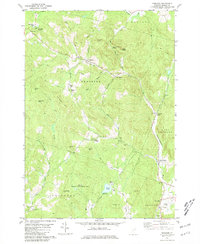
 1981 Knox Mountain1981 Print · USGSThe Vermont highlands near Orange and Groton are captured in the early 1980s, showing a landscape shaped by state forests and mountain peaks. Genealogists and hikers can locate Westville Cem, the William Scott Mem Mon, and the Lookout Tower atop Spruce Mtn.2 unique versions available
 - 1981 Map of South Strafford
 1981 South Strafford1981 Print · USGSThe rural uplands of Orange County come into focus in the early eighties, documenting a landscape shaped by mining and the Ompompanoosuc River. Researchers can trace the industrial footprint of the Elizabeth Mine, locate family plots at Kibling Cem, or find the Covered Bridge at Union Village.2 unique versions available
 - 1981 Map of South Royalton
 1981 South Royalton1981 Print · USGSWindsor County in the early eighties shows a landscape of river-valley villages and winding upland roads. Genealogists and local historians can trace family locations through sites like Hickey Cem, Haven Cem, and the village of East Bethel.2 unique versions available
 - 1981 Map of Lyme
 1981 Lyme1981 Print · USGSThe Upper Valley of the Connecticut River comes alive in the early eighties, showcasing the rural character of Vermont and New Hampshire. Genealogists and local historians can trace family ties through Lyme Cem, Highland Cem, and the historic Thetford Academy.3 unique versions available
 - 1981 Map of West Topsham
 1981 West Topsham1981 Print · USGSThe hill country of Orange and Topsham in the early 1980s reveals a landscape of isolated valley settlements and high ridges. Genealogists can trace family names at Hutchinson Cem or locate old sites like Union No 36 Sch and the mines on Pike Hill.
 - 1981 Map of Washington
 1981 Washington1981 Print · USGSCentral Vermont's rural landscape is captured here in the early eighties, showcasing the intersection of small upland hamlets and managed timberlands. Genealogists and local historians can locate several family cemeteries such as Fish Cem and Clough Cem, or trace the winding roads connecting Washington to Kennedy Corners.2 unique versions available
 - 1981 Map of Vershire
 1981 Vershire1981 Print · USGSOrange County's hill country is captured in the early 1980s, showcasing a landscape of dispersed hamlets and mountain farmsteads. Genealogists and historians can trace old property access via Old City Road and locate rural landmarks such as Vershire Center and the Mountain Sch.4 unique versions available
 - 1981 Map of Randolph
 1981 Randolph1981 Print · USGSThe Orange County hills and river valleys around Randolph are captured here in the early 1980s. Local researchers can trace the Central Vermont rail line and locate historic landmarks like the General Thomas Monument and Pleasant View Cem.2 unique versions available
 - 1981 Map of Fairlee
 1981 Fairlee1981 Print · USGSThe Connecticut River valley in the early eighties shows a landscape of lakeside leisure and transit corridors. Researchers can trace the Boston and Maine rail line, locate St Martins Chapel, and find local landmarks like the Drive-in Theater and Bear Ridge Raceway.3 unique versions available
 - 1981 Map of Chelsea
 1981 Chelsea1981 Print · USGSOrange County, Vermont, maintains its traditional river-valley character in this early 1980s survey of the White River highlands. Researchers can trace historic timber spans like the Larkin Covered Bridge and locate numerous family burial grounds, including Lincoln Cem and Durkee Cem.3 unique versions available
 - 1981 Map of Randolph Center
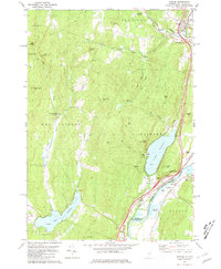
 1981 Randolph Center1981 Print · USGSCentral Vermont in the late seventies reveals a landscape of ridge-top institutions and valley-floor hamlets. Trace family histories at Allen Cem or Kelsey Mtn Cem, and locate traditional landmarks like the Cilley Covered Bridge and Vermont Technical College.2 unique versions available
 - 1982 Map of Lancaster, 1983 Print
 1982 Lancaster1983 Print · USGSThe Connecticut River valley comes alive in the early eighties as a network of rail lines and riverside towns. Genealogists and historians can trace family-named hills and find local landmarks like St Matthews Ch, the Covered Bridge, and Riverside Cem.2 unique versions available
 - 1983 Map of Barnet
 1983 Barnet1983 Print · USGSThe Vermont and New Hampshire borderlands come alive in the early eighties, centered on the river-and-rail corridor of the Connecticut River. Researchers can trace the Canadian Pacific tracks through Barnet and locate small hamlets like Ewells Mills and Mosquitoville.
 - 1983 Map of St. Johnsbury
 1983 St. Johnsbury1983 Print · USGSCaledonia County's rail and river corridors are captured in the early eighties as the region balanced its industrial heritage with expanding highway infrastructure. Genealogists can locate family sites from Greenbank Hollow to Walden, including the Pope Cem and the Noyesville Sch.2 unique versions available
 - 1983 Map of Cornwall, 1990 Print
 1983 Cornwall1990 Print · USGSMid-century Addison County comes alive in this topographic study of the Otter Creek valley. Genealogists and historians can locate family landmarks like Evergreen Cem, the Rutland Railroad line, and several rural schoolhouses including Cady School and School No 2.
Showing maps 1-25 of 118
Top cities of Vermont
- Burlington historical maps
- South Burlington historical maps
- Colchester historical maps
- Rutland City historical maps
- Essex historical maps
- Essex Junction historical maps
See more
Top counties of Vermont
- Chittenden County historical maps
- Rutland County historical maps
- Washington County historical maps
- Windsor County historical maps
- Windham County historical maps
- Bennington County historical maps
See more
Frequently asked questions
- What are the different types of historical maps available for Vermont?
- What is the oldest map of Vermont?
- Where can I purchase historical maps of Vermont for my home or office?
- Where can I download high-res historical maps of Vermont?
- Are there historical topographic maps available for Vermont?
- Is there historical aerial imagery available for Vermont?
- Where are historical maps of Vermont sourced from?