1990s Maps of Vermont
Explore 81 historic maps of Vermont from the 1990s. These maps offer a rare glimpse into what life looked like during the 1990s — showing old roads, neighborhoods, homes, and landmarks that have changed or disappeared over time.
Whether you're researching your family's past, planning a metal detecting trip, or studying how Vermont's landscape evolved across the 1990s, these high-resolution maps are a powerful tool for exploring the history of this region.
- Focus on a specific era: All maps on this page are from the 1990s, giving you a focused view of this time period.
- See what’s changed: Compare century-old streets, trails, and buildings to today's modern landscape using overlays and satellite layers.
- Research with precision: Use these maps for genealogy, historical research, land use analysis, or educational projects.
- View, download, or print: Maps are fully viewable online in high resolution, and can be downloaded or printed for your own records.
Start exploring Vermont's history through authentic maps from the 1990s. This is your window into the past.
Vermont maps
(81)- 1990 Map of Northfield
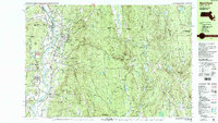 1990 Northfield1990 Print · USGSThe tri-state border of Massachusetts, New Hampshire, and Vermont comes into focus in the 1990s as a landscape of river valleys and forested peaks. Researchers can trace the grounds of the Northfield Mt Hermon School or locate old burial sites like South Parish Cem and Center Cem.2 unique versions available
 - 1990 Map of Bernardston
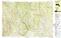 1990 Bernardston1990 Print · USGSFranklin County and the Vermont borderlands appear in the early nineties as a blend of Colonial frontier sites and industrial river hamlets. Researchers can locate historic fortifications like Fort Morrison (Site), rural schools like Leyden Sch, and family-named cemeteries such as Grove Cem.2 unique versions available
 - 1990 Map of Rowe
 1990 Rowe1990 Print · USGSThe Deerfield River valley of northern Franklin County comes into focus in the 1980s, balancing industrial sites with large tracts of state forest. Genealogists and local historians can locate several family cemeteries, the Davis Mine, and the iconic Hoosac Tunnel.2 unique versions available
 - 1995 Map of Averill, 1999 Print
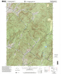
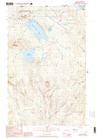 1995 Averill1999 Print · USGSUpper Essex County in the late twentieth century remains a pristine wilderness of timberlands and glacial lakes along the Canadian border. Genealogists and historians can trace old logging camps like Camp No 11 or survey the waters of Great Averill Pond and Little Averill Pond.
 - 1995 Map of North Pownal, 2000 Print
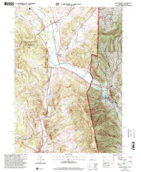 1995 North Pownal2000 Print · USGSThe borderlands of New York and Vermont come alive in the 1990s, where the Hoosic River cuts between the Taconic and Green Mountains. Trace local heritage through rural landmarks like Petersburg Junction, the Gardner Cem, and Hoosick Sch.
 - 1995 Map of West Rupert, 2000 Print
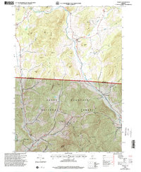
 1995 West Rupert2000 Print · USGSBennington County during the mid-1990s reveals a landscape where deep mountain hollows and high peaks dictate the limits of settlement. Genealogists and historians can trace the remote outposts of West Sandgate and Beartown or locate families near Lake Madeleine and Barber Lake.
 - 1995 Map of Pawlet, 2000 Print
 1995 Pawlet2000 Print · USGSThe Mettawee River valley in the mid-1990s reveals a Vermont landscape defined by small river-towns and timbered highlands. Genealogists and local historians can trace family locations near Mettawee Valley Cem or investigate industrial sites like the various Quarries and the Mach Airfield.
 - 1995 Map of Shushan, 2000 Print
 1995 Shushan2000 Print · USGSWashington County, New York, and the Vermont borderland are captured here in the mid-1990s, showcasing a network of historic rural settlements. Genealogists and researchers can trace family lands near Shushan, Pumpkin Hook, and the Bininger Cem, or locate the district schoolhouses that once served these valley communities.
 - 1995 Map of Salem, 2000 Print
 1995 Salem2000 Print · USGSThe rural landscape of the New York-Vermont border is captured here during the mid-1990s, centering on the valley of the Batten Kill. Researchers can trace old family names and settlements through landmarks like Evergreen Cem, Rexleigh, and the rail junction at Greenwich Junc.
 - 1995 Map of West Pawlet, 2000 Print
 1995 West Pawlet2000 Print · USGSCrossing the New York and Vermont border in the mid-1990s, this area shows a landscape of upland ridges and clustered valley hamlets. Researchers can trace rural lineages through numerous sites like Taylor Hill Cem or locate the site of Chamberlain Mills along the creek beds.2 unique versions available
 - 1995 Map of Hoosick Falls, 2000 Print
 1995 Hoosick Falls2000 Print · USGSThe Rensselaer County borderlands come alive in the mid-nineties as small settlements and rail junctions follow the winding river valleys into Vermont. Researchers can trace family sites from St Marys Ch to rural outposts like Post Corners and Center White Creek.
 - 1996 Map of Rutland, 2000 Print
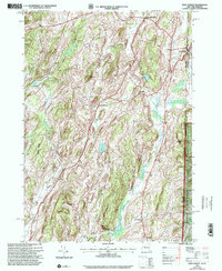
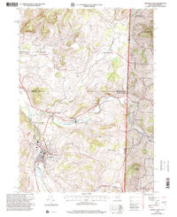
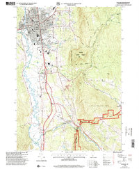 1996 Rutland2000 Print · USGSRutland and the Otter Creek valley are shown here in the mid-1990s, capturing the city alongside its rural foothills. Genealogists and local historians can trace family landmarks and civic sites like the Riverside Reformatory, Union Chapel, and Mount St Joseph Academy.
 - 1996 Map of Lovering Mountain, 2000 Print
 1996 Lovering Mountain2000 Print · USGSNorthern Coos County is shown in the mid-1990s as the regional landscape supported both forest management and recreation. Researchers can trace the layout of Colebrook, find the Fish Hatchery, and locate local landmarks such as Stewartstown Hollow or Beaver Brook Falls.
 - 1996 Map of Quechee, 2000 Print
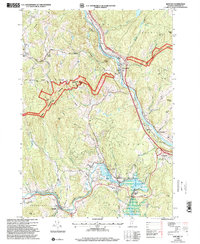 1996 Quechee2000 Print · USGSWindsor County in the late nineties showcases a landscape where the Ottauquechee River meets ancient colonial routes and deep forest preserves. Researchers can trace family history through numerous local sites like Centertown Cem, Deweys Mills, and the Taftsville covered bridge.
 - 1996 Map of Delectable Mountain, 2000 Print
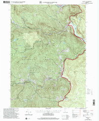
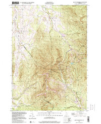
 1996 Delectable Mountain2000 Print · USGSThe Green Mountain interior of Windsor and Rutland counties comes into focus in this mid-nineties survey of high ridges and deep hollows. Researchers can trace remote locales like Notown, find the Stony Brook Shelter along the trail, and locate landmarks like Lakota Lake.
 - 1996 Map of Piermont, 2001 Print
 1996 Piermont2001 Print · USGSThe Connecticut River valley and the western edge of the White Mountains are shown here in the mid-nineties. You can trace the Appalachian National Scenic Trail past Mount Cube or locate family plots at Cedar Grove Cemetery and Dame Hill Cemetery.
 - 1996 Map of Enfield, 2001 Print
 1996 Enfield2001 Print · USGSGrafton County during the mid-1990s shows a landscape defined by the rise of Moose Mountain and the sprawling waters of Mascoma Lake. Researchers can trace the heritage of Enfield near the Shaker Bridge or follow the Appalachian Trail through the high woods of the White Mountain National Forest.
 - 1996 Map of Hanover, 2001 Print
 1996 Hanover2001 Print · USGSThe Upper Valley comes to life in the late nineties, centered on the historic academic and industrial hubs along the Connecticut River. Researchers can trace the winding Appalachian Scenic Trail or locate family roots at Hillside Cemetery and St Barnabas Ch.
 - 1996 Map of Lyme, 2001 Print
 1996 Lyme2001 Print · USGSThe Upper Valley river towns of Lyme and Thetford are captured here in the mid-nineties, showing the rural character of the Vermont and New Hampshire border. Researchers can locate family landmarks like the Thetford Academy, the Covered Bridge, and the Wilmot Cem near High Peak.
 - 1997 Map of Ludlow, 1999 Print
 1997 Ludlow1999 Print · USGSIn the late 1990s, the Black River valley in Windsor County maintained its blend of traditional village life and mountain recreation. Researchers can trace historic cemeteries and civic sites from Pleasant View Cem to the Black River High Sch and the hamlet of Tyson.
 - 1997 Map of Weston, 2000 Print
 1997 Weston2000 Print · USGSWeston and the Green Mountains are shown in the late nineties, capturing a landscape of deep river valleys and high forest ridges. Researchers can trace local landmarks like Weston Priory, the Wantastiquet Trout Club, and the winding Rootbeer Ridge Trail.
 - 1997 Map of Rowe, 2000 Print
 1997 Rowe2000 Print · USGSThe Berkshires of Franklin County meet the Vermont border in the 1990s, showcasing a landscape of state forests and hydroelectric engineering. Trace the legendary Hoosac Tunnel rail line and locate local landmarks like the Rowe Sch, West Cem, and the settlement of Monroe Bridge.
 - 1997 Map of Jamaica, 2000 Print
 1997 Jamaica2000 Print · USGSWindham County at the close of the twentieth century shows a landscape defined by the rugged Green Mountains and the winding West River. Researchers can trace historic settlements from Jamaica to the small community of Podunk, while locating remote landmarks like South Hill Cem and Pikes Falls.
 - 1997 Map of Mount Mansfield, 2000 Print
 1997 Mount Mansfield2000 Print · USGSThe Green Mountains near the Lamoille and Chittenden county line are captured here in the late 1990s, showcasing a landscape of high summits and recreational heritage. Researchers can trace the Long Trail past Taft Lodge or locate the old Harvey Sch and Morses Mill in the valleys.
 - 1997 Map of Woodstock North, 2000 Print
 1997 Woodstock North2000 Print · USGSWindsor County in the late 1990s showcases a landscape of highland villages and protected wilderness before the modern era. Genealogists and historians can trace family plots at Village Cem or Cushing Cem and locate landmarks like Central Sch and the Appalachian National Scenic Trail.
Showing maps 1-25 of 81
Top cities of Vermont
- Burlington historical maps
- South Burlington historical maps
- Colchester historical maps
- Rutland City historical maps
- Essex historical maps
- Essex Junction historical maps
See more
Top counties of Vermont
- Chittenden County historical maps
- Rutland County historical maps
- Washington County historical maps
- Windsor County historical maps
- Windham County historical maps
- Bennington County historical maps
See more
Frequently asked questions
- What are the different types of historical maps available for Vermont?
- What is the oldest map of Vermont?
- Where can I purchase historical maps of Vermont for my home or office?
- Where can I download high-res historical maps of Vermont?
- Are there historical topographic maps available for Vermont?
- Is there historical aerial imagery available for Vermont?
- Where are historical maps of Vermont sourced from?