Old Maps of Accomack County, Virginia for Metal Detecting
Plan your next treasure hunt with 275 historic maps of Accomack County. Find old homesites, ghost towns, trails, and gathering spots that may be lost to time — perfect for identifying promising metal detecting locations.
- Locate forgotten sites: Uncover places like long-lost settlements, abandoned rail lines, or gathering spots.
- Plan better hunts: Use map overlays combined with LiDAR or satellite views to narrow in on historically rich areas.
- Made for detectorists: Thousands of hobbyists use these maps to discover relics, coins, and hidden history.
Use these historic maps to boost your research and find new opportunities beneath the surface of Accomack County.
Accomack County, VA maps
(275)- 1901 Map of Snow Hill
 1901 Snow Hill1901 Print · USGSSnow Hill and the surrounding Worcester County wetlands are captured at the opening of the twentieth century, when the Pocomoke River was a vital Steamboat Route. Researchers can trace the Waterman culture through historic sites like Public Landing and the railway hubs at Girdletree and Stockton.4 unique versions available
 - 1901 Map of Green Run
 1901 Green Run1901 Print · USGSThe Maryland and Virginia coastline at the start of the century was a land of life-saving stations and isolated landings. Trace the maritime heritage of the barrier islands through North Beach L.S.S. and the commercial roots of Scotts Landing.4 unique versions available
 - 1903 Map of Crisfield
 1903 Crisfield1903 Print · USGSCoastal Somerset County at the turn of the century reveals a landscape defined by the water and the oyster trade. Genealogists and historians can trace old community footprints at Sackertown, Lawsonia, and Parsonville, or locate the Janes Island L.H. and the remote reaches of Smith Island.4 unique versions available
 - 1917 Map of Ewell
 1917 Ewell1917 Print · USGSIsolated island life in the Chesapeake comes into focus during the early twentieth century. Researchers can trace the original footprints of Ewell, Rhodes Point, and Tangier, alongside maritime landmarks like the Smith Point LH and old Steamboat Routes.2 unique versions available
 - 1920 Map of Crisfield
 1920 Crisfield1920 Print · USGSMaryland's seafood capital and the isolated island communities of the Chesapeake are captured just after the First World War. Researchers can trace the waterfront rail lines of the N.Y.P. & N. R.R. or locate ancestral homes in Sackertown, Birdtown, and Ewell.
 - 1931 Map of Accomac
 1931 Accomac1931 Print · USGSThe Eastern Shore of Virginia in the early thirties shows a thriving rail corridor and a wild, unbridged Atlantic coast. Genealogists can locate family landmarks like Oak Grove Chapel and Becker Ch or trace the early days of the Keller Fairgrounds.4 unique versions available
 - 1935 Map of Accomac
 1935 Accomac1935 Print · USGSCoastal Virginia in the mid-thirties was a landscape of deep-rooted maritime traditions and railroad commerce. Genealogists and historians can trace old homesteads near Burton Ch, locate the Fairgrounds at Tasley, or study the barrier islands from Metomkin Island down to Parramore Island.2 unique versions available
 - 1938 Map of Green Run, 1960 Print
 1938 Green Run1960 Print · USGSAssateague Island and the Delmarva coast appear here in the late 1930s, showing a landscape of maritime outposts and undeveloped barrier beaches. Researchers can trace the early locations of North Beach and Green Run Inlet Coast Guard Stations.
 - 1941 Map of Broadwater
 1941 Broadwater1941 Print · USGSThe Virginia barrier islands appear here just before the mid-century, showing the isolated settlement of Broadwater on Hog Island. Researchers can trace old coastal infrastructure and maritime landmarks like the Little Machipongo Inlet C G S and Great Machipongo Inlet.
 - 1942 Map of Chesconessex
 1942 Chesconessex1942 Print · USGSThe salt marshes and tidal creeks of the Virginia Eastern Shore are captured here during the early war years. Genealogists and local historians can trace family-named landmarks like Savage Island, Leatherbury Church, and the village of Chesconessex.2 unique versions available
 - 1942 Map of Nandua Creek, 1952 Print
 1942 Nandua Creek1952 Print · USGSThe Eastern Shore of Virginia is captured during the early 1940s, focusing on the aquatic transition between Accomack County and the Chesapeake Bay. Local historians can trace coastal landforms like Hacks Neck and the essential Pungoteague Creek Light.
 - 1942 Map of Ewell, 1957 Print
 1942 Ewell1957 Print · USGSSmith Island and its isolated waterman communities are captured here in the early 1940s, split by the Maryland and Virginia state line. Genealogists and historians can trace the small settlements of Ewell, Rhodes Point, and Tylerton alongside cemeteries and the Smith Island Light.
 - 1942 Map of Great Fox Island, 1957 Print
 1942 Great Fox Island1957 Print · USGSThe maritime borderlands of Maryland and Virginia appear in the early 1940s as a complex network of sounds, guts, and marshes. Genealogists and historians can trace local landmarks like Horse Hammock, the James Island Light, and the remote Great Fox Island.
 - 1942 Map of Chincoteague East, 1962 Print
 1942 Chincoteague East1962 Print · USGSCoastal Virginia in the early 1940s is shown here as a landscape of interconnected bays and marshes. Researchers can locate the Assateague Lighthouse, the military footprint at Camp Fletcher, and the small community at Birch Town.
 - 1942 Map of Tangier Island, 1962 Print
 1942 Tangier Island1962 Print · USGSTangier Island at the start of the 1940s reveals a maritime community defined by its unique ridge-top settlements and marshy harbors. Genealogists and historians can trace residents living along Main Ridge and Canton Ridge, or locate landmarks like Mailboat Harbor and Watts Island.
 - 1942 Map of Mappsville, 1962 Print
 1942 Mappsville1962 Print · USGSThe Virginia Shore during the 1940s reveals a landscape of isolated farming necks and rail-side villages. Genealogists can trace family roots through numerous country chapels and cemeteries like Woodbury Ch, Mears Cem, and the settlement at Modest Town.
 - 1942 Map of Little Machipongo Inlet, 1962 Print
 1942 Little Machipongo Inlet1962 Print · USGSThe Virginia barrier islands at the height of the Second World War reveal a landscape of shifting sands and isolated maritime settlements. Researchers can trace the layout of Broadwater on Hog Island and locate nearby landmarks like the Cem and Rogue Island.
 - 1942 Map of Nassawadox, 1962 Print
 1942 Nassawadox1962 Print · USGSCoastal Northampton County at the onset of the 1940s reveals a landscape defined by the Pennsylvania railroad and the vast marshes of the Eastern Shore. Trace early settlement patterns around Nassawadox and Weirwood, or locate historical maritime sites like Thomas Wharf.
 - 1942 Map of Wallops Island, 1962 Print
 1942 Wallops Island1962 Print · USGSWallops Island and the Accomack coast are captured here during the early years of the war, when this barrier beach was defined by maritime watchmen rather than rockets. Researchers can trace the original location of the Wallops Beach Coast Guard Station and the lone Watch House among the marshes of Bogues Bay.
 - 1942 Map of Saxis, 1962 Print
 1942 Saxis1962 Print · USGSCoastal Accomack County and Somerset County come to life in this mid-century survey of the tidal marshes and fishing villages along Pocomoke Sound. Genealogists can trace family roots through the island community of Saxis or locate rural landmarks like Halls Chapel and Pocomoke Church.
 - 1942 Map of Parksley, 1962 Print
 1942 Parksley1962 Print · USGSThe rail-and-water economy of Accomack County comes into focus in the early 1940s, centered on the Parksley corridor. Researchers can trace family-named landings and rural community landmarks like Guilford Church, Parksley Airport, and Hunting Creek Wharf.
 - 1943 Map of Nassawadox
 1943 Nassawadox1943 Print · USGSThe Virginia Eastern Shore during the early 1940s reveals a landscape defined by the intersection of the Pennsylvania R R and the Atlantic marshes. Researchers can trace the layout of small rail-side communities like Nassawadox or locate coastal landmarks such as Thomas Wharf and The Deeps Light.
 - 1943 Map of Boxiron
 1943 Boxiron1943 Print · USGSThe Maryland-Virginia borderlands are captured here during the mid-century, showing a landscape of tidal marshes and remote coastal landings. Researchers can trace historic access points like George Island Landing and family-named features such as Robbins Tump or Purnell Pond.
 - 1943 Map of Ewell
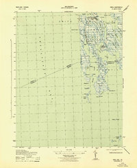 1943 Ewell1943 Print · USGSSmith Island during the early 1940s presents a unique view of Maryland's isolated island communities and their intricate waterborne geography. Local historians can trace the footings of Ewell and Tylerton, or locate landmarks like Smith Island Light and the curiously named Amen Corner.
 - 1943 Map of Jamesville
 1943 Jamesville1943 Print · USGSThe Virginia Eastern Shore is revealed in the early 1940s as a thriving network of waterfront wharves and small neck settlements. Genealogists and historians can trace the deep maritime roots of Jamesville while locating family-named landmarks like James Wharf and Davis Whf.2 unique versions available
Showing maps 1-25 of 275
Top cities of Accomack County
- Chincoteague historical maps
- Captains Cove historical maps
- Wattsville historical maps
- Onancock historical maps
- Horntown historical maps
- Parksley historical maps
See more
Frequently asked questions
- What are the different types of historical maps available for Accomack County?
- What is the oldest map of Accomack County?
- Where can I purchase historical maps of Accomack County for my home or office?
- Where can I download high-res historical maps of Accomack County?
- Are there historical topographic maps available for Accomack County?
- Is there historical aerial imagery available for Accomack County?
- Where are historical maps of Accomack County sourced from?