1980s Maps of Chelan County, Washington
Explore 28 historic maps of Chelan County from the 1980s. These maps offer a rare glimpse into what life looked like during the 1980s — showing old roads, neighborhoods, homes, and landmarks that have changed or disappeared over time.
Whether you're researching your family's past, planning a metal detecting trip, or studying how Chelan County's landscape evolved across the 1980s, these high-resolution maps are a powerful tool for exploring the history of this region.
- Focus on a specific era: All maps on this page are from the 1980s, giving you a focused view of this time period.
- See what’s changed: Compare century-old streets, trails, and buildings to today's modern landscape using overlays and satellite layers.
- Research with precision: Use these maps for genealogy, historical research, land use analysis, or educational projects.
- View, download, or print: Maps are fully viewable online in high resolution, and can be downloaded or printed for your own records.
Start exploring Chelan County's history through authentic maps from the 1980s. This is your window into the past.
Chelan County, WA maps
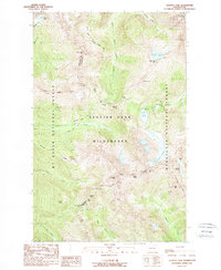
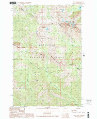
(28)- 1988 Map of Glacier Peak West
 1988 Glacier Peak West1988 Print · USGSThe high Cascades of Snohomish County are captured here in the late eighties, showing the convergence of three major wilderness areas. Trace the Pacific Crest National Scenic Trail past Kennedy Hot Spring or locate the Mackinaw Shelter and White Chuck Glacier.
 - 1988 Map of Lucerne
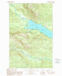
 1988 Lucerne1988 Print · USGSLake Chelan's western shore in the late eighties remained a wilderness frontier defined by ferry access and high-altitude ridges. Researchers can trace remote sites like Lucerne and Moore, alongside landmarks like Domke Falls and Bearcat Ridge.
 - 1988 Map of Saska Peak
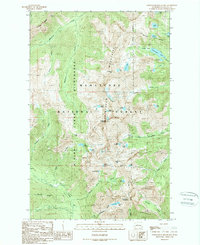
 1988 Saska Peak1988 Print · USGSThe high Entiat and Chelan ranges are documented in the late eighties as a network of wilderness trails and alpine summits. You can trace established backcountry sites like the Cottonwood Guard Station or locate remote waters such as Myrtle Lake and Larch Lakes.2 unique versions available
 - 1988 Map of Pyramid Mountain
 1988 Pyramid Mountain1988 Print · USGSThe high Cascades above Lake Chelan are shown here in the late eighties, documenting a roadless wilderness of peaks and deep drainages. Hikers and historians can trace the Duncan Ridge Trail and locate remote camps like Spruce Grove Campground.
 - 1988 Map of Suiattle Pass
 1988 Suiattle Pass1988 Print · USGSThe high Cascades at the Snohomish and Chelan border are captured here in the late eighties, showing a landscape of ice and alpine passes. Hikers and historians can trace the Pacific Crest National Scenic Trail past Glacier Peak Mines and over the stony heights of Suiattle Pass.2 unique versions available
 - 1988 Map of Pinnacle Mountain
 1988 Pinnacle Mountain1988 Print · USGSThe high Cascades of Chelan County are documented here in the late 1980s, where the Glacier Peak Wilderness meets the Wenatchee National Forest. Hikers and historians can trace the paths of Railroad Creek, the remote Emerald Park, and the heights of Lucerne Mountain.
 - 1988 Map of Trinity
 1988 Trinity1988 Print · USGSThe high Cascades of Chelan County are documented here in the late 1980s, centered on the Chiwawa River drainage. Researchers can trace the footprint of the Red Mountain Mine and the remote settlement of Trinity set against the Entiat Mountains.2 unique versions available
 - 1988 Map of Glacier Peak East
 1988 Glacier Peak East1988 Print · USGSThe high Cascades at the Snohomish and Chelan county line appear in this late 1980s survey of glacial systems and alpine peaks. Researchers can trace the extent of the Suiattle Glacier and Kennedy Glacier or locate isolated features like Airplane Lake and Tenpeak Mountain.
 - 1988 Map of Holden
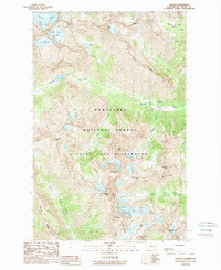 1988 Holden1988 Print · USGSThe high Chelan Mountains and the mining settlement of Holden are captured here in the late eighties. Researchers can trace the industrial landscape of the Mine and Tailings alongside prominent peaks like Seven Fingered Jack and Mt Maude.2 unique versions available
 - 1988 Map of Clark Mountain
 1988 Clark Mountain1988 Print · USGSThe high Cascades of Chelan County are mapped in detail during the 1980s, showcasing the massive ice fields of the Glacier Peak Wilderness. Researchers can trace remote alpine routes through Little Giant Pass and Boulder Pass or locate the headwaters of the Chiwawa River.
 - 1989 Map of Swauk Pass
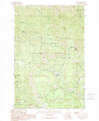 1989 Swauk Pass1989 Print · USGSThe high ridges of the Wenatchee Mountains appear here in the late eighties as a landscape of forest management and alpine recreation. Trace historical mining interests at the Swauk Prospects or locate backcountry sites like Tronsen Campground and Haney Meadow.2 unique versions available
 - 1989 Map of Big Jim Mountain
 1989 Big Jim Mountain1989 Print · USGSHigh in the Cascades during the late eighties, this survey captures a landscape of alpine lakes and dramatic ridgelines within the Wenatchee National Forest. Hikers and geologists can trace the remote waters of Lake Augusta and Lake Julius or locate the deep descent of Battle Canyon.
 - 1989 Map of Leavenworth
 1989 Leavenworth1989 Print · USGSLeavenworth in the late eighties serves as a gateway between the river valley and the high Stuart Range. Genealogists and historians can trace the town's layout near Mtn View Cem, the Cascade Jr-Sr High, and the Leavenworth National Fish Hatchery.3 unique versions available
 - 1989 Map of Jack Ridge
 1989 Jack Ridge1989 Print · USGSThe high Wenatchee Mountains are captured in the late eighties as a preserved wilderness under forest management. Trace high-country routes to Bootjack Mountain, Trout Lake, and the Prospects located near the Kittitas County line.
 - 1989 Map of Cashmere Mountain
 1989 Cashmere Mountain1989 Print · USGSThe high country of the Wenatchee National Forest is captured here in the late eighties, documenting a landscape of steep summits and glacial basins. Trace trail routes to Eightmile Lake or explore campgrounds along Icicle Creek like Bridge Creek Campground.
 - 1989 Map of Winton
 1989 Winton1989 Print · USGSThe Wenatchee River corridor in the late eighties reveals a landscape of industrial utility and mountain recreation. Trace the railway through the tunnel or locate family-named features like Freund Creek and the small settlement of Winton.
 - 1989 Map of Mount Stuart
 1989 Mount Stuart1989 Print · USGSThe high Cascades of Kittitas and Chelan Counties are shown here during the late eighties, dominated by the peaks of the Stuart Range. Outdoor historians can trace the trails and glacial basins surrounding Mount Stuart, Ingalls Lake, and Lake Camp Fire Girls.2 unique versions available
 - 1989 Map of Tiptop
 1989 Tiptop1989 Print · USGSCamas Land and the high ridges of Chelan County are documented here in the late 1980s as the area balanced forestry and recreation. Researchers can trace the drainages of Camas Creek or locate landmarks like the Quarry and Bonanza Campground near Mission Ridge.
 - 1989 Map of Schaffer Lake
 1989 Schaffer Lake1989 Print · USGSHigh in the Cascades during the late eighties, this terrain highlights the intersection of protected wilderness and national forest lands. Hikers and historians can trace the paths around Twin Lakes or locate riverfront sites like Riverbend Campground and Schaefer Creek Campground.
 - 1989 Map of Peshastin
 1989 Peshastin1989 Print · USGSThe Wenatchee River valley in the late 1980s shows a landscape shaped by irrigation and rail transit. Genealogists and local historians can trace family-named sites like Brender Canyon and find landmarks such as the local Cem or the Peshastin Pinnacles.
 - 1989 Map of Van Creek
 1989 Van Creek1989 Print · USGSThe foothills of the Cascades are captured in the late eighties, showing a landscape defined by timberlands and steep drainage canyons. Researchers can trace the path of the Chumstick Railroad or locate family-named landmarks like Bjork Canyon and Walker Canyon.
 - 1989 Map of Chiwaukum Mountains
 1989 Chiwaukum Mountains1989 Print · USGSThe Chiwaukum Mountains are shown in detail during the late 1980s, a period of established wilderness preservation. Trace remote high-country routes like the Pack Trail past Loch Eileen and across the ridgelines of Icicle Ridge.2 unique versions available
 - 1989 Map of Lake Wenatchee
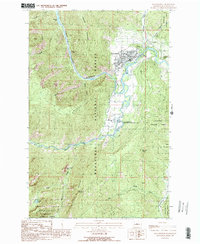
 1989 Lake Wenatchee1989 Print · USGSChelan County in the late eighties shows a landscape of deep alpine lakes and vital transport corridors. Researchers can trace the Burlington Northern railroad through Merritt or locate recreational landmarks like Camp Zanika Lache and Glacier View Campground.2 unique versions available
 - 1989 Map of Liberty
 1989 Liberty1989 Print · USGSThe high country of Kittitas County is seen here in the late eighties, just as recreational and mining interests converged in the Wenatchee Mountains. Researchers can locate specific prospect sites and strip mines near the settlement of Liberty or trace routes through Blewett Pass.2 unique versions available
 - 1989 Map of Blewett
 1989 Blewett1989 Print · USGSThe mountain terrain of the Cascades near the Chelan and Kittitas border is documented here in the late eighties. Researchers can trace the winding route of U.S. 97 past the settlement at Blewett or locate high-country landmarks like Iron Mountain and Snow Lakes.2 unique versions available
Showing maps 1-25 of 28
Top cities of Chelan County
- Wenatchee historical maps
- Chelan historical maps
- Cashmere historical maps
- Leavenworth historical maps
- Entiat historical maps
Frequently asked questions
- What are the different types of historical maps available for Chelan County?
- What is the oldest map of Chelan County?
- Where can I purchase historical maps of Chelan County for my home or office?
- Where can I download high-res historical maps of Chelan County?
- Are there historical topographic maps available for Chelan County?
- Is there historical aerial imagery available for Chelan County?
- Where are historical maps of Chelan County sourced from?