1960s Maps of Chelan County, Washington
Explore 63 historic maps of Chelan County from the 1960s. These maps offer a rare glimpse into what life looked like during the 1960s — showing old roads, neighborhoods, homes, and landmarks that have changed or disappeared over time.
Whether you're researching your family's past, planning a metal detecting trip, or studying how Chelan County's landscape evolved across the 1960s, these high-resolution maps are a powerful tool for exploring the history of this region.
- Focus on a specific era: All maps on this page are from the 1960s, giving you a focused view of this time period.
- See what’s changed: Compare century-old streets, trails, and buildings to today's modern landscape using overlays and satellite layers.
- Research with precision: Use these maps for genealogy, historical research, land use analysis, or educational projects.
- View, download, or print: Maps are fully viewable online in high resolution, and can be downloaded or printed for your own records.
Start exploring Chelan County's history through authentic maps from the 1960s. This is your window into the past.
Chelan County, WA maps
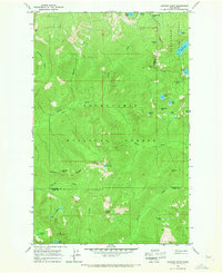
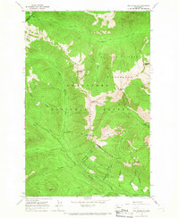
(63)- 1961 Map of Liberty, 1963 Print
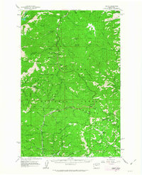 1961 Liberty1963 Print · USGSThe high Cascades of Chelan and Kittitas counties are captured here in the early sixties, showing the transition from mining era to modern recreation. Trace the former Blewett townsite, the historic mining camp of Liberty, and the Mineral Springs Resort.2 unique versions available
 - 1961 Map of Mount Stuart, 1963 Print
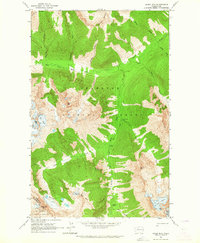
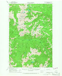
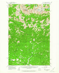 1961 Mount Stuart1963 Print · USGSThe high Cascades at the start of the sixties are detailed here, showing the intersection of alpine wilderness and mountain industry. Trace the locations of the Skookum Mine, lookouts like Stafford Lookout, and high-altitude water at the Lower Enchantment Lakes.3 unique versions available
 - 1962 Map of Concrete
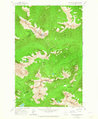
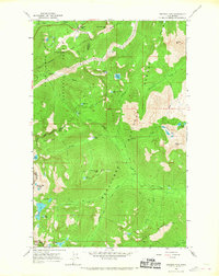
 1962 Concrete1962 Print · USGSThe Northern Cascades in the early sixties reveal a landscape of high alpine peaks and deep river valleys before the modern park era. Genealogists and historians can trace rail-and-river towns like Concrete, Darrington, and Stehekin, alongside industry at the Holden Mine.
 - 1963 Map of Washington Pass, 1964 Print
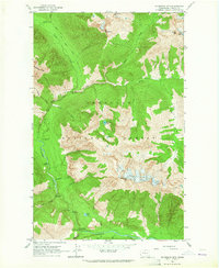
 1963 Washington Pass1964 Print · USGSHigh Cascades mountain passes and national forest boundaries appear in detail during the early 1960s. Hikers and historians can trace the early Cascade Crest Trail (Alternate) and Early Winters Trail past Liberty Bell Mtn and Washington Pass.3 unique versions available
 - 1963 Map of Mc Gregor Mtn, 1964 Print
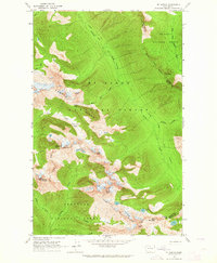
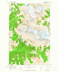
 1963 Mc Gregor Mtn1964 Print · USGSThe Cascades of Chelan County appear here in the early sixties, showing a wilderness landscape of glaciers and remote camps. Researchers can locate high-country features like Sandalee Glacier, the High Bridge Guard Station, and the Dolly Varden Campground along the Stehekin River.5 unique versions available
 - 1963 Map of Agnes Mtn, 1964 Print
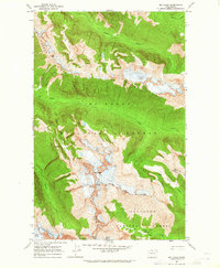
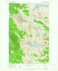
 1963 Agnes Mtn1964 Print · USGSThe high peaks of Chelan and Snohomish counties are documented here in the early 1960s, showing the intersection of wilderness and recreation. You can trace the Cascade Crest Trail past Fivemile Camp and locate glaciers such as Blue Glacier and Chickamin Glacier.4 unique versions available
 - 1963 Map of Mt. Arriva, 1964 Print
 1963 Mt. Arriva1964 Print · USGSThe high Cascade crest at the Skagit and Okanogan county lines is documented here in the early sixties. Hikers and historians can trace the original Cascade Crest Trail as it passes Silent Lakes and the Lewis Glacier.3 unique versions available
 - 1963 Map of Mt Logan, 1965 Print
 1963 Mt Logan1965 Print · USGSThe high North Cascades appear in the early sixties as a wilderness of ice and rock along the Skagit and Chelan county lines. Hikers and historians can trace the original path of the Cascade Crest Trail past Mt Logan and the sprawling Douglas Glacier.3 unique versions available
 - 1963 Map of Mt Lyall, 1965 Print
 1963 Mt Lyall1965 Print · USGSChelan County’s high wilderness is documented here in the early 1960s within the Okanogan National Forest. Backcountry travelers and geologists can trace the Cascade Crest Trail past Agnes Gorge and locate the Company Glacier beneath Mt Lyall.3 unique versions available
 - 1963 Map of Dome Peak, 1965 Print
 1963 Dome Peak1965 Print · USGSThe high Cascades of the early sixties are captured here at the junction of three counties, where massive glaciers dominate the divide. Outdoor historians and geologists can trace the mid-century extent of the South Cascade Glacier and Dana Glacier near prominent summits like Dome Peak.3 unique versions available
 - 1963 Map of Cascade Pass, 1965 Print
 1963 Cascade Pass1965 Print · USGSThe high North Cascades reached an era of detailed documentation in the early sixties, capturing the glaciated divide between Skagit and Chelan counties. Researchers can locate remote mining sites like the Diamond Mine or trace the drainages of Doubtful Lake and Horseshoe Basin.4 unique versions available
 - 1963 Map of Goode Mtn, 1970 Print
 1963 Goode Mtn1970 Print · USGSThe High Cascades near the Chelan and Skagit county line were still a remote wilderness of ice and granite in the early sixties. Hikers and historians can trace high-country routes like the Park Creek Trail past Cottonwood Camp and the icy heights of Goode Mtn.3 unique versions available
 - 1964 Map of Leavenworth, 1966 Print
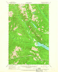
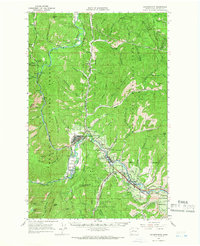 1964 Leavenworth1966 Print · USGSThe Wenatchee River valley and its rail-and-river network are captured in detail during the mid-sixties. Researchers can trace the development of Leavenworth and Peshastin, or locate family-history sites like the Leavenworth Cem and Medicine Spring.3 unique versions available
 - 1965 Map of Ritzville
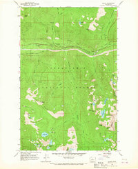
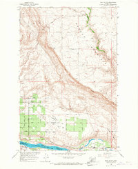
 1965 Ritzville1965 Print · USGSCentral Washington during the mid-sixties shows a landscape shaped by massive irrigation projects and the Cold War. Genealogists and historians can trace rail-town life and military presence through Ephrata Air Base, the Telford Station, and local schools.
 - 1965 Map of Captain Point, 1967 Print
 1965 Captain Point1967 Print · USGSThe Cascades back-country at the meeting of Snohomish, Chelan, and King counties is shown here in the mid-sixties. Trace high-altitude routes like the Cascade Crest Trail and find remote waters including Grizzly Lake and Saucer Lake.2 unique versions available
 - 1965 Map of Chiwaukum Mts, 1967 Print
 1965 Chiwaukum Mts1967 Print · USGSThe high Cascades at the boundary of Chelan and Kittitas counties come into focus in the mid-sixties, showing a landscape of alpine lakes and trails. Genealogists and historians can trace the Van Epps Mine or locate early recreation sites like French Creek Campground and the Guard Station.2 unique versions available
 - 1965 Map of Stevens Pass, 1967 Print
 1965 Stevens Pass1967 Print · USGSStevens Pass in the mid-1960s captures a critical intersection of high-mountain transit and wilderness management. Trace the path of the Great Northern railroad and locate remote landmarks like Bark Cabin and the Stevens Pass Guard Station.5 unique versions available
 - 1965 Map of Wenatchee Lake, 1967 Print
 1965 Wenatchee Lake1967 Print · USGSUpper Chelan County in the mid-1960s is captured here at a height of mountain railroading and early alpine recreation. Genealogists and historians can trace the Great Northern rail line through Berne or locate seasonal sites like Camp Zanika Lache and Telma.2 unique versions available
 - 1965 Map of Poe Mountain, 1967 Print
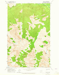
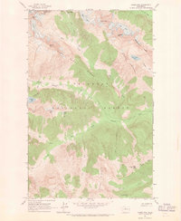
 1965 Poe Mountain1967 Print · USGSChelan County is shown at a peak of backcountry wilderness management in the mid-sixties, dominated by high summits and the headwaters of the Wenatchee. Hikers and historians can trace old pack routes like the Cady Ridge Trail to landmarks such as Poe Mountain and Meander Meadow.3 unique versions available
 - 1965 Map of Bench Mark Mtn, 1967 Print
 1965 Bench Mark Mtn1967 Print · USGSHigh in the Cascades during the mid-sixties, this area is defined by the intersection of three national forests and remote alpine terrain. Trace historic pack trails through Dishpan Gap, Cady Pass, and past the shores of Lake Sally Ann.
 - 1965 Map of Scenic, 1967 Print
 1965 Scenic1967 Print · USGSIn the mid-1960s, the high Cascades near the King and Chelan county line remained a rugged corridor of rail engineering and wilderness trails. Genealogists and hikers can trace the original Great Northern Railroad alignment, the Cascade Tunnel, and the historic Tonga Ridge Pack Trail.4 unique versions available
 - 1965 Map of The Cradle, 1967 Print
 1965 The Cradle1967 Print · USGSThe Wenatchee Mountains in the mid-1960s featured a complex network of alpine trails and high-country lake basins. Trace the historic route of the Cascade Crest Trail past The Cradle and through the Paddy-Go-Easy Pass.3 unique versions available
 - 1965 Map of Labyrinth Mtn, 1967 Print
 1965 Labyrinth Mtn1967 Print · USGSThe Cascades crest at Stevens Pass is captured here in the mid-1960s, showing the intersection of three counties and major mountain transit. Trace the routes of the Great Northern Tunnel, the Stevens Pass Hwy, and the Pacific Crest National Scenic Trail.5 unique versions available
 - 1966 Map of Rock Island, 1967 Print
 1966 Rock Island1967 Print · USGSThe Douglas County high country meets the river valley in the mid-1960s, showing a landscape shaped by aviation and agriculture. Researchers can trace the development of Pangborn Field, locate the Hamilton Cem, and follow the Great Northern rail line along the Columbia River.2 unique versions available
 - 1966 Map of Wenatchee, 1968 Print
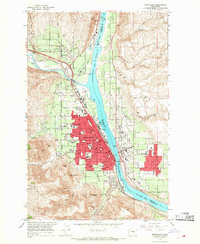 1966 Wenatchee1968 Print · USGSWenatchee and the river valley were flourishing mid-century as major apple-growing and rail hubs. Genealogists and local researchers can locate numerous schools and cemeteries like Sunnyslope Cem, Evergreen Memorial Park, and the Golden King Mine.5 unique versions available
Showing maps 1-25 of 63
Top cities of Chelan County
- Wenatchee historical maps
- Chelan historical maps
- Cashmere historical maps
- Leavenworth historical maps
- Entiat historical maps
Frequently asked questions
- What are the different types of historical maps available for Chelan County?
- What is the oldest map of Chelan County?
- Where can I purchase historical maps of Chelan County for my home or office?
- Where can I download high-res historical maps of Chelan County?
- Are there historical topographic maps available for Chelan County?
- Is there historical aerial imagery available for Chelan County?
- Where are historical maps of Chelan County sourced from?