
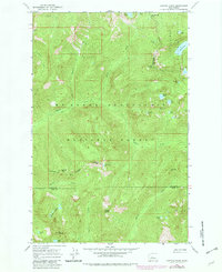
1965 Map of Captain Point
USGS Topo · Published 1967About this map
The Wenatchee National Forest and Snoqualmie National Forest meet in this mid-1960s survey, defined by high-elevation peaks and an intricate network of glacial lakes. Central to the sheet is the Rapid River, which carves through the landscape as it flows westward. The survey documents a critical junction of three counties—Snohomish, Chelan, and King—where the terrain rises to notable heights at Captain Point and Valhalla Mtn.
Find a feature on this map
44 named features on this map. Tap any name to fly to it.
Don’t see what you’re looking for? This feature index may not catch every label — zoom into the map to look around manually.
Map Details
Editions of this 1965 Captain Point Map
2 editions found
Other maps of this area

1902 · Skykomish
USGS Topo · 1:125,000

1905 · Skykomish
USGS Topo · 1:125,000

1957 · Wenatchee
USGS Topo · 1:250,000

1965 · Evergreen Mtn
USGS Topo · 1:24,000

1965 · Stevens Pass
USGS Topo · 1:24,000

1965 · Skykomish
USGS Topo · 1:24,000

1965 · Poe Mountain
USGS Topo · 1:24,000
1965 · Bench Mark Mtn
USGS Topo · 1:24,000
1965 · Scenic
USGS Topo · 1:24,000
1965 · Labyrinth Mtn
USGS Topo · 1:24,000