1960s Maps of Kittitas County, Washington
Explore 30 historic maps of Kittitas County from the 1960s. These maps offer a rare glimpse into what life looked like during the 1960s — showing old roads, neighborhoods, homes, and landmarks that have changed or disappeared over time.
Whether you're researching your family's past, planning a metal detecting trip, or studying how Kittitas County's landscape evolved across the 1960s, these high-resolution maps are a powerful tool for exploring the history of this region.
- Focus on a specific era: All maps on this page are from the 1960s, giving you a focused view of this time period.
- See what’s changed: Compare century-old streets, trails, and buildings to today's modern landscape using overlays and satellite layers.
- Research with precision: Use these maps for genealogy, historical research, land use analysis, or educational projects.
- View, download, or print: Maps are fully viewable online in high resolution, and can be downloaded or printed for your own records.
Start exploring Kittitas County's history through authentic maps from the 1960s. This is your window into the past.
Kittitas County, WA maps
(30)- 1961 Map of Yakima
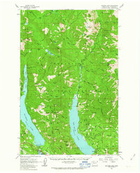
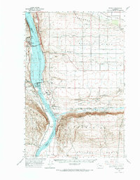
 1961 Yakima1961 Print · USGSCentral Washington thrived in the mid-century as an agricultural powerhouse defined by the Yakima River. Trace local roots through Medicine Valley School, Fort Simcoe, and the rail lines of the Northern Pacific RR.
 - 1961 Map of Liberty, 1963 Print
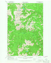
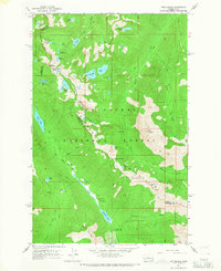
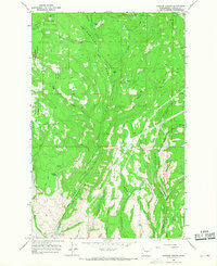
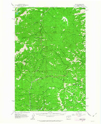 1961 Liberty1963 Print · USGSThe high Cascades of Chelan and Kittitas counties are captured here in the early sixties, showing the transition from mining era to modern recreation. Trace the former Blewett townsite, the historic mining camp of Liberty, and the Mineral Springs Resort.2 unique versions available
 - 1961 Map of Mount Stuart, 1963 Print
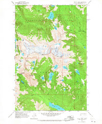
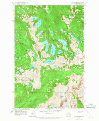
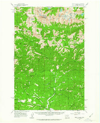 1961 Mount Stuart1963 Print · USGSThe high Cascades at the start of the sixties are detailed here, showing the intersection of alpine wilderness and mountain industry. Trace the locations of the Skookum Mine, lookouts like Stafford Lookout, and high-altitude water at the Lower Enchantment Lakes.3 unique versions available
 - 1961 Map of Snoqualmie Pass, 1963 Print
 1961 Snoqualmie Pass1963 Print · USGSSnoqualmie Pass and the surrounding Cascade peaks are shown in the early sixties as the region's rail and water infrastructure matured. Researchers can trace the transcontinental routes of the Northern Pacific RR and locate early mountain outposts like Hyak and Whittier.3 unique versions available
 - 1961 Map of Easton, 1963 Print
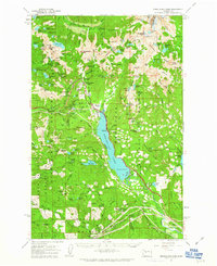
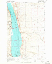
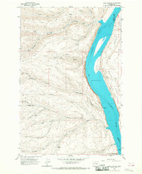
 1961 Easton1963 Print · USGSUpper Kittitas County is captured here in the early sixties, centered on the coal-mining and railroad corridor of the Yakima Valley. Local historians can trace the industrial footprint of Roslyn, Ronald, and the Roslyn-Cascade Mine 4 alongside the Lake Easton shoreline.2 unique versions available
 - 1961 Map of Kachess Lake, 1963 Print
 1961 Kachess Lake1963 Print · USGSThe Cascades wilderness of Kittitas County is seen here in the early sixties, centered on the major reservoirs and high forest ridges. Researchers can trace the early layout of Easton, locate the Salmon la Sac Guard Sta, and find legacy sites like the Elsnor Mine.3 unique versions available
 - 1962 Map of Lester, 1964 Print
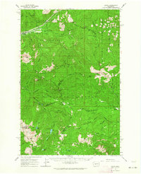 1962 Lester1964 Print · USGSThe Cascades at the start of the sixties come into focus here, showing the protected Green River Watershed and the remote Lester rail stop. Trace old mountain routes through Naches Pass or find historic camps at Government Meadow and Timothy Meadow.3 unique versions available
 - 1965 Map of Ritzville
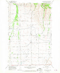
 1965 Ritzville1965 Print · USGSCentral Washington during the mid-sixties shows a landscape shaped by massive irrigation projects and the Cold War. Genealogists and historians can trace rail-town life and military presence through Ephrata Air Base, the Telford Station, and local schools.
 - 1965 Map of Vantage, 1966 Print
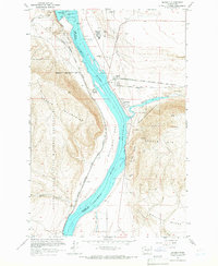
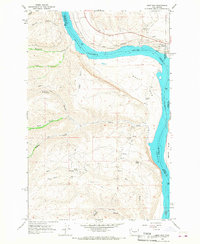
 1965 Vantage1966 Print · USGSThe Columbia River dominates this mid-1960s landscape as it passes between Kittitas and Grant counties during the era of hydroelectric expansion. Researchers can trace the massive Wanapum Dam works, find the desert settlement of Vantage, and explore the geological reaches of Sand Hollow.3 unique versions available
 - 1965 Map of Badger Pocket, 1966 Print
 1965 Badger Pocket1966 Print · USGSBenton County agriculture and rail infrastructure are on full display in the mid-sixties, from the Yakima River banks to the high Horse Heaven Hills. Researchers can trace old family holdings and rural landmarks like the Prior Ranch, the Horseheaven settlement, and the Cemetery on the plateau.
 - 1965 Map of Priest Rapids, 1966 Print
 1965 Priest Rapids1966 Print · USGSThe Columbia River bend underwent a profound transformation in the 1960s as hydroelectric power and federal projects reshaped the desert landscape. Genealogists and historians can trace family locations like Meeboor Ranch or the Black Rock Cem alongside the massive Priest Rapids Dam.
 - 1965 Map of Beverly, 1966 Print
 1965 Beverly1966 Print · USGSThe mid-Columbia River valley comes alive in this mid-sixties survey of the Sentinel Gap and Saddle Mountains. Researchers can trace the railroad operations at Beverly Junction and the infrastructure of the newly built Wanapum Dam.
 - 1965 Map of Beverly, 1966 Print
 1965 Beverly1966 Print · USGSCentral Washington during the mid-sixties reveals a river landscape transformed by hydroelectric power and irrigation. You can trace the rail corridor of the Chicago Milwaukee St Paul and Pacific and locate settlements like Wanapum Village and Vantage.
 - 1965 Map of Chiwaukum Mts, 1967 Print
 1965 Chiwaukum Mts1967 Print · USGSThe high Cascades at the boundary of Chelan and Kittitas counties come into focus in the mid-sixties, showing a landscape of alpine lakes and trails. Genealogists and historians can trace the Van Epps Mine or locate early recreation sites like French Creek Campground and the Guard Station.2 unique versions available
 - 1965 Map of Mount Daniel, 1967 Print
 1965 Mount Daniel1967 Print · USGSThe high Central Cascades at the boundary of King and Kittitas counties are captured here in the mid-1960s. You can trace the high-altitude Cascade Crest Trail or find remote landmarks like Cathedral Rock and Bears Breast Mtn.3 unique versions available
 - 1965 Map of Big Snow Mtn, 1967 Print
 1965 Big Snow Mtn1967 Print · USGSThe high Cascades at the King and Kittitas county line are captured here in the mid-1960s. Trace the remote ridges around Big Snow Mtn and find alpine water bodies like Angeline Lake and the string of gems in Necklace Valley.4 unique versions available
 - 1965 Map of The Cradle, 1967 Print
 1965 The Cradle1967 Print · USGSThe Wenatchee Mountains in the mid-1960s featured a complex network of alpine trails and high-country lake basins. Trace the historic route of the Cascade Crest Trail past The Cradle and through the Paddy-Go-Easy Pass.3 unique versions available
 - 1966 Map of Colockum Pass SW, 1967 Print
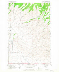
 1966 Colockum Pass SW1967 Print · USGSThe Kittitas Valley during the mid-1960s reveals a structured landscape of irrigation canals and family-named homestead roads. Researchers can trace the water-and-road network through the Pyle Canal and find local landmarks like Fairview Hall or the State Game Farm.2 unique versions available
 - 1966 Map of Colockum Pass SE, 1967 Print
 1966 Colockum Pass SE1967 Print · USGSThe eastern ridges of the Kittitas Valley are captured here in the mid-1960s, showing a network of rural roads and mountain drainages. Researchers can trace family-named routes like Lyons Road and Cristensen Road near the slopes of Whiskey Dick Mtn.
 - 1966 Map of Colockum Pass, 1968 Print
 1966 Colockum Pass1968 Print · USGSKittitas County high country is shown here in the 1960s, a period of forest management and early utility expansion. You can trace seasonal mountain camps and remote landmarks like Mountain Home, the Naneum Airstrip, and the crossing at Colockum Pass.3 unique versions available
 - 1966 Map of Cape Horn SE, 1968 Print
 1966 Cape Horn SE1968 Print · USGSKittitas County and the Columbia River are shown here in the mid-sixties, a period defined by rugged canyon access and early state park development. Local historians can trace old river access points like Scammon Landing or inland landmarks such as Kohler Spring and Box Canyon.3 unique versions available
 - 1966 Map of Mission Peak, 1968 Print
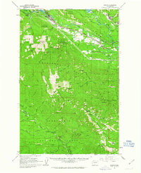
 1966 Mission Peak1968 Print · USGSThe high ridges of Chelan and Kittitas Counties are shown here during the mid-sixties, capturing the early development of the regional ski industry. Researchers can trace the Dutch Settlement, early fire lookouts at Beehive Mtn, and the Peavine Canyon Pack Trail.4 unique versions available
 - 1966 Map of West Bar, 1968 Print
 1966 West Bar1968 Print · USGSThe Columbia River gorge and the settlement of Trinidad are captured here in the mid-sixties, showing a landscape shaped by the Great Northern rail line. Researchers can trace the development of the Crescent Bar Recreation Area or locate remote landmarks like Sumac Spring and the Tekison Trail.2 unique versions available
 - 1966 Map of Stray Gulch, 1968 Print
 1966 Stray Gulch1968 Print · USGSKittitas County’s rugged canyon country is captured in the 1960s, showing a landscape shaped by drainage systems and early resource access. You can trace early routes like Brewton Road and Caribou Perkins Road past Stray Gulch and Sheridan Spring.2 unique versions available
 - 1966 Map of Naneum Canyon, 1968 Print
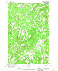
 1966 Naneum Canyon1968 Print · USGSKittitas County was a landscape of deep canyons and high mountain flats in the mid-sixties. Researchers can trace early water management and high-country routes through Naneum Canyon, the Gaging Station Filtration Plant, and Leonard Spring.4 unique versions available
Showing maps 1-25 of 30
Top cities of Kittitas County
- Kittitas historical maps
- Ellensburg historical maps
- Cle Elum historical maps
- Roslyn historical maps
- South Cle Elum historical maps
- Easton historical maps
See more
Frequently asked questions
- What are the different types of historical maps available for Kittitas County?
- What is the oldest map of Kittitas County?
- Where can I purchase historical maps of Kittitas County for my home or office?
- Where can I download high-res historical maps of Kittitas County?
- Are there historical topographic maps available for Kittitas County?
- Is there historical aerial imagery available for Kittitas County?
- Where are historical maps of Kittitas County sourced from?