1980s Maps of Kittitas County, Washington
Explore 33 historic maps of Kittitas County from the 1980s. These maps offer a rare glimpse into what life looked like during the 1980s — showing old roads, neighborhoods, homes, and landmarks that have changed or disappeared over time.
Whether you're researching your family's past, planning a metal detecting trip, or studying how Kittitas County's landscape evolved across the 1980s, these high-resolution maps are a powerful tool for exploring the history of this region.
- Focus on a specific era: All maps on this page are from the 1980s, giving you a focused view of this time period.
- See what’s changed: Compare century-old streets, trails, and buildings to today's modern landscape using overlays and satellite layers.
- Research with precision: Use these maps for genealogy, historical research, land use analysis, or educational projects.
- View, download, or print: Maps are fully viewable online in high resolution, and can be downloaded or printed for your own records.
Start exploring Kittitas County's history through authentic maps from the 1980s. This is your window into the past.
Kittitas County, WA maps
(33)- 1982 Map of Moses Lake, 1983 Print
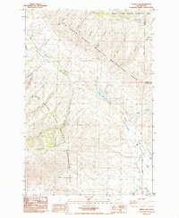
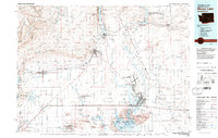 1982 Moses Lake1983 Print · USGSThe Columbia Basin during the early eighties shows a landscape transformed by large-scale irrigation and military aviation. Researchers can trace the development of Larson Air Force Base or locate vanished rail stops along the Burlington Northern near Ephrata and Quincy.2 unique versions available
 - 1984 Map of Manastash Creek
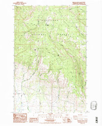
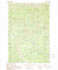
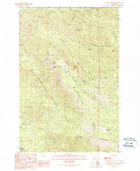
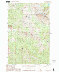
 1984 Manastash Creek1984 Print · USGSKittitas County at the mid-eighties shows a rugged landscape of high ridges and managed wildlife areas. Trace high-altitude landmarks like the University of Washington Observatory or follow old routes through Ellensburg Pass and High Valley Ranch.2 unique versions available
 - 1984 Map of The Cottonwoods, 1985 Print
 1984 The Cottonwoods1985 Print · USGSThe high desert of Yakima and Kittitas counties is captured here in the mid-1980s as a preserve for wildlife and water. Researchers can locate Wenas Cemetery or trace the path of Old Durr Road past The Cottonwoods.
 - 1984 Map of Cle Elum, 1985 Print
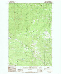
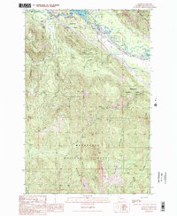
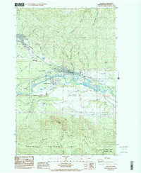 1984 Cle Elum1985 Print · USGSKittitas County coal and rail hubs come to life in the 1980s as the regional economy transitions. Genealogists and historians can trace the proximity of Roslyn to various workings like No 5 Mine and locate civic landmarks such as Cle Elum High Sch.2 unique versions available
 - 1985 Map of Swauk Prairie
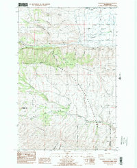
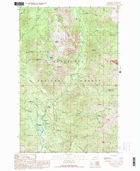
 1985 Swauk Prairie1985 Print · USGSKittitas County high country meets the valley floor in the mid-1980s, documenting a landscape of mountain ridges and small settlements. Trace family history at Swauk Prairie Cem or explore the terrain around Liberty and Lauderdale Junction.2 unique versions available
 - 1985 Map of Reecer Canyon
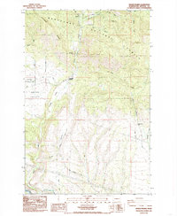
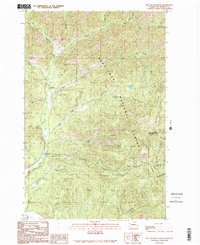
 1985 Reecer Canyon1985 Print · USGSUpper Kittitas County in the mid-eighties shows a high-country landscape of forest management and seasonal stock trails. Trace the historical routes through Wenatchee National Forest to find remote landmarks like Riders Cabin and Garrison Spring.2 unique versions available
 - 1985 Map of Taneum Canyon
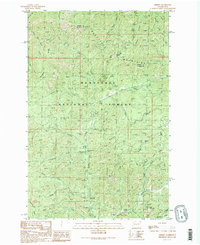
 1985 Taneum Canyon1985 Print · USGSThe Kittitas County back country comes into focus in the mid-1980s, showcasing the high ridges and deep canyons between the forest and the prairie. You can trace early forest access and water infrastructure at Taneum Campground, Whisky Flats, and the South Branch Canal.2 unique versions available
 - 1985 Map of Wenas Lake
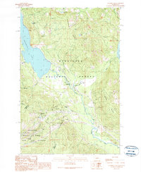
 1985 Wenas Lake1985 Print · USGSThe Yakima Valley appears here in the mid-1980s as a landscape of conservation lands and rural landmarks along Wenas Creek. Genealogists and local historians can locate the Wenas Cem, trace the route of Longmire Lane, and explore the canyon systems of Cleman Mountain.2 unique versions available
 - 1985 Map of Teanaway
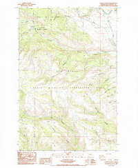
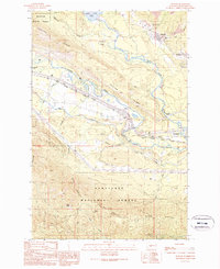
 1985 Teanaway1985 Print · USGSThe Yakima River valley was a bustling transport corridor in the mid-eighties, defined by rail lines and river junctions. You can trace the path of the Burlington Northern through settlements like Bristol and explore landmarks like Indian John Hill and Swauk Prairie.2 unique versions available
 - 1985 Map of Frost Mtn
 1985 Frost Mtn1985 Print · USGSHigh mountain ridges and seasonal grazing camps defined the central Cascades in the mid-eighties. Researchers can trace forest management history and old mountain routes via Cow Camp, Frost Mtn, and the remote Manastash Lake.2 unique versions available
 - 1989 Map of Swauk Pass
 1989 Swauk Pass1989 Print · USGSThe high ridges of the Wenatchee Mountains appear here in the late eighties as a landscape of forest management and alpine recreation. Trace historical mining interests at the Swauk Prospects or locate backcountry sites like Tronsen Campground and Haney Meadow.2 unique versions available
 - 1989 Map of Easton
 1989 Easton1989 Print · USGSUpper Kittitas County in the late eighties remains a vital corridor of timber and mountain transit. Researchers can trace the town of Easton and the Old Railroad Grade alongside modern recreational sites like Lake Easton State Park.2 unique versions available
 - 1989 Map of Raven Roost
 1989 Raven Roost1989 Print · USGSThe high ridges of the Cascades meet the Yakima valley headwaters in the late 1980s. Hikers and historians can trace the Pacific Crest Nat Scenic Trail past Raven Roost Radio Facility and the Huckleberry Forest Camp.
 - 1989 Map of Ronald
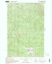
 1989 Ronald1989 Print · USGSThe mining corridor between Ronald and Roslyn is captured here during the late eighties, showing the region's transition from an industrial hub to a recreational gateway. Genealogists and historians can locate the Roslyn Cascade Mine No 4, the local Cem, and the route of the John Wayne Pioneer State Park Trail (Pack).2 unique versions available
 - 1989 Map of Stampede Pass
 1989 Stampede Pass1989 Print · USGSThe Cascades crossing at Stampede Pass comes into focus in the late eighties, showing a landscape defined by critical rail and water infrastructure. Researchers can locate the Whittier (Site), the deep Stampede Tunnel, and the high-elevation Keechelus Lake.2 unique versions available
 - 1989 Map of Lester
 1989 Lester1989 Print · USGSThe mountain landscape of eastern King County is shown here in the late 1980s, centered on the Green River corridor. Researchers can trace the layout of Lester, follow the Landing Strip, and locate high-altitude landmarks like Colquhoun Peak and Kelly Butte.
 - 1989 Map of Quartz Mountain
 1989 Quartz Mountain1989 Print · USGSThe high ridges of the Cascades near the Kittitas and Yakima county line are captured here in the late eighties. Researchers can trace forest access via numerous 4WD routes and Pack Trails to landmarks like the Quartz Radio Facility and Fishhook Flats.
 - 1989 Map of Jack Ridge
 1989 Jack Ridge1989 Print · USGSThe high Wenatchee Mountains are captured in the late eighties as a preserved wilderness under forest management. Trace high-country routes to Bootjack Mountain, Trout Lake, and the Prospects located near the Kittitas County line.
 - 1989 Map of Davis Peak
 1989 Davis Peak1989 Print · USGSThe northern Cascades near the Cle Elum River were a hub for forest management and alpine recreation in the late eighties. Researchers can locate remote high-altitude Adits, the historic Salmon la Sac F S Station, and backcountry retreats like Lake Michael.
 - 1989 Map of Noble Knob
 1989 Noble Knob1989 Print · USGSThe high Cascades of Washington's Pierce County are documented here in the late eighties, showing the path of the Pacific Crest National Scenic Trail through the timber. Trace the locations of Camp Urich, the high-altitude Corral Pass Campground, and remote landmarks like Noble Knob.2 unique versions available
 - 1989 Map of Chikamin Peak
 1989 Chikamin Peak1989 Print · USGSThe high Cascades of Kittitas County come into focus during the late eighties, documenting the intersection of two National Forests. You can trace the Pacific Crest National Scenic Trail past high-altitude landmarks like Chikamin Peak and Spectacle Lake.2 unique versions available
 - 1989 Map of Blowout Mountain
 1989 Blowout Mountain1989 Print · USGSHigh in the Cascades during the late 1980s, the county line between King and Kittitas counties divides a landscape of protected watersheds and forests. Hikers and historians can trace the Pacific Crest National Scenic Trail across Tacoma Pass to the slopes of Blowout Mountain.
 - 1989 Map of Mount Stuart
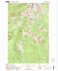
 1989 Mount Stuart1989 Print · USGSThe high Cascades of Kittitas and Chelan Counties are shown here during the late eighties, dominated by the peaks of the Stuart Range. Outdoor historians can trace the trails and glacial basins surrounding Mount Stuart, Ingalls Lake, and Lake Camp Fire Girls.2 unique versions available
 - 1989 Map of Red Top Mountain
 1989 Red Top Mountain1989 Print · USGSKittitas County high country is shown in the late 1980s as a managed wilderness within the Wenatchee National Forest. Trace backcountry routes to Red Top Mountain, the FS Station, and campsites at 29 Pines Campground.
 - 1989 Map of Liberty
 1989 Liberty1989 Print · USGSThe high country of Kittitas County is seen here in the late eighties, just as recreational and mining interests converged in the Wenatchee Mountains. Researchers can locate specific prospect sites and strip mines near the settlement of Liberty or trace routes through Blewett Pass.2 unique versions available
Showing maps 1-25 of 33
Top cities of Kittitas County
- Kittitas historical maps
- Ellensburg historical maps
- Cle Elum historical maps
- Roslyn historical maps
- South Cle Elum historical maps
- Easton historical maps
See more
Frequently asked questions
- What are the different types of historical maps available for Kittitas County?
- What is the oldest map of Kittitas County?
- Where can I purchase historical maps of Kittitas County for my home or office?
- Where can I download high-res historical maps of Kittitas County?
- Are there historical topographic maps available for Kittitas County?
- Is there historical aerial imagery available for Kittitas County?
- Where are historical maps of Kittitas County sourced from?