1950s Maps of Kittitas County, Washington
Explore 34 historic maps of Kittitas County from the 1950s. These maps offer a rare glimpse into what life looked like during the 1950s — showing old roads, neighborhoods, homes, and landmarks that have changed or disappeared over time.
Whether you're researching your family's past, planning a metal detecting trip, or studying how Kittitas County's landscape evolved across the 1950s, these high-resolution maps are a powerful tool for exploring the history of this region.
- Focus on a specific era: All maps on this page are from the 1950s, giving you a focused view of this time period.
- See what’s changed: Compare century-old streets, trails, and buildings to today's modern landscape using overlays and satellite layers.
- Research with precision: Use these maps for genealogy, historical research, land use analysis, or educational projects.
- View, download, or print: Maps are fully viewable online in high resolution, and can be downloaded or printed for your own records.
Start exploring Kittitas County's history through authentic maps from the 1950s. This is your window into the past.
Kittitas County, WA maps
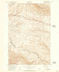
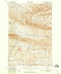
(34)- 1950 Map of Yakima, 1951 Print
 1950 Yakima1951 Print · USGSThe Yakima Valley and the towering Cascades meet in this mid-century survey of South Central Washington. Genealogists and local historians can trace the irrigation-era growth of Yakima, the historic Fort Simcoe outpost, and the White Swan Mission on the Yakima Indian Reservation.
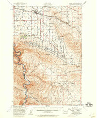
 - 1951 Map of Priest Rapids
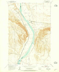
 1951 Priest Rapids1951 Print · USGSThe Columbia River and its powerful rapids dominate this landscape during the early fifties, before modern development transformed the river valley. Genealogists and researchers can trace ranching heritage at the Taylor Ranch or locate the Black Rock Cem.
 - 1953 Map of McDonald Spring, 1957 Print
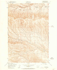
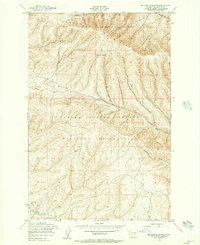 1953 McDonald Spring1957 Print · USGSThe Saddle Mountains and the Yakima Firing Center defined this Kittitas County landscape in the early fifties. Researchers can locate the Silica Mines near Squaw Creek or trace water sources like McDonald Spring and Hanson Creek across the military reservation.2 unique versions available
 - 1953 Map of Ginkgo, 1957 Print
 1953 Ginkgo1957 Print · USGSThe high desert of Kittitas County is mapped here in the early 1950s, showing the dramatic basalt plateaus before the arrival of the modern interstate. Local historians and geologists can trace water sources like Lone Star Spring and the steep terrain of Schnebly Coulee.3 unique versions available
 - 1953 Map of Black Rock Spring NW, 1957 Print
 1953 Black Rock Spring NW1957 Print · USGSThe Yakima Valley high desert in the early fifties shows a landscape transitioning between private ranching and military expansion. You can trace early agricultural infrastructure like the Selah Ditch and Abandoned Dam or locate family landmarks such as Holmes Ranch.2 unique versions available
 - 1953 Map of Pomona, 1957 Print
 1953 Pomona1957 Print · USGSThe Yakima Valley's mid-century transition is documented here as irrigation projects and military expansion reshaped the land. Researchers can trace the Northern Pacific tracks through Pomona or locate military infrastructure like the Post Headquarters and Target Range.4 unique versions available
 - 1953 Map of Doris, 1957 Print
 1953 Doris1957 Print · USGSKittitas County's high desert terrain is captured here in the early fifties, showing the vital rail corridor through the Saddle Mountains. Researchers can trace the Chicago Milwaukee St Paul and Pacific line through small outposts like Doris and Rye.2 unique versions available
 - 1953 Map of Badger Gap, 1957 Print
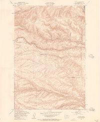
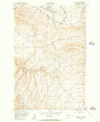 1953 Badger Gap1957 Print · USGSThe mid-century Kittitas high country is captured here as a landscape of military maneuvers and mineral discovery. Genealogists and industrial historians can trace the numerous Silica Mines and the winding course of Squaw Creek through the Yakima Firing Center Military Reservation.
 - 1953 Map of East Kittitas, 1957 Print
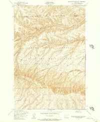
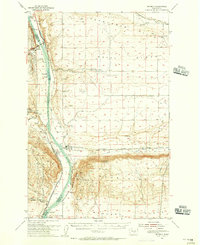
 1953 East Kittitas1957 Print · USGSThe Kittitas Valley agricultural landscape is captured here in the early fifties, defined by a massive irrigation network and the Milwaukee Road. Trace the historic path of the Highline Canal and the vanished rail stop at Renslow.2 unique versions available
 - 1953 Map of Kittitas, 1957 Print
 1953 Kittitas1957 Print · USGSThe Kittitas Valley at mid-century is captured here as a productive landscape defined by its irrigation canals and transcontinental rail lines. Researchers can trace the routes of the Chicago Milwaukee St Paul and Pacific through Regal or locate rural landmarks like Denmark Hall and Edgemont.4 unique versions available
 - 1953 Map of Boylston, 1957 Print
 1953 Boylston1957 Print · USGSHigh desert railroading and rugged coulees define this portion of Kittitas County in the early fifties. Genealogists and rail historians can trace the Milwaukee Road through the Boylston Mountains and locate the stations at Boylston and Chevlot.3 unique versions available
 - 1953 Map of Wymer, 1957 Print
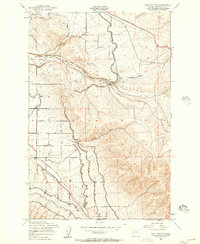
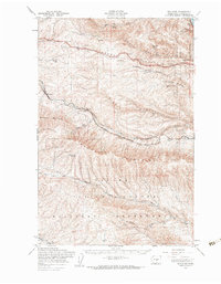
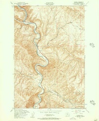 1953 Wymer1957 Print · USGSKittitas County’s canyon country is shown in detail during the early 1950s, where the river and rail were the lifelines of the region. Local researchers can trace the old Northern Pacific line through stops at Umtanum, Wymer, and Roza, or locate the Abandoned Mine tucked into the slopes of Umtanum Ridge.2 unique versions available
 - 1953 Map of Black Rock Spring NE, 1957 Print
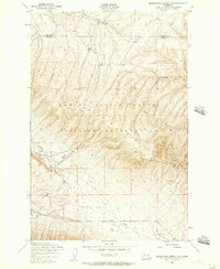
 1953 Black Rock Spring NE1957 Print · USGSThe high rangeland of Central Washington was transitioning to specialized military use in the early fifties. Local historians can trace the remote Stewart Ranch and the natural barriers of Umtanum Ridge and Alkali Canyon.2 unique versions available
 - 1953 Map of Selah Springs, 1957 Print
 1953 Selah Springs1957 Print · USGSThe high ridges of central Washington are captured here in the early 1950s as they were repurposed for Cold War military operations. Researchers can trace specialized defense infrastructure including the Drone Landing Strip, Selah Springs, and an Abandoned Dam.3 unique versions available
 - 1953 Map of Black Rock Spring, 1958 Print
 1953 Black Rock Spring1958 Print · USGSThe Yakima County highlands are captured here in the early 1950s as military and ranching interests converged. Genealogists and local historians can trace family landholdings like the Bernhardi Ranch and Coffin Ranch near Nelson Springs.2 unique versions available
 - 1953 Map of Badger Pocket, 1958 Print
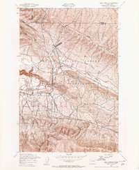
 1953 Badger Pocket1958 Print · USGSThe Kittitas Valley at the dawn of the fifties was a landscape of intensive irrigation and dual rail lines. Researchers can trace the agricultural footprint of Kittitas and East Kittitas alongside the industrial activity of the Silica Mines and Cameron Airfield.2 unique versions available
 - 1953 Map of Yakima East, 1958 Print
 1953 Yakima East1958 Print · USGSThe Yakima Valley in the early fifties shows a landscape of military reservations and expanding irrigation. Trace the growth of Moxee City and Union Gap or locate family roots at Holland Cem and Central School.3 unique versions available
 - 1953 Map of Boylston, 1960 Print
 1953 Boylston1960 Print · USGSIn the early 1950s, the high desert of central Washington was a critical corridor for the Chicago Milwaukee St Paul and Pacific railroad. You can trace the remote sidings at Boylston and Doris or locate landmarks like the Kittitas Micro-Wave Tower and the sprawling Yakima Firing Center.
 - 1953 Map of Walla Walla, 1964 Print
 1953 Walla Walla1964 Print · USGSSoutheast Washington enters the atomic and hydroelectric age in the mid-twentieth century as new dams reshape the desert landscape. You can trace the development of the Hanford Works, identify remote rail stops like Novara Siding, and locate the historic Dry Creek Cem.3 unique versions available
 - 1953 Map of Ritzville, 1966 Print
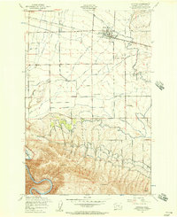
 1953 Ritzville1966 Print · USGSEastern Washington was undergoing a massive agricultural and industrial transformation in the mid-fifties as irrigation from the Grand Coulee Dam reached the plateau. Researchers can trace the mid-century rail network of the Great Northern and locate vital local sites like Larson Air Force Base and Odessa.3 unique versions available
 - 1954 Map of Beverly, 1955 Print
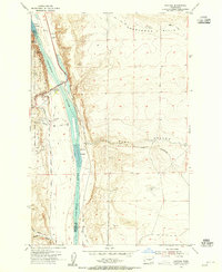
 1954 Beverly1955 Print · USGSCentral Washington in the mid-1950s was a landscape of rail-and-river logistics dominated by the Columbia River and the Saddle Mountains. Researchers can trace the path of the Milwaukee Road through Beverly and identify landmarks like Sentinel Bluffs and Priest Rapids.
 - 1954 Map of Vantage, 1955 Print
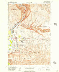
 1954 Vantage1955 Print · USGSMid-century Kittitas and Grant counties meet at this strategic Columbia River crossing just as the regional road network was expanding. Researchers can locate the original sites of Vantage and Cohassett, plus ancient Indians Petroglyphs and the Vantage Bridge.
 - 1954 Map of Beverly, 1956 Print
 1954 Beverly1956 Print · USGSCentral Washington's Columbia River corridor is captured here in the mid-fifties, just as the region's agricultural and military footprint was expanding. Researchers can trace the Milwaukee Road rail line through Beverly and Jericho, or find cultural landmarks like the Indian Petroglyphs near Vantage.
 - 1957 Map of Wenatchee, 1973 Print
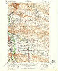
 1957 Wenatchee1973 Print · USGSThe northern Cascades and Columbia River valley appear here in the mid-fifties, showing the region's critical rail and transit corridors. Researchers can trace the routes of the Great Northern RR and Milwaukee Road through settlements like Skykomish, Baring, and Dryden.2 unique versions available
 - 1958 Map of Walla Walla
 1958 Walla Walla1958 Print · USGSThe Tri-Cities and Walla Walla region are captured here during the mid-century expansion of atomic energy and river infrastructure. Genealogists and historians can trace the early layout of Richland (AEC), the rural Hatton and Washtucna settlements, and landmarks like Palouse Falls State Park.
Showing maps 1-25 of 34
Top cities of Kittitas County
- Kittitas historical maps
- Ellensburg historical maps
- Cle Elum historical maps
- Roslyn historical maps
- South Cle Elum historical maps
- Easton historical maps
See more
Frequently asked questions
- What are the different types of historical maps available for Kittitas County?
- What is the oldest map of Kittitas County?
- Where can I purchase historical maps of Kittitas County for my home or office?
- Where can I download high-res historical maps of Kittitas County?
- Are there historical topographic maps available for Kittitas County?
- Is there historical aerial imagery available for Kittitas County?
- Where are historical maps of Kittitas County sourced from?