1950s Maps of Lewis County, Washington
Explore 29 historic maps of Lewis County from the 1950s. These maps offer a rare glimpse into what life looked like during the 1950s — showing old roads, neighborhoods, homes, and landmarks that have changed or disappeared over time.
Whether you're researching your family's past, planning a metal detecting trip, or studying how Lewis County's landscape evolved across the 1950s, these high-resolution maps are a powerful tool for exploring the history of this region.
- Focus on a specific era: All maps on this page are from the 1950s, giving you a focused view of this time period.
- See what’s changed: Compare century-old streets, trails, and buildings to today's modern landscape using overlays and satellite layers.
- Research with precision: Use these maps for genealogy, historical research, land use analysis, or educational projects.
- View, download, or print: Maps are fully viewable online in high resolution, and can be downloaded or printed for your own records.
Start exploring Lewis County's history through authentic maps from the 1950s. This is your window into the past.
Lewis County, WA maps
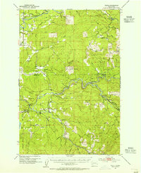
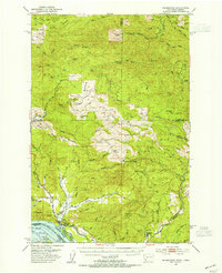
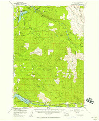
(29)- 1950 Map of Yakima, 1951 Print
 1950 Yakima1951 Print · USGSThe Yakima Valley and the towering Cascades meet in this mid-century survey of South Central Washington. Genealogists and local historians can trace the irrigation-era growth of Yakima, the historic Fort Simcoe outpost, and the White Swan Mission on the Yakima Indian Reservation.
 - 1953 Map of Hoquiam
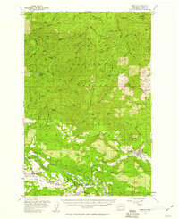
 1953 Hoquiam1953 Print · USGSSouthwest Washington in the early fifties shows a landscape shaped by timber, rail, and river commerce from the coast to the Cascades. Genealogists and historians can trace the development of timber towns like Ryderwood and the industrial hubs of Hoquiam and Kelso.2 unique versions available
 - 1953 Map of Toutle, 1955 Print
 1953 Toutle1955 Print · USGSCowlitz County’s timber-driven landscape comes into focus during the early fifties as logging operations expanded through the river valleys. Researchers can trace the Weyerhaeuser Timber Co Railroad, locate the Toutle Lake School, and find old sites like Eden Valley or the Windom Mine.3 unique versions available
 - 1953 Map of Castle Rock, 1955 Print
 1953 Castle Rock1955 Print · USGSThe Cowlitz River valley in the early fifties shows a busy corridor of rail lines and river settlements. Genealogists can locate several family cemeteries and former rural school sites like the Wayside Sch and Lone Hill Cemetery near Toledo.2 unique versions available
 - 1953 Map of Ryderwood, 1955 Print
 1953 Ryderwood1955 Print · USGSThe logging country of Lewis and Cowlitz counties is documented here in the early fifties as industrial rail gave way to trucking. Trace the transition of the company town Ryderwood, find the Snow Cem burial site, or locate the Dismantled Railroad corridors.3 unique versions available
 - 1953 Map of Rochester, 1955 Print
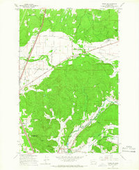
 1953 Rochester1955 Print · USGSThurston and Lewis counties in the early fifties reveal a dense network of timberlands and river-bottom farms. Genealogists can locate the Finnish Cem and Grand Mound Cem, or trace the Fort Henness Site and the vanished logging community of Bordeaux.3 unique versions available
 - 1953 Map of Skamokawa, 1955 Print
 1953 Skamokawa1955 Print · USGSThe riverfront culture of Wahkiakum County is on full display here in the early 1950s, showing the intersection of the Columbia River and the logging woods. Researchers can locate the Fern Hill Cem, the Blaney Lookout, and vanished infrastructure like the Dismantled RR.3 unique versions available
 - 1953 Map of Pe Ell, 1955 Print
 1953 Pe Ell1955 Print · USGSThe timber country of Lewis and Pacific Counties comes to life here during the mid-twentieth century. Genealogists and rail historians can trace the paths of the Northern Pacific through Pe Ell or locate the Sylvan Cem near Dryad.3 unique versions available
 - 1953 Map of Malone, 1955 Print
 1953 Malone1955 Print · USGSThe Chehalis River valley was a bustling rail corridor in the mid-1950s, supporting timber towns and riverside communities. Genealogists and historians can trace rail stops at Malone and Porter, find the Sharon Cem, or locate the North River Consolidated Sch.3 unique versions available
 - 1953 Map of Adna, 1955 Print
 1953 Adna1955 Print · USGSWestern Lewis County's river-and-rail landscape is captured here in the early fifties, showing the communities along the Chehalis River. Researchers can locate family landmarks like Boistfort Sch, Claquato Cemetery, and the Crego Grange.3 unique versions available
 - 1953 Map of Elk Rock, 1958 Print
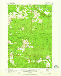 1953 Elk Rock1958 Print · USGSCowlitz County’s timber-driven landscape comes into focus in the early fifties, showing the extensive logging camps and rail networks of the day. Researchers can locate remote sites like Camp Baker, trace the Spirit Lake Highway, or find early landmarks like the Shingle Mill and Elk Rock Lookout.3 unique versions available
 - 1954 Map of Onalaska, 1956 Print
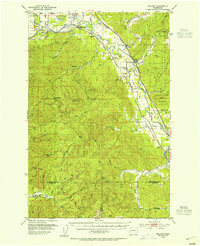
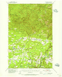 1954 Onalaska1956 Print · USGSLewis County in the mid-fifties is seen here as a network of river-valley settlements and timber-hauling rail lines. Researchers can trace the Cowlitz and Chehalis Railway through Onalaska or locate family sites like Alpha Cem and Cowlitz Prairie.3 unique versions available
 - 1954 Map of Centralia, 1956 Print
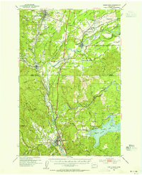
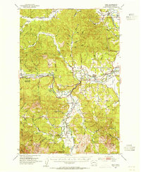
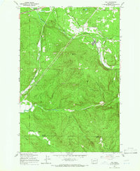
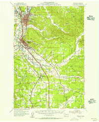 1954 Centralia1956 Print · USGSCentralia and Chehalis thrive at the intersection of major rail lines and rivers during the mid-fifties. Researchers can trace the layout of old settlements and sites like Berwick, Evaline, and Mendota, or locate the historic Jackson Prairie Courthouse.2 unique versions available
 - 1956 Map of Mineral, 1957 Print
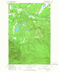
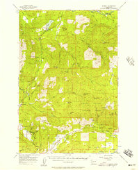 1956 Mineral1957 Print · USGSThe timber and rail corridors of eastern Lewis County come alive in this mid-fifties survey of the forest lands between the Nisqually and Cowlitz rivers. Researchers can locate vanished rail stops and fire watch stations like Kosmos Lookout, the settlement of Carlson, and the old Cem near Mineral Lake.3 unique versions available
 - 1956 Map of Kapowsin, 1958 Print
 1956 Kapowsin1958 Print · USGSPierce County’s timber and hydroelectric corridors are in clear view during the mid-fifties, from the rail lines at Kapowsin to the heights of The Divide. Researchers can trace the path of the Electron Flume Road or locate family sites at Neff Ranch and Voss Resort.3 unique versions available
 - 1957 Map of Hoquiam
 1957 Hoquiam1957 Print · USGSCoastal timber ports and inland rail hubs define Southwest Washington during the late fifties. Genealogists can trace early twentieth-century settlements like Bordeaux, Tono, and Cosmopolis alongside the expanding tracks of the Northern Pacific.
 - 1957 Map of Morton, 1959 Print
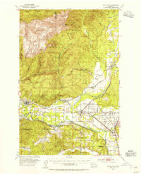
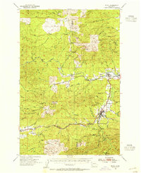
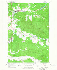
 1957 Morton1959 Print · USGSLewis County timber and river life are captured here in the late fifties, from the valley floor to the high peaks. Genealogists and researchers can trace the original locations of Riffe and Swofford or locate the Logging RR serving Morton.3 unique versions available
 - 1957 Map of Spirit Lake, 1959 Print
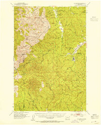
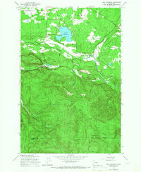
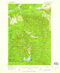 1957 Spirit Lake1959 Print · USGSThe Gifford Pinchot National Forest in the late fifties is captured here as a thriving hub of recreation and mining before the 1980 eruption altered the landscape. Researchers can trace historic lakeside developments like Harmony Falls Lodge or locate early industrial sites such as the Polar Star Mine and the Cowlitz Chehalis & Cascade Railroad.3 unique versions available
 - 1958 Map of Yakima, 1964 Print
 1958 Yakima1964 Print · USGSThe Yakima Valley in the late fifties shows a landscape of mountain peaks and irrigated plains at the height of its rail-era development. Researchers can trace the lineage of early settlements through sites like Fort Simcoe, the Wenas Cemetery, and the Yakima Indian Agency School.3 unique versions available
 - 1958 Map of Hoquiam, 1969 Print
 1958 Hoquiam1969 Print · USGSSouthwest Washington and the Columbia River estuary appear here in the mid-century, before major landscape shifts. Researchers can trace the rail lines of the Northern Pacific, locate the Fort Henness Site, or explore the Naselle Air Force Station.2 unique versions available
 - 1959 Map of Vail, 1966 Print
 1959 Vail1966 Print · USGSThurston and Lewis counties come into focus in the late fifties as logging operations shape the terrain. You can trace the complex Logging Railroad and Mulqueen Railroad lines that connect Vail to timber stands at Baumgard Hill.2 unique versions available
 - 1959 Map of Lake Lawrence, 1966 Print
 1959 Lake Lawrence1966 Print · USGSThurston County’s timber and farming lands are captured here in the late fifties, showing the area as the logging economy shaped the landscape. Genealogists and researchers can locate family sites like Reichel Ranch and the Roundtree Cabin or trace the path of the Logging Railroad.2 unique versions available
 - 1959 Map of Tenino SW, 1966 Print
 1959 Tenino SW1966 Print · USGSThe prairies of southern Thurston County meet the coal-rich hills of the Lewis County line during the mid-century. Genealogists and industrial historians can trace the paths of the Northern Pacific Railroad and locate family-named sites like the Monarch Mine, Stoker Mine, or Bucoda.2 unique versions available
 - 1959 Map of Bald Hill, 1966 Print
 1959 Bald Hill1966 Print · USGSIn the late fifties, the timberlands of Thurston County were defined by the winding Nisqually and Deschutes rivers. Genealogists and historians can trace the rural infrastructure of the era, from the Lackamas Sch to Deschutes Falls and Fossil Rock.2 unique versions available
 - 1959 Map of Bucoda, 1966 Print
 1959 Bucoda1966 Print · USGSThurston and Lewis Counties are captured here in the late fifties as a hub of rail activity and river valley industry. Researchers can trace the path of the Great Northern railroad, locate the Black Prince Mine, or find the Oregon Trail Monument.3 unique versions available
Showing maps 1-25 of 29
Top cities of Lewis County
- Centralia historical maps
- Chehalis historical maps
- Napavine historical maps
- Winlock historical maps
- Packwood historical maps
- Morton historical maps
See more
Frequently asked questions
- What are the different types of historical maps available for Lewis County?
- What is the oldest map of Lewis County?
- Where can I purchase historical maps of Lewis County for my home or office?
- Where can I download high-res historical maps of Lewis County?
- Are there historical topographic maps available for Lewis County?
- Is there historical aerial imagery available for Lewis County?
- Where are historical maps of Lewis County sourced from?