1980s Maps of Lewis County, Washington
Explore 52 historic maps of Lewis County from the 1980s. These maps offer a rare glimpse into what life looked like during the 1980s — showing old roads, neighborhoods, homes, and landmarks that have changed or disappeared over time.
Whether you're researching your family's past, planning a metal detecting trip, or studying how Lewis County's landscape evolved across the 1980s, these high-resolution maps are a powerful tool for exploring the history of this region.
- Focus on a specific era: All maps on this page are from the 1980s, giving you a focused view of this time period.
- See what’s changed: Compare century-old streets, trails, and buildings to today's modern landscape using overlays and satellite layers.
- Research with precision: Use these maps for genealogy, historical research, land use analysis, or educational projects.
- View, download, or print: Maps are fully viewable online in high resolution, and can be downloaded or printed for your own records.
Start exploring Lewis County's history through authentic maps from the 1980s. This is your window into the past.
Lewis County, WA maps
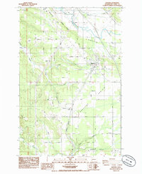
(52)- 1980 Map of Centralia
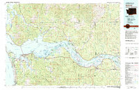
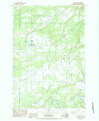
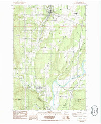
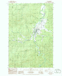
 1980 Centralia1980 Print · USGSThe rail and river corridors of southwestern Washington are captured here in the late twentieth century, showing the region's transition from resource extraction to managed forest land. Researchers can trace the industrial footprint of the Stoker Mine, the rails of the Union Pacific, and the early development of Centralia and Chehalis.
 - 1981 Map of Astoria, 1982 Print
 1981 Astoria1982 Print · USGSThe Oregon and Washington borderlands meet at the Columbia River estuary in the early eighties, a time of active timber transport and maritime trade. Researchers can trace the river's many islands, the grounds of Fort Stevens, and riverside towns like Cathlamet and Westport.3 unique versions available
 - 1983 Map of Winters Mtn
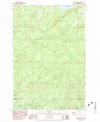
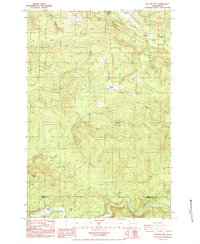
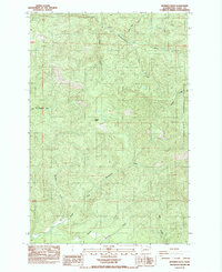
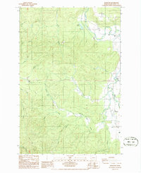
 1983 Winters Mtn1983 Print · USGSThe northern reaches of the Cowlitz River valley are captured here in the early eighties, showing Riffe Lake and the shifting forest landscape. Researchers can trace the impact of volcanic activity through numerous blowdown zones and locate remote landmarks like Soda Spring and Alta Vista.
 - 1983 Map of Coyote Mtn
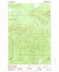
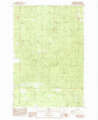
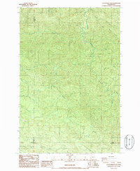
 1983 Coyote Mtn1983 Print · USGSIn the early 1980s, the timbered ridges along the Lewis and Cowlitz county line were still defined by logging camps and backcountry tracks. Genealogists and historians can trace the locations of Camp 9, Camp 10, and the inundation line of Riffe Lake.2 unique versions available
 - 1983 Map of Cowlitz Falls, 1984 Print
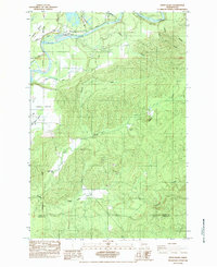
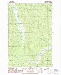
 1983 Cowlitz Falls1984 Print · USGSThe Gifford Pinchot National Forest meets the Mount St. Helens National Volcanic Monument in the early eighties. Researchers can trace remote mountain access via Pack Trail and 4WD routes to sites like Kelly Ranch, Deep Lake, and Cowlitz Falls.2 unique versions available
 - 1984 Map of Hatchet Mtn
 1984 Hatchet Mtn1984 Print · USGSThe Lewis and Cowlitz county line was a hub of timber activity in the mid-1980s, defined by the North Fork Toutle River valley. Trace the logging roads and camps of the era, from 19 Mile Camp to the ridges near Hatchet Mtn.2 unique versions available
 - 1984 Map of Vanson Peak
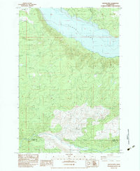
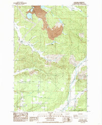
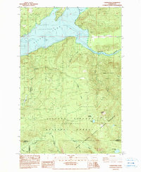 1984 Vanson Peak1984 Print · USGSThe high Cascades of Lewis and Skamania counties are captured here in the early 1980s, shortly after the Mount St. Helens eruption. Trace the rugged terrain from Vanson Peak down to the Cowlitz River and the inundated shores of Riffe Lake.
 - 1984 Map of Eden Valley
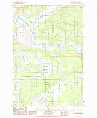
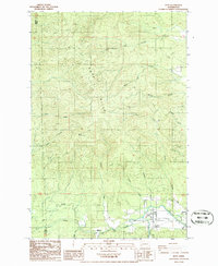
 1984 Eden Valley1984 Print · USGSThe Cowlitz River valley in the mid-1980s shows a landscape of fish hatcheries, prairie farms, and upland mines. Researchers can trace the settlement at Alexander and locate industrial sites like the Windom Mine or the Cowlitz Trout Hatchery.2 unique versions available
 - 1984 Map of Toledo
 1984 Toledo1984 Print · USGSToledo and the surrounding Cowlitz River valley are shown here in the mid-1980s as the area balanced its agricultural roots with modern development. Researchers can trace family sites near Lone Hill Cemetery, the historic St Francis Xavier Mission (Site), and the rural outpost at Knab.2 unique versions available
 - 1984 Map of Onalaska
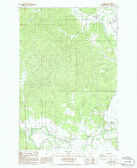
 1984 Onalaska1984 Print · USGSThe rural timber and farming landscape of Lewis County is captured in the mid-1980s, centered on the mill town of Onalaska. Local researchers can trace family lands along Beck Road, visit Alpha Cemetery, or follow the banks of the Cowlitz River.2 unique versions available
 - 1984 Map of Mayfield Lake
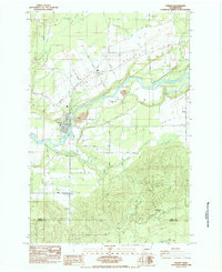
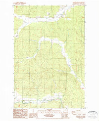
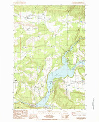 1984 Mayfield Lake1984 Print · USGSThe Cowlitz River valley is shown in the mid-eighties as a hub for both industry and outdoor recreation. Researchers can trace family roots at Shoestring Cem, locate the Mossyrock Trout Hatchery, and explore the rural layout of Salkum and Silver Creek.2 unique versions available
 - 1984 Map of Logan Hill, 1985 Print
 1984 Logan Hill1985 Print · USGSLewis County in the mid-1980s shows a landscape balancing large industrial footprints with deep-rooted rural communities. Researchers can trace historic locations like Mendota and Nulls Crossing or locate the Logan Hill Grange near the coal-rich Open Pit Mine.
 - 1985 Map of Jackson Prairie
 1985 Jackson Prairie1985 Print · USGSJackson Prairie in the mid-1980s is captured here at a time when family farms and historic landmarks shaped the Lewis County landscape. Researchers can trace the layout of early settlements like Forest and Marys Corner or locate the Jackson House and Matilda Jackson State Park.2 unique versions available
 - 1985 Map of Winlock
 1985 Winlock1985 Print · USGSIn the mid-eighties, the towns of Winlock and Vader remained vital hubs along the dual-rail corridor of Lewis County. Researchers can trace local genealogy and land use through landmarks like Little Falls Cemetery, Mt. St. Helens High Sch., and the forested slopes of Finn Hill.2 unique versions available
 - 1985 Map of Centralia
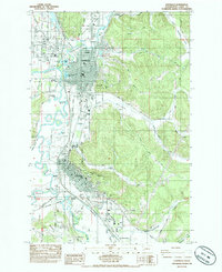 1985 Centralia1985 Print · USGSCentralia and Chehalis are shown in the mid-1980s as they expanded along the river valleys and major rail lines. Genealogists and historians can trace local landmarks like Greenwood Cem, Fern Hill Cem, and the old rail nexus at Chehalis Junction.2 unique versions available
 - 1985 Map of Bernier Creek
 1985 Bernier Creek1985 Print · USGSLewis County's timberlands and river headwaters are captured here during the mid-1980s, showing the intersection of forest management and natural hydrology. Researchers can trace the drainage of the Skookumchuck River and locate specific features like Windy Knob and the Snoqualmie National Forest boundary.2 unique versions available
 - 1985 Map of Onalaska NW
 1985 Onalaska NW1985 Print · USGSLewis County's timberlands and river valleys are captured here in the mid-1980s as rural industry and geography intersect. Researchers can trace the courses of the North Fork Newaukum River and Lucas Creek, or locate old resource sites like the Gravel Pit.2 unique versions available
 - 1985 Map of Napavine
 1985 Napavine1985 Print · USGSThe Napavine and Evaline area in the mid-eighties shows a landscape of open prairies and river bottoms shaped by the railroad. Genealogists can trace family footprints through the Napavine Cem, the Evaline School, and the settlement at St Urban.2 unique versions available
 - 1986 Map of Rainbow Falls
 1986 Rainbow Falls1986 Print · USGSWestern Lewis County is documented in the mid-1980s as the river-and-rail economy evolved alongside public recreation areas. Researchers can trace the path of the R. R. near Dryad, locate the Quarry at Meskill, and explore the grounds of Rainbow Falls State Park.2 unique versions available
 - 1986 Map of Doty
 1986 Doty1986 Print · USGSThe Chehalis River valley in the mid-1980s reveals a timber and rail landscape defined by the Doty Hills. Researchers can trace the heritage of small settlements like Doty and Dryad, locate the Sylvan Cem, or follow the Old R. R. Grade through the river bottomlands.2 unique versions available
 - 1986 Map of Adna
 1986 Adna1986 Print · USGSLewis County in the mid-1980s reveals a landscape shaped by the Chehalis River and the timbered heights of the Pacific Northwest. Genealogists and local historians can trace family-named sites and rural clusters including Adna, Claquato, and the Lincoln Creek Valley.2 unique versions available
 - 1986 Map of Pe Ell
 1986 Pe Ell1986 Print · USGSThe Lewis County timberlands and the Chehalis River valley are captured here in the mid-1980s. Local historians can trace the townsite of Pe Ell, the settlement at Walville, and named landmarks like Fisk Falls and Pe Ell Prairie.2 unique versions available
 - 1986 Map of Boistfort
 1986 Boistfort1986 Print · USGSLewis County in the mid-eighties shows a landscape defined by the winding Chehalis River and the productive Boistfort Prairie. Researchers can trace old timber operations and local landmarks like Camp McDonald (Site), Ceres, and the Lumber Sorting Yard.2 unique versions available
 - 1986 Map of Elochoman Pass
 1986 Elochoman Pass1986 Print · USGSThe high timberlands of the Washington interior are captured here in the mid-1980s at the meeting of three counties. Researchers can trace the headwaters of the Chehalis River and find localized landmarks like Elochoman Pass and the Borrow Pit.
 - 1986 Map of Wildwood
 1986 Wildwood1986 Print · USGSSouthwestern Washington in the mid-1980s reveals a landscape of timber-driven topography and rural infrastructure. Genealogists and historians can trace the paths of the South Fork Chehalis River and the Old Railroad Grade near Wildwood and Ryderwood.
Showing maps 1-25 of 52
Top cities of Lewis County
- Centralia historical maps
- Chehalis historical maps
- Napavine historical maps
- Winlock historical maps
- Packwood historical maps
- Morton historical maps
See more
Frequently asked questions
- What are the different types of historical maps available for Lewis County?
- What is the oldest map of Lewis County?
- Where can I purchase historical maps of Lewis County for my home or office?
- Where can I download high-res historical maps of Lewis County?
- Are there historical topographic maps available for Lewis County?
- Is there historical aerial imagery available for Lewis County?
- Where are historical maps of Lewis County sourced from?