1990s Maps of Lewis County, Washington
Explore 33 historic maps of Lewis County from the 1990s. These maps offer a rare glimpse into what life looked like during the 1990s — showing old roads, neighborhoods, homes, and landmarks that have changed or disappeared over time.
Whether you're researching your family's past, planning a metal detecting trip, or studying how Lewis County's landscape evolved across the 1990s, these high-resolution maps are a powerful tool for exploring the history of this region.
- Focus on a specific era: All maps on this page are from the 1990s, giving you a focused view of this time period.
- See what’s changed: Compare century-old streets, trails, and buildings to today's modern landscape using overlays and satellite layers.
- Research with precision: Use these maps for genealogy, historical research, land use analysis, or educational projects.
- View, download, or print: Maps are fully viewable online in high resolution, and can be downloaded or printed for your own records.
Start exploring Lewis County's history through authentic maps from the 1990s. This is your window into the past.
Lewis County, WA maps
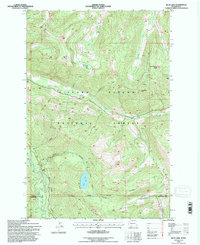
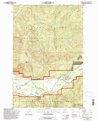
(33)- 1990 Map of Vail, 1995 Print
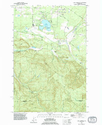
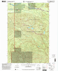
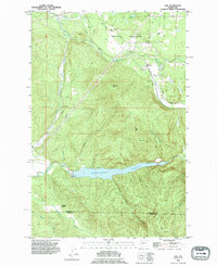 1990 Vail1995 Print · USGSThe timber and rail corridors of Thurston County come into focus in the 1990s as the Vail Railway winds through Ruth Prairie. Researchers can trace the industrial footprint of Vail through its logging roads and the massive Skookumchuck Reservoir.
 - 1990 Map of Bucoda, 1995 Print
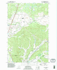
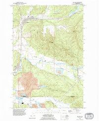 1990 Bucoda1995 Print · USGSThe Tenino and Bucoda area in the 1990s shows a landscape of timbered ridges and active valley mining. Researchers can trace the legacy of the Black Prince Mine, explore the Forest Cemetery, and follow the Old Railroad Grade through the Hanaford Valley.
 - 1990 Map of Bald Hill, 1995 Print
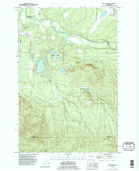 1990 Bald Hill1995 Print · USGSThurston County’s lake country and river valleys are documented here in the mid-1990s, where the Nisqually and Deschutes Rivers frame a landscape of water and timber. Local historians can trace the boundaries of Elbow Lake State Park or locate the cascades at Deschutes Falls and the landmark Fossil Rock.
 - 1990 Map of Eatonville, 1995 Print
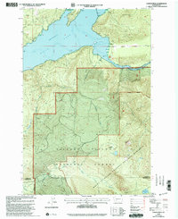
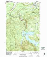 1990 Eatonville1995 Print · USGSEatonville and the Nisqually River valley appear here in the final decade of the millennium, defined by heavy timber research and massive hydro projects. Genealogists and local historians can trace the development of Alder, locate the Swanson Airport, and explore the bounds of the Charles Lathrop Pack Experimental Forest.
 - 1990 Map of Lake Lawrence, 1995 Print
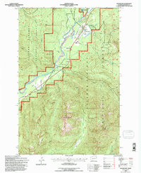
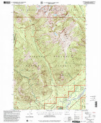
 1990 Lake Lawrence1995 Print · USGSThurston and Lewis counties come together in this 1990s record of a landscape shaped by logging and highland ranching. Genealogists and local historians can trace the Old Grade Railroad, locate the Roundtree Cabin, and identify family sites like Reichel Ranch.
 - 1990 Map of Violet Prairie, 1995 Print
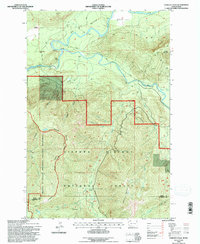
 1990 Violet Prairie1995 Print · USGSThurston and Lewis counties come together in this 1990s survey of the prairie landscapes south of the state capital. Genealogists can trace early mining operations at Monarch Mine or locate families near Bucoda and Violet.
 - 1990 Map of Logan Hill, 1995 Print
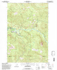
 1990 Logan Hill1995 Print · USGSThe Lewis County countryside near Centralia is shown here as it transitioned through the early 1990s. Researchers can trace the industrial footprint of local Mine works near Mendota or follow the legacy of old transportation lines along the Old Railroad Grade.
 - 1992 Map of Chehalis River, 1993 Print
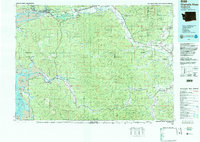 1992 Chehalis River1993 Print · USGSThe Chehalis River valley and the timberlands of the Black Hills are captured here in the early nineties. Researchers can trace rail-and-river history through Montesano and Raymond, or locate the unique Mima Mounds and Bordeaux.2 unique versions available
 - 1994 Map of Blue Lake, 1996 Print
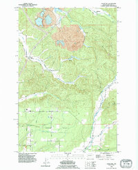
 1994 Blue Lake1996 Print · USGSThe southern Washington Cascades are mapped here in the mid-nineties, showing the intersection of Lewis and Skamania counties within the Gifford Pinchot National Forest. Researchers can trace remote water features like Blue Lake and Jackpot Lake or locate high-country landmarks such as Castle Butte and the Twin Sisters.
 - 1994 Map of Hamilton Buttes, 1996 Print
 1994 Hamilton Buttes1996 Print · USGSThe Cascades high country of Lewis County comes to life in the mid-nineties, showing a landscape defined by protected wilderness and timber management. Hikers and researchers can locate landmarks like Sanctuary Arch and St Michael Lake, or trace the rugged Goat Ridge.
 - 1994 Map of Greenhorn Buttes, 1996 Print
 1994 Greenhorn Buttes1996 Print · USGSThe northern Cascades transition from river valleys to high timbered ridges during the mid-1990s. Researchers can trace the varied terrain from the banks of the Cispus River up to the summits of Iron Creek Butte and Huffaker Mtn.
 - 1994 Map of Randle, 1996 Print
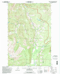
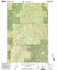
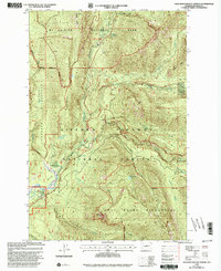
 1994 Randle1996 Print · USGSThe Cowlitz River valley in the mid-1990s reveals a pocket of settlement surrounded by the vast Gifford Pinchot National Forest. Researchers can trace local infrastructure from the White Pass High Sch to family-named landmarks and the Silver Brook community.
 - 1994 Map of Purcell Mtn., 1996 Print
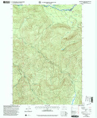
 1994 Purcell Mtn.1996 Print · USGSThe Cowlitz River valley near Kilborn was a landscape of forest management and valley ranching in the mid-1990s. Genealogists and local historians can trace family-named landmarks like Cora Bridge and Big Bottom, alongside remote mountain features like Little Paradise.
 - 1994 Map of Packwood, 1996 Print
 1994 Packwood1996 Print · USGSPackwood and the high Cascades are shown in the mid-nineties as the region balanced forestry with growing recreation. Researchers can trace forest access roads and landmarks like the Landing Strip, Snyder Lake, and the winding Cowlitz River.
 - 1994 Map of Cowlitz Falls, 1996 Print
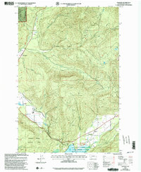
 1994 Cowlitz Falls1996 Print · USGSThe Lewis and Skamania county line runs through this mid-nineties survey of the Cowlitz River basin. Researchers can trace the timber and water landscape from the Gaging Station and Landing Strip to landmarks like Quartz Creek Big Trees.
 - 1994 Map of Tower Rock, 1996 Print
 1994 Tower Rock1996 Print · USGSThe southern Washington Cascades appear in detail during the mid-1990s as the Cispus River basin is managed for education and recreation. Researchers can locate specific sites like the Cispus Environmental Learning Center, Tower Rock, and the North Fork Group Campground.
 - 1998 Map of Vanson Peak, 2003 Print
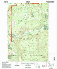
 1998 Vanson Peak2003 Print · USGSThe Lewis and Cowlitz county borders intersect here during the late 1990s, where protected volcanic monuments meet national forest lands. Researchers can trace the high-elevation terrain around Vanson Peak, Vanson Lake, and the shorelines of Riffe Lake.
 - 1998 Map of Tatoosh Lakes, 2003 Print
 1998 Tatoosh Lakes2003 Print · USGSLewis County at the close of the twentieth century shows a landscape defined by the high peaks of the Tatoosh Range and the valley of the Cowlitz River. Researchers can trace the development of High Valley and locate the Cem and Skate Creek Sno-Park along the mountain foothills.
 - 1998 Map of The Rockies, 2003 Print
 1998 The Rockies2003 Print · USGSLewis County forestland in the late 1990s reveals a high-elevation landscape where the Mt Baker Snoqualmie and Gifford Pinchot National Forests meet. Researchers can trace the headwaters of the Nisqually River and locate landmarks like Stahl Mountain or Goose Lake.
 - 1998 Map of Glenoma, 2003 Print
 1998 Glenoma2003 Print · USGSRainey Valley and the surrounding Lewis County highlands are shown here in the late nineties, documenting a landscape of timber, water, and conservation. Map collectors and genealogists can trace the rural layout of Glenoma, find the shoreline of Riffe Lake, or locate family landmarks near Rainey Creek and Coal Canyon.
 - 1998 Map of Sawtooth Ridge, 2003 Print
 1998 Sawtooth Ridge2003 Print · USGSIn the late 1990s, the boundary between Lewis and Pierce counties served as a rugged gateway to the national parks. Outdoor enthusiasts and local historians can trace high-country trails to Sawtooth Ridge, High Rock, and the Nisqually Entrance Guard Station.
 - 1998 Map of Ohanapecosh Hot Springs, 2003 Print
 1998 Ohanapecosh Hot Springs2003 Print · USGSThe Lewis County high country comes into focus in the late nineties, documenting the intersection of national park and forest lands. Hikers and historians can trace trail networks and recreation sites like Ohanapecosh Hot Springs, Backbone Lake, and La Wis Wis Campground.
 - 1998 Map of Kiona Peak, 2003 Print
 1998 Kiona Peak2003 Print · USGSThe Big Cowlitz River valley in the late nineties shows a landscape of timbered peaks and riverside settlements. Researchers can locate the mountain communities of Owen and Huff, trace the drainage of Kiona Creek, or find the local Cem and Landing Strip.
 - 1998 Map of Anderson Lake, 2003 Print
 1998 Anderson Lake2003 Print · USGSThe Nisqually River valley and high Pierce County ridges appear in the late nineties before modern digital mapping dominated. Trace the mountain drainages of Mineral Creek, find the remote Anderson Lake, and locate the high Communication Tower.
 - 1998 Map of Morton, 2003 Print
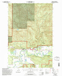
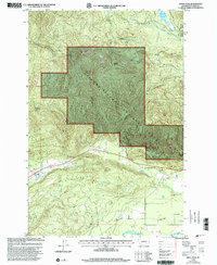
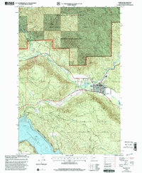 1998 Morton2003 Print · USGSMorton and the surrounding Lewis County timberlands are captured here during the late nineties, showing a landscape defined by forest management and river valleys. Genealogists and local historians can locate Strom Field, the local Cem, and the winding banks of the Tilton River.
Showing maps 1-25 of 33
Top cities of Lewis County
- Centralia historical maps
- Chehalis historical maps
- Napavine historical maps
- Winlock historical maps
- Packwood historical maps
- Morton historical maps
See more
Frequently asked questions
- What are the different types of historical maps available for Lewis County?
- What is the oldest map of Lewis County?
- Where can I purchase historical maps of Lewis County for my home or office?
- Where can I download high-res historical maps of Lewis County?
- Are there historical topographic maps available for Lewis County?
- Is there historical aerial imagery available for Lewis County?
- Where are historical maps of Lewis County sourced from?