Old Maps of Skamania County, Washington for Metal Detecting
Plan your next treasure hunt with 372 historic maps of Skamania County. Find old homesites, ghost towns, trails, and gathering spots that may be lost to time — perfect for identifying promising metal detecting locations.
- Locate forgotten sites: Uncover places like long-lost settlements, abandoned rail lines, or gathering spots.
- Plan better hunts: Use map overlays combined with LiDAR or satellite views to narrow in on historically rich areas.
- Made for detectorists: Thousands of hobbyists use these maps to discover relics, coins, and hidden history.
Use these historic maps to boost your research and find new opportunities beneath the surface of Skamania County.
Skamania County, WA maps
(372)- 1918 Map of Troutdale
 1918 Troutdale1918 Print · USGSEast of Portland in the late nineteen-teens, the riverfront and rail lines were transforming the landscape of Multnomah County. Genealogists and historians can trace family roots at the Multnomah County Farm, Sundial Ranch, and small rural schools like Cedar School.2 unique versions available
 - 1919 Map of Mount St Helens
 1919 Mount St Helens1919 Print · USGSThe Cascades wilderness of Cowlitz and Skamania counties comes alive in this era of early forest management and mining. Trace the original profiles of Mt St Helens and Spirit Lake, and locate remote landmarks like Polar Star Mine or Basket Ferry.4 unique versions available
 - 1926 Map of Steamboat Mtn, 1954 Print
 1926 Steamboat Mtn1954 Print · USGSThe northern Cascades in the mid-twenties are shown here as a wilderness of timber and ice during the early years of the National Forest system. Researchers can locate remote outposts like Tower Rock Ranger Sta, the historic Williams Mine, and forgotten sites like Graveyard Camp.3 unique versions available
 - 1926 Map of Hood River, 1955 Print
 1926 Hood River1955 Print · USGSThe Columbia River Gorge in the mid-twenties shows a landscape defined by competing railroads and early trans-river engineering. Trace the rail lines between Stevenson and Hood River, or locate historic sites like Hemlock Sch and the Bridge of the Gods.
 - 1929 Map of Hood River
 1929 Hood River1929 Print · USGSThe Columbia River Gorge and Hood River Valley are captured here in the late twenties during a period of significant infrastructure growth. Researchers can trace the early rail networks, find remote forest outposts like Race Track Ranger Sta, and locate vanished landmarks such as the Government Sprs Hotel.3 unique versions available
 - 1931 Map of Steamboat Mtn
 1931 Steamboat Mtn1931 Print · USGSSkamania and Lewis Counties appear as a managed wilderness of national forests in the years before World War II. Researchers can trace the early footprint of forest management at the Cispus Lookout Sta and remote sites like Graveyard Camp or Buckhorn Camp.2 unique versions available
 - 1934 Map of Troutdale
 1934 Troutdale1934 Print · USGSThe Columbia River shoreline and the wooded hills of Clark County come alive in this mid-1930s survey of the riverfront. Researchers can trace early rural life through Washougal and local landmarks like Fern Prairie Grange, Lackamas Lake, and the Silver Star Mine.
 - 1940 Map of Lookout Mtn
 1940 Lookout Mtn1940 Print · USGSSkamania County's high country is documented here just before the mid-century, showing a landscape of fire lookouts and forest camps. Researchers can trace early ranger infrastructure and remote sites like the Summit Guard Station, 4th of July Camp, and the Miners site near Copper Creek.
 - 1941 Map of Yacolt
 1941 Yacolt1941 Print · USGSIn the early 1940s, Clark County's timber and river country centered on the rail-connected town of Yacolt. Researchers can trace old homesteads and landmarks like Golden Wonder Mine, Riverview School, and the remote Sunset Guard Sta.
 - 1941 Map of Camas
 1941 Camas1941 Print · USGSThe Columbia River corridor is captured here just before the mid-century, showing the bustling industrial towns of Camas and Washougal alongside a rural network of country schools. Genealogists and historians can trace family roots through landmarks like the Silver Star Mine, Cemetery Hill, and dozens of local schoolhouses such as Harmony Sch.
 - 1942 Map of Camas
 1942 Camas1942 Print · USGSThe Columbia River corridor is captured here in the early 1940s, showing the industrial heart of Camas and the rural outskirts of Gresham. Genealogists and historians can trace early schools like Twelvemile Corner Sch and the location of the Silver Star Mine.2 unique versions available
 - 1948 Map of Vancouver, 1957 Print
 1948 Vancouver1957 Print · USGSPost-war growth transforms the river valleys of the Pacific Northwest as the timber and rail economy thrives. Trace family roots in Tillamook or Oregon City, and locate vanished landmarks like the spit at Bayocean or the Skamania Mine.
 - 1950 Map of Vancouver
 1950 Vancouver1950 Print · USGSCoastal Oregon and the lower Columbia River valley are captured in detail just after the war. Researchers can trace historic rail routes like the Southern Pacific or locate early settlements such as Vernonia, Gaston, and the Grand Ronde Indian Reservation.
 - 1950 Map of Vancouver, 1951 Print
 1950 Vancouver1951 Print · USGSThe Pacific Northwest urban corridor meets the rugged coast in the years following the war, showing the expansion of Portland and Vancouver. Genealogists and historians can trace the reach of the Southern Pacific RR and locate coastal communities like Tillamook, Seaside, and Tolovana Park.
 - 1950 Map of Yakima, 1951 Print
 1950 Yakima1951 Print · USGSThe Yakima Valley and the towering Cascades meet in this mid-century survey of South Central Washington. Genealogists and local historians can trace the irrigation-era growth of Yakima, the historic Fort Simcoe outpost, and the White Swan Mission on the Yakima Indian Reservation.
 - 1953 Map of Hoquiam
 1953 Hoquiam1953 Print · USGSSouthwest Washington in the early fifties shows a landscape shaped by timber, rail, and river commerce from the coast to the Cascades. Genealogists and historians can trace the development of timber towns like Ryderwood and the industrial hubs of Hoquiam and Kelso.2 unique versions available
 - 1953 Map of Lookout Mtn, 1956 Print
 1953 Lookout Mtn1956 Print · USGSThe deep forests of Skamania County come into focus during the early fifties, showing a landscape of lookouts and timber management. Genealogists and historians can trace the locations of the Mineral Springs Guard Station, early sites like Spring Camp, and the winding East Fork Lewis River.3 unique versions available
 - 1953 Map of The Dalles, 1965 Print
 1953 The Dalles1965 Print · USGSThe Columbia River Gorge at mid-century shows a region being transformed by massive hydroelectric dams and a growing highway network. Researchers can trace the development of The Dalles Dam, locate the Maryhill Museum, and find old rail stops in Rufus, Wishram, and Arlington.3 unique versions available
 - 1954 Map of Bridal Veil, 1958 Print
 1954 Bridal Veil1958 Print · USGSThe Columbia River Gorge in the mid-1950s was a bustling corridor of rail lines and early highways. Genealogists and historians can trace the foundations of riverside communities like Bridal Veil and Dodson or locate industrial sites like the Skamania Mine.4 unique versions available
 - 1954 Map of Camas, 1958 Print
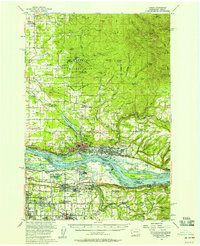 1954 Camas1958 Print · USGSThe Columbia River corridor in the mid-fifties shows the industrial growth of Camas and Washougal alongside the evolving suburbs of Gresham and Troutdale. Researchers can trace old school districts like Norway Sch and follow the S P & S RY through the river valley.3 unique versions available
 - 1956 Map of The Dalles
 1956 The Dalles1956 Print · USGSThe Columbia River Gorge and the high Cascades are captured in the mid-1950s, showing a vital corridor of rail and road. Researchers can trace the original path of The Old Oregon Trail or locate historical landmarks like the Maryhill Museum and Mount Hood.
 - 1956 Map of Yacolt, 1958 Print
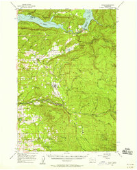 1956 Yacolt1958 Print · USGSIn the mid-1950s, the Clark County foothills were a landscape of logging camps and river power before the height of modernization. Researchers can trace the Northern Pacific Railroad route or locate family sites at Gravel Point Cem and the settlement of Venersborg.2 unique versions available
 - 1957 Map of Hoquiam
 1957 Hoquiam1957 Print · USGSCoastal timber ports and inland rail hubs define Southwest Washington during the late fifties. Genealogists can trace early twentieth-century settlements like Bordeaux, Tono, and Cosmopolis alongside the expanding tracks of the Northern Pacific.
 - 1957 Map of The Dalles
 1957 The Dalles1957 Print · USGSThe Columbia River Gorge and the high plateaus of the mid-1950s come alive on this detailed survey of northern Oregon and southern Washington. Researchers can trace the path of the Oregon Trail and The Old Barlow Road alongside river towns like The Dalles and Wishram.
 - 1957 Map of Bonneville Dam, 1959 Print
 1957 Bonneville Dam1959 Print · USGSThe Columbia River Gorge in the late fifties was a landscape of industrial power and remote forest trails. Map collectors can trace the mid-century footprints of Stevenson and Cascade Locks or locate landmarks like St Martins Hot Springs and the Bridge of the Gods.2 unique versions available
Showing maps 1-25 of 372
Top cities of Skamania County
Frequently asked questions
- What are the different types of historical maps available for Skamania County?
- What is the oldest map of Skamania County?
- Where can I purchase historical maps of Skamania County for my home or office?
- Where can I download high-res historical maps of Skamania County?
- Are there historical topographic maps available for Skamania County?
- Is there historical aerial imagery available for Skamania County?
- Where are historical maps of Skamania County sourced from?