Old Maps of Acme, Washington for Genealogy
Trace your family roots with 10 historic maps of Acme. These high-res maps reveal old neighborhoods, homesites, landmarks, and streets — helping you uncover where your ancestors lived and how the area evolved over time.
- Explore historic neighborhoods: Identify where your relatives may have lived in the 1800s or 1900s.
- Compare maps over time: Trace the changes in streets, buildings, and landmarks for multi-generational research.
- Perfect for genealogy & ancestry research: Used by family historians and researchers to map out lineage and migration.
These maps are an incredible resource for exploring your personal connection to Acme's past.
Acme, WA maps
(10)- 1921 Map of Wickersham
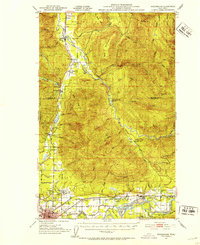
 1921 Wickersham1921 Print · USGSThe Skagit and Samish river valleys come alive in this map from the early twenties, showcasing a landscape of timber, mines, and rail. Genealogists and historians can trace the foundations of local life at Northern State Hospital, the Lyman Ferry, and the Cokedale Mine.2 unique versions available
 - 1951 Map of Wickersham, 1953 Print
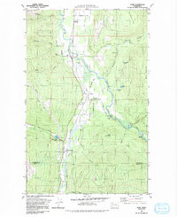
 1951 Wickersham1953 Print · USGSSkagit County in the early fifties shows a landscape of river-valley industry and timber outposts along the Skagit River. Genealogists and historians can locate the Northern State Hospital, trace the Cokedale Mine, and find rural centers like Samish School.3 unique versions available
 - 1957 Map of Victoria, 1960 Print
 1957 Victoria1960 Print · USGSThe San Juan Islands and the North Cascades coastline are shown in detail during the late fifties, a period of significant military and industrial presence. Researchers can trace historic rail lines like the Great Northern or locate sites such as the Whidbey Island Naval Air Sta and Friday Harbor.4 unique versions available
 - 1975 Map of Bellingham, 1977 Print
 1975 Bellingham1977 Print · USGSNorthwest Washington in the mid-seventies is captured here, from the Canadian border at Blaine to the San Juan Islands. Researchers can trace tribal lands on the Lummi Indian Reservation, find rural settlements like Cokedale, or follow the Burlington Northern rail lines.
 - 1980 Map of Acme, 1992 Print
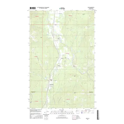
 1980 Acme1992 Print · USGSThe South Fork Nooksack River valley is shown during the early 1980s, documenting the corridor between Whatcom and Skagit counties. Researchers can trace the legacy of logging and rail at Wickersham, Mirror Lake Siding, and the Saxon Cem.2 unique versions available
 - 2011 Map of Acme, 2011 Print
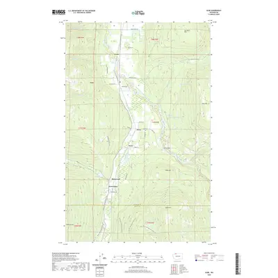
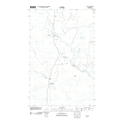 2011 Acme2011 Print · USGSCovers Acme, including Wickersham, Whatcom County, and other nearby areas
 - 2014 Map of Acme, 2014 Print
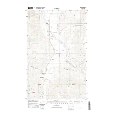 2014 Acme2014 Print · USGSCovers Acme, including Wickersham, Whatcom County, and other nearby areas
 - 2017 Map of Acme, 2017 Print
 2017 Acme2017 Print · USGSCovers Acme, including Wickersham, Whatcom County, and other nearby areas
 - 2020 Map of Acme, 2020 Print
 2020 Acme2020 Print · USGSCovers Acme, including Wickersham, Whatcom County, and other nearby areas
 - 2023 Map of Acme, 2023 Print
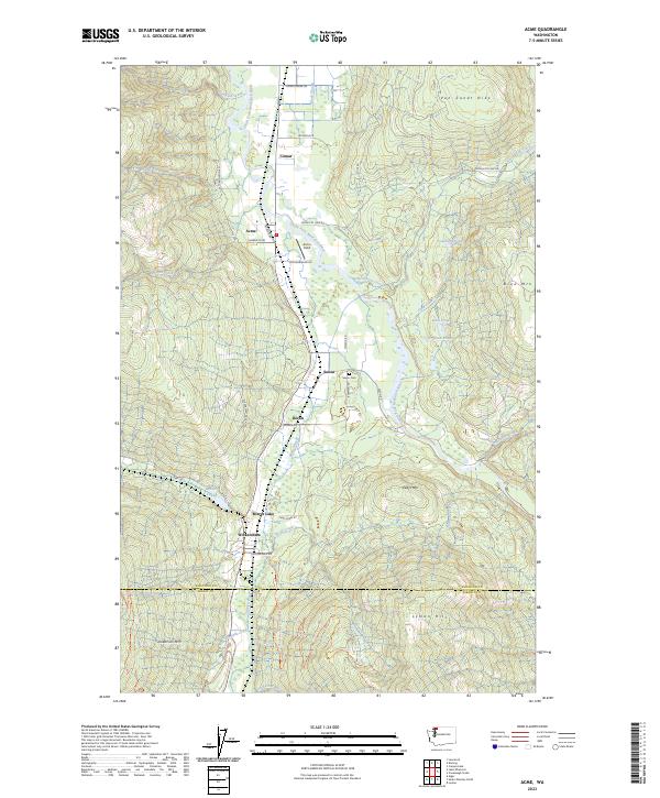 2023 Acme2023 Print · USGSThe South Fork Nooksack River valley comes to life in this recent study of Whatcom County's agricultural and forest lands. Researchers can trace local landmarks like Saxon Cem and Acme Field, or follow the Pacific Northwest National Scenic Trl past Mirror Lake.
End of results
Showing maps 1-10 of 10
Top cities near Acme
- Bellingham historical maps
- Lynden historical maps
- Sedro-Woolley historical maps
- Burlington historical maps
- Maple Falls historical maps
Frequently asked questions
- What are the different types of historical maps available for Acme?
- What is the oldest map of Acme?
- Where can I purchase historical maps of Acme for my home or office?
- Where can I download high-res historical maps of Acme?
- Are there historical topographic maps available for Acme?
- Is there historical aerial imagery available for Acme?
- Where are historical maps of Acme sourced from?