1980s Maps of Whitman County, Washington
Explore 32 historic maps of Whitman County from the 1980s. These maps offer a rare glimpse into what life looked like during the 1980s — showing old roads, neighborhoods, homes, and landmarks that have changed or disappeared over time.
Whether you're researching your family's past, planning a metal detecting trip, or studying how Whitman County's landscape evolved across the 1980s, these high-resolution maps are a powerful tool for exploring the history of this region.
- Focus on a specific era: All maps on this page are from the 1980s, giving you a focused view of this time period.
- See what’s changed: Compare century-old streets, trails, and buildings to today's modern landscape using overlays and satellite layers.
- Research with precision: Use these maps for genealogy, historical research, land use analysis, or educational projects.
- View, download, or print: Maps are fully viewable online in high resolution, and can be downloaded or printed for your own records.
Start exploring Whitman County's history through authentic maps from the 1980s. This is your window into the past.
Whitman County, WA maps
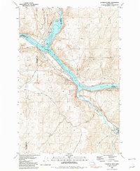
(32)- 1980 Map of Chapman Lake, 1981 Print
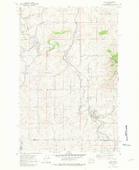
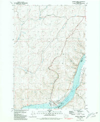
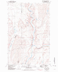
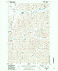
 1980 Chapman Lake1981 Print · USGSThe basalt coulees and deep-water lakes of the Channeled Scablands are captured in this 1980s-era study. Researchers can trace the path of the Mullan Road and find old routes like Texas Ferry Road and Cossalman Road.
 - 1980 Map of Latah, 1981 Print
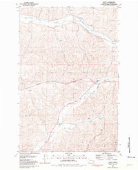
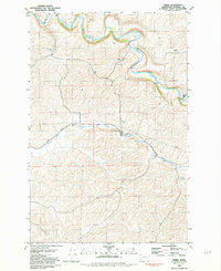
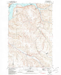
 1980 Latah1981 Print · USGSThe rural borderlands of Spokane and Whitman Counties are captured here during the late twentieth century. Genealogists and local historians can trace family land via Adams Road, locate family plots at Latah Cem, or follow the Union Pacific line through Latah.
 - 1980 Map of Plaza, 1981 Print
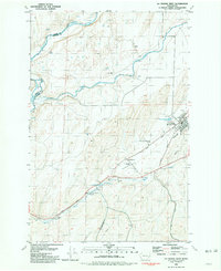
 1980 Plaza1981 Print · USGSAgricultural life in eastern Washington during the late seventies is centered on the rail corridors and small grain-handling hubs. Genealogists and local historians can trace family-named routes like Powers Road and locate the Grain Elevator or Storage Bins near Plaza.
 - 1980 Map of Tekoa Mountain, 1981 Print
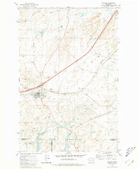
 1980 Tekoa Mountain1981 Print · USGSThe borderlands of eastern Washington and northern Idaho come into focus in the early eighties, showcasing the intersection of four counties. Trace the path of the Chicago Milwaukee St Paul and Pacific rail line and local landmarks like Tekoa Mountain and Lovell Valley.
 - 1980 Map of Spring Valley, 1981 Print
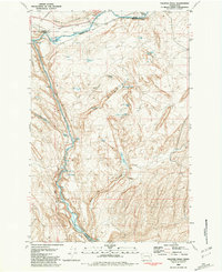
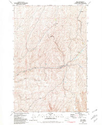
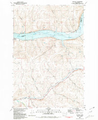
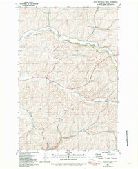
 1980 Spring Valley1981 Print · USGSIn the rolling wheat country of eastern Washington, this late twentieth-century survey shows the vital rail corridors and rural life near the Spokane and Whitman county line. Researchers can trace the path of the Burlington Northern through the settlement of North Pine and past Muskwat Lake.
 - 1981 Map of Dusty
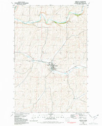
 1981 Dusty1981 Print · USGSWhitman County's rolling Palouse hills are documented here in the early eighties, showing a landscape defined by grain production and creek drainages. Researchers can trace rural infrastructure from the Grain Elevator at Dusty to the banks of Union Flat Creek.
 - 1981 Map of La Crosse West
 1981 La Crosse West1981 Print · USGSWhitman County agriculture and rail infrastructure are captured in the early 1980s as the town of La Crosse remains a hub for the local grain trade. Genealogists and researchers can trace the Union Pacific route, locate the Cem, and find rural landmarks like the Robert Camp Memorial Track.
 - 1981 Map of Sprague
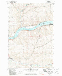
 1981 Sprague1981 Print · USGSThe rail-centered town of Sprague is shown here in the early eighties at a significant junction of two major lines. Genealogists and researchers can trace local landmarks like Lake View Cem, Maccabee Cem, and the waters of Fourth of July Lake.
 - 1981 Map of Central Ferry
 1981 Central Ferry1981 Print · USGSThe Snake River corridor in the early 1980s reveals a landscape of industrial river transport and upland farming. Researchers can trace the development of the Port of Central Ferry and find local landmarks like Selbu Church and Camas Prairie.
 - 1981 Map of Palouse Falls
 1981 Palouse Falls1981 Print · USGSThe scablands of Eastern Washington are captured here in the early eighties, showcasing a landscape defined by the Palouse River and heavy rail. Researchers can trace the lines of the Union Pacific through Hooper Junction or locate remote landmarks like Gildersleeve Spring.
 - 1981 Map of Fishtrap Lake
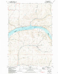
 1981 Fishtrap Lake1981 Print · USGSThe scablands and lakes of eastern Washington are captured here in the early eighties, showcasing the rail lines and rural outposts of the Lincoln and Spokane county borders. Trace the routes of the Burlington Northern railroad past the storage bins at Rodna and the shores of Fishtrap Lake.
 - 1981 Map of Starbuck East
 1981 Starbuck East1981 Print · USGSThe Snake River corridor in southeastern Washington comes alive in this early 1980s survey, showing the impact of damming and rail transport on the landscape. Local historians can trace the Union Pacific route through Starbuck and Riparia, alongside agricultural landmarks like Grain Elevators.
 - 1981 Map of Ping
 1981 Ping1981 Print · USGSThe Snake River canyon at the Whitman and Garfield county line is captured here in the early eighties. Local historians can trace the community at Ping, the nearby Cem, and river landings like Rice Bar and Tucker Bar.
 - 1981 Map of Honn Lakes
 1981 Honn Lakes1981 Print · USGSWhitman County's rugged coulee country is captured in the early 1980s as a landscape of basalt drainage and isolated ranching infrastructure. Genealogists and local historians can trace family-named sites like Lehrbas Spring and Honn Lakes alongside the Benge Winona Landing Strip.
 - 1981 Map of Thera
 1981 Thera1981 Print · USGSWhitman County agriculture and transport are captured here in the early 1980s as the rail and river networks converge. Trace the Union Pacific line through Rebel Flat to see the infrastructure at Thera, including Grain Elevators and Matlock Bridge.
 - 1981 Map of Hay
 1981 Hay1981 Print · USGSWhitman County agriculture and rail operations come into focus in the early eighties. Genealogists and local historians can trace the Union Pacific line through Hay and Jerita, locating the community Cem and prominent Grain Elevators.
 - 1981 Map of Starbuck West
 1981 Starbuck West1981 Print · USGSThe confluence of the Palouse and Snake Rivers is captured here in the early eighties, showcasing a landscape shaped by water and rail. Trace the Union Pacific line past Starbuck or locate the Marmes Rock Shelter and Old Bones Cem.
 - 1981 Map of Rattlesnake Canyon
 1981 Rattlesnake Canyon1981 Print · USGSThe Palouse River valley in the early 1980s reveals a critical junction of rail and water infrastructure along the Adams and Whitman county line. Researchers can trace the Union Pacific line as it serves rural stations like Hooper and Willow, or locate isolated landmarks like Negro Lake and Rattlesnake Canyon.
 - 1981 Map of La Crosse East
 1981 La Crosse East1981 Print · USGSWhitman County, Washington, is captured here in the early 1980s, revealing a landscape shaped by rail transport and large-scale grain farming. Researchers can locate specific Grain Elevators and rural landmarks like Wasselman, Wies, and the Union Pacific line.
 - 1981 Map of Dodge
 1981 Dodge1981 Print · USGSThe riverfront and rail corridors of Garfield County are captured here in the early eighties. Researchers can trace the Union Pacific line through the Pataha Valley or locate the Port of Garfield and the settlement of Dodge.
 - 1981 Map of Amber
 1981 Amber1981 Print · USGSSpokane County's lake district is captured here in the early eighties, showing the rural community of Amber and its rail connections. Genealogists and researchers can trace family-named routes like Calvert Road or locate the Historical Monument near Negro Creek.
 - 1981 Map of Delaney
 1981 Delaney1981 Print · USGSSoutheastern Washington's river valleys and wheat country are captured here in the early 1980s as the rail-and-river economy matured. Trace the Union Pacific line through Delaney, locate the Grain Elevator, or find the Little Goose Landing Strip near the Snake River.
 - 1981 Map of Endicott
 1981 Endicott1981 Print · USGSEndicott and the surrounding Palouse hills are captured here in the early eighties, showing the critical link between the railroad and the local grain industry. Researchers can trace the Union Pacific line as it passes the Grain Elevator or locate the Low-Water Ford along the Palouse River.
 - 1981 Map of Clarkston
 1981 Clarkston1981 Print · USGSNorthwestern river life and mountain terrain meet in the early eighties as the Snake River carves through the landscape. Researchers can trace rail history along the Camas Prairie Railroad and locate smaller settlements like Peola and Anatone.2 unique versions available
 - 1981 Map of Little Penawawa Creek
 1981 Little Penawawa Creek1981 Print · USGSWhitman County agriculture and rural life take center stage in the early eighties. Researchers can trace land use through landmarks like the Wilcox Grange, local Grain Elevators, and the Cem near Union Flat Creek.
Showing maps 1-25 of 32
Top cities of Whitman County
- Pullman historical maps
- Colfax historical maps
- Palouse historical maps
- Tekoa historical maps
- Rosalia historical maps
- Garfield historical maps
See more
Frequently asked questions
- What are the different types of historical maps available for Whitman County?
- What is the oldest map of Whitman County?
- Where can I purchase historical maps of Whitman County for my home or office?
- Where can I download high-res historical maps of Whitman County?
- Are there historical topographic maps available for Whitman County?
- Is there historical aerial imagery available for Whitman County?
- Where are historical maps of Whitman County sourced from?