1910s Maps of Greenbrier County, West Virginia
Explore 7 historic maps of Greenbrier County from the 1910s. These maps offer a rare glimpse into what life looked like during the 1910s — showing old roads, neighborhoods, homes, and landmarks that have changed or disappeared over time.
Whether you're researching your family's past, planning a metal detecting trip, or studying how Greenbrier County's landscape evolved across the 1910s, these high-resolution maps are a powerful tool for exploring the history of this region.
- Focus on a specific era: All maps on this page are from the 1910s, giving you a focused view of this time period.
- See what’s changed: Compare century-old streets, trails, and buildings to today's modern landscape using overlays and satellite layers.
- Research with precision: Use these maps for genealogy, historical research, land use analysis, or educational projects.
- View, download, or print: Maps are fully viewable online in high resolution, and can be downloaded or printed for your own records.
Start exploring Greenbrier County's history through authentic maps from the 1910s. This is your window into the past.
Greenbrier County, WV maps
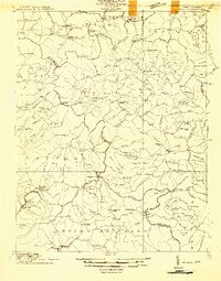
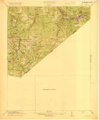
(7)- 1912 Map of Meadow Creek
 1912 Meadow Creek1912 Print · USGSWest Virginia's Fayette and Greenbrier borderlands are captured here in the early twentieth century, showing a landscape of timber and mountain settlements. Genealogists can locate dozens of country schools like Rock of Ages School and Eureka School, alongside the Sandstone Falls on the New River.3 unique versions available
 - 1914 Map of Winona
 1914 Winona1914 Print · USGSCentral West Virginia's rugged highlands are captured here just as the timber industry began to reshape the landscape. Local historians can trace early mountain life through dozens of named schools like Bean School and crossings such as Carnefix Ferry and Raders Ford.2 unique versions available
 - 1915 Map of Meadow Creek
 1915 Meadow Creek1915 Print · USGSThe West Virginia highlands come to life in this detailed survey of the mountain ridges and river valleys just before the First World War. Genealogists can locate dozens of country schools and remote post offices like Rock of Ages School, Brownwood Lawton P.O., and Layland.3 unique versions available
 - 1915 Map of Webster Springs
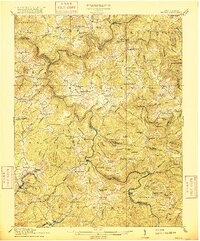
 1915 Webster Springs1915 Print · USGSWebster County at the start of the Great War was a landscape of high ridges and deep river valleys. Genealogists and historians can trace old homesteads and mountain schoolhouses like Redoak School and Cherry Falls School along the banks of the Elk River.3 unique versions available
 - 1916 Map of Winona
 1916 Winona1916 Print · USGSNicholas and Fayette Counties are documented here before the mid-century industrial shifts, showing a world of river crossings and mountain schools. Genealogists can trace family footprints at Carnifex Ferry, Withrows Mill, and dozens of rural sites like Nutterville.3 unique versions available
 - 1918 Map of Webster Springs
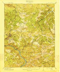
 1918 Webster Springs1918 Print · USGSThe West Virginia highlands are shown in detail during the height of the early twentieth-century timber boom. Researchers can trace historic transport lines like the Virginia and West Virginia RR and locate early community centers like Webster Springs (Addison) and St. Michael School.4 unique versions available
 - 1918 Map of Richwood
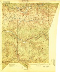
 1918 Richwood1918 Print · USGSNicholas County’s timber and rail economy is in full swing during the late years of the Great War. Genealogists can trace family roots through over a dozen rural schools such as Mayflower School and Dawson School, or find ancestors in riverside towns like Richwood and Fenwick.2 unique versions available
End of results
Showing maps 1-7 of 7
Top cities of Greenbrier County
- Lewisburg historical maps
- White Sulphur Springs historical maps
- Fairlea historical maps
- Ronceverte historical maps
- Rainelle historical maps
- Rupert historical maps
See more
Frequently asked questions
- What are the different types of historical maps available for Greenbrier County?
- What is the oldest map of Greenbrier County?
- Where can I purchase historical maps of Greenbrier County for my home or office?
- Where can I download high-res historical maps of Greenbrier County?
- Are there historical topographic maps available for Greenbrier County?
- Is there historical aerial imagery available for Greenbrier County?
- Where are historical maps of Greenbrier County sourced from?