1970s Maps of Greenbrier County, West Virginia
Explore 24 historic maps of Greenbrier County from the 1970s. These maps offer a rare glimpse into what life looked like during the 1970s — showing old roads, neighborhoods, homes, and landmarks that have changed or disappeared over time.
Whether you're researching your family's past, planning a metal detecting trip, or studying how Greenbrier County's landscape evolved across the 1970s, these high-resolution maps are a powerful tool for exploring the history of this region.
- Focus on a specific era: All maps on this page are from the 1970s, giving you a focused view of this time period.
- See what’s changed: Compare century-old streets, trails, and buildings to today's modern landscape using overlays and satellite layers.
- Research with precision: Use these maps for genealogy, historical research, land use analysis, or educational projects.
- View, download, or print: Maps are fully viewable online in high resolution, and can be downloaded or printed for your own records.
Start exploring Greenbrier County's history through authentic maps from the 1970s. This is your window into the past.
Greenbrier County, WV maps
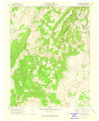
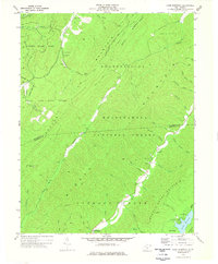
(24)- 1971 Map of Alderson, 1974 Print
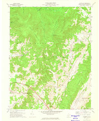
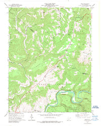
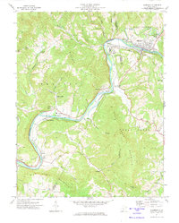 1971 Alderson1974 Print · USGSAlderson and the Greenbrier River valley are documented here in the early 1970s, showing a landscape defined by its mountains and institutional landmarks. Researchers can locate Federal Reformatory for Women, trace the Chesapeake and Ohio rail line, or find local spots like Pence Springs and Keller Ch.2 unique versions available
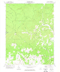
 - 1971 Map of Dawson, 1974 Print
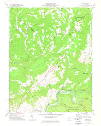
 1971 Dawson1974 Print · USGSGreenbrier and Summers counties are captured here in the early seventies, a landscape of steep hollows and high ridges. Researchers can locate remote rural landmarks like Blue Sulphur Springs, Keeney Knob, and small country congregations at Maude Chapel and Mt Zion Ch.
 - 1971 Map of Ronceverte, 1975 Print
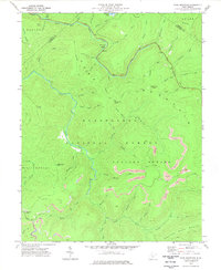
 1971 Ronceverte1975 Print · USGSGreenbrier and Monroe counties are captured here in the early seventies, showing the rail-and-river hub of Ronceverte. Genealogists can trace local roots through sites like Organ Cave, Morgan Cem, and the numerous country churches like Salem Ch and Elizabeth Chapel.
 - 1971 Map of Fort Spring, 1975 Print
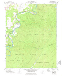
 1971 Fort Spring1975 Print · USGSMonroe County in the early seventies shows a landscape defined by the winding Greenbrier River and heavy rail industry. Local historians can trace industrial sites like Snowflake and old water-powered landmarks including Nickells Mill and the Covered Bridge.2 unique versions available
 - 1971 Map of Roanoke, 1977 Print
 1971 Roanoke1977 Print · USGSThe Virginia Piedmont and Blue Ridge mountains meet in this early 1970s landscape of river valleys and rail hubs. Researchers can trace historic transportation routes and landmarks like the Appomattox Court House Nat Hist Pk, the Peaks of Otter, and Amelia Court House.2 unique versions available
 - 1972 Map of Cornstalk, 1974 Print
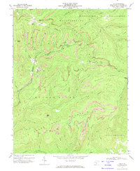
 1972 Cornstalk1974 Print · USGSGreenbrier County's high ridges and quiet hollows are captured here in the early seventies, showing the transition from the summits of Buffalo Mountain to the farms of Clintonville. Local researchers can locate remote landmarks like Kuhn Glades and family-linked sites such as James Chapel or the Wallace Memorial Cem.2 unique versions available
 - 1972 Map of Rupert, 1974 Print
 1972 Rupert1974 Print · USGSGreenbrier County's highland valleys are documented here in the early seventies, showing the vital corridors of the Meadow River and the Nicholas Fayette and Greenbrier railroad. Trace local heritage through landmarks like Sam Black Church, the Rainelle Airpark, and several mountain Strip Mine sites.2 unique versions available
 - 1972 Map of Lewisburg, 1974 Print
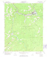
 1972 Lewisburg1974 Print · USGSLewisburg and the Greenbrier Valley are captured in the early seventies, showing a landscape shaped by the river and the rail. Researchers can trace local genealogy at Greenbrier Memorial Gardens or locate rural landmarks like Calvary Ch and the Arbuckle School.2 unique versions available
 - 1972 Map of Nettie, 1974 Print
 1972 Nettie1974 Print · USGSNettie and the Nicholas County highlands are mapped here in the early 1970s during a period of active coal production. Researchers can locate family-named landmarks like Fields Cem, rural congregations at Mt Zion Ch, and the industrial footprint of numerous local Strip Mines.2 unique versions available
 - 1972 Map of Williamsburg, 1974 Print
 1972 Williamsburg1974 Print · USGSGreenbrier County's high ridges and farming valleys are meticulously documented in the early 1970s. Genealogists and researchers can locate several rural churches and burial sites, including Mary Immaculate Ch, Wesley Chapel, and the Pilgrim Rest Cem.
 - 1972 Map of Quinwood, 1974 Print
 1972 Quinwood1974 Print · USGSThe West Virginia coal country of Greenbrier and Nicholas counties is captured here in the early seventies, dominated by the timber and mining industries. Researchers can trace the rail-reliant settlements of Quinwood, Leslie, and Anjean, or locate family landmarks like Bridge Ch and the Drive-in Theater.2 unique versions available
 - 1972 Map of Asbury, 1974 Print
 1972 Asbury1974 Print · USGSGreenbrier County in the early seventies remains a landscape of steep hollows and historic mill sites. Genealogists can trace family roots through Hanger Cem or locate the rural communities of Asbury, Blaker Mills, and Kitchen.2 unique versions available
 - 1972 Map of Anthony, 1974 Print
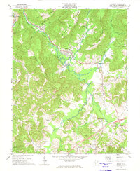
 1972 Anthony1974 Print · USGSThe Greenbrier River valley in the early seventies shows a landscape defined by deep ridges and small mountain communities. Genealogists and hikers can trace the Chesapeake and Ohio rail line past Falling Spring to local landmarks like Enon Ch and the Blue Bend Recreation Area.
 - 1972 Map of Duo, 1974 Print
 1972 Duo1974 Print · USGSGreenbrier County coal country is captured here in the early seventies, showing a landscape shaped by active extraction and mountain terrain. Trace the footprint of the Duo settlement and locate former industrial sites like the tipple and slag dump near Beech Knob.2 unique versions available
 - 1972 Map of Richwood, 1975 Print
 1972 Richwood1975 Print · USGSRichwood and the Cherry River valley are captured here in the early seventies during a period of active mountain industry. Genealogists and local historians can trace old homesteads and family sites like Baber Cem, Lynn Low Place, and the New Hope Sch.3 unique versions available
 - 1972 Map of White Sulphur Springs, 1975 Print
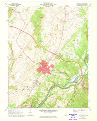
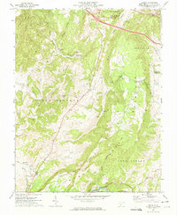
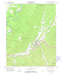 1972 White Sulphur Springs1975 Print · USGSWhite Sulphur Springs was a hub of recreation and rail in the early 1970s, nestled between several mountain ridges. Researchers can trace the town's footprint including the Fish Hatchery, Eckle Ch, and the winding Greenbrier River.2 unique versions available
 - 1973 Map of Lobelia, 1977 Print
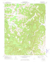
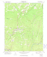
 1973 Lobelia1977 Print · USGSPocahontas County was a landscape of high-elevation wilderness and quiet hollows in the early seventies, centered on the settlement of Lobelia. Genealogists and historians can trace local landmarks like Emmanuel Ch, the Mikes Knob Lookout Tower, and the unique Cranberry Glades Botanical Area.
 - 1973 Map of Droop, 1989 Print
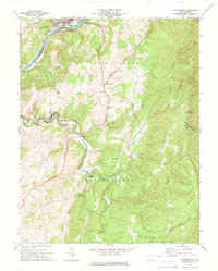
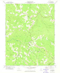
 1973 Droop1989 Print · USGSHighland ridges and river valleys define this part of Greenbrier County in the early seventies, centered on the site of a historic battlefield. Local researchers can trace family names and landmarks like Renicks Valley, Mt Zion Ch, and the Covered Bridge along Locust Creek.
 - 1977 Map of Droop, 1978 Print
 1977 Droop1978 Print · USGSGreenbrier and Pocahontas counties meet in this mid-1970s mountain survey, where high ridges overlook the river-and-rail corridor. You can trace family sites near Whiteoak Grove, locate the Covered Bridge at Droop, and explore the grounds of Droop Mountain Battlefield State Park.
 - 1977 Map of Fork Mountain, 1978 Print
 1977 Fork Mountain1978 Print · USGSGreenbrier County’s rugged highland interior is captured here in the late seventies as industrial mining expanded across the Monongahela National Forest. Researchers can find land-use patterns through numerous Strip Mine locations and family-named features like Manning Knob or the local Cem.2 unique versions available
 - 1977 Map of Denmar, 1978 Print
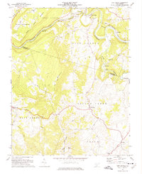
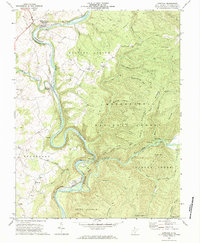
 1977 Denmar1978 Print · USGSThe Greenbrier River valley in the late 1970s is a landscape of public forests and quiet riverside settlements. Genealogists and historians can trace the grounds of the State Hospital at Denmar, locate the Old Droop Ch, and follow the Chesapeake and Ohio rail line.2 unique versions available
 - 1977 Map of Lake Sherwood, 1978 Print
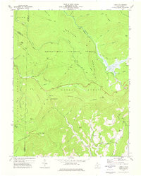
 1977 Lake Sherwood1978 Print · USGSPocahontas County was a landscape of protected forests and mountain waters in the late seventies. Genealogists and hikers can locate remote landmarks like Beaver Creek Ch, the Columbia Sulphur Springs site, and the early trail network of Watoga State Park.
 - 1977 Map of Trout, 1978 Print
 1977 Trout1978 Print · USGSGreenbrier County mountain life in the late seventies is centered here around high ridges and small creek-side settlements. Genealogists and historians can locate rural landmarks like Mt Pleasant Ch, the Reed Cem, and the community at Friars Hill.3 unique versions available
 - 1979 Map of Marlinton, 1982 Print
 1979 Marlinton1982 Print · USGSThe West Virginia highlands are shown in detail during the late seventies, featuring the dense rail networks and mountain towns of the Allegheny range. Researchers can trace family roots through sites like Buckeye Cem, Mount Nebo Ch, and the lumber and coal hubs of Richwood and Rainelle.
End of results
Showing maps 1-24 of 24
Top cities of Greenbrier County
- Lewisburg historical maps
- White Sulphur Springs historical maps
- Fairlea historical maps
- Ronceverte historical maps
- Rainelle historical maps
- Rupert historical maps
See more
Frequently asked questions
- What are the different types of historical maps available for Greenbrier County?
- What is the oldest map of Greenbrier County?
- Where can I purchase historical maps of Greenbrier County for my home or office?
- Where can I download high-res historical maps of Greenbrier County?
- Are there historical topographic maps available for Greenbrier County?
- Is there historical aerial imagery available for Greenbrier County?
- Where are historical maps of Greenbrier County sourced from?