1960s Maps of Greenbrier County, West Virginia
Explore 15 historic maps of Greenbrier County from the 1960s. These maps offer a rare glimpse into what life looked like during the 1960s — showing old roads, neighborhoods, homes, and landmarks that have changed or disappeared over time.
Whether you're researching your family's past, planning a metal detecting trip, or studying how Greenbrier County's landscape evolved across the 1960s, these high-resolution maps are a powerful tool for exploring the history of this region.
- Focus on a specific era: All maps on this page are from the 1960s, giving you a focused view of this time period.
- See what’s changed: Compare century-old streets, trails, and buildings to today's modern landscape using overlays and satellite layers.
- Research with precision: Use these maps for genealogy, historical research, land use analysis, or educational projects.
- View, download, or print: Maps are fully viewable online in high resolution, and can be downloaded or printed for your own records.
Start exploring Greenbrier County's history through authentic maps from the 1960s. This is your window into the past.
Greenbrier County, WV maps
(15)- 1961 Map of Charleston
 1961 Charleston1961 Print · USGSWest Virginia's capital region and the highlands to the east are shown in detail during the early sixties. Genealogists and historians can trace rail networks like the Baltimore and Ohio RR and find early state parks such as Watoga State Park.
 - 1961 Map of Bluefield
 1961 Bluefield1961 Print · USGSThe coalfields and mountain ridges of southern West Virginia and southwest Virginia are captured in the early sixties. Genealogists can trace family ties through rail-linked towns like Princeton and Richlands or along the shores of Bluestone Reservoir.
 - 1961 Map of Mountain Grove, 1964 Print
 1961 Mountain Grove1964 Print · USGSThe Virginia and West Virginia borderlands in the early 1960s feature a network of high ridges and isolated hollows. Genealogists and historians can trace family-named sites like Mooretown and Gochran Creek Ch, or locate the Chesapeake and Ohio line near Bacova Junction.2 unique versions available
 - 1963 Map of Roanoke
 1963 Roanoke1963 Print · USGSCentral Virginia and the Blue Ridge front appear here in the early sixties, caught between their deep railroad roots and new postwar developments. Genealogists and historians can trace the rail lines of the Norfolk and Western through towns like Bedford and Altavista, or locate family landmarks near Smith Mountain Lake.
 - 1964 Map of Asbury, 1984 Print
 1964 Asbury1984 Print · USGSWest Virginia's extraction landscape and small valley settlements are captured here in the mid-1960s. Researchers can locate numerous family-named landmarks and rural centers like Coxs Mills, Mt Union Ch, and the Lowther Cem.
 - 1966 Map of Falling Spring, 1967 Print
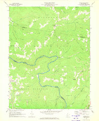
 1966 Falling Spring1967 Print · USGSThe Jackson River valley and the rugged ridges of the George Washington National Forest define this mid-century landscape. Genealogists and hikers can trace old mountain routes and family settlements near Falling Spring, Carloover, and the Emory Ch.3 unique versions available
 - 1966 Map of Glace, 1968 Print
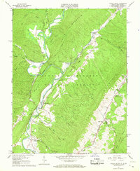
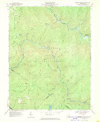
 1966 Glace1968 Print · USGSThe West Virginia and Virginia borderlands come to life in the mid-sixties, showing the rugged topography of the Greenbrier State Forest. Genealogists and hikers can trace old landmarks like Hylton Ch, the Catholic Cem, and Moncove Lake.2 unique versions available
 - 1966 Map of Rucker Gap, 1968 Print
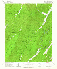
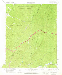
 1966 Rucker Gap1968 Print · USGSThe high ridges of the Alleghenies meet along the Virginia-West Virginia border in the mid-1960s, where national forests converge at Rucker Gap. Genealogists and hikers can trace old family landmarks like Watts Chapel Cem and the waters of Anthony Creek or Ogle Creek.2 unique versions available
 - 1966 Map of Jerrys Run, 1968 Print
 1966 Jerrys Run1968 Print · USGSThe Virginia and West Virginia borderlands in the 1960s reveal a landscape of deep railroad engineering and forest management. Trace the path of the Chesapeake and Ohio through the Lewis Tunnels and locate the mountain settlement at Alleghany.2 unique versions available
 - 1967 Map of Webster Springs SW, 1970 Print
 1967 Webster Springs SW1970 Print · USGSWest Virginia's high forest country comes alive in this late 1960s survey of the river forks and mountain ridges. Researchers can trace historic access points and landmarks like the Mills Mtn Ch, Red Oak Knob lookout, and the Cranberry Campground.3 unique versions available
 - 1969 Map of Alvon, 1971 Print
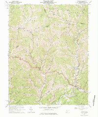
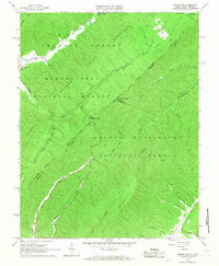
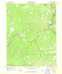
 1969 Alvon1971 Print · USGSGreenbrier County is captured here in the late sixties as its mountain communities and forest lands intersect along the Allegheny front. Researchers can trace the footprints of Alvon, Neola, and the Little Creek Ch amidst the vast timberlands of the Monongahela National Forest.3 unique versions available
 - 1969 Map of Winona, 1973 Print
 1969 Winona1973 Print · USGSFayette County coal country is documented here in the late sixties, where the Meadow River separates several mountain ridges. Genealogists and historians can trace family sites like the Old Stone House, Tyree Cem, and the communities of Nallen and Winona.2 unique versions available
 - 1969 Map of Rainelle, 1973 Print
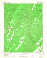
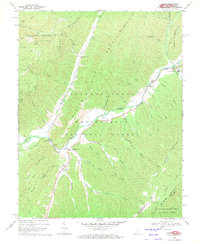
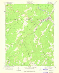 1969 Rainelle1973 Print · USGSRainelle and the surrounding mountain ridges are captured here during a peak era of coal and rail activity in the late sixties. Genealogists and local historians can trace rural landmarks from Big Sewell Ch and Spring Dale to the vanished rail stops near Bellwood.2 unique versions available
 - 1969 Map of Corliss, 1973 Print
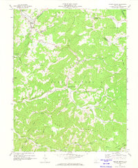
 1969 Corliss1973 Print · USGSThe West Virginia highlands in the late 1960s reveal a landscape defined by industrial extraction and small settlements. Researchers can trace the river-and-rail era through the oxbow of The Loop, the community at Corliss, and local landmarks like Minnie Bell Ch.2 unique versions available
 - 1969 Map of Meadow Bridge, 1974 Print
 1969 Meadow Bridge1974 Print · USGSMeadow Bridge and the surrounding high ridges of West Virginia are captured here in the late sixties as traditional mountain life met industrial coal mining. Genealogists can locate family landmarks such as Little Meadow Ch, Lively Sch, and several remote cemeteries tucked along Lick Creek.3 unique versions available
End of results
Showing maps 1-15 of 15
Top cities of Greenbrier County
- Lewisburg historical maps
- White Sulphur Springs historical maps
- Fairlea historical maps
- Ronceverte historical maps
- Rainelle historical maps
- Rupert historical maps
See more
Frequently asked questions
- What are the different types of historical maps available for Greenbrier County?
- What is the oldest map of Greenbrier County?
- Where can I purchase historical maps of Greenbrier County for my home or office?
- Where can I download high-res historical maps of Greenbrier County?
- Are there historical topographic maps available for Greenbrier County?
- Is there historical aerial imagery available for Greenbrier County?
- Where are historical maps of Greenbrier County sourced from?