1920s Maps of Greenbrier County, West Virginia
Explore 19 historic maps of Greenbrier County from the 1920s. These maps offer a rare glimpse into what life looked like during the 1920s — showing old roads, neighborhoods, homes, and landmarks that have changed or disappeared over time.
Whether you're researching your family's past, planning a metal detecting trip, or studying how Greenbrier County's landscape evolved across the 1920s, these high-resolution maps are a powerful tool for exploring the history of this region.
- Focus on a specific era: All maps on this page are from the 1920s, giving you a focused view of this time period.
- See what’s changed: Compare century-old streets, trails, and buildings to today's modern landscape using overlays and satellite layers.
- Research with precision: Use these maps for genealogy, historical research, land use analysis, or educational projects.
- View, download, or print: Maps are fully viewable online in high resolution, and can be downloaded or printed for your own records.
Start exploring Greenbrier County's history through authentic maps from the 1920s. This is your window into the past.
Greenbrier County, WV maps
(19)- 1921 Map of Callaghan
 1921 Callaghan1921 Print · USGSThe West Virginia and Virginia borderlands come alive in this early 1920s survey of the mountain gaps and valley drafts. Researchers can trace rural life through numerous country schools like Bound School and landmarks such as Columbia Sulphur Springs and Wileys Crossing.
 - 1921 Map of Alderson
 1921 Alderson1921 Print · USGSThe Greenbrier River valley and the West Virginia highlands come alive in the early 1920s, showing the region's rail-dependent economy and rural school networks. Researchers can trace family roots at Nickels Mill, Spider Den School, and the settlement of Sinks Grove.3 unique versions available
 - 1921 Map of White Sulphur Springs
 1921 White Sulphur Springs1921 Print · USGSThe Greenbrier Valley in the early twenties reveals a landscape of dense rural settlements and early mountain thoroughfares. Genealogists can trace family footprints across dozens of local sites like Germany School, Balm of Gilead Church, and White Sulphur Springs.2 unique versions available
 - 1921 Map of Clintonville
 1921 Clintonville1921 Print · USGSGreenbrier County is captured in the early twentieth century as a landscape of mountain ridges and valley settlements connected by the historic James River and Kanawha Turnpike. Researchers can locate dozens of family-named landmarks, including Baker Mill, Maude Chapel, and the famous mineral waters at Blue Sulphur Springs.
 - 1921 Map of Ronceverte
 1921 Ronceverte1921 Print · USGSThe West Virginia and Virginia borderlands come alive in this early 1920s record of the Greenbrier Valley and Allegheny ridges. Genealogists can trace family roots through numerous local landmarks like Organ Cave, Red Mill, and the Highland Green School.2 unique versions available
 - 1921 Map of Richwood
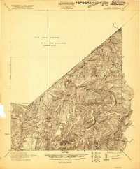 1921 Richwood1921 Print · USGSThe West Virginia mountain country of Greenbrier and Nicholas counties is captured here just after the Great War. Researchers can trace rural life through old schoolhouses like Fallbrook School and Big Stone School, or locate settlements at Jettsville and Quinnwood.2 unique versions available
 - 1923 Map of Lobelia
 1923 Lobelia1923 Print · USGSGreenbrier and Pocahontas Counties are shown in the early 1920s as mountain farming and timber harvesting shaped the landscape. Researchers can trace dozens of rural institutions, from Ellis Chapel and Band of Hope Church to remote schools like West Droop School.2 unique versions available
 - 1923 Map of Clintonville
 1923 Clintonville1923 Print · USGSGreenbrier County in the early twenties was a landscape of remote mountain valleys and thermal springs connected by early turnpikes. Researchers can trace ancestral farmsteads near Blue Sulphur Springs, Sam Black Church, and the many district schools like Sugar Grove School.2 unique versions available
 - 1923 Map of White Sulphur Springs
 1923 White Sulphur Springs1923 Print · USGSGreenbrier County is documented in the early twenties as a landscape of river-bend railroads and mountain turnpikes. Genealogists can trace family schoolhouses like Carroll Hill School and local landmarks such as Mathews Fort or Pilgrims Rest.3 unique versions available
 - 1923 Map of Ronceverte
 1923 Ronceverte1923 Print · USGSSoutheast West Virginia in the early twenties is a landscape of mountain ridges and remote hollows. Genealogists can trace the rural communities of Gap Mills and Sweet Springs, alongside dozens of landmarks like Organ Cave and Schley School.4 unique versions available
 - 1923 Map of Marlinton
 1923 Marlinton1923 Print · USGSPocahontas County at the start of the twenties shows a landscape defined by the timber industry and the winding Greenbrier River. Genealogists can trace family names through dozens of rural landmarks, including Grimes School, Hefners School, and May Chapel.6 unique versions available
 - 1923 Map of Warm Springs
 1923 Warm Springs1923 Print · USGSThe mountain border between West Virginia and Virginia comes into focus in the early 1920s, revealing a landscape of remote mountain gaps and hollows. Researchers can locate numerous local landmarks like Minnehaha Springs, Mt Carmel Church, and the Circle Hill School.2 unique versions available
 - 1923 Map of Callaghan
 1923 Callaghan1923 Print · USGSThe West Virginia and Virginia borderlands come alive in the early 1920s, showing a landscape of remote schoolhouses and mineral springs. Genealogists can trace family footprints near Columbia Sulphur Springs or locate long-gone schools like Wades Draft School and Whites Draft School.3 unique versions available
 - 1923 Map of Alderson
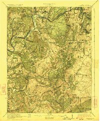 1923 Alderson1923 Print · USGSMonroe and Greenbrier Counties are shown here in the early 1920s, a landscape defined by mineral springs and a dense network of rural schoolhouses. Researchers can locate dozens of local sites like Hokes Mill, Sinks Grove P O, and the Spider Den School.3 unique versions available
 - 1923 Map of Richwood
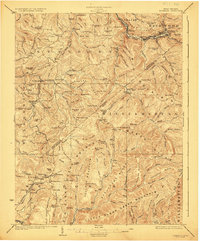 1923 Richwood1923 Print · USGSThe Gauley River and its mountain forks in the early 1920s reveal a landscape of deep timber valleys and upland schoolhouses. Trace the path of the Baltimore and Ohio RR to Richwood and locate old sites like Hominy Mill or Namos Chapel.3 unique versions available
 - 1925 Map of Marlinton
 1925 Marlinton1925 Print · USGSMarlinton and the Greenbrier River valley are captured in the mid-twenties, showing a landscape defined by the Chesapeake and Ohio railroad. Genealogy researchers can locate family landmarks like Locust PO, Trinity Church, and many rural schools.3 unique versions available
 - 1925 Map of Lobelia
 1925 Lobelia1925 Print · USGSThe mountains and wetlands of Greenbrier County are captured here in the mid-1920s, showing a landscape of high ridges and rural valley settlements. Trace old family sites and mountain outposts like Lobelia, Trout Valley, and the Cranberry Glades.2 unique versions available
 - 1926 Map of Warm Springs
 1926 Warm Springs1926 Print · USGSThe West Virginia and Virginia borderlands come alive in this mid-1920s survey of the high Alleghenies. Researchers can trace rural life through landmarks like Minnehaha Springs, Westminster Church, and schools at Rimel and Sunset.5 unique versions available
 - 1929 Map of Falling Spring
 1929 Falling Spring1929 Print · USGSThe Jackson River valley comes to life in this late 1920s survey of the Virginia highlands. Researchers can locate early schools and settlements like Tinkersville, Greavers Mill, and the Valley View Valley Sch.2 unique versions available
End of results
Showing maps 1-19 of 19
Top cities of Greenbrier County
- Lewisburg historical maps
- White Sulphur Springs historical maps
- Fairlea historical maps
- Ronceverte historical maps
- Rainelle historical maps
- Rupert historical maps
See more
Frequently asked questions
- What are the different types of historical maps available for Greenbrier County?
- What is the oldest map of Greenbrier County?
- Where can I purchase historical maps of Greenbrier County for my home or office?
- Where can I download high-res historical maps of Greenbrier County?
- Are there historical topographic maps available for Greenbrier County?
- Is there historical aerial imagery available for Greenbrier County?
- Where are historical maps of Greenbrier County sourced from?