2020s Maps of Marion County, West Virginia
Explore 11 historic maps of Marion County from the 2020s. These maps offer a rare glimpse into what life looked like during the 2020s — showing old roads, neighborhoods, homes, and landmarks that have changed or disappeared over time.
Whether you're researching your family's past, planning a metal detecting trip, or studying how Marion County's landscape evolved across the 2020s, these high-resolution maps are a powerful tool for exploring the history of this region.
- Focus on a specific era: All maps on this page are from the 2020s, giving you a focused view of this time period.
- See what’s changed: Compare century-old streets, trails, and buildings to today's modern landscape using overlays and satellite layers.
- Research with precision: Use these maps for genealogy, historical research, land use analysis, or educational projects.
- View, download, or print: Maps are fully viewable online in high resolution, and can be downloaded or printed for your own records.
Start exploring Marion County's history through authentic maps from the 2020s. This is your window into the past.
Marion County, WV maps
(11)- 2023 Map of Hundred, 2023 Print
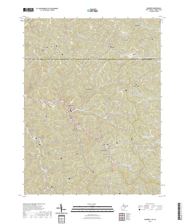 2023 Hundred2023 Print · USGSThe Wetzel County borderlands come into focus in this recent survey of the ridges and hollows surrounding the town of Hundred. Researchers can trace genealogical roots across dozens of family burial sites like Stottlemire Run Cem or follow the historic path of the East Wetzel Rail-Trl through Cusicks Crossing.
 - 2023 Map of Gladesville, 2023 Print
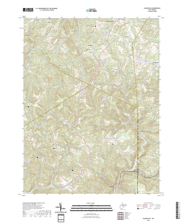 2023 Gladesville2023 Print · USGSThe hills of Taylor and Monongalia counties are shown here in detail, centered on the communities of Halleck and Gladesville. Researchers can trace old family burial sites like Oak Grove Cem and Amnon Cem near the winding waters of Whiteday Creek.
 - 2023 Map of Wallace, 2023 Print
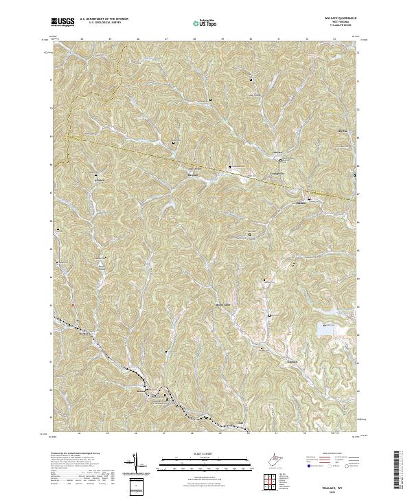 2023 Wallace2023 Print · USGSHarrison and Marion counties appear in the modern era as a landscape of interconnected creek valleys and rural hubs. Genealogists can locate family burial sites like Hildreth Cem and Bennett Cem near settlements such as Alliance and Margaret.
 - 2023 Map of Grant Town, 2023 Print
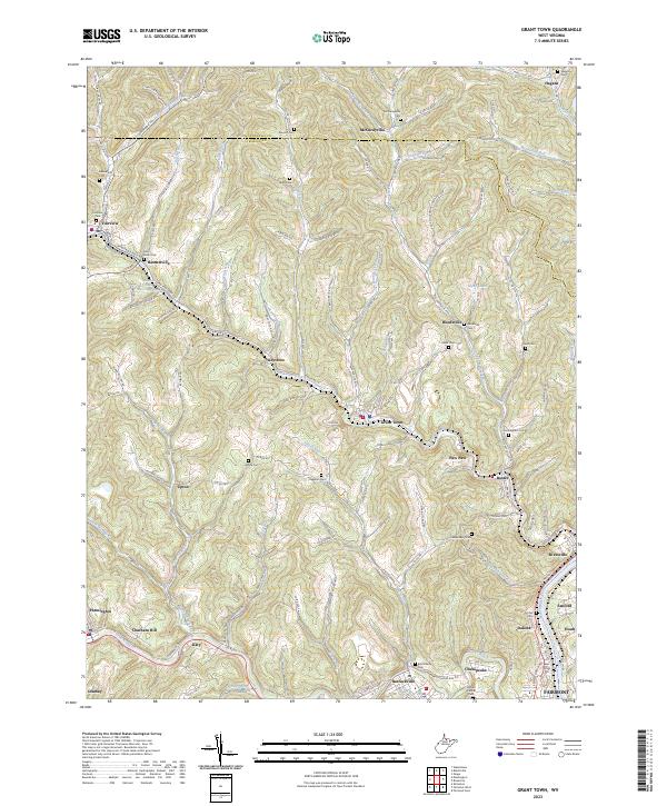 2023 Grant Town2023 Print · USGSMarion and Monongalia counties are shown here in the early twenty-first century, centered on the coal-country settlements and narrow hollows west of the Monongahela. Researchers can trace family history through over a dozen burial sites including Wilson Cem, Barb Cem, and the Saint Johns Cem near Basnettville.
 - 2023 Map of Glover Gap, 2023 Print
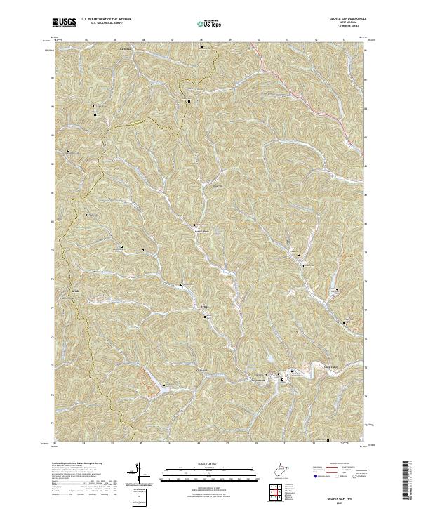 2023 Glover Gap2023 Print · USGSMarion and Wetzel counties are shown here as they appear in the early 2020s, defined by the winding hollows of the West Virginia hills. Genealogists can trace a remarkable number of family burial sites, including Cunningham Cem, Yost Cem, and Mannington Memorial Cem.
 - 2023 Map of Rivesville, 2023 Print
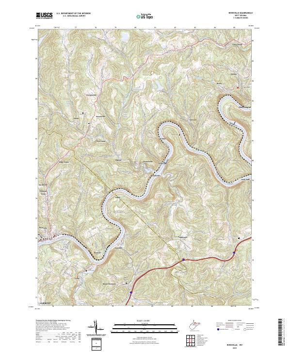 2023 Rivesville2023 Print · USGSThe Monongahela River valley comes into focus in this recent survey of the West Virginia coal and river country. Researchers can trace historic family burial sites at Snider Cem and Pisgah Cem or explore rail-to-trail corridors like the Mon River South Rail-Trl.
 - 2023 Map of Fairmont West, 2023 Print
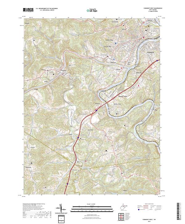 2023 Fairmont West2023 Print · USGSMarion County and the city of Fairmont are mapped in this modern edition, showing the confluence of the West Fork and Tygart Valley rivers. Genealogists and historians can trace many local burial sites, from Evergreen Cem and Davis Ridge Cem to the Janes Memorial Cem near the Taylor County line.
 - 2023 Map of Shinnston, 2023 Print
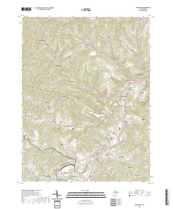 2023 Shinnston2023 Print · USGSThe coal and river valleys of Harrison and Marion Counties are shown in great detail during the early 2020s. Researchers can trace deep family roots at the Enterprise IOOF Cem, locate Sturms Mill, or follow the industrial footprint of the Williams Mine.
 - 2023 Map of Fairmont East, 2023 Print
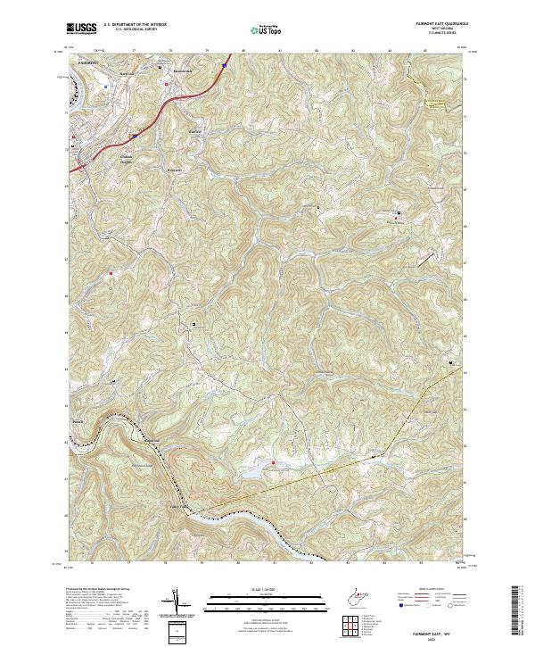 2023 Fairmont East2023 Print · USGSMarion County's highland ridges and river valleys are captured here in the early twenty-first century as the area east of Fairmont continues its transition. Researchers can locate many family burial sites such as Hayhurst Cem or trace the river's path through Valley Falls State Park.
 - 2023 Map of Wadestown, 2023 Print
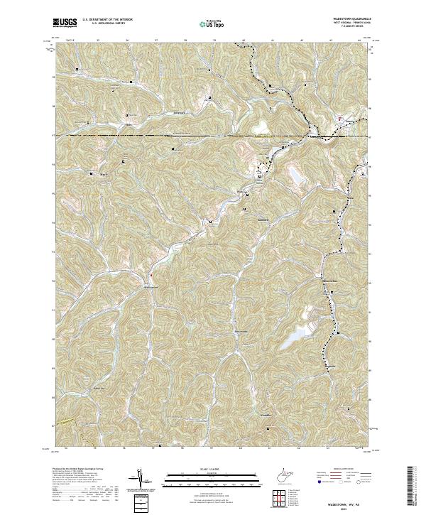 2023 Wadestown2023 Print · USGSThe West Virginia and Pennsylvania borderlands come alive in this survey of the hollows and ridges near Monongalia County. Researchers can trace family sites and early settlements through numerous burial grounds like Old Mount Tabor Cem and the village of Wadestown.
 - 2023 Map of Mannington, 2023 Print
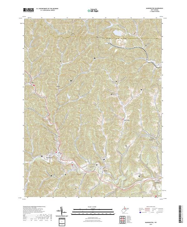 2023 Mannington2023 Print · USGSMarion County's coal and rail heritage is well-preserved in this modern survey of the Mannington area. Researchers can trace family history across numerous hillside burial grounds like View Point Cem and Highland Cem or locate the site of Consol Number 9.
End of results
Showing maps 1-11 of 11
Top cities of Marion County
- Fairmont historical maps
- Pleasant Valley historical maps
- Mannington historical maps
- Barrackville historical maps
- Rivesville historical maps
- Monongah historical maps
See more
Frequently asked questions
- What are the different types of historical maps available for Marion County?
- What is the oldest map of Marion County?
- Where can I purchase historical maps of Marion County for my home or office?
- Where can I download high-res historical maps of Marion County?
- Are there historical topographic maps available for Marion County?
- Is there historical aerial imagery available for Marion County?
- Where are historical maps of Marion County sourced from?