1960s Maps of Tucker County, West Virginia
Explore 13 historic maps of Tucker County from the 1960s. These maps offer a rare glimpse into what life looked like during the 1960s — showing old roads, neighborhoods, homes, and landmarks that have changed or disappeared over time.
Whether you're researching your family's past, planning a metal detecting trip, or studying how Tucker County's landscape evolved across the 1960s, these high-resolution maps are a powerful tool for exploring the history of this region.
- Focus on a specific era: All maps on this page are from the 1960s, giving you a focused view of this time period.
- See what’s changed: Compare century-old streets, trails, and buildings to today's modern landscape using overlays and satellite layers.
- Research with precision: Use these maps for genealogy, historical research, land use analysis, or educational projects.
- View, download, or print: Maps are fully viewable online in high resolution, and can be downloaded or printed for your own records.
Start exploring Tucker County's history through authentic maps from the 1960s. This is your window into the past.
Tucker County, WV maps
(13)- 1960 Map of Rowlesburg, 1961 Print
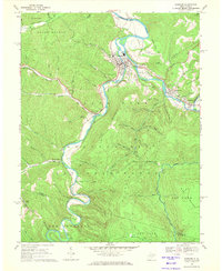
 1960 Rowlesburg1961 Print · USGSPreston County's steep ridges and river bends come to life in the early 1960s as the rail and river economy thrives. Genealogists and historians can trace the family names of Watkins Cem, visit the Covered Bridge, or follow the Baltimore and Ohio Railroad through Rowlesburg.4 unique versions available
 - 1961 Map of Cumberland
 1961 Cumberland1961 Print · USGSThe tri-state highlands of Maryland, West Virginia, and Pennsylvania are shown in the mid-twentieth century as a complex landscape of ridges and river valleys. Researchers can trace the winding Potomac River and find old rail-and-river towns like Cumberland, Keyser, and Morgantown.
 - 1962 Map of Cumberland
 1962 Cumberland1962 Print · USGSThe central Appalachians meet at the height of the mid-century industrial era, showing the rugged topography between Morgantown and Winchester. Genealogists can trace family lands near Fort Necessity or along the vital Baltimore & Ohio RR corridors.
 - 1967 Map of Mount Storm Lake, 1972 Print
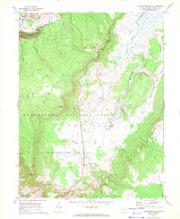
 1967 Mount Storm Lake1972 Print · USGSThe high plateau of Grant County is captured here in the late sixties, a landscape of industrial energy and high-country wilderness. Researchers can trace the Western Maryland rail line and locate numerous strip mines, the Stony River Dam, and Snowy Point.3 unique versions available
 - 1967 Map of Blackbird Knob, 1972 Print
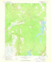
 1967 Blackbird Knob1972 Print · USGSThe high plateau of eastern West Virginia is captured here in the late sixties, showcasing the wild landscape of Dolly Sods. Researchers can trace the drainages of Red Creek and Jordan Run or locate specific landmarks like Bear Rocks and Blackbird Knob.3 unique versions available
 - 1967 Map of Davis, 1972 Print
 1967 Davis1972 Print · USGSThe West Virginia and Maryland borderlands come into focus in the late sixties, highlighting a rugged mining landscape and rail corridor. Trace the Western Maryland railroad through Kempton, locate the historic Fairfax Stone, or find the Thomas Cemetery.5 unique versions available
 - 1968 Map of Harman, 1971 Print
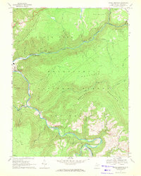
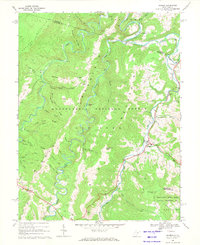 1968 Harman1971 Print · USGSHigh in the Alleghenies during the late sixties, the settlements of Harman and Jenningston sit along the winding DRY FORK river. Genealogists can trace family landmarks including Riverside Ch and numerous local cemeteries tucked between Shavers Mountain and Laurel Mountain.3 unique versions available
 - 1968 Map of Parsons, 1971 Print
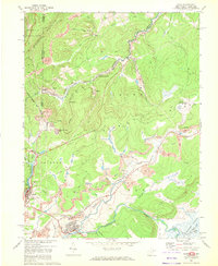
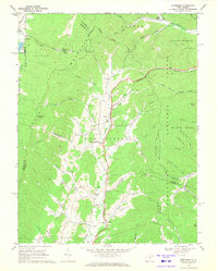
 1968 Parsons1971 Print · USGSThe river valleys of Tucker County converge in the late 1960s at Parsons, where the railroad and mountain waters meet. Genealogists and historians can trace family burial sites like Hamrick Cem, local landmarks such as Irons Chapel, and the industrial path of the Western Maryland railway.2 unique versions available
 - 1968 Map of Blackwater Falls, 1972 Print
 1968 Blackwater Falls1972 Print · USGSTucker County's high-country wilderness is documented here in the late sixties as state parks and national forests began defining the region's character. Local historians and hikers can trace the Western Maryland railroad, locate the Cem near Cortland, and find natural landmarks like Chimney Rock and Bearden Knob.3 unique versions available
 - 1968 Map of Mozark Mountain, 1972 Print
 1968 Mozark Mountain1972 Print · USGSTucker County during the late sixties is a landscape of industrial transit and Appalachian wilderness where the Blackwater River cuts through the forest. Genealogists and local historians can trace family locations near Hendricks, Elk, and Brights Chapel.2 unique versions available
 - 1969 Map of Montrose, 1971 Print
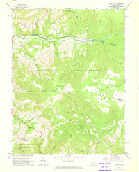
 1969 Montrose1971 Print · USGSRandolph and Tucker Counties are seen here in the late sixties as the mountain landscape remained defined by valley farming and timber. Researchers can trace the Maryland Western RR past Montrose to find rural landmarks like Israel Ch and the Elkins Speedway.3 unique versions available
 - 1969 Map of Hopeville, 1973 Print
 1969 Hopeville1973 Print · USGSThe South Branch Potomac River winds through central Grant County in the late sixties, a time when the region's wilderness and mountain hamlets were increasingly protected for recreation. Genealogists and hikers can trace the geography of Hopeville, locate the North Fork Ch, and find geological landmarks like Champe Rocks or the Smoke Hole Caverns.3 unique versions available
 - 1969 Map of Laneville, 1973 Print
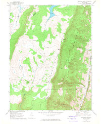
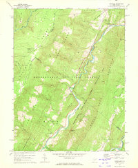
 1969 Laneville1973 Print · USGSThe West Virginia highlands are shown in detail during the late sixties as conservation and recreation areas expanded. Researchers can trace family sites and local landmarks like Flanagan Memorial Cem, the Wolford Ch, and the high plateau at Roaring Plains.3 unique versions available
End of results
Showing maps 1-13 of 13
Top cities of Tucker County
- Parsons historical maps
- Davis historical maps
- Thomas historical maps
- Hendricks historical maps
- Hambleton historical maps
Frequently asked questions
- What are the different types of historical maps available for Tucker County?
- What is the oldest map of Tucker County?
- Where can I purchase historical maps of Tucker County for my home or office?
- Where can I download high-res historical maps of Tucker County?
- Are there historical topographic maps available for Tucker County?
- Is there historical aerial imagery available for Tucker County?
- Where are historical maps of Tucker County sourced from?