2020s Maps of Harrison, Wisconsin
Explore 5 historic maps of Harrison from the 2020s. These maps offer a rare glimpse into what life looked like during the 2020s — showing old roads, neighborhoods, homes, and landmarks that have changed or disappeared over time.
Whether you're researching your family's past, planning a metal detecting trip, or studying how Harrison's landscape evolved across the 2020s, these high-resolution maps are a powerful tool for exploring the history of this region.
- Focus on a specific era: All maps on this page are from the 2020s, giving you a focused view of this time period.
- See what’s changed: Compare century-old streets, trails, and buildings to today's modern landscape using overlays and satellite layers.
- Research with precision: Use these maps for genealogy, historical research, land use analysis, or educational projects.
- View, download, or print: Maps are fully viewable online in high resolution, and can be downloaded or printed for your own records.
Start exploring Harrison's history through authentic maps from the 2020s. This is your window into the past.
Harrison, WI maps
(5)- 2022 Map of Chilton, 2022 Print
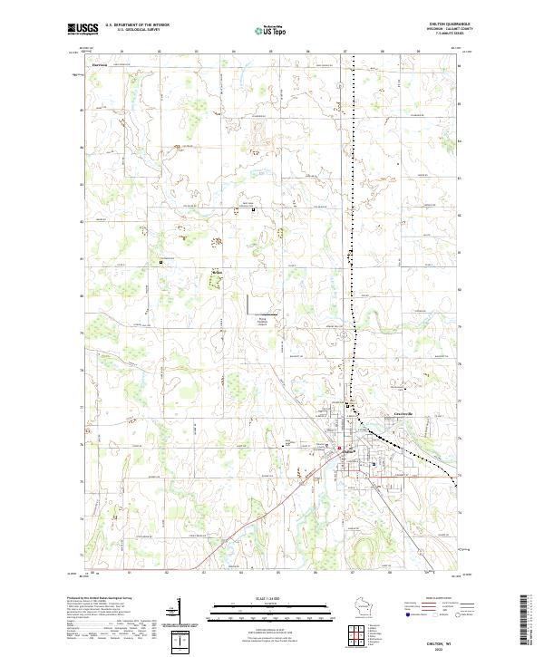 2022 Chilton2022 Print · USGSCalumet County's seat of government and its surrounding farmsteads are documented here in the early twenty-first century. Genealogists can trace family connections through numerous local burial grounds including Portland Cem, Saint Luke Lutheran Cem, and the Hillside Cem.
 - 2022 Map of Neenah, 2022 Print
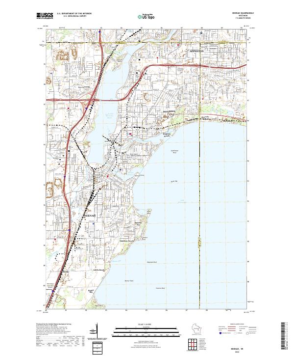 2022 Neenah2022 Print · USGSThe Fox River valley's industrial heart comes into focus during this era of suburban growth and lakeside recreation. Researchers can trace the development of Neenah and Menasha, from the shores of Doty Island to Saint Patrick's Cem.
 - 2022 Map of Stockbridge, 2022 Print
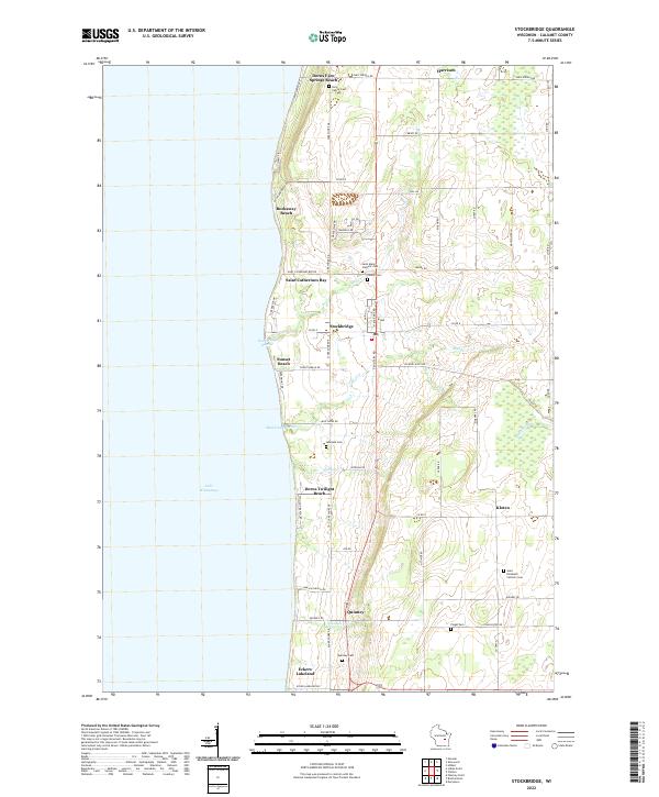 2022 Stockbridge2022 Print · USGSThe eastern shore of Lake Winnebago comes into focus in this recent survey of Calumet County. Genealogists and local researchers can trace a network of historic burial sites, from the Indian Cem and Quinney Cem to the family-named Dorn Family Cem.
 - 2022 Map of Sherwood, 2022 Print
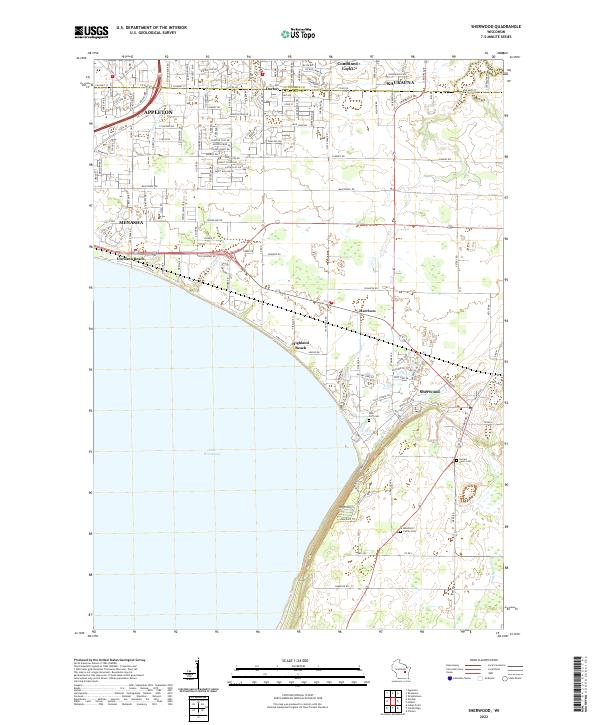 2022 Sherwood2022 Print · USGSThe eastern shores of Lake Winnebago and the heights of High Cliff appear in detail in this modern era survey. Trace family history at Sacred Heart Cem or explore the development of Sherwood and Highland Beach.
 - 2022 Map of Hilbert, 2022 Print
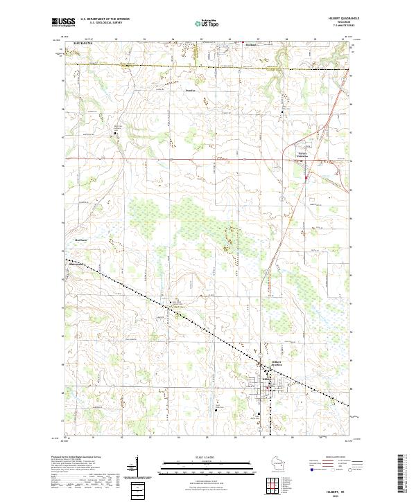 2022 Hilbert2022 Print · USGSCalumet County settlements and the headwaters of the Manitowoc River system are documented here during the early 2020s. Genealogists and local historians can trace rural family plots at Saint Mary's Cem and follow the path of the Friendship State Trl through Forest Junction.
End of results
Showing maps 1-5 of 5
Top cities near Harrison
- Appleton historical maps
- Oshkosh historical maps
- Neenah historical maps
- De Pere historical maps
- Grand Chute historical maps
- Fox Crossing historical maps
See more
Top neighborhoods of Harrison
- Highland Beach historical maps
- Memory Meadows historical maps
- Crystal Valley historical maps
- Peaceful Valley historical maps
- Ridgepoint historical maps
- State Park Meadows historical maps
See more
Frequently asked questions
- What are the different types of historical maps available for Harrison?
- What is the oldest map of Harrison?
- Where can I purchase historical maps of Harrison for my home or office?
- Where can I download high-res historical maps of Harrison?
- Are there historical topographic maps available for Harrison?
- Is there historical aerial imagery available for Harrison?
- Where are historical maps of Harrison sourced from?