2000s (21st Century) Maps of Fern, Wisconsin
Explore 9 historic maps of Fern from the 2000s (21st Century). These maps offer a rare glimpse into what life looked like during the 2000s — showing old roads, neighborhoods, homes, and landmarks that have changed or disappeared over time.
Whether you're researching your family's past, planning a metal detecting trip, or studying how Fern's landscape evolved across the 2000s, these high-resolution maps are a powerful tool for exploring the history of this region.
- Focus on a specific era: All maps on this page are from the 2000s, giving you a focused view of this time period.
- See what’s changed: Compare century-old streets, trails, and buildings to today's modern landscape using overlays and satellite layers.
- Research with precision: Use these maps for genealogy, historical research, land use analysis, or educational projects.
- View, download, or print: Maps are fully viewable online in high resolution, and can be downloaded or printed for your own records.
Start exploring Fern's history through authentic maps from the 2000s. This is your window into the past.
Fern, WI maps
(9)- 2011 Map of Naults, 2011 Print
 2011 Naults2011 Print · USGSCovers Fern, including Florence, Mastodon Township, and other nearby areas
 - 2013 Map of Naults, 2013 Print
 2013 Naults2013 Print · USGSCovers Fern, including Florence, Mastodon Township, and other nearby areas
 - 2014 Map of Naults, 2014 Print
 2014 Naults2014 Print · USGSCovers Fern, including Florence, Mastodon Township, and other nearby areas
 - 2017 Map of Naults, 2017 Print
 2017 Naults2017 Print · USGSCovers Fern, including Florence, Mastodon Township, and other nearby areas
 - 2019 Map of Naults, 2019 Print
 2019 Naults2019 Print · USGSCovers Fern, including Florence, Mastodon Township, and other nearby areas
 - 2022 Map of Florence SW, 2022 Print
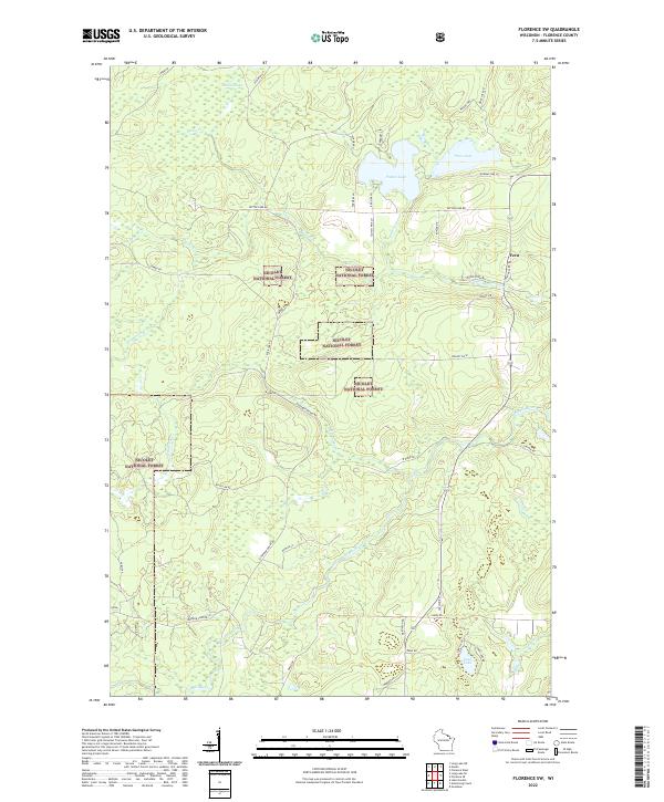 2022 Florence SW2022 Print · USGSFlorence County, Wisconsin, is documented here in the early 2020s as a landscape of deep timber and protected forest. Researchers can trace the winding Popple River and locate remote water bodies such as Patten Lake and the small crossroads at Fern.
 - 2022 Map of Florence West, 2022 Print
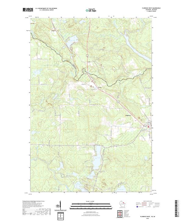 2022 Florence West2022 Print · USGSThe Wisconsin-Michigan border comes to life in the early 2020s, showing the intricate river systems and lakefront communities of Florence County. Researchers can trace local landmarks like Keyes Lake and Sea Lion Lake, or locate the settlements of Stager and Tyran.
 - 2022 Map of Florence SE, 2022 Print
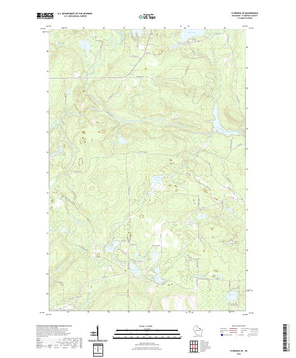 2022 Florence SE2022 Print · USGSSoutheastern Florence County in the early 2020s remains a landscape defined by its deep woods and managed waterways. Trace the complex hydrography of the Pine River through landmarks like Breakwater Falls and the Pine River Flowage.
 - 2023 Map of Naults, 2023 Print
 2023 Naults2023 Print · USGSThe Michigan-Wisconsin borderlands are shown here in the 2020s, dominated by the timber and water of the Whisker Lake Wilderness. You can trace old routes near the settlement of Naults or locate remote water bodies like Camp Thirteen Lake and Boot Lake.
End of results
Showing maps 1-9 of 9
Top cities near Fern
- Crystal Falls historical maps
- Laona historical maps
- Dunbar historical maps
- Aurora historical maps
- Goodman historical maps
- Mastodon historical maps
See more
Frequently asked questions
- What are the different types of historical maps available for Fern?
- What is the oldest map of Fern?
- Where can I purchase historical maps of Fern for my home or office?
- Where can I download high-res historical maps of Fern?
- Are there historical topographic maps available for Fern?
- Is there historical aerial imagery available for Fern?
- Where are historical maps of Fern sourced from?