2000s (21st Century) Maps of Birch, Wisconsin
Explore 4 historic maps of Birch from the 2000s (21st Century). These maps offer a rare glimpse into what life looked like during the 2000s — showing old roads, neighborhoods, homes, and landmarks that have changed or disappeared over time.
Whether you're researching your family's past, planning a metal detecting trip, or studying how Birch's landscape evolved across the 2000s, these high-resolution maps are a powerful tool for exploring the history of this region.
- Focus on a specific era: All maps on this page are from the 2000s, giving you a focused view of this time period.
- See what’s changed: Compare century-old streets, trails, and buildings to today's modern landscape using overlays and satellite layers.
- Research with precision: Use these maps for genealogy, historical research, land use analysis, or educational projects.
- View, download, or print: Maps are fully viewable online in high resolution, and can be downloaded or printed for your own records.
Start exploring Birch's history through authentic maps from the 2000s. This is your window into the past.
Birch, WI maps
(4)- 2022 Map of Harrison, 2022 Print
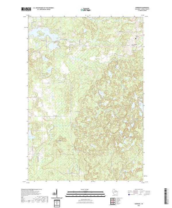 2022 Harrison2022 Print · USGSHarrison and the surrounding Lincoln County highlands are captured here in the early 2020s, showing a landscape of glacial ridges and sprawling lakefronts. Local historians can trace the community around Harrison and the Saint Augustine Cem, or follow the modern path of the Ice Age National Scenic Trl through the hills.
 - 2022 Map of Irma, 2022 Print
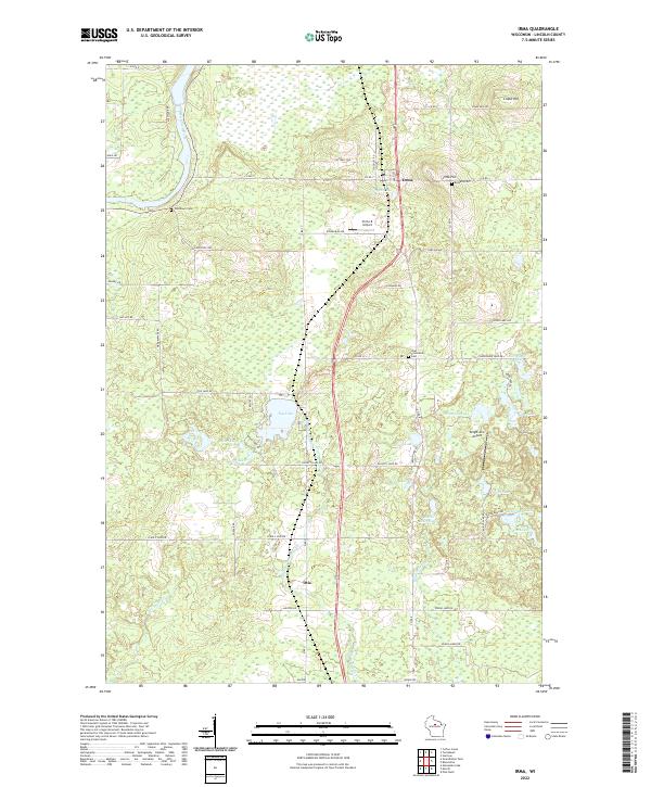 2022 Irma2022 Print · USGSLincoln County comes to life in this contemporary survey, showing the quiet communities of Irma and Otis as they appear today. Genealogists and historians can trace family locations near Bethany Cem, Woodlawn Cem, and the waters of Tug Lake.
 - 2022 Map of Bloomville, 2022 Print
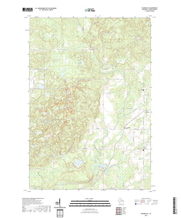 2022 Bloomville2022 Print · USGSLincoln County’s glaciated terrain is documented here in the early 2020s, showing a landscape defined by kettle lakes and river valleys. Genealogists can locate family sites near Gleason, Bloomville, and the Luther Memorial Cem.
 - 2022 Map of Tomahawk, 2022 Print
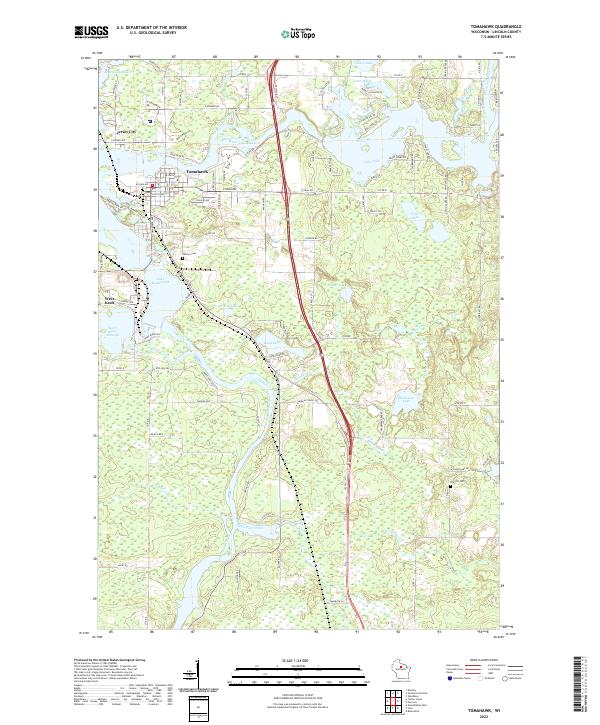 2022 Tomahawk2022 Print · USGSTomahawk and the surrounding Northwoods lakes are showcased here as they appeared in the early twenty-first century. Genealogists and local historians can trace family locations near Calvary Cem, Jersey City, and the shorelines of Lake Mohawksin or Lake Alice.
End of results
Showing maps 1-4 of 4
Top cities near Birch
- Merrill historical maps
- Tomahawk historical maps
- Bradley historical maps
- Maine historical maps
- Pine River historical maps
- Harrison historical maps
See more
Top neighborhoods of Birch
Frequently asked questions
- What are the different types of historical maps available for Birch?
- What is the oldest map of Birch?
- Where can I purchase historical maps of Birch for my home or office?
- Where can I download high-res historical maps of Birch?
- Are there historical topographic maps available for Birch?
- Is there historical aerial imagery available for Birch?
- Where are historical maps of Birch sourced from?