1990s Maps of Hot Springs County, Wyoming
Explore 7 historic maps of Hot Springs County from the 1990s. These maps offer a rare glimpse into what life looked like during the 1990s — showing old roads, neighborhoods, homes, and landmarks that have changed or disappeared over time.
Whether you're researching your family's past, planning a metal detecting trip, or studying how Hot Springs County's landscape evolved across the 1990s, these high-resolution maps are a powerful tool for exploring the history of this region.
- Focus on a specific era: All maps on this page are from the 1990s, giving you a focused view of this time period.
- See what’s changed: Compare century-old streets, trails, and buildings to today's modern landscape using overlays and satellite layers.
- Research with precision: Use these maps for genealogy, historical research, land use analysis, or educational projects.
- View, download, or print: Maps are fully viewable online in high resolution, and can be downloaded or printed for your own records.
Start exploring Hot Springs County's history through authentic maps from the 1990s. This is your window into the past.
Hot Springs County, WY maps
(7)- 1991 Map of Twin Peaks, 1997 Print
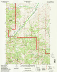
 1991 Twin Peaks1997 Print · USGSThe Absaroka Range in the early nineties is a place of deep wilderness and high summits at the meeting point of three Wyoming counties. Backcountry researchers can trace the historic boundaries of the Washakie Wilderness and Wind River Indian Reservation near Twin Peaks and Standard Peak.
 - 1991 Map of Monument Peak, 1997 Print
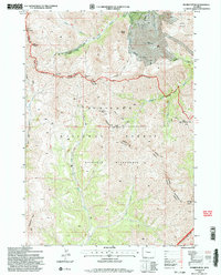
 1991 Monument Peak1997 Print · USGSThe Wind River Indian Reservation and Shoshone National Forest converge in the Wyoming high country during the early nineties. Forest researchers and hikers can trace the Basin Trail Ridge past the Muddy Monument Peak Lookout and the Washakie Needles.
 - 1991 Map of Dunrud Peak, 1997 Print
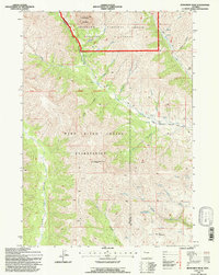
 1991 Dunrud Peak1997 Print · USGSThe high Absaroka wilderness at the start of the 1990s is captured here at the triple junction of Fremont, Park, and Hot Springs counties. Researchers can trace remote alpine routes like the Bear Creek Trail across East Fork Pass to peaks such as Dunrud Peak and Spar Mountain.2 unique versions available
 - 1991 Map of Noon Point, 1997 Print
 1991 Noon Point1997 Print · USGSThe Wyoming wilderness comes into focus in the early nineties, revealing a landscape defined by forest boundaries and river forks. Trace the remote Larson Ranch and high-country irrigation features like the Nelson Ditch and Chance Only Ditch.
 - 1991 Map of Soapy Dale Peak, 1997 Print
 1991 Soapy Dale Peak1997 Print · USGSThe borderlands of Hot Springs and Park counties are revealed in this late-century survey of high rangeland and remote peaks. Trace the rugged ranching landscape from Dollar Ranch to the heights of Soapy Dale Peak and the edges of Shoshone National Forest.
 - 1991 Map of Cottonwood Peak, 1997 Print
 1991 Cottonwood Peak1997 Print · USGSThe high Absaroka Range of the 1990s is captured here, centered on the towering Cottonwood Peak and the remote Shoshone National Forest. Researchers and hikers can trace the original Wind River Trail and explore the rugged drainage systems of Gooseberry Creek and Castle Rocks.
 - 1991 Map of Milk Creek, 1997 Print
 1991 Milk Creek1997 Print · USGSHot Springs County, Wyoming, is shown during the early nineties as a landscape of remote drainages and high-desert landmarks. Trace the intersections of industry and terrain at the Oil Well near Hess Creek or follow the trails toward The Holy City and Squaw Teat Butte.
End of results
Showing maps 1-7 of 7
Top cities of Hot Springs County
Frequently asked questions
- What are the different types of historical maps available for Hot Springs County?
- What is the oldest map of Hot Springs County?
- Where can I purchase historical maps of Hot Springs County for my home or office?
- Where can I download high-res historical maps of Hot Springs County?
- Are there historical topographic maps available for Hot Springs County?
- Is there historical aerial imagery available for Hot Springs County?
- Where are historical maps of Hot Springs County sourced from?