Old Maps of Hot Springs County, Wyoming for Academic Research
Study the evolution of Hot Springs County with 150 high-resolution historic maps. Whether you're teaching, researching, or modeling changes in land use, these maps provide essential visual documentation of urban, environmental, and geographic change.
- Analyze long-term change: Track patterns in development, transportation, and natural features.
- Ideal for environmental or urban studies: Support academic projects with primary historical map data.
- Use in the classroom or lab: Educators and researchers rely on these maps to bring historical context to life.
These maps are a powerful tool for teaching, research, and visualizing how Hot Springs County has changed over the decades.
Hot Springs County, WY maps
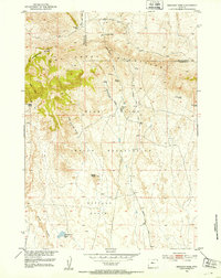
(150)- 1904 Map of Kirwin, 1957 Print
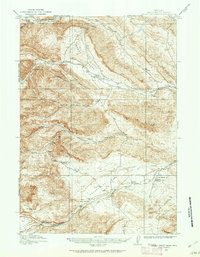
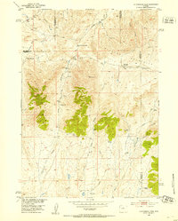
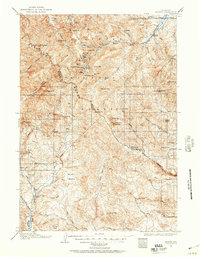 1904 Kirwin1957 Print · USGSHigh-country mining and ranching define this region of the Absaroka Range at the turn of the century. Genealogists can trace family holdings like Double Diamond Ranch and Antler Ranch, or the high-altitude mining outpost at Kirwin.
 - 1906 Map of Kirwin
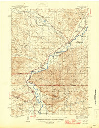
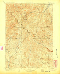 1906 Kirwin1906 Print · USGSThe Absaroka Mountains and upper Wind River country are shown here in the early nineteen-hundreds during a period of active prospecting. Researchers can find old mining sites like the Gold Reef Tunnel and remote ranching hubs such as Kirwin and the Double Diamond Ranch.2 unique versions available
 - 1911 Map of Meeteetse, 1957 Print
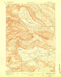
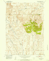
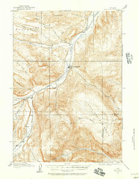 1911 Meeteetse1957 Print · USGSMeeteetse and the Bighorn Basin are captured here in the early twentieth century as ranching and early mining took hold. Researchers can trace the historic Cody Road and locate old landmarks like the Black Diamond Mine and Renner's Ranch.
 - 1913 Map of Meeteetse
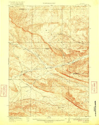
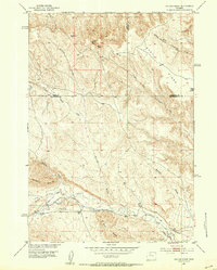
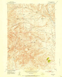
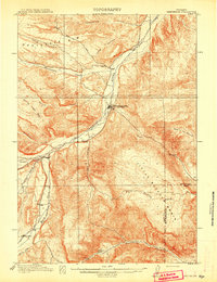 1913 Meeteetse1913 Print · USGSMeeteetse and the surrounding ranchlands are captured here in the years before World War I. Researchers can trace the early road network like Cody Road or locate historical sites such as Dumbell, Sunshine, and the Black Diamond Mine.3 unique versions available
 - 1913 Map of Grass Creek Basin, 1962 Print
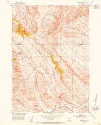
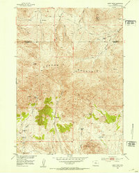
 1913 Grass Creek Basin1962 Print · USGSHot Springs County ranching life is preserved here during the early twentieth century, showing a remote landscape of isolated family homesteads and vital water sources. Genealogists and historians can locate early properties like Wales Ranch and Kemp Ranch, or trace the rugged geography of the Putney Mine and Grass Creek Basin.2 unique versions available
 - 1914 Map of Blue Mesa, 1975 Print
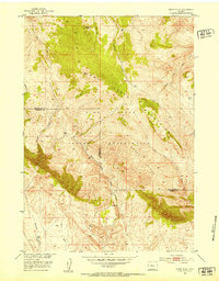
 1914 Blue Mesa1975 Print · USGSHot Springs and Washakie Counties are documented here shortly after the turn of the century, showing a remote landscape defined by its vital water sources. Researchers can trace the paths of Cottonwood Creek and Grass Creek, or locate Keg Spring and Harris Spring among the draws of Blue Mesa.
 - 1915 Map of Grass Creek Basin
 1915 Grass Creek Basin1915 Print · USGSHot Springs County homesteads and early Wyoming resource extraction are documented here in the years before the Great War. Genealogists and historians can locate family-named landmarks like Littlejohn Ranch, Putney Mine, and Wagonhound Spring.3 unique versions available
 - 1916 Map of Blue Mesa
 1916 Blue Mesa1916 Print · USGSHot Springs and Washakie counties are captured here just before the Great War, showing a network of high-desert drainages and cattle country. Trace early water sources like Harris Spring, Ivy Spring, and the winding Grass Creek through the Blue Mesa landscape.2 unique versions available
 - 1945 Map of Kirby, 1958 Print
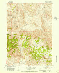
 1945 Kirby1958 Print · USGSThe Bighorn River valley in the mid-1940s shows a region transitioning from its peak coal-mining years. Genealogists and historians can trace defunct operations like Crosby Mine, rail stops at Chatham Sta, and old frontier landmarks like The Willows (Old Stage Sta).2 unique versions available
 - 1946 Map of Kirby
 1946 Kirby1946 Print · USGSThe Bighorn River valley in the mid-1940s reveals a transition from active coal extraction to a rail-and-ranching economy. Researchers can locate the remnants of the Crosby Mine, the site of The Willows (Old Stage Sta), and the settlement of Gebo.
 - 1951 Map of Hillberry Rim, 1953 Print
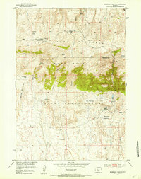
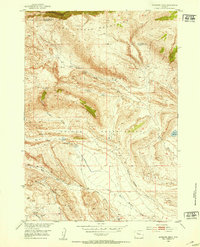
 1951 Hillberry Rim1953 Print · USGSThe Wyoming high plains south of Meeteetse come to life in the early fifties, showing a landscape of livestock ranching and early water management. Researchers can locate specific ranching landmarks like the Dickie Shearing Sheds, the Wild Horse Corral, and irrigation works along Gooseberry Creek.2 unique versions available
 - 1951 Map of Boysen, 1953 Print
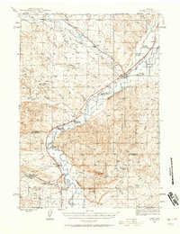
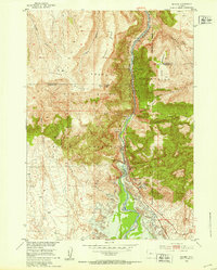 1951 Boysen1953 Print · USGSFremont County and the Wind River Canyon are captured here in the early fifties, just as major water projects were beginning to transform the landscape. Researchers can trace the original rail route of the Burlington and Quincy and locate local landmarks like Boysen Dam and Boysen Camp.3 unique versions available
 - 1951 Map of Dutch Nick Flat SW, 1953 Print
 1951 Dutch Nick Flat SW1953 Print · USGSThe Bighorn Basin badlands come into focus in the early fifties, documenting a landscape of isolated ranching and water management. Researchers can trace the development of irrigation at Steele Ditch and Perkins Ditch near the old Steele School.2 unique versions available
 - 1951 Map of Mexican Pass, 1953 Print
 1951 Mexican Pass1953 Print · USGSThe Owl Creek Mountains and the northern border of the Wind River Indian Reservation meet in this mid-century survey of the Wyoming high desert. Researchers can trace historic routes through Mexican Pass and locate remote ranching outposts such as Engle Ranch and the Mexican Place.
 - 1951 Map of Gillies Draw, 1953 Print
 1951 Gillies Draw1953 Print · USGSHot Springs and Washakie Counties are mapped here in the early fifties, documenting a landscape shaped by water rights and high-desert terrain. Researchers can trace historical irrigation systems like the Quartz Pipe Line Ditch and the Murphy Ditch (Abandoned).2 unique versions available
 - 1951 Map of Birdseye Pass, 1953 Print
 1951 Birdseye Pass1953 Print · USGSThe high passes of the Owl Creek Mountains come into focus in the early fifties during a period of mining and ranching transition. Researchers can locate the Birdseye Station (Abandoned) and trace old mineral claims like the Gold Nugget Mine.3 unique versions available
 - 1951 Map of Morrison Canyon, 1953 Print
 1951 Morrison Canyon1953 Print · USGSFremont County ranching and reservation lands are documented here in the early fifties, showing the high-country transition of the Owl Creek Mountains. Genealogists and historians can locate established outposts like the Bean Ranch and Burgess Ranch near Morrison Meadows.3 unique versions available
 - 1952 Map of Cottonwood Pass, 1953 Print
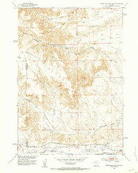
 1952 Cottonwood Pass1953 Print · USGSHigh Wyoming rangeland at the junction of Fremont, Hot Springs, and Natrona counties shows a landscape of remote homesteading in the early fifties. Researchers can trace family sites like Nichols Ranch and Britain Ranch or locate the deserted McWilliams Homestead near Cottonwood Pass.3 unique versions available
 - 1952 Map of Rathbun Ranch, 1953 Print
 1952 Rathbun Ranch1953 Print · USGSHot Springs County ranching life is captured here in the early fifties, documenting a landscape of seasonal winter quarters and family homesteads. Genealogists and local historians can trace the foundations of the Rathbun Ranch, Day Homestead, and Bloomquist Ranch among the slopes of Lysite Mountain.
 - 1952 Map of Kates Basin, 1953 Print
 1952 Kates Basin1953 Print · USGSThe high desert and mountain border of Hot Springs and Fremont counties come into focus during the early fifties. Genealogists and researchers can locate the Duncan Homestead and trace the complex drainages of Kates Basin and the Owl Creek Mountains.
 - 1952 Map of Antelope Ridge, 1953 Print
 1952 Antelope Ridge1953 Print · USGSThe high desert of Fremont County and the Wind River Indian Reservation are captured here in the early 1950s. Researchers can trace petroleum development at the Maverick Spring Oil Field or locate water sources like Antelope Springs and Bargee Reservoir.3 unique versions available
 - 1952 Map of Arapahoe Butte, 1953 Print
 1952 Arapahoe Butte1953 Print · USGSHigh-desert ranchlands on the border of Hot Springs and Fremont counties come to life in the early fifties. Researchers can locate remote family sites like Bow and Arrow Ranch, the isolated Greer settlement, and early aviation landmarks like Fuller Airstrip.
 - 1952 Map of De Pass, 1953 Print
 1952 De Pass1953 Print · USGSFremont and Hot Springs counties are captured here in the early 1950s, showing a transition from active copper mining to remote ranching life. Genealogists can trace family holdings at Philp Ranch or Canning Ranch and locate the historic Bridger Trail.2 unique versions available
 - 1952 Map of Guffy Peak, 1953 Print
 1952 Guffy Peak1953 Print · USGSThe high-desert mining and ranching country of Central Wyoming is captured here during the early fifties. Researchers can trace remote family outposts like Quien Sabe Ranch and locate historical mining sites including the Stardust Tungsten Mine.4 unique versions available
 - 1952 Map of Sheep Ridge, 1953 Print
 1952 Sheep Ridge1953 Print · USGSThe Wind River Indian Reservation and the heights of the Owl Creek Mountains define this Wyoming landscape in the early fifties. Researchers can trace land markers such as Cottonwood Ranger Station, Harris Ranch, and the Sheep Ridge divide.2 unique versions available
Showing maps 1-25 of 150
Top cities of Hot Springs County
Frequently asked questions
- What are the different types of historical maps available for Hot Springs County?
- What is the oldest map of Hot Springs County?
- Where can I purchase historical maps of Hot Springs County for my home or office?
- Where can I download high-res historical maps of Hot Springs County?
- Are there historical topographic maps available for Hot Springs County?
- Is there historical aerial imagery available for Hot Springs County?
- Where are historical maps of Hot Springs County sourced from?