
1952 Map of Sheep Ridge
USGS Topo · Published 1953About this map
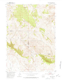
The Wind River Indian Reservation dominates the southern landscape of this 1952 topographic study, where the high-altitude terrain of the Owl Creek Mountains meets the prominent Sheep Ridge. The survey illustrates a transition between the rugged mountain slopes and the lower drainages, anchored by the Cottonwood Ranger Station in the north and the Harris Ranch near the center. The map's detail provides a look at the essential water sources that defined land use in this part of Wyoming, including the North Fork Owl Creek and the numerous forks of West Fork Sheep Creek. These drainages, along with landmarks like Mud Flat, highlight the sparse but strategic human presence within the reservation and along the Hot Springs and Fremont County border.
Find a feature on this map
16 named features on this map. Tap any name to fly to it.
Don’t see what you’re looking for? This feature index may not catch every label — zoom into the map to look around manually.
Map Details
Editions of this 1952 Sheep Ridge Map
2 editions found
Other maps of this area

1950 · Shotgun Butte
USGS Topo · 1:24,000

1951 · Eagle Point
USGS Topo · 1:24,000

1951 · Jenkins Mountain
USGS Topo · 1:24,000

1952 · Kates Basin
USGS Topo · 1:24,000

1952 · Bargee
USGS Topo · 1:24,000

1955 · Thermopolis
USGS Topo · 1:250,000
1957 · Jenkins Mountain
USGS Topo · 1:24,000

1958 · Thermopolis
USGS Topo · 1:250,000

1962 · Thermopolis
USGS Topo · 1:250,000

1965 · Arapahoe Ranch
USGS Topo · 1:24,000