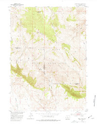
1952 Map of Sheep Ridge
USGS Topo · Published 1977About this map
Wind River Indian Reservation territory defines the southern half of this mid-century survey, where the high ridges of the Owl Creek Mountains meet the rugged terrain of Sheep Ridge. This map captures a landscape shaped by seasonal watercourses and remote outposts, including the Cottonwood Ranger Station in the north and Harris Ranch along the southern foothills. The boundary between Hot Springs and Fremont Counties cuts directly through these summits, highlighting the political geography of the Wyoming interior.
Find a feature on this map
17 named features on this map. Tap any name to fly to it.
Don’t see what you’re looking for? This feature index may not catch every label — zoom into the map to look around manually.
Map Details
Editions of this 1952 Sheep Ridge Map
2 editions found
Other maps of this area

1950 · Shotgun Butte
USGS Topo · 1:24,000

1951 · Eagle Point
USGS Topo · 1:24,000

1951 · Jenkins Mountain
USGS Topo · 1:24,000

1952 · Kates Basin
USGS Topo · 1:24,000

1952 · Sheep Ridge
USGS Topo · 1:24,000

1952 · Bargee
USGS Topo · 1:24,000

1955 · Thermopolis
USGS Topo · 1:250,000
1957 · Jenkins Mountain
USGS Topo · 1:24,000

1958 · Thermopolis
USGS Topo · 1:250,000

1962 · Thermopolis
USGS Topo · 1:250,000