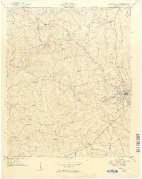
1949 Map of Abbeville
USGS Topo · Published 1949About this map
Abbeville serves as the hub of this late 1940s landscape, where the Seaboard Air Line railroad intersects a dense network of rural communities defined by their schools and houses of worship. The map reveals a high concentration of institutional landmarks such as Upper Long Cane Ch and Cold Spring Sch, illustrating the dispersed yet organized settlement pattern of the South Carolina Piedmont before the era of widespread school consolidation.
Find a feature on this map
46 named features on this map. Tap any name to fly to it.
Don’t see what you’re looking for? This feature index may not catch every label — zoom into the map to look around manually.
Map Details
Editions of this 1949 Abbeville Map
2 editions found
Other maps of this area

1892 · Abbeville
USGS Topo · 1:125,000

1893 · Elberton
USGS Topo · 1:125,000

1948 · Abbeville East
USGS Topo · 1:24,000

1948 · Verdery
USGS Topo · 1:24,000

1948 · Abbeville West
USGS Topo · 1:24,000

1949 · Abbeville
USGS Topo · 1:24,000

1949 · Calhoun Creek
USGS Topo · 1:24,000

1950 · Verdery
USGS Topo · 1:24,000

1950 · Abbeville East
USGS Topo · 1:24,000

1954 · Greenville
USGS Topo · 1:250,000