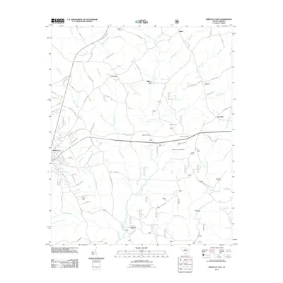
2011 Map of Abbeville East
USGS Topo · Published 2011About this map
Long Cane Creek and its many tributaries, including McCord Creek, Keller Branch, and Bagg Creek, define the drainage patterns east of the historic town of Abbeville. This early 21st-century landscape is characterized by a network of rural settlements such as Millers Mill, Darraugh, and Smithville, connected by a web of local routes including the Old Abbeville Hwy. The map provides significant genealogical value through its many named burial sites, ranging from the Ebeneezer Cemetery near Morton Bridge to family-named plots like Aiken Cemetery and Saint John Cemetery. The presence of Davis Field and the Midway Hunt Campground reflects the modern recreational and utility uses of the land. In the southern portion of the quadrangle, the H D Poole Pond Dam illustrates water management along the Big Curtail Creek drainage.
Find a feature on this map
91 named features on this map. Tap any name to fly to it.
Don’t see what you’re looking for? This feature index may not catch every label — zoom into the map to look around manually.
Map Details
Editions of this 2011 Abbeville East Map
This is the sole edition of this map. No revisions or reprints were ever made.
Other maps of this area

1892 · Abbeville
USGS Topo · 1:125,000

1948 · Abbeville East
USGS Topo · 1:24,000

1948 · Verdery
USGS Topo · 1:24,000

1948 · Abbeville West
USGS Topo · 1:24,000

1949 · Abbeville
USGS Topo · 1:24,000

1949 · Calhoun Creek
USGS Topo · 1:24,000

1949 · Greenwood
USGS Topo · 1:24,000

1950 · Bradley
USGS Topo · 1:24,000

1950 · Verdery
USGS Topo · 1:24,000

1950 · Abbeville East
USGS Topo · 1:24,000